Related Research Articles
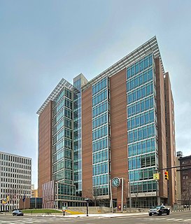
Kent County is located in the U.S. state of Michigan. As of the 2020 Census, the county had a population of 657,974, making it the fourth-most populous county in Michigan, and the largest outside of Metro Detroit. Its county seat is Grand Rapids. The county was set off in 1831, and organized in 1836. It is named for New York jurist and legal scholar James Kent, who represented the Michigan Territory in its dispute with Ohio over the Toledo Strip.

Alpine Township is a civil township of Kent County in the U.S. state of Michigan. The population was 13,336 at the 2010 census.

Byron Township is a civil township of Kent County in the U.S. state of Michigan. The population was 20,317 at the 2010 census, an increase from 17,553 at the 2000 census.

Kentwood is a city in Kent County in the U.S. state of Michigan. The population was 54,304 as of the 2020 census. The city is bordered on the northwest by Grand Rapids and is the third most-populated municipality in the Grand Rapids metropolitan area.
Wyoming is a city in Kent County in the U.S. state of Michigan. The population was 76,501 at the 2020 census. Wyoming is the second most-populated community in the Grand Rapids metropolitan area and is bordered by Grand Rapids on the northeast. After Grand Rapids, it is also the second most-populated city in West Michigan.

The Grand River is a river in the southwestern portion of the southern peninsula of Michigan, United States, that flows into Lake Michigan's southeastern shore. It is the longest river in Michigan, running 252 miles (406 km) from its headwaters in Hillsdale County on the southern border north to Lansing and west to its mouth on the Lake at Grand Haven.
M-37 is a north–south state trunkline highway in the US state of Michigan. The southern terminus is near the border between Kalamazoo and Calhoun counties at exit 92 of Interstate 94 (I-94) southwest of Battle Creek. The northern terminus is at the Mission Point Light on Old Mission Point in Grand Traverse County. In between, the highway connects Battle Creek, Grand Rapids and Traverse City. Motorists will travel through agricultural land, forests, suburbs and large cities along the way. The section of M-37 on the Old Mission Peninsula was designated what is now a Pure Michigan Scenic Byway in 2008.
Interstate 296 (I-296) is a part of the Interstate Highway System in the US state of Michigan. It is a north–south state trunkline highway that runs for 3.43 miles (5.52 km) entirely within the Grand Rapids area. Its termini are I-196 near downtown Grand Rapids and I-96 on the north side of Grand Rapids in Walker. For most of its length, the Interstate runs concurrently with U.S. Highway 131 (US 131), which continues as a freeway built to Interstate Highway standards north and south of the shorter I-296. The highway was first proposed in the late 1950s and opened in December 1962, but the Michigan Department of Transportation (MDOT) has since eliminated all signage for I-296 and removed the designation from their official state map. The designation is therefore unsigned, but still listed on the Interstate Highway System route log maintained by the Federal Highway Administration (FHWA).
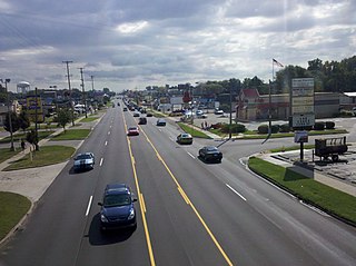
M-6, or the Paul B. Henry Freeway, is a 19.7-mile-long (31.7 km) east–west freeway and state trunkline highway in the United States that serves portions of southern Kent and eastern Ottawa counties south of Grand Rapids, Michigan. Although the freeway is named for Paul B. Henry, local residents and the press continue to use the original name, South Beltline as well on occasion. The freeway connects Interstate 196 (I-196) on the west with I-96 on the east. M-6 also provides a connection to U.S. Highway 131 (US 131) in the middle of its corridor while running through several townships on the south side of the Grand Rapids metropolitan area in Western Michigan. Each end is in a rural area while the central section has suburban development along the trunkline.
The Interurban Transit Partnership operates a public transit system called The Rapid, which provides bus service to the Grand Rapids, Michigan metropolitan area and beyond. The Rapid was recognized in 2004 and 2013 by receipt from the American Public Transportation Association of an "Outstanding Public Transportation System Award". In 2021, the system had a ridership of 4,490,200, or about 19,500 per weekday as of the fourth quarter of 2021.
M-231 is the designation of a state trunkline highway in the Lower Peninsula of the US state of Michigan that serves as a partial bypass to US Highway 31 (US 31) around Grand Haven. This highway was built south of Interstate 96 (I-96) as an additional crossing over the Grand River. The route runs from M-45 northward and across the river to a connection with I-96 near the current M-104 interchange.
U.S. Route 202 is a US Highway running from New Castle, Delaware, northeast to Bangor, Maine. The route runs through the southeastern part of the U.S. state of Pennsylvania, passing through the western and northern suburbs of Philadelphia. It follows a general southwest–northeast direction through the state, serving West Chester, King of Prussia, Bridgeport, Norristown, Montgomeryville, Doylestown, and New Hope. US 202 enters Pennsylvania from Delaware and heads north as a divided highway, where it becomes concurrent with US 322 at an intersection with US 1 in Painters Crossing. The two routes run north and become a freeway that bypasses West Chester to the east, with US 322 splitting from US 202. US 202 continues north and east along the freeway to King of Prussia, where it reverts to an at-grade divided highway following an interchange with Interstate 76 (I-76). The route becomes a one-way pair as it passes through Bridgeport and Norristown before both directions rejoin and the road continues northeast. US 202 follows an expressway-grade parkway between Montgomeryville and Doylestown prior to bypassing Doylestown to the south along a freeway. The route continues northeast as an at-grade road to New Hope, where it turns into a freeway again before it crosses the Delaware River on the New Hope–Lambertville Toll Bridge into New Jersey.
The Paul Henry Rail Trail is a rail trail in Kent County, Michigan. Originally running from 44th Street SE and Kalamazoo Ave. SE in a southeasterly direction to 60th street, the trail now connects with both the Thornapple Trail and Kent Trails. It has a 10-foot (3.0 m) wide paved surface. The Irving to Middleville segment is part of the North Country National Scenic Trail. The trail connects with the Frederik Meijer Trail at Wing Avenue in Kentwood. Extensions of the trail are planned. One portion of the trail, known as the Thornapple trail, begins in Middleville, Michigan, and continues south along the Thornapple River. This trail has paved and unpaved segments, as well as some on-road segments of varying distances. Many of the on-road segments are on gravel roads.
The Thornapple Trail is the abbreviated name for the a partially completed Paul Henry-Thornapple Trail in west Michigan. The Middleville portion is being connected to the Kent County section which will eventually link to Kent Trails. When complete, the Paul Henry - Thornapple Trail will be a 42-mile multi-use recreation trail running from Grand Rapids, Michigan to Vermontville, Michigan.

The Frederik Meijer M-6 Trail, formerly called the M-6 Trail, is a rail trail in Kent County, Michigan. It connects the Paul Henry Rail Trail with the Kent Trails in Byron Township, Michigan.

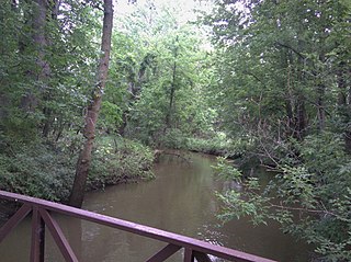
Plaster Creek is a 25.9-mile-long (41.7 km) urban stream in Kent County, Michigan in the United States. It is a tributary of the Grand River. The stream is named for the large deposit of gypsum found at its mouth. Its mean monthly flow averages 22 million gallons per day.

The Dequindre Cut is a below-grade pathway, formerly a Grand Trunk Western Railroad line, located on the east side of Detroit, Michigan, just west of St. Aubin Street. Much of the Cut has been converted to a greenway; the colorful graffiti along the pathway has been left in place.

Gaines Charter Township is a charter township of Kent County in the U.S. state of Michigan. The population was 25,146 at the 2010 census. The township is part of the Grand Rapids metropolitan area and is located about 3.0 miles (4.8 km) south of the city of Grand Rapids.

Plainfield Charter Township is a charter township of Kent County in the U.S. state of Michigan. The population was 30,952 at the 2010 census.
Buck Creek is a 20.3-mile-long (32.7 km) tributary of the Grand River in Kent and Allegan counties in the U.S. state of Michigan. It rises in northern Allegan County in Byron and Gaines townships, and flows through the cities of Kentwood and Wyoming as an urban stream to enter the Grand River in Grandville. The Grand River is a tributary of Lake Michigan.
References
- ↑ "Kent Trails". accessKent. Archived from the original on 2009-08-26. Retrieved 2009-09-19.
- ↑ "Trail system gets another link near M-6". Grand Rapids Press. 2008-06-16. Retrieved 2009-09-19.
- ↑ "Kent County approves widening six-miles of Kent Trails". Grand Rapids Press. 2009-05-28. Retrieved 2009-09-19.
Coordinates: 42°53′39″N85°43′55″W / 42.89408°N 85.73192°W
| | This Kent County, Michigan location article is a stub. You can help Wikipedia by expanding it. |