Kings Park, New York | |
---|---|
Coordinates: 40°53′19″N73°14′33″W / 40.88861°N 73.24250°W | |
Country | United States |
State | New York |
County | Suffolk |
Town | Smithtown |
Area | |
• Total | 7.05 sq mi (18.25 km2) |
• Land | 6.67 sq mi (17.28 km2) |
• Water | 0.38 sq mi (0.97 km2) |
Elevation | 174 ft (53 m) |
Population (2020) | |
• Total | 17,085 |
• Density | 2,560.70/sq mi (988.74/km2) |
Time zone | UTC-5 (Eastern (EST)) |
• Summer (DST) | UTC-4 (EDT) |
ZIP code | 11754 |
Area code(s) | 631, 934 |
FIPS code | 36-39672 |
GNIS feature ID | 0954667 |
Kings Park is a hamlet and census-designated place (CDP) in the Town of Smithtown, in Suffolk County, on Long Island, in New York, United States. The population was 17,282 as of the 2010 census. [2] [3] [4]
According to the United States Census Bureau, the CDP has a total area of 6.6 square miles (17.1 km2), of which 6.2 square miles (16.1 km2) is land and 0.39 square miles (1.0 km2), or 5.93%, is water. [2] [5]
Kings Park is bordered by Nissequogue to its east across the Nissequogue River, by Fort Salonga to its west, by Commack to its southwest, and by the hamlet of Smithtown to its southeast. [6]
Census | Pop. | Note | %± |
---|---|---|---|
2020 | 17,085 | — | |
U.S. Decennial Census [7] |
As of the census of 2010, there were 17,282 people and 6,212 households residing in the CDP. The population density was 2,787.4 inhabitants per square mile (1,076.2/km2). There were 6,469 housing units at an average density of 1,043.4 per square mile (402.9/km2). The racial makeup of the CDP was 80.1% White, 5.1% African American, 0.1% Native American, 8.4% Asian, 0.02% Pacific Islander, 4.9% some other race, and 1.3% from two or more races. Hispanic or Latino of any race were 16.3% of the population. [8]
There were 6,212 households in 2010, out of which 34.6% had children under the age of 18 living with them, 60.2% were headed by married couples living together, 9.4% had a female householder with no husband present, and 27.1% were non-families. 23.3% of all households were made up of individuals, and 12.1% were someone living alone who was 65 years of age or older. The average household size was 2.71, and the average family size was 3.24. [8]
In the CDP, the population was spread out, with 23.3% under the age of 18, 6.6% from 18 to 24, 23.4% from 25 to 44, 29.4% from 45 to 64, and 17.2% who were 65 years of age or older. The median age was 43.3 years. For every 100 females, there were 93.7 males. For every 100 females age 18 and over, there were 90.8 males. [8]
Over the period 2007-2011, the median annual income for a household in the CDP was $92,921, and the median income for a family was $106,128. Males had a median income of $78,882 versus $55,872 for females. The per capita income for the CDP was $37,980. About 1.6% of families and 3.3% of the population were below the poverty line, including 2.6% of those under age 18 and 6.3% of those age 65 or over. [9]
Kings Park is largely a Catholic community, with nearly 60% identifying as Catholic. The town parish, St. Joseph’s has the largest census population of all religious communities in the Town of Smithtown. The current pastor is Father Peter J. Dugandzic and has been in service since June 26, 2019.
Sunken Meadow State Park borders Long Island Sound and is accessible by the Sunken Meadow State Parkway. It is a part of the New York State Parks system. In addition to the water, the park has 6 miles (10 km) of public trails and 27 holes of golf. The park's facilities are used for different activities, among them various distance running competitions. "Cardiac Hill" is well known by local runners.[ citation needed ]
The Nissequogue River, 6 miles (10 km) in length, empties into Long Island Sound and is used for different types of water activities. [6] The river flows through the Nissequogue River State Park. [6]
Kings Park Bluff, sandwiched between Sunken Meadow State Park and Short Beach in Smithtown sits the Kings Park Bluff which empties into the Long Island Sound. Used as a boat launch and a popular fishing location for locals.[ citation needed ]
Kings Park is home to Leo P. Ostebo Kings Park Heritage Museum, the only school community managed town heritage museum in the United States, which is located in the first school building built in 1928. [10]
The Carlson Family - In the 1950s, the Carlson family revolutionized human waste disposal with a number of highly innovative inventions that were manufactured and sold in Kings Park and whose patented plans were used throughout the world. The two main inventions are the precast concrete cesspool and the precast concrete septic tank. There are several additional inventions for these two main products including their underground arrangement, metal manufacturing molds, and lifting apparatuses for loading and installation. These precast concrete cesspools and septic tanks are still manufactured and in use today worldwide.
Kings Park is the hometown of Houston Astros catcher/second baseman/outfielder Craig Biggio.[ citation needed ] Biggio was named one of the five greatest second basemen of all time by baseball statistician Bill James. He is also the modern-era record-holder for HBPs with 273, and the first player in history to be named an All-Star at both the catcher and second baseman positions. [11] Biggio was elected into the National Baseball Hall of Fame in 2015. Kings Park High School named their men's varsity baseball field after Craig Biggio.
Three original members of the progressive metal band Dream Theater were raised in Kings Park, including guitarist John Petrucci, bassist John Myung, and keyboardist Kevin Moore.
Kings Bay Base is a census-designated place (CDP) in Camden County, Georgia, United States; it is home to the Kings Bay Naval Submarine Base. The population was 1,777 at the 2010 census.
South Eliot is a census-designated place (CDP) in the town of Eliot in York County, Maine, United States. The population was 3,550 at the 2010 census. It is part of the Portland–South Portland–Biddeford, Maine Metropolitan Statistical Area.
Springvale is a village and former census-designated place in the city of Sanford in York County, Maine, United States. The population was 3,292 at the 2010 census. It is part of the Portland–South Portland–Biddeford, Maine metropolitan statistical area. The CDP was abolished when the town of Sanford reincorporated as a city.
Redford is a hamlet and census-designated place in the town of Saranac in Clinton County, New York, United States. The population was 477 at the 2010 census.
Lorenz Park is a census-designated place (CDP) in Columbia County, New York, United States. The population was 2,001 in 2020, a slight decrease from the 2,053 at the 2010 census.
Fairview is a hamlet and census-designated place (CDP) in Dutchess County, New York, United States. The population was 5,515 at the 2010 census. It is part of the Poughkeepsie–Newburgh–Middletown, NY Metropolitan Statistical Area as well as the larger New York–Newark–Bridgeport, NY-NJ-CT-PA Combined Statistical Area.
Hillside Lake is a hamlet and census-designated place (CDP) in Dutchess County, New York, United States. The population was 1,084 at the 2010 census. It is part of the Poughkeepsie–Newburgh–Middletown, NY Metropolitan Statistical Area as well as the larger New York–Newark–Bridgeport, NY-NJ-CT-PA Combined Statistical Area.
Flanders is a hamlet and a census-designated place (CDP) in Suffolk County, New York, United States. The population was 4,472 at the 2010 census. It is the location of the Big Duck.
Fort Salonga is a hamlet and census-designated place (CDP) in the Towns of Huntington and Smithtown in Suffolk County, on the North Shore of Long Island, in New York, United States. The population was 10,008 at the 2010 census.
Halesite is a hamlet and census-designated place (CDP) in the Town of Huntington in Suffolk County, on the North Shore of Long Island, in New York, United States. The population was 2,498 at the 2010 census.
Nesconset is a hamlet and census-designated place (CDP) in the town of Smithtown, located in Suffolk County, Long Island, New York, United States. The population was 13,387 at the 2010 census.
Nissequogue is a village in Suffolk County, on the North Shore of Long Island, in New York, United States. The village population was 1,564 at the 2020 census.
Shelter Island Heights is a hamlet and census-designated place (CDP) located in the Town of Shelter Island, in Suffolk County, New York, United States. It is located on the north side of Shelter Island, surrounding the village of Dering Harbor. The population was 1,601 at the time of the 2020 census.
Terryville is a census-designated place (CDP) in the Town of Brookhaven, Suffolk County, New York, United States. The population was 11,849 at the 2010 census.
West Hills is a hamlet and census-designated place (CDP) in the Town of Huntington, Suffolk County, New York. The population was 5,592 at the 2010 census. Residents share a post office with the hamlet of Huntington but much earlier in its history, West Hills had its own post office, located on Jericho Turnpike. Also, it is adjacent to the hamlet of Woodbury. It is considered part of the greater Huntington area, which is anchored by Huntington.
North Springfield is a census-designated place (CDP) in Fairfax County, Virginia, United States. The population was 7,274 at the 2010 census.
Gorham is a census-designated place (CDP) and the main village in the town of Gorham in Coos County, New Hampshire, United States. The population of the CDP was 1,851 at the 2020 census, out of 2,698 people in the entire town of Gorham.
Windham is a hamlet and census-designated place (CDP) in the town of Windham, Greene County, New York, United States. The population of the CDP was 367 at the 2010 census, out of a total of 1,703 people in the town.
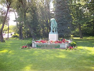
Smithtown is a hamlet and census-designated place (CDP) within the Town of Smithtown in Suffolk County, New York. The population was 25,629 at the 2020 census.
Smithtown is a town in Suffolk County, New York, on the North Shore of Long Island. It is part of the New York metropolitan area. The population was 116,296 at the 2020 Census.