Konya

Last updated
Konya
Konya 21 (cropped).JPG
Maulana Jelaledin Muhammad Rumi in konya.jpg
Selimiye Mosque Konya.jpg
KulturparkKonya.jpg
Aziziye Mosque, Konya (cropped).JPG
Clockwise from top: Konya city view; Selimiye Mosque; Aziziye Mosque; Konya Kültürpark; and Mevlana Museum
Konya city emblem.png
Turkey relief location map.jpg
Red pog.svg
Konya
Location of Konya, Turkey
Europe relief laea location map.jpg
Red pog.svg
Konya
Konya (Europe)
World location map (equirectangular 180).svg
Red pog.svg
Konya
Konya (Earth)
Coordinates: 37°52′N32°29′E / 37.867°N 32.483°E / 37.867; 32.483
CountryFlag of Turkey.svg  Turkey
Region Central Anatolia
Province Konya
Government
   Mayor Uğur İbrahim Altay (AKP)
Area
   Metropolitan municipality 38,873 km2 (15,009 sq mi)
  Urban
6,600 km2 (2,500 sq mi)
  Metro
6,600 km2 (2,500 sq mi)
Elevation
1,016 m (3,333 ft)
Population
 (2021 estimation) [1]
   Metropolitan municipality 2,277,017
  Density59/km2 (150/sq mi)
   Urban
1,390,051
  Urban density210/km2 (550/sq mi)
   Metro
1,390,051
  Metro density210/km2 (550/sq mi)
GDP
[2]
   Metropolitan municipality TRY 149.229 billion
US$ 16.616 billion (2021)
  Per capita TRY 65,928
US$ 7,341 (2021)
Time zone UTC+3 (TRT)
Postal code
42XXX
Area code (+90) 332
Licence plate 42
Website www.konya.bel.tr

Konya [lower-alpha 1] is a major city in central Turkey, on the southwestern edge of the Central Anatolian Plateau, and is the capital of Konya Province. During antiquity and into Seljuk times it was known as Iconium. In 19th-century accounts of the city in English its name is usually spelt Konia or Koniah. In the late medieval period, Konya was the capital of the Seljuk Turks' Sultanate of Rum, from where the sultans ruled over Anatolia.

Contents

As of 2023, the population of the Metropolitan Province was just over 2.3 million, making it the sixth most populous city in Turkey, and second most populous of the Central Anatolia Region, after Ankara. Konya is served by TCDD high-speed train (YHT) services from Istanbul, Ankara and Karaman. The local airport (Konya Havalimanı, KYA) is served by frequent flights from Istanbul whereas flights to and from Izmir are offered few times a week.

Name

Konya is believed to correspond to the Late Bronze Age toponym Ikkuwaniya known from Hittite records. [3] [4] This placename is regarded as Luwian in origin. [5] During classical antiquity and the medieval period it was known as Ἰκόνιον (Ikónion) in Greek (with regular Medieval Greek apheresis Kónio(n)) and as Iconium in Latin. [6] [7]

A folk etymology holds that the name Ikónion was derived from εἰκών ('icon'), referring to an ancient Greek legend according to which the hero Perseus vanquished the native population with an image of the " Gorgon Medusa's head" before founding the city. [8]

Konya was known as Dârülmülk to the Rum Seljuks. [9]

History

Overview

The Konya region has been inhabited since the third millennium BC and fell at different times under the rule of the Hittites, the Phrygians, the Greeks, the Persians and the Romans. In the 11th century the Seljuk Turks conquered the area and began ruling over its Rûm (Byzantine Greek) inhabitants, making Konya the capital of their new Sultanate of Rum. Under the Seljuks, the city reached the height of its wealth and influence. Following their demise, Konya came under the rule of the Karamanids, before being taken over by the Ottoman Empire in the 15th century. After the Turkish War of Independence the city became part of the modern Republic of Turkey.

Ancient history

Hercules Sarcophagus (ca. 250-260 AD) in the Konya Archaeological Museum Roman Sarcophagus (6526103787).jpg
Hercules Sarcophagus (ca. 250–260 AD) in the Konya Archaeological Museum
A marble statue of Nike, the Ancient Greek goddess located in Konya Archaeological Museum. Konya Archaeological Museum, Turkey 04.jpg
A marble statue of Nike, the Ancient Greek goddess located in Konya Archaeological Museum.
Marble Sarcophagus, typical of Pamphylia. Roman period, 3rd century AD, in the Konya Archaeological Museum Konya archeological museum - sarcophagus1.jpg
Marble Sarcophagus, typical of Pamphylia. Roman period, 3rd century AD, in the Konya Archaeological Museum

Excavations have shown that the region was inhabited during the Late Copper Age, around 3000 BC. [8]

The Phrygians established their kingdom in central Anatolia in the eighth century BC and Xenophon describes Iconium (as the city was originally called) as the last city of Phrygia. The region was overwhelmed by Cimmerian invaders c. 690 BC. Later it formed part of the Persian Empire, until Darius III was defeated by Alexander the Great in 333 BC. Alexander's empire broke up shortly after his death and the town came under the rule of Seleucus I Nicator.

During the Hellenistic period the town was ruled by the kings of Pergamon. As Attalus III, the last king of Pergamon, was about to die without an heir, he bequeathed his kingdom to the Roman Republic. Once incorporated into the Roman Empire, under emperor Claudius, the city's name was changed to Claudiconium. During the reign of emperor Hadrianus it was known as Colonia Aelia Hadriana.

St Paul and Iconium

According to the Acts of the Apostles, the apostles Paul and Barnabas preached in Iconium during their First Missionary Journey in about 47–48 AD, [10] [11] [12] having been persecuted in Antioch. Their visit to the synagogue of the Jews in Iconium divided the Jewish and non-Jewish communities between those who believed Paul and Barnabas' message and those who did not, provoking a disturbance during which attempts were made to stone the apostles. They fled to Lystra and Derbe in Lycaonia. This experience is also mentioned in the Second Letter to Timothy, [13] and 19th-century American theologian Albert Barnes suggested that Timothy had been present with Paul in Iconium, Antioch and Lystra. [14] Paul and Silas probably visited Konya again during Paul's Second Missionary Journey in about 50, [15] [16] [17] as well as near the beginning of his Third Missionary Journey several years later. [18] [19]

According to the apocryphal Acts of Paul and Thecla, Iconium was also the birthplace of Saint Thecla, who saved the city from attack by the Isaurians in 354. [20]

Byzantine Era

Under the Byzantine Empire, the city became the seat of a bishop, and in c. 370 was raised to the status of a metropolitan see for Lycaonia, with Saint Amphilochius as the first metropolitan bishop. [20] In the 7th century it became part of the Anatolic Theme and was, together with the nearby (Caballa) Kaballah Fortress (Turkish: Gevale Kalesi) (location) a frequent target of Arab attacks during the Arab–Byzantine wars in the eighth to tenth century, [20] being captured by Arabs in 723-4. [21] The rebellious general Andronikos Doukas used the Kaballah fortress as his base in 905–906. [22] During the tenth or eleventh century the church of Saint Amphilochius was constructed inside the citadel of Kaballa, housing the tomb of the saint which the Turks later believed to be the tomb of Plato, renaming the church to Eflâtun Mescidi (mosque of Plato). [23] The monastery of Saint Chariton, another local from Iconium, was located a few miles away in Sylata. [24]

The Seljuk Turks first raided the area in 1069, but a period of chaos overwhelmed Anatolia after the Seljuk victory in the Battle of Manzikert in 1071, and the Norman mercenary leader Roussel de Bailleul rose in revolt at Iconium. The city was finally conquered by the Seljuks in 1084. [20]

Seljuk and Karamanid eras

Late evening view of Mevlana Fountain opposite the Selimiye Mosque, Konya. Turkey. Sadirvan, Konya (cropped).jpg
Late evening view of Mevlana Fountain opposite the Selimiye Mosque, Konya. Turkey.
Ince Minaret Medrese (1279) in Konya Ince Minareli Medrese 01.jpg
Ince Minaret Medrese (1279) in Konya

Iconium became the second capital of the Seljuk Sultanate of Rum after the fall of Nicaea until 1243. [25] It was briefly occupied by the army of the First Crusade (August 1097) and Frederick Barbarossa (May 18, 1190) after the Battle of Iconium (1190). The area was reoccupied by the Turks after the Crusaders left.

Established in 1273, the Sufi Mevlevi Order and its Whirling Dervishes are renowned symbols of Konya and Turkey. Mevlana Konya.jpg
Established in 1273, the Sufi Mevlevi Order and its Whirling Dervishes are renowned symbols of Konya and Turkey.

Konya reached the height of its wealth and influence in the second half of the 12th century when the Seljuk sultans of Rum also subdued the Anatolian beyliks to their east, especially that of the Danishmends, thus establishing their rule over virtually all of eastern Anatolia,. They also acquired several port towns along the Mediterranean (including Alanya) and the Black Sea (including Sinop) and even gained a brief foothold in Sudak, Crimea. This golden age lasted until the first decades of the 13th century.[ citation needed ]

Many Persians and Persianised Turks from Persia and Central Asia migrated to Anatolian cities either to flee the invading Mongols or to benefit from the opportunities for educated Muslims in a newly established kingdom. [26]

The Mevlana Museum (1274) is the last resting place of the Sufi mystic and poet Rumi in Konya, the capital of the Anatolian Seljuk Sultanate. Mausoleo Mevlana.jpg
The Mevlana Museum (1274) is the last resting place of the Sufi mystic and poet Rumi in Konya, the capital of the Anatolian Seljuk Sultanate.

Following the fall of the Anatolian Seljuk Sultanate in 1307, Konya became the capital of the Karamanids, a Turkish beylik, which lasted until 1322 when the city was captured by the neighbouring Beylik of Karamanoğlu. In 1420, the Beylik of Karamanoğlu fell to the Ottoman Empire and, in 1453, Konya was made the provincial capital of the Karaman Eyalet.

Ottoman Empire

Under Ottoman rule, Konya was administered by the Sultan's sons (Şehzade), starting with Şehzade Mustafa and Şehzade Cem (the sons of Sultan Mehmed II), and continuing with the future Sultan Selim II.

Between 1483 and 1864, Konya was the administrative capital of the Karaman Eyalet. During the reforming Tanzimat period, it became the seat of the larger Vilayet of Konya which replaced the Karaman Eyalet, as part of the new vilayet system introduced in 1864.

In 1832 Anatolia was invaded by Mehmed Ali Paşa of Kavala whose son, İbrahim Paşa, occupied Konya. Although he was driven out with the help of the European powers, Konya went into a decline after this, as described by the British traveller, William Hamilton, who visited in 1837 and found a scene 'of destruction and decay', as he recorded in his Researches in Asia Minor, Pontus and Armenia, published in 1842. [27]

Konya's textile and mining industries flourished under the Ottomans. [28]

Turkish Republic

Greeks from nearby village of Sille in 19th century Anatolian Greeks Konya.JPG
Greeks from nearby village of Sille in 19th century

During the Turkish War of Independence (1919–22) Konya was a major air base. In 1922, the air force, renamed as the Inspectorate of Air Forces, [lower-alpha 2] was headquartered in Konya. [29] [30] Before 1923, 4,000 Orthodox, Turkish-speaking and Greek-speaking Christians lived there. The Greek community numbered approximately 2,500 people who maintained, at their own expense, a church, a boys' school and a girls' school. In 1923 during the population exchange between Greece and Turkey, the Greeks of the nearby village of Sille were forced to leave as refugees and resettle in Greece. [31]

Government

Konya Metropolitan Governor's Office Konya - Valilik - panoramio.jpg
Konya Metropolitan Governor's Office

The first local administration in Konya was founded in 1830 and converted into a municipality in 1876. [lower-alpha 3] In March 1989, the municipality became a Metropolitan Municipality. As of that date, Konya had three central district municipalities (Meram, Selçuklu, Karatay) and a Metropolitan Municipality.

Economy

Home to several industrial parks. The city ranks among the Anatolian Tigers. [32] [33] [34] [35] In 2012 exports from Konya reached 130 countries. [35] A number of Turkish industrial conglomerates, such as Bera (ex Kombassan) Holding, have their headquarters in Konya. [36]

While agriculture-based industries play a role, the city's economy has evolved into a center for the manufacturing of components for the automotive industry; machinery manufacturing; agricultural tools; casting; plastic paints and chemicals; construction materials; paper and packaging; processed foods; textiles; and leather. [35]

Turkey's largest solar farm is located 20 miles east of the city, near Karapınar. [37]

Geography

Konya sits in the center of the largest province, in the largest plain (Konya Plain), and is the seventh most heavily populated city in Turkey. [38]

Lake Meke, a large crater lake in Konya Province Lake Meke at Night 2.jpg
Lake Meke, a large crater lake in Konya Province

The city is in the southern part of the Central Anatolia Region with the southernmost side of the province hemmed in by the Taurus Mountains.

Climate

Konya has a cold semi-arid climate (BSk) under the Köppen classification [39] and a temperate continental (Dc) climate under the Trewartha classification.

Summer daytime temperatures average 30 °C (86 °F), although summer nights are cool. The highest temperature recorded in Konya was 40.9 °C (106 °F) on 14 August 2023, closely beating the former record of 40.6 °C (105 °F) on 30 July 2000. Winters average −4.2 °C (24 °F), and the lowest temperature recorded was −26.5 °C (−16 °F) on 6 February 1972. Precipitation levels are low and happen mainly in winter and spring.

Climate data for Konya (1991–2020, extremes 1929–2023)
MonthJanFebMarAprMayJunJulAugSepOctNovDecYear
Record high °C (°F)19.3
(66.7)
23.8
(74.8)
28.9
(84.0)
34.6
(94.3)
34.4
(93.9)
36.7
(98.1)
40.6
(105.1)
40.9
(105.6)
38.8
(101.8)
32.3
(90.1)
25.4
(77.7)
21.8
(71.2)
40.9
(105.6)
Mean daily maximum °C (°F)4.6
(40.3)
6.9
(44.4)
12.5
(54.5)
17.6
(63.7)
22.8
(73.0)
27.4
(81.3)
31.0
(87.8)
30.9
(87.6)
26.7
(80.1)
20.4
(68.7)
12.7
(54.9)
6.3
(43.3)
18.3
(64.9)
Daily mean °C (°F)−0.3
(31.5)
1.3
(34.3)
6.0
(42.8)
10.9
(51.6)
15.9
(60.6)
20.5
(68.9)
24.1
(75.4)
24.0
(75.2)
19.4
(66.9)
13.4
(56.1)
6.2
(43.2)
1.5
(34.7)
11.9
(53.4)
Mean daily minimum °C (°F)−3.9
(25.0)
−3.3
(26.1)
0.2
(32.4)
4.4
(39.9)
9.0
(48.2)
13.6
(56.5)
17.1
(62.8)
17.2
(63.0)
12.3
(54.1)
7.0
(44.6)
0.8
(33.4)
−2.2
(28.0)
6.0
(42.8)
Record low °C (°F)−28.2
(−18.8)
−26.5
(−15.7)
−16.4
(2.5)
−8.6
(16.5)
−1.2
(29.8)
1.8
(35.2)
6.0
(42.8)
5.3
(41.5)
−3.0
(26.6)
−8.4
(16.9)
−20.0
(−4.0)
−26.0
(−14.8)
−28.2
(−18.8)
Average precipitation mm (inches)35.9
(1.41)
23.1
(0.91)
27.4
(1.08)
34.2
(1.35)
38.2
(1.50)
27.8
(1.09)
6.5
(0.26)
6.5
(0.26)
15.9
(0.63)
29.7
(1.17)
34.5
(1.36)
45.6
(1.80)
325.3
(12.81)
Average precipitation days10.538.979.8010.8312.478.103.002.634.407.277.1310.1095.2
Average relative humidity (%)79.873.363.458.756.147.538.939.444.257.670.179.959.0
Mean monthly sunshine hours 105.4138.4195.3216.0269.7309.0344.1334.8291.0235.6159.0102.32,700.6
Mean daily sunshine hours 3.44.96.37.28.710.311.110.89.77.65.33.37.4
Source 1: Turkish State Meteorological Service [40]
Source 2: NOAA (humidity) [41]

Culture

Mevlana Cultural Centre in Konya Mevlana Cultural Center, Konya.jpg
Mevlana Cultural Centre in Konya

Konya has a reputation for being one of the more religiously conservative metropolitan centres in Turkey. [42]

Konya was the final home of Rumi (Mevlana), whose turquoise-domed tomb in the city is its primary tourist attraction. In 1273, Rumi's followers established the Mevlevi Sufi order of Islam and became known as the Whirling Dervishes.

Every Saturday, there are Whirling Dervish performances (semas) at the Mevlana Cultural Centre. Unlike some of the commercial performances staged in cities like Istanbul, these are genuinely spiritual sessions.

Expensive, richly patterned Konya carpets were exported to Europe during the Renaissance [43] and were draped over furniture to show off the wealth and status of their owners. They often crop up in contemporary oil paintings as symbols of the wealth of the painter's clients. [44]

Attractions

Alaaddin Mosque (1235) on Alaaddin Hill (Alaaddin Tepesi) in central Konya Alaeddin Mosque, Konya 01.jpg
Alaaddin Mosque (1235) on Alaaddin Hill (Alaaddin Tepesi) in central Konya
Taskopru, Beysehir. KonyaTaskopruBeysehir.jpg
Taşköprü, Beyşehir.

Food

One of the city's best-known dishes, etli ekmek consists of slices of lamb served on flaps of soft white bread. [48] Konya is also known for unfeasibly long pides (Turkish pizzas) intended to be shared, and tirit, a traditional rice dish made from meat and assorted vegetables.

Tirit Tirit Kofte.jpg
Tirit

Konya is also known for its sweets, including cezerye , an old Turkish sweet made from carrots, and pişmaniye, which is similar to American cotton candy.

Sports

Konya Metropolitan Stadium in Konya TORKU ARENA - panoramio.jpg
Konya Metropolitan Stadium in Konya

The city's football team Konyaspor is part of the Turkish Professional Football League. On May 31, 2017, they won their first national trophy, beating İstanbul Başakşehir to the Türkiye Kupası in a penalty shootout. They repeated this success on August 6, 2017, defeating Beşiktaş to win the Türkiye Süper Kupası (Turkish Super Bowl).

Konya Metropolitan Stadium (Konya Büyükşehir Stadyumu) is in the Selçuklu neighbourhood and can seat up to 42,000 spectators.

The city hosted the 2022 Islamic Solidarity Games in August 2022.

Education

Founded in 1975, Selçuk University had the largest number of students (76,080) of any public university in Turkey during the 2008–09 academic year. [49] [ better source needed ] The other public university, Necmettin Erbakan University, was established in Konya in 2010. [50] [ better source needed ]

A view from KTO Karatay University KTO,KARATAY.jpg
A view from KTO Karatay University

Private colleges in Konya include the KTO Karatay University. [51] [ better source needed ]

Konya hosts the Anatolian Eagle Tactical Training Centre for training NATO Allies and friendly Air Forces. [52] [ better source needed ]

Transportation

A TCDD HT65000 on the Ankara-Konya line of the Turkish State Railways TCDD HT65000 high-speed train.jpg
A TCDD HT65000 on the Ankara–Konya line of the Turkish State Railways
A Skoda 28 T tram produced for the upcoming Konya Metro Tramvaj 28T.jpg
A Škoda 28 T tram produced for the upcoming Konya Metro

Intercity buses

The central bus station has connections to a range of destinations, including Istanbul, Ankara and İzmir. It is connected to the town centre by a tram.

Inner-city public transport

The Konya Tram network is 41 km (25 mi) long and has two lines with 41 stations. Opened in 1992, it was expanded in 1996 and 2015. The Konya Tram uses Škoda 28 T vehicles. [53]

Work began on building a Konya Metro in 2020 and is expected to be completed in 2024 and will have 22 stations. [54]

Konya also has an extensive inner-city bus network.

Railway

Konya is connected to Ankara, Eskişehir, Istanbul and Karaman via the high-speed railway services of the Turkish State Railways. [55] [56]

Airport and airbase

Konya Airport (KYA) is a public airport but also a military airbase used by NATO. The Third Air Wing [lower-alpha 4] of the 1st Air Force Command [lower-alpha 5] is based at the Konya Air Base. The wing controls the four Boeing 737 AEW&C Peace Eagle aircraft of the Turkish Air Force. [57] [58]

Notable people

Twin towns – sister cities

Konya is twinned with:

See also

Notes

  1. Turkish pronunciation: [ˈkoɲ.ja]
  2. Turkic:Kuva-yı Havaiye Müfettişliği
  3. "İhtisab Agalıgi" (Islamic-Ottoman office for public regularity)
  4. Ana Jet Üssü or AJÜ
  5. Hava Kuvvet Komutanlığı

Related Research Articles

<span class="mw-page-title-main">Ankara</span> Capital of Turkey

Ankara, historically known as Ancyra and Angora, is the capital of Turkey. Located in the central part of Anatolia, the city has a population of 5.1 million in its urban center and 5.8 million in Ankara Province, making it Turkey's second-largest city after Istanbul, but first by the urban area (4,130 km2).

<span class="mw-page-title-main">Anatolia</span> Peninsula in West Asia

Anatolia, also known as Asia Minor, is a large peninsula located in West Asia and a region of Turkey, constituting most of its contemporary territory. Geographically, the Anatolian region is bounded by the Mediterranean Sea to the south, the Aegean Sea to the west, the Turkish Straits to the north-west, and the Black Sea to the north. The eastern and southeastern boundary is either the southeastern and eastern borders of Turkey, or an imprecise line from the Gulf of Iskenderun to the Black Sea. Topographically, the Sea of Marmara connects the Black Sea with the Aegean Sea through the Bosporus strait and the Dardanelles strait, and separates Anatolia from Thrace in the Balkan peninsula of Southeastern Europe.

<span class="mw-page-title-main">Kayseri</span> Metropolitan municipality in Central Anatolia, Turkey

Kayseri is a large city in Central Anatolia, Turkey, and the capital of Kayseri province. Historically known as Caesarea, it has been the historical capital of Cappadocia since ancient times. The Kayseri Metropolitan Municipality area is composed of five districts: the two central districts of Kocasinan and Melikgazi, and since 2004, also outlying Hacılar, İncesu, and Talas.

<span class="mw-page-title-main">Kilij Arslan II</span> Seljuq Sultan of Rum

Kilij Arslan II or ʿIzz ad-Dīn Kilij Arslān ibn Masʿūd was a Seljuk Sultan of Rûm from 1156 until his death in 1192.

<span class="mw-page-title-main">Karamanids</span> 1250–1487 beylik in south-central Anatolia

The Karamanids, also known as the Emirate of Karaman and Beylik of Karaman, was one of the Anatolian beyliks, centered in South-Central Anatolia around the present-day Karaman Province. From the mid 14th century until its fall in 1487, the Karamanid dynasty was one of the most powerful beyliks in Anatolia.

<span class="mw-page-title-main">Karaman</span> City in south-central Turkey

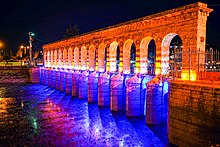
Karaman, historically known as Laranda, is a city in south central Turkey, located in Central Anatolia, north of the Taurus Mountains, about 100 km (62 mi) south of Konya. It is the seat of Karaman Province and Karaman District. Its population is 175,390 (2022). The town lies at an average elevation of 1,039 m (3,409 ft). The Karaman Museum is one of the major sights.

<span class="mw-page-title-main">Sultanate of Rum</span> Turkish state in central Anatolia from 1077 to 1308

The Sultanate of Rûm was a culturally Turco-Persian Sunni Muslim state, established over conquered Byzantine territories and peoples (Rûm) of Anatolia by the Seljuk Turks following their entry into Anatolia after the Battle of Manzikert (1071). The name Rûm was a synonym for the medieval Eastern Roman Empire and its peoples, as it remains in modern Turkish. The name is derived from the Aramaic (rhōmī) and Parthian (frwm) names for ancient Rome, via the Greek Ῥωμαῖοι (Romaioi).

<span class="mw-page-title-main">Anatolian beyliks</span> Historical, small Turkic principalities in Anatolia

Anatolian beyliks were small principalities in Anatolia governed by beys, the first of which were founded at the end of the 11th century. A second and more extensive period of establishment took place as a result of the decline of the Seljuq Sultanate of Rûm in the latter half of the 13th century.

<span class="mw-page-title-main">Ince Minaret Madrasa</span> 13th-century madrasa (and now museum) in Konya, Turkey

İnce Minareli Medrese is a 13th-century madrasa located in Konya, Turkey, now housing the Museum of Stone and Wood Art, noted for its ornate entrance, domed courtyard, ornamentally bricked minaret, partially destroyed in 1901, and exemplar Anatolian Seljuk architecture.

<span class="mw-page-title-main">Germiyanids</span> Turkic Beylik in Anatolia between 1300-1429

The Germiyanids was a prominent Anatolian beylik established by the Oghuz Turkish tribes after the decline of Sultanate of Rûm. However, while the beylik was always mentioned as Turkoman or Oghuz Turkish, the population consisted of Turks and Yezidi Kurds, brought by the Seljuks from the east of Malatya to western Anatolia as militia guards against the threatening Turkish tribesmen.

<span class="mw-page-title-main">Museums in Turkey</span> Museums based in the Republic of Turkey

Following the proclamation of the Republic, Turkish museums developed considerably, mainly due to the importance Atatürk had attached to the research and exhibition of artifacts of Anatolia. When the Republic of Turkey was proclaimed, there were only the İstanbul Archaeology Museum called the "Asar-ı Atika Müzesi", the Istanbul Military Museum housed in the St. Irene Church, the Islamic Museum in the Suleymaniye Complex in Istanbul and the smaller museums of the Ottoman Empire Museum in a few large cities of Anatolia.

<span class="mw-page-title-main">Nevşehir</span> Municipality in Turkey

Nevşehir is a city in the Central Anatolia Region of Turkey. It is the seat of Nevşehir Province and Nevşehir District. Its population is 123,882 (2022). It is 290 km (180 mi) from the capital Ankara and lies within the historical region of Cappadocia.

<span class="mw-page-title-main">Kayqubad I</span> Seljuq sultan of Rum (1220-1237 AD)

Alā ad-Dīn Kayqubād ibn Kaykhusraw, also known as Kayqubad I, was the Seljuq Sultan of Rûm who reigned from 1220 to 1237. He expanded the borders of the sultanate at the expense of his neighbors, particularly the Mengujek Beylik and the Ayyubids, and established a Seljuq presence on the Mediterranean with his acquisition of the port of Kalon Oros, later renamed Ala'iyya in his honor. The sultan, sometimes styled Kayqubad the Great, is remembered today for his rich architectural legacy and the brilliant court culture that flourished under his reign.

<span class="mw-page-title-main">Turkish art</span> Overview of art in the Republic of Turkey

Turkish art refers to all works of visual art originating from the geographical area of what is present day Turkey since the arrival of the Turks in the Middle Ages. Turkey also was the home of much significant art produced by earlier cultures, including the Hittites, Ancient Greeks, and Byzantines. Ottoman art is therefore the dominant element of Turkish art before the 20th century, although the Seljuks and other earlier Turks also contributed. The 16th and 17th centuries are generally recognized as the finest period for art in the Ottoman Empire, much of it associated with the huge Imperial court. In particular the long reign of Suleiman the Magnificent from 1520 to 1566 brought a combination, rare in any ruling dynasty, of political and military success with strong encouragement of the arts.

<span class="mw-page-title-main">Alâeddin Mosque</span> 12th-century Seljuk-era mosque in Konya, Turkey

The Alâeddin Mosque is the principal monument on Alaaddin Hill in the centre of Konya, Turkey. Part of the hilltop citadel complex that contained the Seljuk Palace, it served as the main prayer hall for the Seljuk Sultans of Rum and its courtyard contains the burial places of several of the sultans. It was constructed in stages between the mid-12th and mid-13th centuries. It is the largest of several Seljuk mosques to survive in Konya.

Ghiyath al-Dīn Me’sud ibn Kaykaus or Mesud II bore the title of Sultan of Rûm at various times between 1284 and 1308. He was a vassal of the Mongols under Mahmud Ghazan and exercised no real authority. History does not record his ultimate fate. He was the last of the Seljuks.

The Seljuk Empire, or the GreatSeljuk Empire, was a high medieval, culturally Turco-Persian, Sunni Muslim empire, established and ruled by the Qïnïq branch of Oghuz Turks. It spanned a total area of 3.9 million square kilometres from Anatolia and the Levant in the west to the Hindu Kush in the east, and from Central Asia in the north to the Persian Gulf in the south.

<span class="mw-page-title-main">Seljuk architecture</span> Building traditions used by Seljuk dynasty

Seljuk architecture comprises the building traditions that developed under the Seljuk dynasty, when it ruled most of the Middle East and Anatolia during the 11th to 13th centuries. The Great Seljuk Empire contributed significantly to the architecture of Iran and surrounding regions, introducing innovations such as the symmetrical four-iwan layout and the first widespread creation of state-sponsored madrasas. Their buildings were generally constructed in brick, with decoration created using brickwork, tiles, and carved stucco.

Yakub I was the founder of the beylik of Germiyan, located in western Anatolia around Kütahya. Although Germiyan revolted against Mesud II, the Sultan of Rum, Yakub accepted vassalage under Kayqubad III. The Sultanate of Rum disintegrated shortly after. At that point, Yakub's realm extended as far east as Ankara and incorporated various towns taken from the Byzantine Empire and the Catalan Company. Yakub was the suzerain of many of his neighbors, and his reign was described as economically prosperous by contemporary historians. He was succeeded by his son Mehmed, nicknamed Chakhshadan.

<span class="mw-page-title-main">Iplikçi Mosque</span> 13th-century Seljuk-era mosque in Konya, Turkey

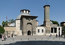
The Iplikçi Mosque, also known as Ebülfazl Mosque, is a 13th-century Seljuk-era Islamic Friday mosque built in 1201-2 AD in the city of Konya, Turkey, to the east of Alaeddin Hill.

References

  1. "Turkey: Administrative Division (Provinces and Districts) - Population Statistics, Charts and Map".
  2. "Statistics by Theme > National Accounts > Regional Accounts". www.turkstat.gov.tr. Retrieved 11 May 2023.
  3. Forlanini, Massimo (2017). "South Central: The Lower Land and Tarḫuntašša". In Weeden, Mark; Ullmann, Lee (eds.). Hittite Landscape and Geography. Brill. p. 244. doi:10.1163/9789004349391_022.
  4. Bryce, Trevor (2006). The Trojans and their neighbours. London: Routledge. p. 81. ISBN   9780415349550.
  5. Klein, Jared; Joseph, Brian; Fritz, Matthias (2017). Handbook of Comparative and Historical Indo-European Linguistics. de Gruyter. p. 239. ISBN   978-3-11-026128-8.
  6. Bryce, Trevor (2006). The Trojans and their neighbours. London: Routledge. p. 81. ISBN   9780415349550.
  7. Klein, Jared; Joseph, Brian; Fritz, Matthias (2017). Handbook of Comparative and Historical Indo-European Linguistics. de Gruyter. p. 239. ISBN   978-3-11-026128-8.
  8. 1 2 "Konya". Encyclopædia Britannica . Retrieved 25 May 2015.
  9. "KONYA İç Anadolu bölgesinde şehir ve bu şehrin merkez olduğu il". TDV Encyclopedia of Islam (44+2 vols.) (in Turkish). Istanbul: Turkiye Diyanet Foundation, Centre for Islamic Studies. 1988–2016.
  10. Acts 13:51
  11. Acts 14:1–5
  12. Acts 14:21)
  13. 2 Timothy 3:10–13
  14. "Acts 14 Barnes' Notes". Bible Hub. Retrieved 2019-08-29.
  15. Acts 16:2
  16. Ramsay, William Mitchell (1908). The Cities of St. Paul. A.C. Armstrong. pp. 315–384.
  17. Bruce, Frederick Fyvie (1977). Paul: Apostle of the Heart Set Free. Eerdmans. p. 475. ISBN   978-0-8028-3501-7.
  18. Acts 19:1
  19. Bruce, Frederick Fyvie (1977). Paul: Apostle of the Heart Set Free. Eerdmans. p. 286. ISBN   978-0-8028-3501-7.
  20. 1 2 3 4 Foss, Clive (1991). "Ikonion". In Kazhdan, Alexander (ed.). Oxford Dictionary of Byzantium . London and New York: Oxford University Press. p. 985. ISBN   978-0-19-504652-6.
  21. Whittow, Mark (1996). The Making of Byzantium, 600-1025. University of California Press. p. 138. ISBN   9780520204966 . Retrieved 6 October 2023.
  22. Heald Jenkins, Romilly James (1987). Byzantium The Imperial Centuries, AD 610-1071. University of Toronto Press. p. 204. ISBN   9780802066671 . Retrieved 6 October 2023.
  23. Tekinalp, V. Macit (2009). "Palace churches of the Anatolian Seljuks: tolerance ornecessity?". Byzantine and Modern Greek Studies. 332 (2): 148–167. doi:10.1179/174962509X417645.
  24. Breytenbach, Cilliers; Zimmermann, Christiane (2017). Early Christianity in Lycaonia and Adjacent Areas From Paul to Amphilochius of Iconium. Brill. ISBN   9789004352520.
  25. Hiro, Dilip (2011). Inside Central Asia. Gerald Duckworth & Company. p. 76. ISBN   978-0-7156-4038-8.
  26. Mango, Andrew (1972). Discovering Turkey. Hastings House. p. 61. ISBN   0-8038-7111-2. OCLC   309327.
  27. Freely, John (1998). The Western Interior of Turkey (1st ed.). Istanbul: SEV. pp. 235–36. ISBN   9758176226.
  28. Chen, Yuan Julian (2021-10-11). "Between the Islamic and Chinese Universal Empires: The Ottoman Empire, Ming Dynasty, and Global Age of Explorations". Journal of Early Modern History. 25 (5): 422–456. doi:10.1163/15700658-bja10030. ISSN   1385-3783. S2CID   244587800.
  29. "Bir Hata Oluştu". Hvkk.tsk.tr. Archived from the original on 5 May 2015. Retrieved 25 May 2015.
  30. Kocatürk, Utkan (1983). Atatürk ve Türkiye Cumhuriyeti tarihi kronolojisi, 1918–1938 (in Turkish). Türk Tarih Kurumu Basımevi. p. 634.
  31. "IFMSA Exchange Portal". Exchange.ifmsa.org. Retrieved 7 August 2018.
  32. "Financial Times: Reports — Anatolian tigers: Regions prove plentiful" . Ft.com. Archived from the original on 2022-12-10. Retrieved 7 August 2018.
  33. root. "Anatolian Tigers". Investopedia. Retrieved 25 May 2015.
  34. "Zaman: Anatolian tigers conquering the world". Archived from the original on 2013-08-21. Retrieved 2013-08-21.
  35. 1 2 3 "General Overview Of The Konya Economy". En.kto.org.tr. Retrieved 25 May 2015.
  36. "Anasayfa | Bera Holding". beraholding.com.tr. Retrieved 2022-07-21.
  37. "The World's Largest Solar Power Plant in Konya". TR Dergisi. 2017-05-15. Retrieved 2022-07-21.
  38. "Turkey: Provinces & Major Cities – Statistics & Maps on City Population". Archived from the original on 2017-01-14. Retrieved 2013-12-31.
  39. "Updated world map of the Köppen-Geiger climate classification" (PDF). Hydrology and Earth System Sciences Discussions. Retrieved 7 August 2018.
  40. "Resmi İstatistikler: İllerimize Ait Mevism Normalleri (1991–2020)" (in Turkish). Turkish State Meteorological Service. Retrieved 6 July 2021.
  41. "World Meteorological Organization Climate Normals for 1991–2020: Konya" (CSV). National Centers for Environmental Information . Retrieved 2 August 2023.
  42. "'Islam problem' baffles Turkey". BBC News. 2004-12-03. Retrieved 2019-08-29.
  43. Campbell, Gordon (2006). "Carpet II: History". The Grove Encyclopedia of Decorative Arts. Vol. 1. Oxford University Press. p. 189. ISBN   978-0-19-518948-3.
  44. "Carpets of the Ottoman Period". Old Turkish Carpets. 2019-06-19. Retrieved 2019-08-29.
  45. 1 2 3 "Konya Museums and Ruins". www.ktb.gov.tr.
  46. McLean, B. Hudson (2018). Greek and Latin Inscriptions in the Konya Archaeological Museum. British Institute of Archaeology at Ankara. ISBN   978-1-898249-14-6 . Retrieved 7 August 2018 via Google Books.
  47. "Mevlâna Culture Centre | Konya, Turkey | Entertainment - Lonely Planet".
  48. "Konya Büyükşehir Belediyesi". Konya.bel.tr (in Turkish). Archived from the original on 2018-08-08. Retrieved 2019-08-29.
  49. "Small Ruminant Congress". kucukbas2014.com. 2014-10-18. Archived from the original on 2014-10-18. Retrieved 2019-08-29.{{cite web}}: CS1 maint: unfit URL (link)
  50. "Konya Necmettin Erbakan Üniversitesi". Archived from the original on 27 April 2015. Retrieved 25 May 2015.
  51. "KTO Karatay Üniversitesi". Karatay.edu.tr. Retrieved 2011-09-16.
  52. Official Web Site
  53. "Škoda Transportation wins Konya tram contract". Railway Gazette. 2013-03-04. Retrieved 2019-08-29.
  54. Uysal, Onur (2020-10-01). "Last status of metro and tram projects of Turkey". Rail Turkey En. Retrieved 2022-07-22.
  55. "Opening of Ankara – Konya fast line completes strategic link". Railway Gazette. 24 August 2011. Retrieved 2013-02-12.
  56. "Invensys commissions ERTMS solution on Turkish High Speed Line". European Railway Review. 7 September 2011. Archived from the original on 6 January 2012. Retrieved 20 December 2011.
  57. Mehmet Kayhan YILDIZ- Hasan BÖLÜKBAŞ- Serdar ÖZGÜR- Tolga YANIK- Hasan DÖNMEZ/ KONYA,(DHA). "TSK yeni yıldızı Barış Kartalı'na kavuştu". HÜRRİYET – TÜRKİYE'NİN AÇILIŞ SAYFASI. Retrieved 25 May 2015.
  58. "Turkey takes delivery of military aircraft". TodaysZaman. Archived from the original on February 22, 2015. Retrieved 25 May 2015.
  59. Battutah, Ibn (2002). The Travels of Ibn Battutah. London: Picador. pp. 106, 309. ISBN   978-0-330-41879-9.
  60. Thonemann, Peter (2011-05-04). "Amphilochius of Iconium and Lycaonian Asceticism". Journal of Roman Studies. 101: 185–205. doi:10.1017/s0075435811000037. ISSN   0075-4358. S2CID   162127197.
  61. Savramis, Demosthenes (1968). Die soziale Stellung des Priesters in Griechenland [Social position of the priest in Greece] (in German). E. J. Brill.
  62. Kiminas, Demetrius (2009). The ecumenical patriarchate : a history of its metropolitanates with annotated hierarch catalogs. San Bernardino, CA: Borgo Press. p. 100. ISBN   978-1-4344-5876-6.
  63. Rizvi, Kishwar (2015). The Transnational Mosque: Architecture and Historical Memory in the Contemporary Middle East. UNC Press Books. p. 56. ISBN   978-1-4696-2117-3 . Retrieved 16 May 2020.
  64. "Rumi Remembered in Birthplace of Shams". Archived from the original on 7 April 2015. Retrieved 21 March 2015.
  65. Kyoto İle Kardeş Şehir Protokolü İmzalandı, Heyet Japon Parkı'nı Gezdi Archived 2014-10-16 at the Wayback Machine , Konya Büyükşehir Belediyesi (2010)
  66. "Turkish FM's speech to Kirkuk's Turkmen community". ekurd.net. Retrieved 13 May 2024.
  67. "UNPO: Iraqi Turkmen: Turkey Promises Protection Of Turkmen". unpo.org. Retrieved 13 May 2024.

General

Further reading

Published in the 19th century

Published in the 20th century

Published in the 21st century