Kuldhara

Last updated

Kuldhara
Kuldhar
Village
Ghost town
Kuldhara, an abandoned village (30738705327).jpg
Ruins of Kuldhara houses
India Rajasthan location map.svg
Red pog.svg
Kuldhara
Location of Kuldhara in Rajasthan, India
India location map.svg
Red pog.svg
Kuldhara
Kuldhara (India)
Coordinates: 26°52′12″N70°47′06″E / 26.87000°N 70.78500°E / 26.87000; 70.78500
CountryIndia
State Rajasthan
District Jaisalmer
Elevation
266 m (873 ft)
Time zone UTC+5:30 (IST)

Kuldhara is an abandoned village in the Jaisalmer district of Rajasthan, India. Established around the 13th century, it was once a prosperous village inhabited by Paliwal Brahmins. It was abandoned by the early 19th century for unknown reasons, possibly because of dwindling water supply, an earthquake, or as a local legend claims, because of the atrocities by the Jaisalmer State's minister Salim Singh.

Contents

Over the years, Kuldhara has acquired a reputation as a haunted site, and the Government of Rajasthan decided to develop it as a tourist spot in the 2010s.

Geography

The former village site is located about 18 km south-west of the Jaisalmer city. The village was located on an 861 m x 261 m rectangular site aligned in the north-south direction. The township was centred around a temple of the mother goddess. It had three longitudinal roads, which were cut through by a number of latitudinal narrow lanes. [1]

The remains of a city wall can be seen on the north and the south sides of the site. The eastern side of the town faces the dry-river bed of the small Kakni river. The western side was protected by the back-walls of man-made structures. [1]

Establishment

The Kuldhara village was originally settled by Brahmins who had migrated from Pali to Jaisalmer region. [2] These migrants originating from Pali were called Paliwals. Tawarikh-i-Jaisalmer, an 1899 history book written by Lakshmi Chand, states that a Paliwal Brahmin named Kadhan was the first person to settle in the Kuldhara village. He excavated a pond called Udhansar in the village. [1]

The ruins of the village include 3 cremation grounds, with several devalis (memorial stones or cenotaphs). [3] The village was settled by the early 13th century, as indicated by two devali inscriptions. These inscriptions are dated in the Bhattik Samvat (a calendar era starting in 623 CE), and record the deaths of two residents in 1235 CE and 1238 CE respectively. [4]

Demographics

A cartwheel KuldharaKartWheelPrd.jpg
A cartwheel

Population

Ruins of 410 buildings can be seen in the former village. [1] Another 200 buildings were located in the lower township on the outskirts of the village. [5]

Lakshmi Chand's Tawarikh-i-Jaisalmer (1899) provides statistics about Paliwal population and households of several villages. Using the figure of 3.97 persons per household based on these statistics, and considering the number of ruined houses as 400, S. A. N. Rezavi estimated the 17th-18th century population of Kuldhara as 1,588. The British officer James Tod recorded the 1815 population of Kuldhara as 800 (in 200 households), based on information from "the best informed natives". By this time, the Paliwals had already started deserting the village. By 1890, the population of the village had declined to 37 people; the number of houses was recorded as 117. [6]

Social Groups

There are several other devali inscriptions at the site. These inscriptions do not mention the term "Paliwal"; they only describe the inhabitants as Brahmin ("Vrahman" or "Vaman"). Several inscriptions mention the caste of the residents as "Kuldhar" or "Kaldhar". It appears that Kuldhara was a caste group among Paliwal Brahmins, and the village was named after this caste. [7]

Some inscriptions also mention the jati (sub-caste) and gotra (clan) of the residents. The various jatis mentioned in the inscriptions include Harjal, Harjalu, Harjaluni, Mudgal, Jisutiya, Loharthi, Lahthi, Lakhar, Saharan, Jag, Kalsar, and Mahajalar. The gotras mentioned include Asamar, Sutdhana, Gargvi and Gago. One inscription also mentions the kula (family lineage) of a Brahmin as Gonali. Apart from the Paliwal Brahmins, the inscriptions also mention two sutradhars (architects) named Dhanmag and Sujo Gopalna. The inscriptions indicate that the Brahmin residents married within the Brahmin community, although the jatis or sub-castes were exogamous. [7]

Culture

Inscription on a pillar inside the temple of Kuldhara KuldharaInscriptionPrd.jpg
Inscription on a pillar inside the temple of Kuldhara

Religion

The residents of the village were Vaishnavites. The main temple of the village had sculptures of Vishnu and Mahishasura Mardini. Most of the inscriptions start with an invocation to Ganesha, whose miniature sculptures also appear on the gateways. The villagers also worshiped bull and a local horse-riding deity. [8]

Fashion

If the idols on the devalis are considered as representatives of the contemporary fashion, it appears that the men of Kuldhara wore Mughal-style turbans and jamas (tunic-like garment) with kamarband (a type of waist belt). They generally sported a beard, wore a necklace and carried a khanjar (dagger). The women wore tunics or lehengas, and some of them wore necklaces. [8]

Economy

The villagers were mostly agricultural traders, bankers and farmers. They used ornamented pottery made of fine clay. [5]

For agricultural purposes, the villagers used the water from the Kakni river and several wells. They also tapped the water using khareen, an artificial depression dammed on three sides. When the water in the khareen evaporated, it left soil conducive for growing jowar, wheat and gram. A 2.5 km2. khareen was situated to the south of Kuldhara. [9]

The Kakni river branches into two streams near Kuldhara. The first branch is called "Masurdi nadi"; the second branch is now a drain. The Kakni river is a seasonal river. When it went dry, the villagers tapped groundwater using wells and a step-wells. A pillar inscription states that Tejpal, a Kuldhara Brahmin, commissioned the step-well in 1815 VS (1757 CE). [10]

Decline

Ruins of Kuldhara Kuldhara Village.jpg
Ruins of Kuldhara

By the 19th century, the village had been deserted for unknown reasons. Possible causes proposed in the 20th century include lack of water and the atrocities of a Diwan (official) named Salim Singh (or Zalim Singh). [11]

By 1815, most of the wells in the village had dried up. [12] By 1850, only the step-well and two other deep wells were functional. [9] When S. A. N. Rezavi surveyed the village in the 1990s, the only water remaining at the site was the stagnant water at some portions of the dried-up river bed. The dwindling water supply would have greatly reduced agricultural productivity, without a corresponding reduction in tax demands from the Jaisalmer State. This could have forced the Paliwals to abandon Kuldhara. [12] A local legend claims that Salim Singh, the cruel minister of Jaisalmer, levied excessive taxes on the village, leading to its decline. [13]

As stated earlier, the historical records suggest that the population of the village declined gradually: its estimated population was around 1,588 during 17th-18th century; around 800 in 1815; and 37 in 1890. [6] However, a variation of the legend claims that the village was abandoned overnight. According to this version, the lecherous minister Salim Singh was attracted to a beautiful girl from the village. He sent his guards to force the villagers to hand over the girl. The villagers asked the guards to return next morning, and abandoned the village overnight. [14] Another version claims that 83 other villages in the area were also abandoned overnight. [15]

A 2017 study by A. B. Roy et al., published in Current Science , suggests that Kuldhara and other neighbouring Paliwal villages (such as Khabha) were destroyed because of an earthquake. According to the authors, the ruined houses in these villages show evidence of earthquake-related destruction, such as "collapsed roofs, fallen joists, lintels and pillars". [16] Such extensive destruction cannot be attributed to "the normal processes of weathering and erosion". [17] The authors further state that their theory is supported by "the evidence of recent tectonic activities and the observed ground movements along several major faults in the region". [18]

Tourism

Kuldhara Heritage Resort signboard KULDHARA HERITAGE VILLAGE, JAISALMER.JPG
Kuldhara Heritage Resort signboard

The local legend claims that while deserting the village, the Paliwals imposed a curse that no one would be able to re-occupy the village. Those who tried to re-populate the village experienced paranormal activities, and therefore, the village remains uninhabited. [19]

Gradually, the village acquired reputation as a haunted place, and started attracting tourists. [20] [21] The local residents around the area do not believe in the ghost stories, but propagate them in order to attract tourists. [22] In the early 2010s, Gaurav Tiwari of Indian Paranormal Society claimed to have observed paranormal activities at the site. The 18-member team of the Society along with 12 other people spent a night at the village. They claimed to have encountered moving shadows, haunting voices, talking spirits, and other paranormal activities. [23]

In 2006, the government set up a "Jurassic Cactus Park" at the site for botanical studies. [22] In 2011, some scenes of the movie Agent Vinod & In 2017 climax scenes of the Tamil Movie Theeran Adhigaaram Ondru were shot at the site. The film's crew raised new structures for their set. They painted the ruined walls with Taliban insignia and Urdu words for their shooting requirements. They also covered some of the walls with cow dung to get the rustic look. Many tourists accused them of defacing heritage property, and subsequently, the Rajasthan government stalled the shooting. The police booked cases against three of the crew members. The producers defended themselves blaming the episode on a misunderstanding, and stated that they believed they had the necessary permissions. The Archaeological department imposed a fine of 100,000 on the producers, and also asked them to deposit 300,000 for restoring the defaced structures. After three days of restoration, the Taliban pictures, the Urdu phrases and the cow dung was removed from the walls. [24] [25]

In 2015, the Rajasthan government decided to actively develop the village as a tourist spot. [19] The project is being undertaken as a public-private partnership with Jindal Steel Works. The plan includes establishment of visitor facilities such as a cafe, a lounge, a folk-dance performance area, night-stay cottages and shops. [26]

In 2010, a Hindi language feature film was released titled Kaalo - The Desert Witch. [27] [28] The film was based on folktales of the village.

The 2023 Bengali language detective film The Eken: Ruddhaswas Rajasthan was shot in this village.

See also

Related Research Articles

<span class="mw-page-title-main">Rajasthan</span> State in Northwestern India

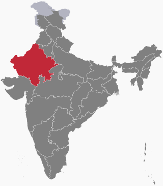
Rajasthan is a state in northwestern India. It covers 342,239 square kilometres (132,139 sq mi) or 10.4 per cent of India's total geographical area. It is the largest Indian state by area and the seventh largest by population. It is on India's northwestern side, where it comprises most of the wide and inhospitable Thar Desert and shares a border with the Pakistani provinces of Punjab to the northwest and Sindh to the west, along the Sutlej-Indus River valley. It is bordered by five other Indian states: Punjab to the north; Haryana and Uttar Pradesh to the northeast; Madhya Pradesh to the southeast; and Gujarat to the southwest. Its geographical location is 23°.3' to 30°.12' North latitude and 69°.30' to 78°.17' East longitude, with the Tropic of Cancer passing through its southernmost tip.

<span class="mw-page-title-main">Fatehpur Sikri</span> Town in Uttar Pradesh, India

Fatehpur Sikri is a town in the Agra District of Uttar Pradesh, India. Situated 35.7 kilometres (22.2 mi) from the district headquarters of Agra, Fatehpur Sikri itself was founded as the capital of the Mughal Empire in 1571 by Emperor Akbar, serving this role from 1571 to 1585, when Akbar abandoned it due to a campaign in Punjab and was later completely abandoned in 1610.

<span class="mw-page-title-main">Jaisalmer</span> City in Rajasthan, India

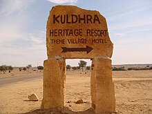
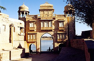
Jaisalmer, nicknamed "The Golden city", is a city in the Indian state of Rajasthan, located 575 kilometres (357 mi) west of the state capital Jaipur. It is the administrative headquarters of Jaisalmer District. Before Indian independence, the town served as the capital of the Jaisalmer State, ruled by the Bhati Rajputs. Jaisalmer stands on a ridge of yellowish sandstone and is crowned by the ancient Jaisalmer Fort. This fort contains a royal palace and several ornate Jain temples. Many of the houses and temples of both the fort and of the town below are built of finely sculptured yellow sandstone. The town lies in the heart of the Thar Desert and has a population, including the residents of the fort, of about 78,000. Jaisalmer ranked 9th on Booking.com's Top 10 The Most Welcoming cities in the world. It is the only Indian city on the list.

<span class="mw-page-title-main">Marwar</span> Region in Rajasthan, India

Marwar is a region of western Rajasthan state in North Western India. It lies partly in the Thar Desert. The word 'maru' is Sanskrit for desert. In Rajasthani languages, "wad" means a protected area. English translation of the word 'marwar' is the region protected by desert.

<span class="mw-page-title-main">Pali, Rajasthan</span> City in Rajasthan, India

Pali is a city and capital division in Pali district in Indian state of Rajasthan. It is the administrative headquarters of Pali district. It is on the bank of the river Bandi and is 70 km (43 mi) south east of West Jodhpur. It is known as "The Industrial City".

<span class="mw-page-title-main">Rajsamand Lake</span> Lake in Rajasthan

Rajsamand Lake is a lake in the city of Rajsamand in the Rajsamand district of Indian state of Rajasthan, 67 km away from Udaipur. Built by Rana Raj Singh, it is approximately 1.75 miles (2.82 km) wide, 4 miles (6.4 km) long and 60 feet (18 m) deep. It was built across the Gomti river which originates from Sewantri, Kelwa and Tali rivers, with a catchment area of approximately 196 sq mi (510 km2).

<span class="mw-page-title-main">Meghwal</span> People of northwest India and Pakistan

The Meghwal or Meghwar people live primarily in northwest India, with a small population in Pakistan. Their traditional occupation was agricultural farming, cattle-herding and weaving. Meghwals are known for their contribution to embroidery and the textile industry. Most are Hindu by religion, with Rishi Megh, Kabir, Ramdev Pir and Bankar Mataji as their chief gods.

<span class="mw-page-title-main">Jaisalmer district</span> District in Rajasthan, India

Jaisalmer district is the largest district in the Indian state of Rajasthan, and the third largest district in India. Located in Marwar, the city of Jaisalmer is the administrative headquarters of the district. It is around 289 km (180 mi) from the city of Jodhpur, and around 559 km (347 mi) from Jaipur, the capital of Rajasthan. As of the 2011 population census, it is the least populous district out of all 33 districts in Rajasthan.

<span class="mw-page-title-main">Jaisalmer Fort</span> Fort in Jaisalmer, Rajasthan, India

Jaisalmer Fort is situated in the city of Jaisalmer, in the Indian state of Rajasthan. It is one of the very few "living forts" in the world, as nearly one fourth of the old city's population still resides within the fort. For the better part of its 860-year history, the fort was the city of Jaisalmer. The first settlements outside the fort walls, to accommodate the growing population of Jaisalmer, are said to have come up in the 17th century.

<span class="mw-page-title-main">Sundha Mata Temple</span> Hindu temple in Rajasthan, India

Sundha Mata temple is a nearly 900-year-old temple of Mother goddess Chamunda situated on a hilltop called Sundha, located at Longitude 72.367°E and Latitude 24.833°N, in Jalore District of Rajasthan. It is 64 km (40 mi) from Mount Abu and 20 km (12 mi) from the town of Bhinmal.

Bamnera is a small village situated along the inner margin of the southwestern part of the Thar Desert in the foothills of Aravali mountain range with panoramic landscapes and a few sandy tracks. In more urban geographical terms, it is situated in the Sumerpur tehsil of Pali District in the state of Rajasthan, 12.5 km west of Sheoganj-Sirohi District from Beawar-Radhanpur NH 14.

<span class="mw-page-title-main">Rajpurohit</span> Caste in Western Rajasthan

Rajpurohit is a Brahmin sub-caste residing in South Asia natively in western Rajasthan of India. Their ancestors belonged to family line of SaptRishis. They maintain traditions that are similar to both Brahmins and Rajputs. They have been historically engaged in administration, trading, jagirdar, and as royal council members and warriors and are spread across the entire country. They were given villages at boundary of kingdom. According to political analysts, the Rajput, Charan and Rajpurohit communities are considered to be identical in regards to their social customs and political ideologies.

<i>Kachche Dhaage</i> 1999 film directed by Milan Luthria

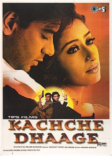
Kachche Dhaage is a 1999 Indian Hindi-language action thriller film directed by Milan Luthria and starring Ajay Devgn, Saif Ali Khan and Manisha Koirala. The film features Devgan as a smuggler, delivering goods across the Rajasthan-Pakistan border, was filmed in the deserts of Rajasthan and in Switzerland. It premiered on 19 February 1999 in Mumbai.

<span class="mw-page-title-main">History of Rajasthan</span> Brief history of the Indian state of Rajasthan

The history of human settlement in the western Indian state of Rajasthan dates back to about 100,000 years ago. Around 5000 to 2000 BCE many regions of Rajasthan belonged as the site of the Indus Valley Civilization. Kalibangan is the main Indus site of Rajasthan, here fire altars have been discovered, similar to those found at Lothal.

<span class="mw-page-title-main">History of Jaisalmer</span> Aspect of history

Jaisalmer state is a region of Western Rajasthan state in western India. It lies in the southern part of Thar Desert.

<span class="mw-page-title-main">Culture of Rajasthan</span> Overview of Rajasthans culture

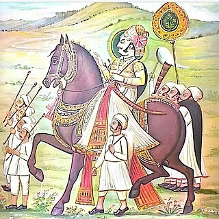
The culture of Rajasthan includes many artistic traditions that reflect the ancient Indian way of life. Rajasthan is also called the "Land of Kings". It has many tourist attractions and facilities for tourists. This historical state of India attracts tourists and vacationers with its rich culture, tradition, heritage and monuments. It also has some wildlife sanctuaries and national parks.

Rajasthani people or Rajasthanis are a group of Indo-Aryan peoples native to Rajasthan, a state in Northern India. Their language, Rajasthani, is a part of the western group of Indo-Aryan languages.

Lanela is a village located in the district of Jaisalmer in the state of Rajasthan in India. It has a population of about 1049 persons living in around 194 households.

<span class="mw-page-title-main">Hill Forts of Rajasthan</span> UNESCO World Heritage Site in northern India

Hill Forts of Rajasthan are six forts, spread across Rajasthan state in northern India. They have been clustered as a series and designated as a UNESCO World Heritage Site in 2013. The hill forts series include—Chittor Fort at Chittorgarh, Kumbhalgarh Fort at Rajsamand, Ranthambore Fort at Sawai Madhopur, Gagron Fort at Jhalawar, Amer Fort at Jaipur and Jaisalmer Fort at Jaisalmer.

References

  1. 1 2 3 4 S. Ali Nadeem Rezavi 1995, p. 312.
  2. S. Ali Nadeem Rezavi 1995, p. 313.
  3. S. Ali Nadeem Rezavi 1995, p. 315.
  4. S. Ali Nadeem Rezavi 1995, pp. 313–314.
  5. 1 2 S. Ali Nadeem Rezavi 1995, p. 320.
  6. 1 2 S. Ali Nadeem Rezavi 1995, p. 321.
  7. 1 2 S. Ali Nadeem Rezavi 1995, p. 314.
  8. 1 2 S. Ali Nadeem Rezavi 1995, p. 319.
  9. 1 2 S. Ali Nadeem Rezavi 1995, p. 322.
  10. S. Ali Nadeem Rezavi 1995, pp. 321–322.
  11. S. Ali Nadeem Rezavi 1995, p. 323-324.
  12. 1 2 S. Ali Nadeem Rezavi 1995, p. 324.
  13. Bindu Manchanda (2001). Jaisalmer: The City of Golden Sands and Strange Spirits. HarperCollins. p. 136. ISBN   9788172234348.
  14. Kayita Rani (2007). Royal Rajasthan. New Holland Publishers. p. 42. ISBN   9781847730916.
  15. Ami Bhat (7 December 2015). "The Eerie Town of Kuldhara, Rajasthan". Moneycontrol.
  16. A. B. Roy 2017, p. 402.
  17. A. B. Roy 2017, p. 403.
  18. A. B. Roy 2017, p. 404.
  19. 1 2 Samonway Duttagupta (18 December 2015). "Jaisalmer's 'haunted' village to be developed and opened for tourists". India Today.
  20. "Agent Vinod's shoot stalled". Hindustan Times. 29 October 2011.
  21. "Kuldhara, India is a cursed 'village of death'". news.com.au. 22 September 2014.
  22. 1 2 Deepika Mahendra (19 May 2014). "The 'haunted' ruins of Kuldhara, where ghost stories mean big bucks". News 18.
  23. "Revealed: Mystery behind the haunted village of Kuldhara". Dainik Bhaskar. 7 May 2013.
  24. PB Chandra and Kunal M Shah (29 October 2011). "Agent Vinod flouts the law". Mumbai Mirror.
  25. Vimal Bhatia (1 November 2011). "Ancient glory returns to Kuldhara". The Times of India.
  26. Rachna Singh (8 February 2016). "Game for night out at 'haunted' Kuldhara?". The Times of India.
  27. "Kulbhata". www.filmfestivals.com. Retrieved 14 July 2023.
  28. "FIRST LOOK: INDIA'S FIRST CREATURE FILM: KAALO, THE DESERT WITCH". www.filmfestivals.com. Retrieved 14 July 2023.

Bibliography