Lamar, South Carolina

Last updated

Lamar, South Carolina
SCMap-doton-Lamar.PNG
Location of Lamar, South Carolina
Coordinates: 34°10′13″N80°3′45″W / 34.17028°N 80.06250°W / 34.17028; -80.06250
Country United States
State South Carolina
County Darlington
Area
[1]
  Total1.21 sq mi (3.14 km2)
  Land1.21 sq mi (3.14 km2)
  Water0.00 sq mi (0.00 km2)
Elevation
171 ft (52 m)
Population
 (2020) [2]
  Total862
  Density710.63/sq mi (274.38/km2)
Time zone UTC-5 (Eastern (EST))
  Summer (DST) UTC-4 (EDT)
ZIP code
29069
Area code(s) 843, 854
FIPS code 45-39805 [3]
GNIS feature ID1246283 [4]
Website www.lamarsc.org

Lamar is a town in Darlington County, South Carolina, United States. The population was 989 at the 2010 census. [5] It is part of the Florence, SC Metropolitan Statistical Area. [6]

Contents

History

In March 2019, the Mayor of Lamar, Darnell Byrd McPherson, called police to her home to investigate a hate crime. She said her car and her husband's car had been sprayed with a yellow substance by some vandals. However, police determined that the substance was just pollen. The current mayor of Lamar is named James Howell. [7] [8]

Geography

Lamar is located in southwestern Darlington County at 34°10′13″N80°3′45″W / 34.17028°N 80.06250°W / 34.17028; -80.06250 (34.170388, -80.062526). [9] U.S. Route 401 passes through the town, leading northeast 14 miles (23 km) to Darlington, the county seat, and southwest 24 miles (39 km) to Sumter. Exit 131 on Interstate 20 is 3 miles (5 km) to the northeast of Lamar on US 401.

According to the United States Census Bureau, the town has a total area of 1.2 square miles (3.0 km2), all land. [5]

Demographics

Historical population
CensusPop.Note
1900 220
1910 592169.1%
1920 78432.4%
1930 91516.7%
1940 9210.7%
1950 9584.0%
1960 1,12117.0%
1970 1,25011.5%
1980 1,3336.6%
1990 1,125−15.6%
2000 1,015−9.8%
2010 989−2.6%
2020 862−12.8%
U.S. Decennial Census [10] [2]

As of the census [3] of 2000, there were 1,015 people, 417 households, and 286 families residing in the town. The population density was 874.6 inhabitants per square mile (337.7/km2). There were 467 housing units at an average density of 402.4 per square mile (155.4/km2). The racial makeup of the town was 53.50% White, 45.71% African American, 0.10% Native American, 0.10% Asian, and 0.59% from two or more races. Hispanic or Latino of any race were 0.89% of the population.

There were 417 households, out of which 24.2% had children under the age of 18 living with them, 46.0% were married couples living together, 18.2% had a female householder with no husband present, and 31.2% were non-families. 29.3% of all households were made up of individuals, and 15.3% had someone living alone who was 65 years of age or older. The average household size was 2.43 and the average family size was 3.01.

In the town, the population was spread out, with 24.5% under the age of 18, 6.9% from 18 to 24, 25.7% from 25 to 44, 25.8% from 45 to 64, and 17.0% who were 65 years of age or older. The median age was 41 years. For every 100 females, there were 91.1 males. For every 100 females age 18 and over, there were 81.9 males.

The median income for a household in the town was $28,571, and the median income for a family was $35,789. Males had a median income of $29,000 versus $26,250 for females. The per capita income for the town was $15,473. About 22.4% of families and 24.4% of the population were below the poverty line, including 35.7% of those under age 18 and 17.7% of those age 65 or over.

Education

Lamar has a public library, a branch of the Darlington County Library System. [11] Lamar is also home to Lamar High School.

Notable people

Related Research Articles

<span class="mw-page-title-main">Lamar County, Alabama</span> County in Alabama, United States

Lamar County is a county in the U.S. state of Alabama. As of the 2020 census, the population was 13,972. Its county seat is Vernon and it is a dry county. It is named in honor of Lucius Quintus Cincinnatus Lamar, a former Confederate officer and former member of both houses of the United States Congress from Mississippi.

<span class="mw-page-title-main">Darlington County, South Carolina</span> County in South Carolina, United States

Darlington County is a county in the U.S. state of South Carolina. As of the 2020 census, its population was 62,905. Its county seat is Darlington. Hartsville is the largest community in the county. Darlington County is home to the Darlington Raceway, which hosts the annual NASCAR Southern 500. Darlington County is also home to Coker College in Hartsville. Darlington County was named by an act in March 1785.

<span class="mw-page-title-main">Millport, Alabama</span> Town in Alabama, United States

Millport is a town in Lamar County, Alabama, United States. It incorporated in 1887. At the 2010 census the population was 1,049, down from 1,160 in 2000. After its incorporation from 1890 to 1900, it was the largest town in Lamar County, losing the distinction to Sulligent. Since 1940, it has been the 3rd largest town.

<span class="mw-page-title-main">Sulligent, Alabama</span> City in Alabama, United States

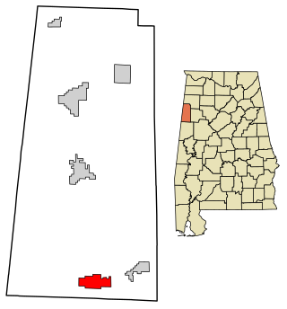
Sulligent is a city in Lamar County, Alabama, United States. As of the 2010 census, the population of the city was 1,927, down from its record high of 2,151 in 2000. From 1910-1950 and again in 2000, it was the largest community in Lamar County before losing the distinction both times to the county seat of Vernon. The name is derived from railroad personnel.

<span class="mw-page-title-main">Gum Springs, Arkansas</span> Town in Arkansas, United States

Gum Springs is a town in Clark County, Arkansas, United States. The population was 120 at the 2010 census, down from 194 in 2000.

<span class="mw-page-title-main">Clare, New York</span> Town in New York, United States

Clare is a town in St. Lawrence County, New York, United States. The population was 105 at the 2010 census.

<span class="mw-page-title-main">Bunn, North Carolina</span> Town in North Carolina, United States

Bunn is a town in Franklin County, North Carolina, United States. The population was 327 at the 2020 census.

<span class="mw-page-title-main">West Brunswick Township, Pennsylvania</span> Township in Pennsylvania, United States

West Brunswick Township is a township located in Schuylkill County, Pennsylvania, United States.

<span class="mw-page-title-main">Williston, South Carolina</span> Town in South Carolina, United States

Williston is a town in Barnwell County, South Carolina, United States. The population was 3,139 at the 2010 census.

<span class="mw-page-title-main">Meggett, South Carolina</span> Town in South Carolina, United States

Meggett is a town in Charleston County, South Carolina, United States. The population was 1,226 at the 2010 census. Meggett is part of the Charleston-North Charleston-Summerville metropolitan area.

<span class="mw-page-title-main">Darlington, South Carolina</span> City in South Carolina, United States

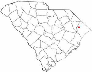
Darlington is a city located in Darlington County, South Carolina, United States. In 2010, its population was 6,289. It is the county seat of Darlington County. It is part of the Florence, South Carolina Metropolitan Statistical Area.

<span class="mw-page-title-main">North Hartsville, South Carolina</span> Census-designated place in South Carolina, United States

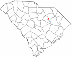
North Hartsville is a census-designated place (CDP) in Darlington County, South Carolina, United States. The population was 3,251 at the 2010 census. It is part of the Florence Metropolitan Statistical Area and the Hartsville Urban Cluster.

<span class="mw-page-title-main">Society Hill, South Carolina</span> Town in South Carolina, United States

Society Hill is a town in Darlington County, South Carolina, United States alongside the Pee Dee River. It is the oldest community in Darlington County and one of the first towns founded in South Carolina. The town was once the intellectual center of the Pee Dee region. However, the town's fortunes declined in the 19th century after rivers became less important as means of transportation. It is part of the Florence Metropolitan Statistical Area.

<span class="mw-page-title-main">Lake City, South Carolina</span> City in South Carolina, United States

Lake City is a city in Florence County, South Carolina, United States. The population was 6,675 at the 2010 census. Located in central South Carolina, it is south of Florence and included as part of the Florence Metropolitan Statistical Area.

<span class="mw-page-title-main">Aynor, South Carolina</span> Town in South Carolina, United States

Aynor is a small town in Horry County, South Carolina, United States, south of Galivants Ferry. The population was 560 at the 2010 census and estimated in 2018 to be 934. Aynor High School consistently ranks as one of the best schools in Horry County and South Carolina.

<span class="mw-page-title-main">North, South Carolina</span> Town in South Carolina, United States

North is a town in Orangeburg County, South Carolina, United States. The population was 696 at the 2020 census.

<span class="mw-page-title-main">Beasley, Texas</span> City in Texas, United States

Beasley is a city in Fort Bend County, Texas, United States, within the Houston–Sugar Land metropolitan area. The city's population was 641 at the 2010 census, up from 590 at the 2000 census. State Highway Loop 540 goes straight through the city from the northeast to the southwest while U.S. Route 59, the Southwest Freeway, passes to the south of Beasley. The Union Pacific Railroad tracks run parallel with Loop 540.

<span class="mw-page-title-main">North Augusta, South Carolina</span> City in South Carolina, United States

North Augusta is a city in Aiken and Edgefield counties in the U.S. state of South Carolina, on the north bank of the Savannah River. It lies directly across the river, and state border, from Augusta, Georgia. The population was 24,379 at the 2020 census, making it the 21st-most populous city in South Carolina. The city is included in the Central Savannah River Area (CSRA) and is part of the Augusta, Georgia, metropolitan area.

<span class="mw-page-title-main">Irmo, South Carolina</span> Town in South Carolina, United States

Irmo is a town in Lexington and Richland counties, South Carolina, United States and a suburb of Columbia. It is part of the Columbia Metropolitan Statistical Area and is located 12 miles (19 km) northwest of the city center. The population of Irmo was 11,097 at the 2010 census.

Burke is a village in Franklin County, New York, United States. The population was 211 at the 2010 census. The village is in the town of Burke and is northeast of Malone, the county seat.

References

  1. "ArcGIS REST Services Directory". United States Census Bureau. Retrieved October 15, 2022.
  2. 1 2 "Census Population API". United States Census Bureau. Retrieved October 15, 2022.
  3. 1 2 "U.S. Census website". United States Census Bureau . Retrieved January 31, 2008.
  4. "US Board on Geographic Names". United States Geological Survey. October 25, 2007. Retrieved January 31, 2008.
  5. 1 2 "Geographic Identifiers: 2010 Demographic Profile Data (G001): Lamar town, South Carolina". U.S. Census Bureau, American Factfinder. Archived from the original on February 13, 2020. Retrieved January 5, 2016.
  6. Gannett, Henry (1905). The Origin of Certain Place Names in the United States. Government Printing Office. p. 180.
  7. "'Hate crime' against Darnell McPherson, S.C. Mayor, turns out to be pollen". Associated Press . March 5, 2019.
  8. "Report: Substance found on mayor's cars is pollen, not spray paint". March 11, 2019.
  9. "US Gazetteer files: 2010, 2000, and 1990". United States Census Bureau. February 12, 2011. Retrieved April 23, 2011.
  10. "Census of Population and Housing". Census.gov. Retrieved June 4, 2015.
  11. "South Carolina libraries and archives". SCIWAY. Retrieved June 8, 2019.
  12. "South Carolina Governor David M. Beasley". National Governors Association. Retrieved December 21, 2012.