Leadore, Idaho

Last updated

Leadore, Idaho
Lemhi County Idaho Incorporated and Unincorporated areas Leadore Highlighted 1645910.svg
Location of Leadore in Lemhi County, Idaho.
Coordinates: 44°40′47″N113°21′38″W / 44.67972°N 113.36056°W / 44.67972; -113.36056
Country United States
State Idaho
County Lemhi
Area
[1]
  Total0.31 sq mi (0.80 km2)
  Land0.31 sq mi (0.80 km2)
  Water0.00 sq mi (0.00 km2)
Elevation
5,971 ft (1,820 m)
Population
 (2010) [2]
  Total105
  Estimate 
(2019) [3]
106
  Density343.04/sq mi (132.62/km2)
Time zone UTC-7 (Mountain (MST))
  Summer (DST) UTC-6 (MDT)
ZIP code
Area code 208
FIPS code 16-45910
GNIS feature ID0396775

Leadore is an incorporated small town in Lemhi County, Idaho, United States. The population was 105 at the 2010 census. [4]

Contents

History

A train of the Gilmore & Pittsburgh Railroad pauses at the railway's depot in Leadore, August 1912. GilmoreAndPittsburgh-01.jpg
A train of the Gilmore & Pittsburgh Railroad pauses at the railway's depot in Leadore, August 1912.

The town of Leadore dates from 1910, when the Gilmore and Pittsburgh Railroad was constructed from Armstead, Montana, over Bannock Pass and into the Lemhi Valley. This occurred because the original location for the train station in the town of Junction had to be altered when the owner of the land refused to sell. The town was home to the railroad's repair shops, and was the point where the railroad's branch line to Gilmore connected with the main line. Though the railroad ceased operating in 1939, Leadore has remained the largest town in the immediate area.

In 2001 a replica of the town's old railway station was constructed in Leadore. The new building serves as the town's community center.

Geography

Leadore is located in southeastern Lemhi County at 44°40′47″N113°21′38″W / 44.67972°N 113.36056°W / 44.67972; -113.36056 (44.679604, -113.360664), [5] in the Lemhi Valley. The Lemhi River flows through the northeast side of the city, running northwest to join the Salmon River at Salmon, Idaho.

Idaho State Highway 28 (Railroad Street) passes through the center of Leadore, leading northwest 45 miles (72 km) to Salmon, the county seat, and southeast 90 miles (140 km) to Interstate 15 at Sage Junction. Idaho State Highway 29 leads northeast from Leadore 13 miles (21 km) to the Montana state line at Bannock Pass on the Continental Divide. Montana Secondary Highway 324 continues northeast from Bannock Pass to join Interstate 15 at Clark Canyon Dam, 48 miles (77 km) northeast of Leadore.

According to the United States Census Bureau, Leadore has a total area of 0.31 square miles (0.80 km2), all of it land. [6]

Climate

Leadore has a steppe climate (BSk) according to the Köppen climate classification system.

Climate data for Leadore #2, Idaho, 1991–2020 normals, 1965-2020 extremes: 6000ft (1829m)
MonthJanFebMarAprMayJunJulAugSepOctNovDecYear
Record high °F (°C)53
(12)
59
(15)
69
(21)
77
(25)
91
(33)
97
(36)
102
(39)
99
(37)
93
(34)
84
(29)
69
(21)
56
(13)
102
(39)
Mean maximum °F (°C)42.1
(5.6)
45.4
(7.4)
58.0
(14.4)
69.9
(21.1)
79.2
(26.2)
86.4
(30.2)
93.0
(33.9)
91.3
(32.9)
85.7
(29.8)
73.5
(23.1)
58.8
(14.9)
45.1
(7.3)
93.6
(34.2)
Average high °F (°C)29.7
(−1.3)
33.6
(0.9)
43.1
(6.2)
52.3
(11.3)
62.4
(16.9)
70.8
(21.6)
82.5
(28.1)
81.4
(27.4)
71.0
(21.7)
55.4
(13.0)
39.5
(4.2)
28.5
(−1.9)
54.2
(12.3)
Daily mean °F (°C)17.3
(−8.2)
20.7
(−6.3)
30.9
(−0.6)
38.6
(3.7)
47.3
(8.5)
54.2
(12.3)
62.0
(16.7)
60.9
(16.1)
52.3
(11.3)
40.2
(4.6)
27.6
(−2.4)
17.1
(−8.3)
39.1
(4.0)
Average low °F (°C)4.9
(−15.1)
7.8
(−13.4)
18.7
(−7.4)
25.0
(−3.9)
32.1
(0.1)
37.7
(3.2)
41.4
(5.2)
40.4
(4.7)
33.6
(0.9)
24.9
(−3.9)
15.7
(−9.1)
5.7
(−14.6)
24.0
(−4.4)
Mean minimum °F (°C)−16.1
(−26.7)
−13.8
(−25.4)
0.8
(−17.3)
10.0
(−12.2)
17.5
(−8.1)
26.4
(−3.1)
32.0
(0.0)
30.2
(−1.0)
21.7
(−5.7)
7.4
(−13.7)
−4.2
(−20.1)
−15.8
(−26.6)
−21.8
(−29.9)
Record low °F (°C)−38
(−39)
−38
(−39)
−19
(−28)
−8
(−22)
4
(−16)
19
(−7)
24
(−4)
19
(−7)
10
(−12)
−14
(−26)
−22
(−30)
−40
(−40)
−40
(−40)
Average precipitation inches (mm)0.32
(8.1)
0.31
(7.9)
0.53
(13)
0.87
(22)
1.55
(39)
1.62
(41)
0.90
(23)
0.90
(23)
0.79
(20)
0.68
(17)
0.36
(9.1)
0.51
(13)
9.34
(236.1)
Average snowfall inches (cm)4.6
(12)
4.5
(11)
3.4
(8.6)
2.8
(7.1)
0.6
(1.5)
0.2
(0.51)
0.0
(0.0)
0.0
(0.0)
0.4
(1.0)
1.5
(3.8)
2.8
(7.1)
4.5
(11)
25.3
(63.61)
Source 1: NOAA (1981-2010 precipitation) [7] [8]
Source 2: XMACIS2 (1998-2020 snowfall, records & monthly max/mins) [9]
Climate data for Leadore (1965-2012)
MonthJanFebMarAprMayJunJulAugSepOctNovDecYear
Record high °F (°C)53
(12)
56
(13)
69
(21)
77
(25)
91
(33)
97
(36)
102
(39)
99
(37)
91
(33)
84
(29)
69
(21)
56
(13)
102
(39)
Average high °F (°C)29.8
(−1.2)
34.8
(1.6)
41.8
(5.4)
51.9
(11.1)
62.5
(16.9)
72.1
(22.3)
84.2
(29.0)
82
(28)
71.3
(21.8)
57.7
(14.3)
40.8
(4.9)
29.8
(−1.2)
54.9
(12.7)
Average low °F (°C)3.7
(−15.7)
8
(−13)
16.6
(−8.6)
23.8
(−4.6)
30.7
(−0.7)
37.7
(3.2)
41.7
(5.4)
40
(4)
32.6
(0.3)
25.1
(−3.8)
16.2
(−8.8)
5.7
(−14.6)
23.5
(−4.7)
Record low °F (°C)−38
(−39)
−38
(−39)
−19
(−28)
−5
(−21)
4
(−16)
19
(−7)
24
(−4)
22
(−6)
10
(−12)
−14
(−26)
−22
(−30)
−40
(−40)
−40
(−40)
Average precipitation inches (mm)0.34
(8.6)
0.21
(5.3)
0.43
(11)
0.68
(17)
1.34
(34)
1.27
(32)
0.77
(20)
0.69
(18)
0.85
(22)
0.61
(15)
0.44
(11)
0.43
(11)
8.05
(204)
Average snowfall inches (cm)3.7
(9.4)
2.1
(5.3)
2.5
(6.4)
2.5
(6.4)
0.4
(1.0)
0.3
(0.76)
0
(0)
0
(0)
0.2
(0.51)
0.6
(1.5)
2.3
(5.8)
3.4
(8.6)
18
(46)
Average precipitation days22347744443347
Source: WRCC [10]

Demographics

Historical population
CensusPop.Note
1950 159
1960 112−29.6%
1970 111−0.9%
1980 1142.7%
1990 74−35.1%
2000 9021.6%
2010 10516.7%
2019 (est.)106 [3] 1.0%
U.S. Decennial Census [11]

2010 census

As of the census [2] of 2010, there were 105 people, 48 households, and 24 families residing in the city. The population density was 338.7 inhabitants per square mile (130.8/km2). There were 81 housing units at an average density of 261.3 per square mile (100.9/km2). The racial makeup of the city was 100.0% White.

There were 48 households, of which 29.2% had children under the age of 18 living with them, 41.7% were married couples living together, 2.1% had a female householder with no husband present, 6.3% had a male householder with no wife present, and 50.0% were non-families. 50.0% of all households were made up of individuals, and 31.3% had someone living alone who was 65 years of age or older. The average household size was 2.19 and the average family size was 3.38.

The median age in the city was 41.3 years. 27.6% of residents were under the age of 18; 6.7% were between the ages of 18 and 24; 20.1% were from 25 to 44; 25.8% were from 45 to 64; and 20% were 65 years of age or older. The gender makeup of the city was 51.4% male and 48.6% female.

2000 census

As of the census [12] of 2000, there were 90 people, 43 households, and 20 families residing in the city. The population density was 275.1 inhabitants per square mile (106.2/km2). There were 66 housing units at an average density of 201.7 per square mile (77.9/km2). The racial makeup of the city was 100.00% White.

There were 43 households, out of which 23.3% had children under the age of 18 living with them, 41.9% were married couples living together, 2.3% had a female householder with no husband present, and 51.2% were non-families. 46.5% of all households were made up of individuals, and 20.9% had someone living alone who was 65 years of age or older. The average household size was 2.09 and the average family size was 3.10.

In the city, the population was spread out, with 24.4% under the age of 18, 1.1% from 18 to 24, 24.4% from 25 to 44, 28.9% from 45 to 64, and 21.1% who were 65 years of age or older. The median age was 46 years. For every 100 females, there were 91.5 males. For every 100 females age 18 and over, there were 100.0 males.

The median income for a household in the city was $11,786, and the median income for a family was $13,750. Males had a median income of $32,188 versus $16,250 for females. The per capita income for the city was $9,452. There were 47.6% of families and 44.8% of the population living below the poverty line, including 50.0% of under eighteens and 28.6% of those over 64.

Notable People

Dennis M. Hilliard, District Ranger for the USDA Forest Service Leadore Ranger District from March 2003 through June 2008. First President of the Upper Lemhi River Chamber of Commerce, service from April 2004 through June 2008. Volunteer Fire Fighter for the Leadore Community Volunteer Fire Department from 2003 through June 2008. Dennis was one of the founders of the Eastern Idaho Houndsman Association. An avid hunter and houndsman who raised Bluetick Coonhounds. Dennis served in the Vietnam War from 1969-1971.

See also

Related Research Articles

<span class="mw-page-title-main">Valley County, Idaho</span> County in Idaho, United States

Valley County is a rural county located in the U.S. state of Idaho. As of the 2020 census, the population was 11,746. The county seat is Cascade, and the largest city is McCall. Established in 1917, it was named after the Long Valley of the North Fork of the Payette River, which extends over 30 miles (50 km) from Payette Lake at McCall south to Cascade to Round Valley. The valley was formerly a summer pasture for livestock from the Boise Valley. Since the completion of the Cascade Dam in 1948, much of the northern valley has been covered by the Cascade Reservoir.

<span class="mw-page-title-main">Lemhi County, Idaho</span> County in Idaho, United States

Lemhi County is a county located in the U.S. state of Idaho. As of the 2020 census, the population was 7,974. The largest city and county seat is Salmon. The county was established in 1869 and named after Fort Lemhi, a remote Mormon missionary settlement from 1855 to 1858 in Bannock and Shoshone territory.

<span class="mw-page-title-main">Franklin County, Idaho</span> County in Idaho, United States

Franklin County is a county located in the U.S. state of Idaho. As of the 2020 Census the county had a population of 14,194. The county seat and largest city is Preston. The county was established in 1913 and named after Franklin D. Richards, an Apostle of the Church of Jesus Christ of Latter-day Saints. It is the only Franklin County in the United States that is not named after Benjamin Franklin. Franklin County is part of the Logan, UT-ID Metropolitan Statistical Area.

<span class="mw-page-title-main">Caribou County, Idaho</span> County in Idaho, United States

Caribou County is a county located in the U.S. state of Idaho. As of the 2020 Census the county had a population of 7,027. The county seat and largest city is Soda Springs.

<span class="mw-page-title-main">Camas County, Idaho</span> County in Idaho, United States

Camas County is a county in the southern portion of the U.S. state of Idaho. The county seat and largest city is Fairfield. The county was established 106 years ago in 1917 by the Idaho Legislature with a partition of Blaine County on February 6. It is named for the camas root, or Camassia, a lily-like plant with an edible bulb found in the region, that Native Americans and settlers used as a food source. As of the 2020 census, the population was 1,077, making it the second-least populous county in the state, after Clark County.

<span class="mw-page-title-main">Bingham County, Idaho</span> County in Idaho, United States

Bingham County is a county in the U.S. state of Idaho. As of the 2020 United States Census, the population was 47,992. The county seat and largest city is Blackfoot.

<span class="mw-page-title-main">Bannock County, Idaho</span> County in Idaho, United States

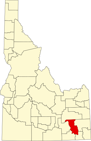
Bannock County is a county in the southeastern part of Idaho. As of the 2020 Census, the population was 87,018, making it the sixth-most populous county in Idaho. The county seat and largest city is Pocatello. The county was established in 1893 and named after the local Bannock tribe. It is one of the counties with territories included in the Fort Hall Indian Reservation of the federally recognized Shoshone-Bannock Tribes.

<span class="mw-page-title-main">Arimo, Idaho</span> City in Bannock County, Idaho, United States

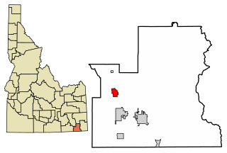
Arimo is a city in the Marsh Valley in central Bannock County, Idaho, United States, that is part of the 'Pocatello Metropolitan Statistical Area'. The population was 354 at the 2020 census.

<span class="mw-page-title-main">Chubbuck, Idaho</span> City in Idaho, United States

Chubbuck is a city in Bannock County, Idaho. It is part of the Pocatello Metropolitan Statistical Area. The population was 13,922 at the 2010 census. Chubbuck is located immediately north of Pocatello, Idaho, and has opposed several consolidation proposals since the 1960s.

<span class="mw-page-title-main">Downey, Idaho</span> City in Bannock County, Idaho, United States

Downey is a city in the Marsh Valley in southern Bannock County, Idaho, United States. It is part of the Pocatello Metropolitan Statistical Area. The population was 625 at the 2010 census.

<span class="mw-page-title-main">Fort Hall, Idaho</span> Census-designated place in Idaho, United States

Fort Hall is a census-designated place (CDP) in the southeastern part of the U.S. state of Idaho which is split between Bannock County in the south and Bingham County in the north. It is located on the Fort Hall Indian Reservation along the Snake River north of Pocatello and near the site of the original Fort Hall in the Oregon Country. The population was 3,201 at the 2010 census.

<span class="mw-page-title-main">Inkom, Idaho</span> City in Idaho, United States

Inkom is a city in Bannock County, Idaho. It is part of the Pocatello, Idaho Metropolitan Statistical Area. The population was 854 at the time of the 2010 census. It is the home of the smallest airport in the world, Simko Field Airport 1ID9, with a runway length of 122 meters.

<span class="mw-page-title-main">Lava Hot Springs, Idaho</span> City in Bannock County, Idaho, United States

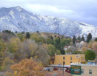
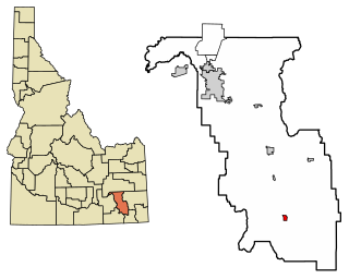
Lava Hot Springs is a city along the Portneuf River in eastern Bannock County, Idaho, United States. It is part of the Pocatello, Idaho metropolitan area. The population was 407 at the 2010 census, down from 521 in 2000. Located in the mountainous valley of the Portneuf River on the old route of the Oregon Trail and California Trail, the city has become a popular resort location, noted for its numerous hot springs amenable to bathing and a turbulent inner tube run through part of the town.

<span class="mw-page-title-main">McCammon, Idaho</span> City in Idaho, United States

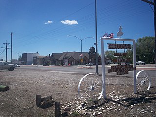
McCammon is a city in Bannock County, Idaho, United States. It is part of the Pocatello, Idaho Metropolitan Statistical Area'. The population was 809 at the 2010 census. In 1892, McCammon became the junction point between the Oregon Short Line Railroad and Utah and Northern Railway, and city gained the nickname Junction City.

<span class="mw-page-title-main">Firth, Idaho</span> City in Bingham County, Idaho, United States

Firth is a city in Bingham County, Idaho, United States. The population was 517 at the 2020 census.

<span class="mw-page-title-main">Clifton, Idaho</span> City in Idaho, United States

Clifton is a city in Franklin County, Idaho, United States. The population was 259 at the 2010 census. It is part of the Logan, Utah-Idaho Metropolitan Statistical Area.

<span class="mw-page-title-main">Dayton, Idaho</span> City in Idaho, United States

Dayton is a city in Franklin County, Idaho, United States. The population was 463 at the 2010 census. It is part of the Logan, Utah-Idaho Metropolitan Statistical Area.

<span class="mw-page-title-main">Stites, Idaho</span> City in Idaho, United States

Stites is a city in Idaho County, Idaho, United States. In the lower canyon of the South Fork of the Clearwater River, it is about four miles (6 km) upstream and south of Kooskia on State Highway 13. The population was 221 at the 2010 census, down from 226 in 2000.

<span class="mw-page-title-main">Salmon, Idaho</span> City in Lemhi County, Idaho, United States

Salmon is a city in Lemhi County, Idaho. The population was 3,112 at the 2010 census. The city is the county seat of Lemhi County.

<span class="mw-page-title-main">St. Donatus, Iowa</span> City in Iowa, United States

St. Donatus is a city in Jackson County, Iowa, United States. The population was 120 at the time of the 2020 census. St. Donatus is known for its status as a Luxembourger village, with historic architecture and views along U.S. Route 52. It is the home of a historic Catholic church, which is dedicated to Saint Donatus of Muenstereifel, the town's namesake. It was formerly named Tete Des Morts, which is the name of a creek that flows through the village.

References

  1. "2019 U.S. Gazetteer Files". United States Census Bureau. Retrieved July 9, 2020.
  2. 1 2 "U.S. Census website". United States Census Bureau . Retrieved December 18, 2012.
  3. 1 2 "Population and Housing Unit Estimates". United States Census Bureau. May 24, 2020. Retrieved May 27, 2020.
  4. "Profile of General Population and Housing Characteristics: 2010 Census Summary File 1 (DP-1), Leadore city, Idaho". American FactFinder. U.S. Census Bureau. Archived from the original on February 13, 2020. Retrieved December 18, 2019.
  5. "US Gazetteer files: 2010, 2000, and 1990". United States Census Bureau. February 12, 2011. Retrieved April 23, 2011.
  6. "US Gazetteer files 2010". United States Census Bureau. Archived from the original on July 2, 2012. Retrieved December 18, 2012.
  7. "Leadore #2, Idaho 1991-2020 Monthly Normals" . Retrieved November 23, 2023.
  8. "Leadore #2, Idaho 1981-2010 Monthly Normals" . Retrieved November 23, 2023.
  9. "xmACIS". National Oceanic and Atmospheric Administration. Retrieved November 23, 2023.
  10. "LEADORE #2, ID (105177)". Western Regional Climate Center. Retrieved November 26, 2015.
  11. "Census of Population and Housing". Census.gov. Retrieved June 4, 2015.
  12. "U.S. Census website". United States Census Bureau . Retrieved January 31, 2008.

See also

Commons-logo.svg Media related to Leadore, Idaho at Wikimedia Commons