
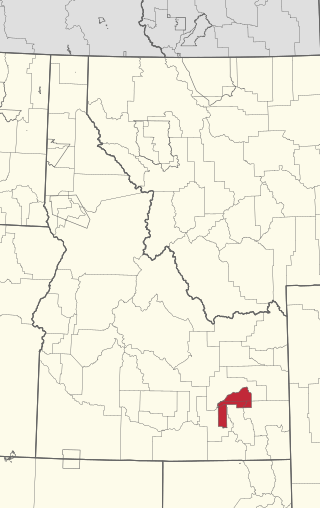
Lemhi County is a county located in the U.S. state of Idaho. As of the 2020 census, the population was 7,974. The largest city and county seat is Salmon. The county was established in 1869 and named after Fort Lemhi, a remote Mormon missionary settlement from 1855 to 1858 in Bannock and Shoshone territory.

The Bear River Massacre, or the Engagement on the Bear River, or the Battle of Bear River, or Massacre at Boa Ogoi, took place in present-day Franklin County, Idaho, on January 29, 1863. After years of skirmishes and food raids on farms and ranches, the United States Army attacked a Shoshone encampment gathered at the confluence of the Bear River and Battle Creek in what was then southeastern Washington Territory, near the present-day city of Preston. Colonel Patrick Edward Connor led a detachment of California Volunteers as part of the Bear River Expedition against Shoshone tribal chief Bear Hunter. Hundreds of Shoshone men, women, and children were killed near their lodges; the number of Shoshone victims reported by local settlers was higher than that reported by soldiers.
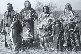
The Shoshone or Shoshoni are a Native American tribe with four large cultural/linguistic divisions:

Washakie was a prominent leader of the Shoshone people during the mid-19th century. He was first mentioned in 1840 in the written record of the American fur trapper, Osborne Russell. In 1851, at the urging of trapper Jim Bridger, Washakie led a band of Shoshones to the council meetings of the Treaty of Fort Laramie. Essentially from that time until his death, he was considered the head of the Eastern Shoshones by the representatives of the United States government. In 1979, he was inducted into the Hall of Great Westerners of the National Cowboy & Western Heritage Museum.

The Indigenous peoples of the Great Basin are Native Americans of the northern Great Basin, Snake River Plain, and upper Colorado River basin. The "Great Basin" is a cultural classification of indigenous peoples of the Americas and a cultural region located between the Rocky Mountains and the Sierra Nevada, in what is now Nevada, and parts of Oregon, California, Idaho, Wyoming, and Utah. The Great Basin region at the time of European contact was ~400,000 sq mi (1,000,000 km2). There is very little precipitation in the Great Basin area which affects the lifestyles and cultures of the inhabitants.

Chief Pocatello was a leader of the Northern Shoshone, a Native American people of the Great Basin in western North America. He led attacks against early settlers during a time of increasing strife between settlers and Native Americans. After making peace with the U.S. Government, he moved his people to their present reservation in Idaho and led the Shoshone during their struggle to survive following their deportation. The city of Pocatello is named in his honor.
The Fort Hall Reservation is a Native American reservation of the federally recognized Shoshone-Bannock Tribes in the U.S. state of Idaho. This is one of five federally recognized tribes in the state. The reservation is located in southeastern Idaho on the Snake River Plain about 20 miles (32 km) north and west of Pocatello. It comprises 814.874 sq mi (2,110.51 km2) of land area in four counties: Bingham, Power, Bannock, and Caribou. To the east is the 60-mile-long (97 km) Portneuf Range; both Mount Putnam and South Putnam Mountain are located on the Fort Hall Reservation.
The Bannock War of 1878 was an armed conflict between the U.S. military and Bannock and Paiute warriors in Idaho and northeastern Oregon from June to August 1878. The Bannock totaled about 600 to 800 in 1870 because of other Shoshone peoples being included with Bannock numbers. they were led by Chief Buffalo Horn, who was killed in action on June 8, 1878. After his death, Chief Egan led the Bannocks. He and some of his warriors were killed in July by a Umatilla party that entered his camp in subterfuge.
The Bannock tribe were originally Northern Paiute but are more culturally affiliated with the Northern Shoshone. They are in the Great Basin classification of Indigenous People. Their traditional lands include northern Nevada, southeastern Oregon, southern Idaho, and western Wyoming. Today they are enrolled in the federally recognized Shoshone-Bannock Tribes of the Fort Hall Reservation of Idaho, located on the Fort Hall Indian Reservation.
Cameahwait was the brother of Sacagawea, and a Shoshone chief. He was the head of the first group of inhabitants of modern-day Idaho who were encountered by Europeans.

The Duck Valley Indian Reservation was established in the 19th century for the federally recognized Shoshone-Paiute Tribe. It is isolated in the high desert of the western United States, and lies on the state line, the 42nd parallel, between Idaho and Nevada.

Sacagawea was a Lemhi Shoshone woman who, in her teens, helped the Lewis and Clark Expedition in achieving their chartered mission objectives by exploring the Louisiana Territory. Sacagawea traveled with the expedition thousands of miles from North Dakota to the Pacific Ocean, helping to establish cultural contacts with Native American people and contributing to the expedition's knowledge of natural history in different regions.

Washakie is a ghost town in far northern Box Elder County, Utah, United States. Lying some 3 miles (4.8 km) southeast of Portage, it was established in 1880 by the Church of Jesus Christ of Latter-day Saints for the settlement of the Northwestern Shoshone. The Washakie Indian Farm was home to the main body of this Native American band through most of the 20th century. By the mid-1970s, Washakie's residents were gone and the property sold to a private ranching operation. Today the tribal reservation consists of a small tract containing the Washakie cemetery, and the tribe is seeking to acquire more of the surrounding land. The old LDS chapel in Washakie is now on the National Register of Historic Places.

The Tukudeka or Mountain Sheepeaters are a band of Shoshone within the Eastern Shoshone and the Northern Shoshone. Before the reservation era, they traditionally lived in the central Sawtooth Range of Idaho and the mountains of what is now northwest Wyoming. Bands were very fluid and nomadic, and they often interacted with and intermarried other bands of Shoshone. Today the Tukudeka are enrolled in the federally recognized Shoshone-Bannock Tribes of the Fort Hall Reservation of Idaho and the Eastern Shoshone of the Wind River Indian Reservation in Wyoming.

Eastern Shoshone are Shoshone who primarily live in Wyoming and in the northeast corner of the Great Basin where Utah, Idaho and Wyoming meet and are in the Great Basin classification of Indigenous People. They lived in the Rocky Mountains during the 1805 Lewis and Clark Expedition and adopted Plains horse culture in contrast to Western Shoshone that maintained a Great Basin culture.
Fort Lemhi was a mission approximately two miles (3 km) north of present-day Tendoy, Idaho, occupied by Mormon missionaries from 1855 to 1858.

The Lemhi Reservation was a United States Indian Reservation for the Lemhi Shoshone from 1875 to 1907. During almost all this time their main chief was Tendoy.
Northern Shoshone are Shoshone of the Snake River Plain of southern Idaho and the northeast of the Great Basin where Idaho, Wyoming and Utah meet. They are culturally affiliated with the Bannock people and are in the Great Basin classification of Indigenous People.
The Box Elder Treaty is an agreement between the Northwestern Shoshone and the United States government, signed on July 30, 1863. It was adopted after a period of conflict which included the Bear River Massacre on January 29, 1863. The treaty had little effect until 1968, when the United States compensated the Northwestern band for their land claim at a rate of about 50¢ per acre.

Brigham Dwaine Madsen was a historian of indigenous peoples of the American West, of the people of Utah and surrounding states, and of Mormonism. He was a professor at the University of Utah.
