Hume Highway, inclusive of the sections now known as Hume Freeway and Hume Motorway, is one of Australia's major inter-city national highways, running for 840 kilometres (520 mi) between Melbourne in the southwest and Sydney in the northeast. Upgrading of the route from Sydney's outskirts to Melbourne's outskirts to dual carriageway was completed on 7 August 2013.

Cumberland Highway is a 34-kilometre (21 mi) long urban highway located in Sydney, New South Wales, Australia. The highway links Pacific Highway and Pacific Motorway (M1) at Pearces Corner, Wahroonga in the northeast with Hume Highway at Liverpool in the southwest. This name covers a few consecutive roads and is widely known to most drivers, but the entire allocation is also known – and signposted – by the names of its constituent parts: Pennant Hills Road, James Ruse Drive, Briens Road, Old Windsor Road, Hart Drive, Freame Street, Emert Street, Jersey Road, Betts Road, Warren Road, Smithfield Road, Palmerston Road, (New) Cambridge Street, Joseph Street and Orange Grove Road. The entire length of Cumberland Highway is designated part of route A28.

The Westlink M7 is a 40-kilometre (25 mi) tolled urban motorway in Sydney, New South Wales that is part of the Sydney Orbital Network. Owned by the NorthWestern Roads (NWR) Group, it connects three motorways: the M5 South-West Motorway at Prestons, the M4 Western Motorway at Eastern Creek, and the M2 Hills Motorway at Baulkham Hills.
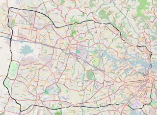
The Sydney Orbital Network is a 110 kilometre motorway standard ring road around and through Sydney, the capital of New South Wales in Australia. It runs north from Sydney Airport, underneath the CBD to the North Shore, west to the Hills District, south to Prestons and then east to connect with the airport. Much of the road is privately owned and financed by tolls.
Transurban is a road operator company that manages and develops urban toll road networks in Australia, Canada and the United States. It is listed on the Australian Securities Exchange (ASX), and is the world’s largest toll road operator.

Huntingwood is a predominantly industrial suburb in the City of Blacktown, in Western Sydney, in the state of New South Wales, Australia.
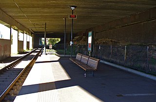
City West Link is a 5.0-kilometre (3.1 mi) link road connecting Parramatta Road and the Western Distributor through the Inner West suburbs of Sydney, New South Wales, Australia. It was bypassed by the WestConnex project upon its completion in November 2023. This name covers a few consecutive roads and is widely known to most drivers, but the entire allocation is also known – and signposted – by the names of its constituent parts: Wattle Street, Dobroyd Parade, City West Link proper and The Cresent.
A directional interchange, colloquially known as a stack interchange, is a type of grade-separated junction between two controlled-access highways that allows for free-flowing movement to and from all directions of traffic. These interchanges eliminate the problems of weaving, have the highest vehicle capacity, and vehicles travel shorter distances when compared to different types of interchanges.
Port River Expressway is a 5.7-kilometre (3.5 mi) freeway-grade road. The expressway links Port Adelaide and the LeFevre Peninsula across the north-western suburbs of Adelaide to major interstate routes via North-South Motorway.
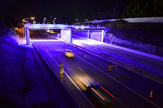
M2 Hills Motorway is a 19.3-kilometre (12.0 mi) tolled urban motorway in Sydney, New South Wales that is part of the Sydney Orbital Network and the National Highway west of Pennant Hills Road. Owned by toll road operator Transurban, it forms majority of Sydney's M2 route, with the Lane Cove Tunnel constituting the rest of the M2 route.

The M4 Motorway is a 55-kilometre (34 mi) series of partially-tolled dual carriageway motorways in Sydney, New South Wales designated as route M4. The M4 designation is part of the wider A4 and M4 route designation, the M4 runs parallel and/or below ground to Great Western Highway, Parramatta Road and City West Link, which are part of route A44.

The M5 Motorway is a 28.8-kilometre (17.9 mi) series of tolled motorways located in Sydney, New South Wales designated as route M5. It is part of the Sydney Orbital Network.
Sydney Bypass refers to a number of roads, existing and proposed, that motorists can use to avoid the congested approaches to the Sydney central business district (CBD). The main bypasses are:
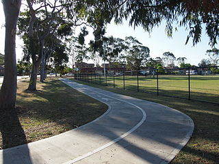
Bike paths in Sydney, New South Wales, Australia, vary widely, with the majority either shared cycle and pedestrian paths or on road paths, and a small number of separated cycleways. In 2009 the Sydney Morning Herald reported that "Sydney's cycleways are not so much an organised network as a fragmented collection of winding paths and half-finished ideas. Most were built or designed when cycling was viewed as a pleasant pastime rather than a practical form of travel and are now poorly suited to commuting."
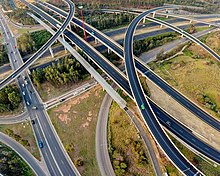
The Sir Roden Cutler VC Memorial Interchange, often shortened to Roden Cutler Interchange and sign-posted as Cutler VC Interchange, is a three-level motorway interchange located in Prestons in South-West Sydney. The interchange forms the junction of the Westlink M7, M5 South-West and M31 Hume Motorways, opening to traffic in December 2005 along with the Westlink M7. It is a major urban feature of the National Highway network with roads linking Sydney south to Canberra and Melbourne and north to Newcastle and Brisbane converging at the interchange.
NorthConnex is a 9-kilometre (5.6 mi) twin-tube motorway tunnel in northern Sydney, New South Wales, Australia, signposted as the M11 Tunnel. It acts as a tunnel bypass of the congested Pennant Hills Road, extending or connecting the M1 Pacific Motorway to the M2 Hills Motorway. Owned by NorthWestern Roads (NWR) Group, it is one of the longest road tunnels in Australia, along with the WestConnex Tunnel. It is also the deepest road tunnel in Australia, with more than half of the tunnel 60 metres (200 ft) deep or more, and the deepest point is underneath the Sydney Metro Northwest, about 90 metres (300 ft) below ground.

Abigroup was an Australian construction company.

The M8 Motorway is a 15.2-kilometre (9.4 mi) tolled dual carriageway motorway in Sydney that is designated the M8 route marker. It consists predominantly of tunnels and includes tunnel connections to the future Western Harbour Tunnel and the M6 Motorway.

The Rozelle Interchange is an underground motorway interchange in Sydney, New South Wales, Australia. It was built as part of WestConnex and opened to traffic on 26 November 2023. The interchange includes a toll-free bypass of Victoria Road between the Iron Cove Bridge and the Anzac Bridge known as the Iron Cove Link.


