List of Nevada historical markers

Last updated

Nevada historical markers identify significant places of interest in Nevada's history. The Historic Marker Program was initiated by the Nevada State Legislature in 1967 to bring the state's heritage to the public's attention with on-site markers. Because of budget cuts the program became dormant in 2009. [1]

List of Nevada historical markers
#Marker nameCountyLocationNotes
1 Empire and the Carson River Mills Carson City 39°11′14″N119°42′23″W / 39.187308°N 119.706364°W / 39.187308; -119.706364 [2]
2 Pioneer Memorial Park Humboldt 40°58′44″N117°44′31″W / 40.978823°N 117.741971°W / 40.978823; -117.741971 [3]
3 West End of Hastings Cutoff Elko [4]
4 Junction House—The First Settlement Washoe 39°29′20″N119°47′42″W / 39.488881°N 119.794943°W / 39.488881; -119.794943

Junction House, Nevada Historical Marker No. 4, Reno, Nevada (6402336411).jpg [5]

5 Pioche Lincoln 37°55′36″N114°26′57″W / 37.926679°N 114.449250°W / 37.926679; -114.449250 [6]
6 El Dorado Canyon Clark 35°49′39″N114°56′11″W / 35.827629°N 114.936453°W / 35.827629; -114.936453 [7]
7 Dayton Lyon 39°14′11″N119°35′21″W / 39.236257°N 119.589297°W / 39.236257; -119.589297 [8]
8 Austin Lander 39°29′N117°04′W / 39.49°N 117.07°W / 39.49; -117.07 [9]
9 Copper Country White Pine [10]
10 Sand Mountain Churchill [11]
11 Eureka Eureka [12]
12 Nevada's Birthplace Douglas [13]
13 The Comstock Lode Storey [14]
14 Goldfield Esmeralda [15]
15 Tonopah Nye [16]
16 Mineral County Mineral [17]
17 Pershing County Pershing [1]
18 Pyramid Lake Washoe 39°54′10″N119°33′57″W / 39.902897°N 119.565775°W / 39.902897; -119.565775

Pyramid Lake, Nevada Historical Marker No. 18, Near Sutcliff, Nevada (4134266029).jpg [5]

19 Ragtown Churchill 39°30′21″N118°55′09″W / 39.505722222222°N 118.91928055556°W / 39.505722222222; -118.91928055556 Ragtown Highway Marker.jpg [11]
20 Columbus Esmeralda [15]
21 The Humboldt Canal Humboldt [3]
22 Humboldt River Humboldt [3]
23 Humboldt House Pershing [18]
24 Olinghouse Washoe [5]
25 Nevada's Capitol Carson City [2]
26 Forty-Mile Desert Churchill [11]
27 Grimes Point Churchill GrimesPoint1.jpeg Prehistoric rock art site [11]
28 Mark Twain Storey [14]
29 Chinese in Nevada Washoe 39°32′05″N119°45′12″W / 39.534713°N 119.753431°W / 39.534713; -119.753431 Nevada Historical Marker 29 Chinese in Nevada.jpg [5]
30 Reno Washoe 39°31′27″N119°48′45″W / 39.524254°N 119.812417°W / 39.524254; -119.812417 Nevada Historical Marker 30 Reno.jpg

Nevada Historical Marker 30 Reno wide.jpg [5]

31 The Old Spanish Trail (1829-1850) Clark [7]
32 The Old Spanish Trail (1829-1850) Clark [7]
33 The Old Spanish Trail (1829-1850) Clark [7]
34 The Old Spanish Trail (1829-1850) Clark [7]
35 Las Vegas Mormon Fort and Rancho Clark 36° 10′ 50.02″ N,

115° 07′ 57.82″ W

Nevada Historical Marker No. 35, Las Vegas Old Mormon Fort Nevada Historical Marker No.35, Las Vegas Old Mormon Fort.jpg
Nevada Historical Marker No. 35, Las Vegas Old Mormon Fort
Nevada's oldest building [7]
36 Moapa Valley Clark [7]
37 Powell of the Colorado Clark [7]
38 Pahranagat Valley Lincoln [6]
39 Panaca Lincoln Southern Nevada's first permanent settlement, from 1864 [6]
40 Las Vegas (The Meadows) Clark [7]
41 Pueblo Grande de Nevada Clark [7]
42 Big Smoky Valley Nye [16]
43 Derby Diversion Dam Washoe [5]
44 Carson City Carson City [2]
45 Humboldt Wells Elko [4]
46 Pilot Peak Elko [4]
47 Fort Halleck Military Reservation Elko 1867-1886 [4]
48 Tuscarora Elko [4]
49 Applegate-Lassen Emigrant Trail Cutoff Pershing [18]
50 Carlin Canyon Elko [4]
51 Schellbourne White Pine 39°47′50″N114°44′28″W / 39.797166666667°N 114.74116666667°W / 39.797166666667; -114.74116666667

2014-05-21 13 19 31 Closeup of the Nevada Historical Marker at Schellbourne, Nevada.JPG 2014-05-21 13 19 25 Nevada Historical Marker at Schellbourne, Nevada.JPG [10]

52 Cherry Creek White Pine [10]
53 Hamilton White Pine [10]
54 Ward Mining District White Pine [10]
55 Culverwell's Ranch Lincoln [6]
56 Virgin Valley Clark [7]
57 Old Boundary (Nevada's Southern Boundary 1861-1867) Lincoln [6]
58 Old Boundary (Nevada's Southern Boundary 1861-1867) Nye
59 Stokes Castle Lander Stokes Castle Nevada Historic Marker.jpg [9]
60 Hawthorne (Present Mineral County Seat—Former Esmeralda County Seat) Mineral [19]
61 Mound House Lyon [8]
62 Truckee River – West Washoe 39°30′34″N119°56′13″W / 39.509479°N 119.936821°W / 39.509479; -119.936821

Truckee River, Nevada Historical Marker No. 62, Near Verdi, Nevada (526801780).jpg [5]

63 Truckee River – East Washoe 39°33′00″N119°34′25″W / 39.550130°N 119.573714°W / 39.550130; -119.573714

Truckee River (East), Nevada Historical Marker No. 63, Near Sparks, Nevada (18083886531).jpg [5]

64 Ophir Nye [16]
65 Palisade Eureka [12]
66 Jacobsville Lander [9]
67 Austin Churches Lander [9]
68 Wadsworth Washoe [5]
69 Jarbidge, Nevada Elko [4]
2014-09-25 13 25 22 Historic marker for the Jarbidge Commercial Hall in Jarbidge, Nevada.jpg
70 Bliss Mansion Carson City [2]
71 Methodist Church of Carson City Carson City [2]
72 Nevada State Children's Home Carson City [2]
73 Unknown Soldiers Elko [4]
74 Wellington Lyon [8]
75 Government Building Carson City [2]
76 Eagle Valley Carson City [2]
77 Dat-So-La-Lee Carson City [2]
78 Orion Clemens' Home Carson City [2]
79 Civil War Plot Washoe 39°32′10″N119°49′12″W / 39.536177°N 119.820027°W / 39.536177; -119.820027 Civil War Plot, Nevada Historical Marker No. 79, Reno, Nevada (6402357819).jpg [5]
80 Eureka County Courthouse Eureka [12]
81 Grand Army Of The Republic Memorial Tree Washoe 39°32′10″N119°49′01″W / 39.5362352°N 119.8170339°W / 39.5362352; -119.8170339

Nevada Historical Marker 81 Grand Army of the Republic Tree.jpg [5]

82 Diamond Valley Eureka [12]
83 Rock Creek (Cold Springs Station) Churchill [11]
84 Jedediah Strong Smith (Explorer of the Western Wilderness) White Pine 39°17′29″N114°50′16″W / 39.291497°N 114.837905°W / 39.291497; -114.837905 (reported missing since 2013) [20]
85 Sutro Lyon Sutro, Nevada Historical Marker No. 85.jpg [8]
86 Tule Springs Clark Archeological Site [7]
87 Savage Mansion (c. 1863) Storey [14]
88 Sparks Washoe 39°32′18″N119°46′01″W / 39.538231°N 119.7670342°W / 39.538231; -119.7670342 Nevada Historical Marker 88 Sparks.jpg [5]
89 Paradise Valley Humboldt [3]
90 Delamar Lincoln "The Widow Maker" (1893-1909) [6]
91 Stewart Indian School Carson City [2]
92 Candelaria and Metallic City Mineral [19]
93 Panaca Mercantile Store Lincoln Built in 1868 as a cooperative for local commerce and trade from Utah [6]
94 The Winters Ranch (Rancho del Sierra) Washoe [5]
95 Battle Mountain Lander [9]
96 Round Mountain Nye 38°44′34″N117°07′27″W / 38.74277°N 117.124042°W / 38.74277; -117.124042

Round Mountain, Nevada Historical Marker No. 96, S.R. 376 Between Carvers and Round Mountain, Nevada (3) (2715227645).jpg [16]

97 Manhattan "The Pine Tree Camp" Nye [16]
98 Osceola (1872-1940) White Pine 39°04′17″N114°26′58″W / 39.071336111111°N 114.44954722222°W / 39.071336111111; -114.44954722222

2015-01-14 11 21 18 Osceola, Nevada historical marker along U.S. Routes 6 and 50 in White Pine County, Nevada.JPG [10]

99 Taylor White Pine [10]
100 Nevada Northern Railway White Pine [10]
101 Miller's Esmeralda [15]
102 Goodsprings Clark 35°49′56″N115°26′04″W / 35.832203°N 115.434320°W / 35.832203; -115.434320 No. 102, Goodsprings.jpg Mining District (1856-1957) [7]
103 Gypsum Cave Clark [7]
104 The Camel Corps Clark 35°10′20″N114°42′39″W / 35.172101°N 114.710793°W / 35.172101; -114.710793 [7] Currently MIA, Removed May 2015
105 Golconda Humboldt [3]
106 Elko Elko [4]
107 Elko Airport Elko Terminus of the First Commercial Air Mail Route [4]
108 Ruby Valley Pony Express Station Elko Reconstructed [4]
109 Lamoille Valley Elko [4]
110 Wagon Jack Shelter Churchill [11]
111 Edwards Creek Valley Churchill [11]
112 Carlin Elko [4]
113 Wabuska Lyon [8]
114 Franktown Washoe

Franktown, Nevada Historical Marker No.114, Washoe Valley, Nevada (7425856616).jpg [5]

115 Potosi Clark 36°00′04″N115°29′07″W / 36.000990°N 115.485413°W / 36.000990; -115.485413 NV Historical Marker No.115- Potosi.jpg [7]
116 Searchlight Clark 35°28′06″N114°55′21″W / 35.468373°N 114.922612°W / 35.468373; -114.922612 [7]
117 Kingsbury Grade Douglas 38°57′56″N119°50′23″W / 38.965531°N 119.839669°W / 38.965531; -119.839669

Kingsbury Grade Marker.jpg [13]

118 Luther Canyon Douglas Luther Canyon.jpg Fay Canyon [13]
119 Reul Colt Gridley Lander [9]
120 Walley's Hot Springs Douglas [13]
121 Mottsville Douglas 38°55′52″N119°50′24″W / 38.931094°N 119.840094°W / 38.931094; -119.840094

Mottsville Nevada Historical Marker.jpg [13]

122 Sheridan Douglas [13]
123 Cradlebaugh Bridge Douglas [13]
124 Boyd Toll Road Douglas [13]
125 Twelve Mile House Douglas [13]
126 Double Springs, Nevada Douglas Double Springs, Nevada.jpg [13]
127 Courthouse Site (1865-1907) Lyon [8]
128 The Great Train Robbery (Nevada) Washoe 39°31′03″N119°59′21″W / 39.517531°N 119.9890372°W / 39.517531; -119.9890372 The Great Train Robbery Nevada Historical Marker.jpg [5]
129 Gardnerville Douglas [13]
130 Minden Douglas [13]
131 Dresslerville Douglas [13]
132 Mackay Mansion Storey [14]
133 Fish Lake Valley Esmeralda [15]
134 Trans-Sierran Pioneer Flight Carson City (March 22, 1919) [2]
135 New Pass Station Churchill [11]
136 Toquima Cave Lander [9]
137 Hickison Summit Lander [9]
138 Belmont Nye Mf bw580.jpg [16]
139 The Old Spanish Trail (Journey of Death) Clark [7]
140 The Old Spanish Trail (Garces Expedition) Clark 35°06′24″N114°39′03″W / 35.106696°N 114.650784°W / 35.106696; -114.650784 [7]
141 The Old Spanish Trail (Armijo's Route) Clark 36°05′52″N114°54′17″W / 36.097650°N 114.904663°W / 36.097650; -114.904663 No. 141, Armijo's Route.jpg [7]
142 The Old Spanish Trail (Mountain Springs Pass) Clark 35°59′54″N115°26′52″W / 35.998436°N 115.447723°W / 35.998436; -115.447723 No.142.jpg [7]
143 Sarah Winnemucca Hopkins Humboldt 1844-1891 [3]
144 Fort McDermitt Humboldt [3]
145 Unionville (Pershing County) Pershing Unionville, Nevada Historical Marker No. 145, Near Unionville, Nevada.jpg [18]
146 McDermitt Indian Reservation Humboldt Northern Paiute [3]
147 A Home of Early Man Churchill [11]
148 The Two Battles Of Pyramid Lake Washoe

The Two Battles of Pyramid Lake, Nevada Historical Marker No. 148, S.R. 447 Between Wadsworth and Pyramid Lake, Nevada (4135064282).jpg [5]

149 High Rock Canyon Washoe [5]
150 Nevada's First State Park Clark [7]
151 Duck Valley Indian Reservation Elko [4]
152 Gerlach Washoe

Gerlach, Nevada Historical Marker No. 152, Gerlach, Nevada (11128459705).jpg [5]

153 Jarbidge Community Hall Elko [4]
154 Belleville Mineral [19]
155 Silver Peak Esmeralda Discovered 1863 [15]
156 Gold Point Esmeralda [15]
157 Lida Esmeralda [15]
158 Palmetto Esmeralda [15]
159 Ione Nye [16]
160 Panaca Spring Lincoln Warm spring and source of Meadow Valley's fertile lands [6]
161 Churchill County Courthouse Churchill [11]
162 Camp McGarry Humboldt

Soldiers Meadow area.jpg [3]

163 Chinatown Lyon Dayton, Nevada Historical Marker No. 7, Dayton, Nevada.jpg Early Name of Dayton [8]
164 Button Point Humboldt [3]
165 Nevada Test Site Nye 36° 35′ 33.49″ N,

116° 01′ 42.01″ W

Nevada Historic Marker No. 165, Nevada Test Site Nevada Historic Marker No. 165, Nevada Test Site.jpg
Nevada Historic Marker No. 165, Nevada Test Site
[16]
166 Bowers Mansion Washoe

Bowers Mansion, Nevada Historical Marker No.166, Washoe Valley, Nevada (7425816234).jpg [5]

167 Valmy Humboldt [3]
168 Arrowhead Trail (1914-1924) Clark

Arrowhead Trail (1914-1924), Nevada Historical Marker No. 168.jpg [7]

169 Glendale School Washoe 39°32′04″N119°45′20″W / 39.534582°N 119.7554212°W / 39.534582; -119.7554212 Nevada Historical Marker 169 Glendale School.jpg

Nevada Historical Marker 169 Glendale School wide.jpg [5]

170 Eureka Sentinel Building Eureka [12]
171 Chief Tecopa (Peacemaker of the Paiutes) Nye [16]
172 Tybo Nye [16]
173 Beatty (Center of the Gold Railroads—"Chicago of the West") Nye

Beatty, Nevada Historical Marker No. 173, Beatty, Nevada (6416347419).jpg [16]

173 Tate's Stage Station (1886-1901) Nye [16]
174 Blair Esmeralda [15]
175 Stewart-Nye Residence Carson City [2]
176 The Surveyors (Nevada) Lander

2014-09-08 12 54 33 "The Surveyors" Nevada historical marker along U.S. Route 50 at Bob Scott Summit, Nevada.JPG [9]

177 Desert Well Station (Overland Mail and Stage Station) Lyon [8]
178 Hazen Churchill Hazen Highway Marker.jpg [11]
179 First Air Flights in Nevada Carson City [2]
180 The Warm Springs Hotel Carson City [2]
181 The Washo Indians Carson City [2]
182 Panaca Ward Chapel Lincoln Oldest building in Lincoln County, built in 1867-68 as a LDS Church meetinghouse [6]
183 Walker River Reservation Mineral [19]
184 Ward Charcoal Ovens White Pine [10]
185 McCone's Foundries Lyon [8]
186 Union Hotel and Post Office Lyon [8]
187 The Cattle Industry Eureka [12]
188Von Schmidt State Boundary Monument Clark 35°00′51″N114°39′43″W / 35.014259°N 114.661825°W / 35.014259; -114.661825 [7]
189 Southern Pacific Railroad Yards Washoe 39°32′05″N119°45′11″W / 39.534694°N 119.7531762°W / 39.534694; -119.7531762 Nevada Historical Marker 189 Southern Pacific Railroad Yard.jpg [5]
190 Original Homesite of Pioneer Las Vegas, "Pop" Squires (1865-1958) Clark [7]
191 Verdi Washoe [5]
192 Buckland's Station (On the California Emigrant Trail) Lyon 39°17′39″N119°15′06″W / 39.294221°N 119.251592°W / 39.294221; -119.251592 Buckland Station Historical Marker 192.jpg

[8]

193 Historic Flume and Lumber Yard Carson City [2]
194 Gardner's Ranch Carson City [2]
195 The Last Spike Clark 35°49′26″N115°17′14″W / 35.823763°N 115.287155°W / 35.823763; -115.287155 No. 195, The Last Spike.jpg Road Marker for Nevada Historical Markers.jpg [7]
196 The United States Mint at Carson City, Nevada Carson City [2]
197 Arrowhead Trail II Clark 35° 59' 50.658" N

114° 57' 32.118" W

Arrowhead Trail Historic Marker Nevada State Historic Marker No 197, Arrowhead Trail, Henderson.jpg
Arrowhead Trail Historic Marker
[7]
198 Steamboat Springs Washoe [5]
199 Camels in Dayton Lyon [8]
200 Hall's Station Lyon [8]
201 Wonder Historic Mining Camp Churchill Historic Mining Camp—1906-1919 [11]
202 Fairview Churchill 1905-1917 [11]
203 Bullionville Lincoln [6]
204 Jackrabbit Lincoln [6]
205 Crystal Springs Lincoln [6]
206 Hiko Lincoln [6]
207 Carson Valley Douglas [13]
208 International Hotel Lander First commercial building constructed in Austin in 1863 [9]
209 Chollar Mine Storey [14]
210 Nevada-California-Oregon Railroad Depot Washoe 39°31′52″N119°48′36″W / 39.531085°N 119.8101022°W / 39.531085; -119.8101022 Nevada Historical Marker 210 Nevada California Oregon Railroad Depot.jpg

Nevada Historical Marker 210 wide.jpg [5]

211 Old Geiger Grade Washoe

Old Geiger Grade, Nevada Historical Marker No. 211, S.R. 341 Near Virginia City, Nevada (6416319951).jpg [5]

212 Galena Washoe

Galena, Nevada Historical Marker No. 212, Reno, Nevada (6402313595).jpg [5]

213 Lakeview Carson City [2]
214 Rafael Rivera Clark 36°05′01″N115°04′22″W / 36.083692°N 115.072761°W / 36.083692; -115.072761 No. 214, Rafael Rivera.jpg [7]
215 Lahontan Dam Churchill [11]
216 Stillwater Churchill [11]
217 Tate's Stage Station Nye [16]
218 Geiger Station (Magnolia House) Washoe

Geiger Station, Nevada Historical Marker No. 218, Reno, Nevada (6320269127).jpg [5]

219 Glenbrook Douglas Glenbrook, Nevada.jpg [13]
220 The Fight of the Century Washoe 39°31′59″N119°47′49″W / 39.533192°N 119.7970442°W / 39.533192; -119.7970442 The Fight of the Century, Nevada Historical Marker No. 220, Reno, Nevada (6320829562).jpg [5]
221 Sand Harbor Washoe 39°12′02″N119°55′51″W / 39.2005193°N 119.9307248°W / 39.2005193; -119.9307248 Nevada Historical Marker 221 Sand Harbor.jpg [5]
222 Tannehill Cabin—One of Eureka's First Houses Eureka [12]
223 Devil's Gate Lyon [8]
224 Kyle Ranch Clark [7]
225 Spooner Area Douglas Logging and Lumber Period: 1868-1895 [13]
226 Cave Rock Douglas [13]
227 Lake Mansion Washoe 39°31′21″N119°49′05″W / 39.522562°N 119.8181126°W / 39.522562; -119.8181126 Nevada Historical Marker 227 Lake Mansion.jpg [5]
228 The Great Fire of 1875 Storey [14]
229 Oil from Shale Elko [4]
230 Mount Rose Weather Observatory Washoe

Mount Rose Weather Observatory, Nevada Historical Marker No. 230, Mount Rose Summit, Nevada Route 431, Nevada (16340363263).jpg [5]

231 Star City Pershing [18]
232 Reunion in Unionville Pershing [18]
233 Dayton Cemetery Lyon [8]
234 Moana Springs Washoe Maps 39°29′32″N119°48′03″W / 39.4923328°N 119.800851°W / 39.4923328; -119.800851

Nevada Historical Marker 234 Moana Springs.jpg [5]

235 Camp Nye Carson City [2]
236 Piper's Opera House Storey [14]
237 Carson and Colorado Railroad Freight Depot Mineral [19]
238 Huffaker's Washoe

Huffaker's, Nevada Historical Marker No. 238, Reno, Nevada (6402424937).jpg [5]

239 Stonehouse Humboldt [3]
240 Coney Island Washoe Maps 39°32′06″N119°46′50″W / 39.535005°N 119.780611°W / 39.535005; -119.780611

Nevada Historical Marker 240 Coney Island.jpg [5]

242 Southern Nevada Consolidated Telephone-Telegraph Company Building Esmeralda [15]
243 Corbett—Fitzsimmons Fight Carson City 39°09′52″N119°45′36″W / 39.164475°N 119.759997°W / 39.164475; -119.759997

Corbet - Fitzsimmons Fight Historical Marker 243.jpg [2]

244 Dinner Station Elko [4]
245 Frederick Joseph DeLongchamps (June 2, 1882 – February 11, 1969) Washoe 39°31′30″N119°48′44″W / 39.524964°N 119.812281°W / 39.524964; -119.812281 Frederick Joseph DeLongchamps, Nevada Historical Marker No. 245, Reno, Nevada (6320284531).jpg [5]
246 The Great Incline of the Sierra Nevada Washoe 39°14′13″N119°55′44″W / 39.236813°N 119.928778°W / 39.236813; -119.928778

Great Incline of the Sierra Nevada, Nevada Historical Marker No. 246, Incline Village, Nevada (16338099834).jpg [5]

247 Site of Nevada's First Public Library Washoe 39°31′30″N119°48′44″W / 39.524964°N 119.812281°W / 39.524964; -119.812281

Site of Nevada's First Public Library, Nevada Historical Marker No. 247, Reno, Nevada (6320808628).jpg [5]

248 Virginia & Truckee Railroad Right of Way Washoe 39°30′53″N119°48′27″W / 39.5146446°N 119.8075372°W / 39.5146446; -119.8075372

Virginia & Truckee Railroad Right of Way, Nevada Historical Marker No. 248.jpg [5]

249 Union Pacific Depot—1923 Lincoln [6]
250 State Printing Building Carson City [2]
251 Diamondfield Jack Davis Elko [4]
252 Rinckel Mansion Carson City [2]
253 Emigrant—Donner Camp Washoe 39°28′34″N119°45′15″W / 39.476005°N 119.754087°W / 39.476005; -119.754087

Emigrant-Donner Camp, Nevada Historical Marker No. 253, Reno, Nevada (18998858006).jpg [5]

254 Nevada's Mining Heritage Eureka [12]
255 Wilson Canyon Lyon [8]
256 Historic Transportation Washoe [5]
257 Nevada's First Gold Discovery Lyon [8]
258 Charles W. Friend House, Observatory, and Weather Station Carson City [2]
259 The Governor's Mansion Carson City [2]
260 Contact Elko [4]
261 Spooner Summit Douglas [13]
262 Dayton School House - 1865 Lyon [8]
263 Oats Park School Churchill [11]
265 Governor Emmet Derby Boyle Washoe [5]
266 African Americans and the Boston Saloon Storey [14]
267 Galena Creek Fish Hatchery Washoe
268 *UNASSIGNED* Nevada
269 Ely - Forging the Link White Pine
270 The Morelli House Clark
271 Pony Express Trail Churchill
272 *UNASSIGNED* Nevada
273 *UNASSIGNED* Nevada
274 Nevada State Hospital Washoe

Notes

  1. 1 2 "Historical Markers". Nevada State Historic Preservation Office. Retrieved 25 March 2017.
  2. 1 2 3 4 5 6 7 8 9 10 11 12 13 14 15 16 17 18 19 20 21 22 23 24 25 26 "Carson City, Nevada". Nevada . Retrieved 17 July 2011.
  3. 1 2 3 4 5 6 7 8 9 10 11 12 "Humboldt County, Nevada". Nevada . Retrieved 18 July 2011.
  4. 1 2 3 4 5 6 7 8 9 10 11 12 13 14 15 16 17 18 19 "Elko Nevada". Nevada . Retrieved 18 July 2011.
  5. 1 2 3 4 5 6 7 8 9 10 11 12 13 14 15 16 17 18 19 20 21 22 23 24 25 26 27 28 29 30 31 32 33 34 35 36 37 38 39 40 41 "Washoe County, Nevada". Nevada . Retrieved 18 July 2011.
  6. 1 2 3 4 5 6 7 8 9 10 11 12 13 14 "Lincoln County, Nevada". Nevada . Retrieved 18 July 2011.
  7. 1 2 3 4 5 6 7 8 9 10 11 12 13 14 15 16 17 18 19 20 21 22 23 24 25 26 27 28 29 "Clark County, Nevada". Nevada . Retrieved 18 July 2011.
  8. 1 2 3 4 5 6 7 8 9 10 11 12 13 14 15 16 17 18 "Lyon County, Nevada". Nevada . Retrieved 18 July 2011.
  9. 1 2 3 4 5 6 7 8 9 10 "Lander County, Nevada". Nevada . Retrieved 18 July 2011.
  10. 1 2 3 4 5 6 7 8 9 "White Pine County, Nevada". Nevada . Retrieved 18 July 2011.
  11. 1 2 3 4 5 6 7 8 9 10 11 12 13 14 15 16 "Churchill County, Nevada". Nevada . Retrieved 18 July 2011.
  12. 1 2 3 4 5 6 7 8 "Eureka County, Nevada". Nevada . Retrieved 18 July 2011.
  13. 1 2 3 4 5 6 7 8 9 10 11 12 13 14 15 16 17 18 "Douglas County, Nevada". Nevada . Retrieved 18 July 2011.
  14. 1 2 3 4 5 6 7 8 "Storey County, Nevada". Nevada . Retrieved 18 July 2011.
  15. 1 2 3 4 5 6 7 8 9 10 "Esmeralda County, Nevada". Nevada . Retrieved 18 July 2011.
  16. 1 2 3 4 5 6 7 8 9 10 11 12 13 "Nye County, Nevada". Nevada . Retrieved 18 July 2011.
  17. "Nevada Historical Markers". Nevada State Historic Preservation Office. Archived from the original on 4 February 2013. Retrieved 24 February 2013.
  18. 1 2 3 4 5 "Pershing County, Nevada". Nevada . Retrieved 18 July 2011.
  19. 1 2 3 4 5 "Mineral County, Nevada". Nevada . Retrieved 18 July 2011.
  20. Marker Statement

Related Research Articles

<span class="mw-page-title-main">Pershing County, Nevada</span> County in Nevada, United States

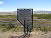
Pershing County is a county in the U.S. state of Nevada. As of the 2020 census, the population was 6,650. Its county seat is Lovelock. The county was named after army general John J. Pershing (1860–1948). It was formed from Humboldt County in 1919, and the last county to be established in Nevada. The Black Rock Desert, location for the annual Burning Man event, is partially in the county. The county is listed as Nevada Historical Marker 17. The marker is at the courthouse in Lovelock.

<span class="mw-page-title-main">Mineral County, Nevada</span> County in Nevada, United States

Mineral County is a county located in the U.S. state of Nevada. As of the 2020 census, the population was 4,554, making it the fifth-least populous county in Nevada. Its county seat is Hawthorne.

<span class="mw-page-title-main">Panaca, Nevada</span> Unincorporated town in the State of Nevada, United States

Panaca is an unincorporated town in eastern Lincoln County, Nevada, United States, on State Route 319, about 1 mile east of U.S. Route 93, near the border with Utah. Its elevation is 4,729 feet above sea level. As of the 2010 census, it had a population of 963. It is one of only two cities in Nevada that prohibits gambling, the other being Boulder City.

<span class="mw-page-title-main">Commemorative plaque</span> Historical marker

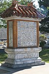
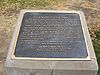
A commemorative plaque, or simply plaque, or in other places referred to as a historical marker, historic marker, or historic plaque, is a plate of metal, ceramic, stone, wood, or other material, typically attached to a wall, stone, or other vertical surface, and bearing text or an image in relief, or both, to commemorate one or more persons, an event, a former use of the place, or some other thing. Many modern plaques and markers are used to associate the location where the plaque or marker is installed with the person, event, or item commemorated as a place worthy of visit. A monumental plaque or tablet commemorating a deceased person or persons, can be a simple form of church monument. Most modern plaques affixed in this way are commemorative of something, but this is not always the case, and there are purely religious plaques, or those signifying ownership or affiliation of some sort. A plaquette is a small plaque, but in English, unlike many European languages, the term is not typically used for outdoor plaques fixed to walls.

<span class="mw-page-title-main">California State Route 88</span> Highway in California

State Route 88 (SR 88), also known as the Carson Pass Highway, is a state highway in the U.S. state of California. It travels in an east–west direction from Stockton, in the San Joaquin Valley, to the Nevada state line, where it becomes Nevada State Route 88, eventually terminating at U.S. Route 395 (US 395). The highway is so named as it crests the Sierra Nevada at Carson Pass. The highway corridor predates the era of the automobile; the path over Carson pass was previously used for the California Trail and the Mormon Emigrant Trail. The mountainous portion of the route is included in the State Scenic Highway System.

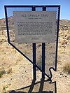
The Arrowhead Trail or Arrowhead Highway was the first all-weather road in the Western United States that connected Los Angeles, California with Salt Lake City, Utah by way of Las Vegas, Nevada. Built primarily during the auto trails period of the 1910s, prior to the establishment of the United States Numbered Highway System, the road was replaced in 1926 by U.S. Route 91 (US 91) and subsequently Interstate 15 (I-15). Small portions of the route in California, Nevada and Utah are sometimes still referred to by the name, or as Arrow Highway.

<span class="mw-page-title-main">Marshall Gold Discovery State Historic Park</span> State park in California

Marshall Gold Discovery State Historic Park is a state park of California, United States, marking the discovery of gold by James W. Marshall at Sutter's Mill in 1848, sparking the California Gold Rush. The park grounds include much of the historic town of Coloma, California, which is now considered a ghost town as well as a National Historic Landmark District. The park contains the California Historical Landmarks: a monument to commemorate James Marshall (#143), the actual spot where he first discovered gold in 1848 (#530). Established in 1942, and Coloma Road (#748),. The park now comprises 576 acres (233 ha) in El Dorado County.

<span class="mw-page-title-main">Hiko, Nevada</span> Unincorporated community in the state of Nevada, United States

Hiko is a small, agrarian community in the Tonopah Basin on State Route 318 in Lincoln County, Nevada, United States. It is a census-designated place, with a population of 119 at the 2010 census.

<span class="mw-page-title-main">Texas Historical Commission</span> Agency of the State of Texas, United States

The Texas Historical Commission is an agency dedicated to historic preservation within the U.S. state of Texas. It administers the National Register of Historic Places for sites in Texas.

<span class="mw-page-title-main">U.S. Route 50 in Nevada</span> Section of U.S. Highway in Nevada, United States

U.S. Route 50 (US 50) is a transcontinental highway in the United States, stretching from West Sacramento, California, in the west to Ocean City, Maryland, on the east coast. The Nevada portion crosses the center of the state and was named "The Loneliest Road in America" by Life magazine in July 1986. The name was intended as a pejorative, but Nevada officials seized it as a marketing slogan. The name originates from large desolate areas traversed by the route, with few or no signs of civilization. The highway crosses several large desert valleys separated by numerous mountain ranges towering over the valley floors, in what is known as the Basin and Range province of the Great Basin.

<span class="mw-page-title-main">Valmy, Nevada</span> Census-designated place in Nevada, United States

Valmy is a census-designated place in Humboldt County, Nevada, United States, named after the Battle of Valmy in France. The Lone Tree gold-mining complex is located adjacent to I-80; mining ended there in 2007, though a small gold resource remains in place there. In 2021, Nevada Gold Mines sold the mine to i-80 Gold, who hope to process ore there.

<span class="mw-page-title-main">Crystal Springs, Nevada</span> Ghost town in Nevada, United States

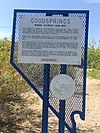
Crystal Springs is a ghost town in the Pahranagat Valley region of Lincoln County, Nevada in the United States. The ghost town is located at the junction of State Route 318 and State Route 375, just northwest of U.S. Route 93. It is a popular destination for passersby who want to visit the towns of Hiko and Rachel. The namesake of the ghost town, the Crystal Springs, lies nearby; it is a large group of marshes and springs along the White River. Crystal Springs provides irrigation for multiple nearby ranches and farms, some of which lie over 5 miles away from the springs.

Blair, Nevada is a mining ghost town in Esmeralda County, Nevada.

<span class="mw-page-title-main">Boundary markers of the original District of Columbia</span> Markers that marked the District of Columbias original boundary

The boundary markers of the original District of Columbia are the 40 milestones that marked the four lines forming the boundaries between the states of Maryland and Virginia and the square of 100 square miles (259 km2) of federal territory that became the District of Columbia in 1801. Working under the supervision of three commissioners that President George Washington had appointed in 1790 in accordance with the federal Residence Act, a surveying team led by Major Andrew Ellicott placed these markers in 1791 and 1792. Among Ellicott's assistants were his brothers Joseph and Benjamin Ellicott, Isaac Roberdeau, George Fenwick, Isaac Briggs and an African American astronomer, Benjamin Banneker.

<span class="mw-page-title-main">Plumas-Eureka State Park</span> State park in California, United States

Plumas-Eureka State Park is a California state park located in the Sierra Nevada and Cascade Range in Plumas County, California.

Tule Springs Archaeological Site is an archeological site listed on the National Register of Historic Places that is located in the Las Vegas Valley of Nevada, United States. It is one of a few sites in the United States where humans were once thought to have lived alongside, and potentially hunted, extinct Ice Age megafauna, although this view is not supported by the available scientific data and is no longer generally accepted.

<span class="mw-page-title-main">Caliente station</span> Former train station in Caliente, Nevada, United States

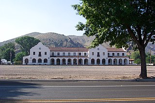
Caliente station is a historic Mission Revival style railway station, located in Caliente, Nevada, United States. The station is listed on the National Register of Historic Places as the Caliente Railroad Depot, and is Nevada Historical Marker number 249.

<span class="mw-page-title-main">Mottsville, Nevada</span> Unincorporated community in the state of Nevada, United States

Mottsville is an unincorporated community within the Humboldt–Toiyabe National Forest on the western edge of the Carson Valley in northwestern Douglas County, Nevada, United States. Mottsville is located at the junction of Nevada State Route 206 and Nevada State Route 207 3 miles (4.8 km) west-southwest of Minden.