
Lake Victoria is one of the African Great Lakes. With a surface area of approximately 59,947 km2 (23,146 sq mi), Lake Victoria is Africa's largest lake by area, the world's largest tropical lake, and the world's second-largest fresh water lake by surface area after Lake Superior in North America. In terms of volume, Lake Victoria is the world's ninth-largest continental lake, containing about 2,424 km3 (1.965×10⁹ acre⋅ft) of water. Lake Victoria occupies a shallow depression in Africa. The lake has an average depth of 40 m (130 ft) and a maximum depth of 80–81 m (262–266 ft). Its catchment area covers 169,858 km2 (65,583 sq mi). The lake has a shoreline of 7,142 km (4,438 mi) when digitized at the 1:25,000 level, with islands constituting 3.7% of this length.

The Samburu National Reserve is a game reserve on the banks of the Ewaso Ng'iro river in Kenya. On the other side of the river is the Buffalo Springs National Reserve. The park is 165 km² in size and is situated 350 kilometers from Nairobi. It ranges in altitude from 800 to 1230 m above sea level. Geographically, it is located in Samburu County.
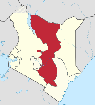
The Eastern Province of Kenya was one of 8 Provinces of Kenya. Its northern boundary ran along with that of Ethiopia; the North Eastern Province and Coast Province lay to the east and south; and the remainder of Kenya's provinces, including Central Province, ran along its western border. The provincial capital was Embu.

The Turkwel River is a river flowing from Mount Elgon on the border of Kenya and Uganda to Lake Turkana. The river is called the Suam River from its source to the border at Turkana County of Kenya. The name Turkwel is derived from the Turkana name for the river, Tir-kol, which means a river that "withstands the wilderness". The Turkwel begins on the lush green slopes of Mount Elgon and the Cherangani Hills, then traverses the Southern Turkana Plains, crosses the Loturerei Desert near Lodwar and empties into the world's largest desert lake, Lake Turkana. The river's flow is seasonally varied, and it is subject to flash floods in the rainy season.
Thompson Falls can refer to:

Ewaso Ng'iro, also called Ewaso Nyiro, is a river in Kenya which rises on the west side of Mount Kenya and flows north then east and finally south-east, passing through Somalia where it joins the Jubba River. The river's name is derived from the local community's language, and means river of brown or muddy water. Downstream, the intermittent stream in Somalia is also called Lagh Dera.
The Naro Moru River starts on Mount Kenya and flows down to the west, through Nyeri County, Kenya, into the Ewaso Ng'iro River. The North and South Naro Moru Rivers are fed by the Teleki Tarn, Lewis Glacier, Tyndall Tarn and Glacier, Hut Tarn and Darwin Glacier at the peaks of Mount Kenya. They join at 2,810 m (9,200 ft) above sea level. The Naro Moru River flows for around 50 km (31 mi), through Naro Moru town, until it reaches the Ewaso Ngiro River. The catchment area of the Naro Moru River is around 83 km2.

Labeobarbus intermedius is an East African ray-finned fish species in the family Cyprinidae. Like the closely related yellowfish, it is hexaploid. A large species, the maximum recorded standard length is nearly 50 cm (20 in). This species has a subspecies named Labeobarbus intermedius intermedius.
Sclerophrys turkanae, the Lake Turkana toad or Turkana toad, is a species of toad in the family Bufonidae. It is endemic to Kenya, and is only known from two localities; Loiyangalani on the southeastern shores of Lake Turkana, and the Ewaso Ng'iro River in the Samburu National Reserve.
Pardiglanis tarabinii, the Somalian giant catfish, is a species of claroteid catfish native to Kenya and Somalia.

Nyahururu Falls is a 74 metres (243 ft) waterfall on the Ewaso Ng'iro river in Central Rift Valley Kenya, a few kilometres from Lake Ol Bolossat, which drains from the Aberdare Range. It is situated 3 kilometres (2 mi) from the town of Nyahururu, at 2,360 metres (7,740 ft) elevation. In 1883 Joseph Thomson was the first European to reach Thomson Falls, and named them for his father. Thomson wrote:
I was impressed mightily by the stupendous thundering of the waters which in magnificent mass plunged down several hundred feet into a fearful gloomy gorge. ... The crevices give support to a splendid drapery of creepers and bushes, the spray from the waters yielding the necessary sustenance. Among other plants wild bananas are to be seen.

Nguruman Escarpment is an escarpment in southern Kenya. The escarpment is around 50 kilometres long and elongated in N-W direction. Its northern edge approximately 120 km southwest of Nairobi, while the southern edge is near the Tanzanian border, at the northwestern corner of Lake Natron. The Southern Ewaso Ng'iro river flows southward along the foot of the escarpment, while Loita Hills are located west of the escarpment. The escarpment forms the western wall of the Great Rift Valley. Below it are the vast plains and the volcanic hills of the Great Rift Valley and in the distance are Lake Magadi and Lake Natron.

Mau Forest is a forest complex in the Rift Valley of Kenya. It is the largest indigenous montane forest in East Africa. The Mau Forest complex has an area of 273,300 hectares.
The Turkwel Hydroelectric Power Station, also Turkwel Dam, is an arch dam on the Turkwel River about 76 km (47 mi) north of Kapenguria in West Pokot County, Kenya. The dam serves several purposes to include hydroelectric power production, irrigation tourism and fisheries. It was constructed between 1986 and 1991. It supports the third largest hydroelectric power plant in the country, having an installed electric capacity of 106 megawatts (142,000 hp).
The Shompole Conservancy is a large privately operated conservation area in the south of the Great Rift Valley, Kenya. It is located between Lake Magadi to the north and Lake Natron to the south, two alkaline lakes.

The Southern Ewaso Ng'iro is a river in the Great Rift Valley in Kenya. It plays an important role in the ecology of Lake Natron, the main regular breeding site for near-threatened lesser flamingos. Changes to land use in the river's headwaters or in the marshes before the river enters the lake could have a serious impact on this species.
Merti is a small town in Isiolo County in northern Kenya. Merti is one of the upcoming urban centres in Isiolo County. It is also the capital of Merti sub-county, which has a population of 47,206.

Amphilius grandis is a species of catfish in the genus Amphilius. It is found in the Tana and Ewaso Ng'iro river basins in Kenya. Its length reaches 18.1 cm.


