Route of the M11 link road overlaid over an older map of the area, with key protest sites marked
The M11 link road protest was a campaign against the construction of the M11 link road in east London in the early to mid-1990s. "A12 Hackney to M11 link road", as it was officially called, was part of a significant local road scheme to connect traffic from the East Cross Route (A12) in Hackney Wick to the M11 via Leyton, Leytonstone, Wanstead and the Redbridge Roundabout, avoiding urban streets.
The road had been proposed since the 1960s, as part of the London Ringways, and was an important link between central London and the Docklands to East Anglia. However, road protests elsewhere had become increasingly visible, and urban road building had fallen out of favour with the public. A local Member of ParliamentHarry Cohen, representing Leyton, had been a vocal opponent of this scheme.
The protests reached a new level of visibility during 1993 as part of a grassroots campaign where protesters came from outside the area to support local opposition to the road. The initial focus was on the removal of a tree on George Green, east of Wanstead, that attracted the attention of local, then national media. The activity peaked in 1994 with several high-profile protesters setting up micronations on property scheduled for demolition, most notably on Claremont Road in Leyton. The final stage of the protest was a single building on Fillebrook Road in Leytonstone, which, due to a security blunder, became occupied by squatters.
The road was eventually built as planned, and opened to traffic in 1999, but the increased costs involved in management and policing of protesters raised the profile of such campaigns in the United Kingdom, and contributed to several road schemes being cancelled or reviewed later on in the decade. Those involved in the protest moved on to oppose other schemes in the country. By 2014, the road had become the ninth most congested in the entire country.[1]
Background
The origin of the link road stems from what were two major arterial roads out of London (the A11 to Newmarket and Norwich, and the A12 to Colchester, Ipswich and Great Yarmouth) and subsequent improvements. The first of these was the Eastern Avenue improvement, that opened on 9 June 1924,[2] which provided a bypass of the old road through Ilford and Romford.
Proposals for the route first arose in the 1960s as part of the London Ringways plan, which would have seen four concentric circular motorways built in the city, together with radial routes, with the M11 motorway ending on Ringway 1, the innermost Ringway, at Hackney Marsh.[3]
The planned London Ringways.
A section of Ringway 1 known as the East Cross Route was built to motorway standards in the late 1960s and early 1970s and designated as the A102(M). A section of the M11 connecting Ringway 2 (now part of the North Circular Road) and Eastern Avenue to Harlow was completed in the late 1970s,[4] opening to traffic in 1977.[5]
The Ringways scheme met considerable opposition; there were protests when the Westway, an urban motorway elevated over the streets of Paddington, was opened in 1970, with local MP John Wheeler later describing the road's presence within 15 metres of properties as "completely unacceptable environmentally,"[6] and the Archway Road public inquiry was repeatedly abandoned during the 1970s as a result of protests.[7][8] By 1974, the Greater London Council announced it would not be completing Ringway 1.[9] The first Link Road Action Group to resist the M11 link road was formed in 1976,[10] and for the next fifteen years activists fought government plans through a series of public inquiries. Their alternative was to build a road tunnel, leaving the houses untouched, but this was rejected on grounds of cost.[11] Drivers travelling in the areas where the new roads would have been built had to continue using long stretches of urban single-carriageway roads. In particular, the suburbs of Leyton, Leytonstone and Wanstead suffered serious traffic congestion.[12][13]
The Roads for Prosperity white paper published in 1989 detailed a major expansion of the road building programme and included plans for the M12 Motorway between London and Chelmsford, as well as many other road schemes.[14] Although the Leyton MP Harry Cohen suggested in May 1989 that the government should scrap the scheme,[15] a public enquiry was held for the scheme in November.[16]
The protest campaign
The Humble Petition of The Stop the M11 Link Road Action Campaign sheweth: That the A12 Hackney Wick to M11 Link Road will be injurious to the health and well being of the Petitioners insofar as it will cause homelessness through their homes being demolished with in many instances no replacement being offered, it will cause ill health through noise and pollution and will be unfavourable to the community at large.
Petition submitted to the House of Commons, June 1990[17]
By the 1980s, planning blight had affected the area and many of the houses had become home to a community of artists and squatters.[18] Eventually, contractors were appointed to carry out the work and a compulsory purchase of property along the proposed route was undertaken.[11] In March 1993, in preparation for the construction of the road, the Earl of Caithness, then the Minister of State for Transport, estimated that there would be 263 properties scheduled for demolition, displacing 550 people, of which he estimated 172 were seeking rehousing.[19] Several original residents, who had in some cases lived in their homes all their lives, refused to sell or move out of their properties.[20]
Protesters from the local area against the link road scheme were joined by large numbers of anti-road campaigners from around the UK and beyond, attracted by the availability of free housing along the route. These experienced protesters, who had participated in earlier events such as the Anti-Nazi Leagueriots in Welling,[21] gave impetus to the campaign. The new arrivals used the skills they had developed during prior protests to construct "defences", blocking the original entrances to the houses and creating new routes directly between them.[11]
Sophisticated techniques were used to delay the construction of the road. Sit-ins and site invasions were combined with sabotage to stop construction work temporarily. This led to large numbers of police and constant security patrols being employed to protect the construction sites, at great expense. By December 1994, the total cost of construction had been estimated at £6 million and rising by £500,000 every month.[22]
The protesters were successful in publicising the campaign, with most UK newspapers and TV news programmes covering the protests on a regular basis. Desktop publishing, then in its infancy, was used to produce publicity materials for the campaign[23] and send out faxes to the media.[24] When the government began evicting residents along the route and demolishing the empty houses, the protesters set up so-called "autonomous republics" such as "Wanstonia" in some groups of the houses.[25][26] Extreme methods were used to force the engineers to halt demolition, including tunnels with protesters secured within by concrete.[27]
The chestnut tree on George Green
The chestnut tree on George Green, Wanstead became a focal point and a symbol for anti-M11 Link Road protesters.
Until late 1993, local opposition to the M11 extension had been relatively limited. While opposition had been going for nearly ten years, institutional avenues of protest had been exhausted, and local residents were largely resigned to the road being built.[29] When outside protesters arrived in September 1993, few residents saw their mission as "their campaign".[30]
One section of the M11 extension was due to tunnel under George Green in Wanstead. Residents had believed that this would save their green, and a 250-year-old sweet chestnut tree that grew upon it,[31] but because this was a cut and cover tunnel, this required the tree to be cut down.[31]
Support for the protests started to extend to the local community when Jean Gosling, a lollipop lady in Wanstead, upon learning of the tree's impending destruction, rallied the support of local children (and was later fired from her job for doing so while wearing her uniform),[26][32] who in turn recruited their parents into the protests.[33] It was then that the non-resident radicals realised that they had significant local support.[31] When local residents gathered for a tree dressing ceremony on 6 November, they found their way barred by security fencing. With support from the protesters, they pulled it down.[31][34]:p. 215
Protesters continued to delay the destruction of the tree. Solicitors for the campaign had even argued in court that receipt of a letter addressed to the tree itself gave it the status of a legal dwelling, causing a further delay.[31][35] In the early morning of 7 December 1993, several hundred police arrived to evict the protesters,[lower-alpha 1] which took ten hours to carry out.[lower-alpha 2] Protesters made numerous complaints against the police;[37] police, in turn, denied these allegations, attributing any misbehaviour to the protesters.[lower-alpha 3] Media attention started to increase regarding the protest, with several daily newspapers putting pictures of the tree on their front pages.[31]
Harry Cohen, MP for Leyton, started to become critical of the scheme and its progress. In March 1994, he said "the Department of Transport's pig-headed approach to the M11 link road has been a shambles, and a costly one at that," and described the ongoing police presence as "a miniature equivalent of the Iraqi occupation of Kuwait."[26] According to him, local resident Hugh Jones had been threatened by demolition men wielding sledgehammers and pickaxes, adding "the project has cost £500,000 in police time alone, to take over and demolish a 250-year-old chestnut tree and half a dozen houses".[26]
Claremont Road
The view from the tower in Claremont Road, Leyton.
By 1994, properties scheduled for demolition had been compulsory purchased, and most were made uninhabitable by removing kitchens, bathrooms and staircases.[38] The notable exception was in one small street, Claremont Road, which ran immediately next to the Central line and consequently required every property on it to be demolished.[27] The street was almost completely occupied by protesters except for one original resident who had not taken up the Department for Transport's offer to move, 92-year-old Dolly Watson, who was born in number 32 and had lived there nearly all her life.[39][40][41] She became friends with the anti-road protesters, saying "they're not dirty hippy squatters, they're the grandchildren I never had."[41] The protesters named a watchtower, built from scaffold poles, after her.[42]
A vibrant and harmonious community sprung up on the road, which even won the begrudging respect of the authorities.[43] The houses were painted with extravagant designs, both internally and externally, and sculptures erected in the road;[27][44][45] the road became an artistic spectacle that one said "had to be seen to be believed".[46]
In November 1994, the eviction of Claremont Road took place, bringing an end to the M11 link road resistance as a major physical protest. Bailiffs, accompanied by the police in full riot gear, carried out the eviction over several days, and the Central line, running adjacent to the road, was suspended. As soon as eviction was completed, the remaining properties were demolished.[27] In the end, the cost to the taxpayer was over a million pounds in police costs alone.[47] Quoting David Maclean, "I understand from the Commissioner of Police of the Metropolis that the cost of policing the protest in order to allow bailiffs to take possession of the premises in Claremont road was £1,014,060." Cohen complained in Parliament about police brutality, stating "were not many of my constituents bullied—including vulnerable people, and others whose only crime was living on the line of route?"[22] The then Secretary of State for Transport, Brian Mawhinney, pointed out that there had already been three public inquiries at which protesters could have lodged their objections against the line of the route.[22]
Towards the end
"Munstonia" as pictured in an Earth First! leaflet
Following the Claremont Road eviction, non-resident protesters moved on to other sites such as Newbury. Meanwhile, Fillebrook Road near Leytonstone Underground station had already had several houses demolished on it due to problems with vandalism.[48] By 1995, the only house left standing was number 135.[49] The house was originally scheduled for demolition at the same time as the others, but had been left standing in order to give the tenant additional time to relocate. After they had done so, on 11 April 1995, the Department for Transport removed the water supply and part of the roof, and left two security guards on duty. When the guards decided to sleep overnight in their cars that evening, leaving the house unoccupied, the protesters moved in.[50] The house was renamed Munstonia (after The Munsters, thanks to its spooky appearance). Like "Wanstonia", they proclaimed themselves a micro-nation and designed their own national anthem and flag, though author Joe Moran mentions their legitimacy was complicated by the protesters continuing to claim unemployment benefits from the "mother country."[51]
The eviction on Fillebrook Road, Leytonstone in June 1995
A tower was built out of the remains of the roof, similar to one that had existed at Claremont Road, and a system of defences and blockades were built. A core of around 30 protesters ensured that there were always people staying there (a legal requirement for a squatted home, as well as a defence against eviction).[50] They were finally evicted on 21 June 1995, whereupon, as at Claremont Road, the building was immediately demolished. The total cost of removing the protesters from Munstonia was given to be £239,349.52, not including additional costs of security guards.[49]
Construction of the road, already underway by this stage, was then free to continue largely unhindered, although systematic sabotage of building sites by local people continued. It was completed in 1999 and given the designation A12; its continuation, the former A102(M), was also given this number as far as the Blackwall Tunnel.
The official opening of the road in October 1999 took place without fanfare, being opened by the Highways Agency Chief Executive rather than a politician, with only journalists with passes being admitted to the ceremony.[52]
Consequences of the protest campaign
The M11 link road protest was ultimately unsuccessful in its aim to stop the building of the link road. The total cost of compensation for the project was estimated to be around £15 million.[53]
Proposals for the M12 motorway were cancelled in 1994 during the first review of the trunk road programme.[54] The most significant response from the government occurred when Labour came into office following the 1997 general election, with the announcement of the New Deal for Trunk Roads in England. This proposal cancelled many previous road schemes, including the construction of the M65 over the Pennines, increased fuel prices, and ensured that road projects would only be undertaken when genuinely necessary,[55] stating "there will be no presumption in favour of new road building as an answer."[56]
In 2002, in response to a major new road building programme and expansion of aviation,[61] a delegation of road protest veterans visited the Department for Transport to warn of renewed direct action in response, delivering a D-lock as a symbol of the past protests.[62] One such protestor, Rebecca Lush went on to found Road Block to support road protesters and challenge the government. In 2007, Road Block became a project within the Campaign for Better Transport.[63] The M11 Link road protests inspired the launch of the video activism organisation Undercurrents. Training activists to film the protests, they released You've got to be choking in 1994, a 40-minute documentary about the M11 link road campaign.[64]
In 2007, the BBC reported that the cost of the M11 link road had doubled due to the intervention of protesters.[65][66]
491 Gallery– a squatted social centre in Leytonstone in a building that escaped demolition
Notes
↑ The BBC give the figure as two hundred;[36] Wall gives the figure as four hundred.[31]
↑ According to the BBC;[36] Wall gives a figure of nine hours.[31]
↑ The BBC quotes then-Chief Superintendent Stuart Giblin as saying "My officers acted professionally despite some of the comments and behaviour of the protesters."[36]
Related Research Articles
The M25 or London Orbital Motorway is a major road encircling most of Greater London. The 117-mile (188-kilometre) motorway is one of the most important roads in the UK and one of the busiest. Margaret Thatcher opened the final section in 1986, making the M25 the longest ring road in Europe upon opening. The Dartford Crossing completes the orbital route but is not classed as motorway; it is classed as a trunk road and designated as the A282. In some cases, including notable legal contexts such as the Communications Act 2003, the M25 is used as a de facto alternative boundary for Greater London.
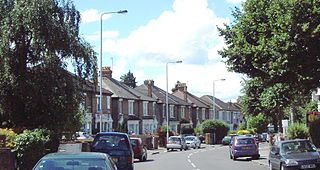
Leyton is a town in east London, England, within the London Borough of Waltham Forest. It borders Walthamstow to the north, Leytonstone to the east, and Stratford to the south, with Clapton, Hackney Wick and Homerton, across the River Lea, to the west. The area includes New Spitalfields Market, Leyton Orient Football Club, as well as part of the Queen Elizabeth Olympic Park. The town consists largely of terraced houses built between 1870 and 1910, interspersed with some modern housing estates. It is 6.2 miles (10 km) north-east of Charing Cross.
The London Borough of Waltham Forest is an outer London borough formed in 1965 from the merger of the municipal boroughs of Leyton, Walthamstow and Chingford.
The M11 is a 55 miles (89 km) motorway that runs north from the North Circular Road (A406) in South Woodford to the A14, northwest of Cambridge, England. Originally proposed as a trunk road as early as 1915, various plans were considered throughout the 1960s, with final construction being undertaken between 1975 and 1980. The motorway was opened in stages, with the first stage between junctions 7 and 8 opening in June 1975, and the completed motorway becoming fully operational in February 1980. Running from Woodford to Girton, the motorway provides direct access to Harlow, Cambridge and since 2002, greatly improved access to London Stansted Airport.
Leytonstone is an area in east London, England, within the London Borough of Waltham Forest. It adjoins Wanstead to the north-east, Forest Gate to the south-east, Stratford to the south-west, Leyton to the west, and Walthamstow to the north-west, and is 7 miles (11 km) north-east of Charing Cross.
The A12 is a major road in Eastern England. It runs north-east/south-west between London and the coastal town of Lowestoft in the north-eastern corner of Suffolk, following a similar route to the Great Eastern Main Line until Ipswich. A section of the road between Lowestoft and Great Yarmouth became part of the A47 in 2017. Between the junctions with the M25 and the A14, the A12 forms part of the unsigned Euroroute E30. Unlike most A roads, this section of the A12, together with the A14 and the A55, has junction numbers as if it were a motorway.
John Robert Cryer is a British politician who has served as Member of Parliament (MP) for Leyton and Wanstead since 2010. A member of the Labour Party, he was previously MP for Hornchurch from 1997 to 2005. Cryer has been Chair of the Parliamentary Labour Party since 2015.
Harry Michael Cohen is a British Labour Party politician, who was the Member of Parliament (MP) for Leyton from 1983 to 1997 and Leyton and Wanstead from 1997 to 2010.
Leyton and Wanstead is a constituency in Greater London created in 1997 and represented in the House of Commons of the UK Parliament since 2010 by John Cryer of the Labour Party.
Cann Hall is a former civil parish in the south of Leytonstone in the London Borough of Waltham Forest. It is north of Stratford and Forest Gate, east of Leyton, and west of Wanstead Flats, the southernmost tip of Epping Forest.
Wanstead Flats is the southernmost portion of Epping Forest, in Leytonstone and Wanstead, London. The flats and by extension the forest ends at Forest Gate directly to the south. It now falls wholly within the boundaries of the London Boroughs of Redbridge and Waltham Forest, though until 1994 two parts of it were in the London Borough of Newham: one of these was the section between Aldersbrook Road and Capel Road east of the junction between Aldersbrook Road and St Margaret's Road, whilst the other was the strip running along Capel Road between its junctions with Centre Road and Ridley Road. As part of Epping Forest, the Flats is managed by the City of London Corporation.
The modern environmental direct action movement in the United Kingdom started in 1991 with the formation of the first UK "Earth First!" group for a protest at Dungeness nuclear power station. Within two years, there were fifty Earth First groups and activists linked with other parties in the road protest movement. There were large camps at Twyford Down and the M11 link road protest. By 1997, the Government had decided to reduce its road-building plans by two thirds.
East Cross Route (ECR) is a dual-carriageway road constructed in east London as part of the uncompleted Ringway 1 as part of the London Ringways plan drawn up the 1960s to create a series of high speed roads circling and radiating out from central London. The road was constructed between 1967 and 1973 and runs from Hackney Wick in north-east London, through the Blackwall Tunnel, to Kidbrooke in south-east London. The ECR was initially designated as part of the A102, but has, subsequently, been partially renumbered so that sections of it are now the A2 and A12.
The London Ringways were a series of four ring roads planned in the 1960s to circle London at various distances from the city centre. They were part of a comprehensive scheme developed by the Greater London Council (GLC) to alleviate traffic congestion on the city's road system by providing high-speed motorway-standard roads within the capital, linking a series of radial roads taking traffic into and out of the city.
The A102 is a road that starts in Clapton, east London, and ends by merging into the A2 road just south of the Sun in the Sands roundabout in Blackheath, south-east London.
The M12 motorway was a planned motorway starting in north-east London and joining the A12 road in Essex. The 1960s scheme would have started at a junction with the M11 motorway and North Circular and ended near Brentwood, Chelmsford, or at the proposed new Maplin Sands airport; the motorway was part of the ambitious London Ringways plan to build motorways throughout London. Although most of the Ringways plan was cancelled in 1969 the M12 motorway project was still included in the Roads for Prosperity white paper published in 1989 along with major proposed developments to the A12 road. It was not formally cancelled until 30 March 1994 by the Secretary of State for Transport, John MacGregor.
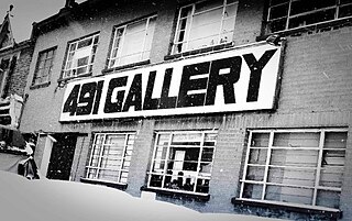
The 491 Gallery was a squatted self-managed social centre and multi-disciplinary gallery in Leytonstone, London, England, that operated from 2001 to 2013. Taking its name from its street number, 491 Grove Green Road, the former factory was home to a community-led art organisation and served as an exhibition space for a diverse range of artists of different origins working in varied media. It contained a range of art and music studios, which were used to host workshops, classes and musical rehearsals. The building was subsequently demolished in 2016.
Grove Green is an interface area of Leyton and Leytonstone in east London. It is situated with the London Borough of Waltham Forest. The population of the ward at the 2011 census was 14,604.
The Green Man is a pub and road junction on High Road, Leytonstone, London. The pub has been rebranded as part of the O'Neill's chain. The current 1920s building replaced an earlier public house, close to the original site; which was built around 1668 and mentioned by Daniel Defoe.
↑ McKay 1996, p.149 "A chestnut tree (later capitalized and given a definite article) suddenly became the focus for protesters and increasing numbers of locals... The protection of the Chestnut Tree came quickly to symbolize what was under threat from the road[.]"
↑ Rowell 1996 "The police were accused of widespread brutality in evicting the protesters. Forty-nine complaints against police were recorded by protesters[.]" Note that Drury & Reicher 2000 gives a figure of fifty-seven.
↑ Shepard, Hayduk and Rofes 2002, p.217. "In place of the usual petitions and marches to save the street, protesters simply moved in—occupying every house on the block (save one house owned and occupied by a feisty 92-year-old woman, who refused the Department of Transport's order to move)."
↑ Shepard, Hayduk and Rofes 2002, p.218. "This coalition, armed with the action model pioneered on Claremont Road, fueled the rebirth of Reclaim the Streets."
↑ BBC 2006. "Figures obtained under the Freedom of Information Act show that the campaign against the M11 extension contributed to a 100% increase in costs."
Shepard, Benjamin; Hayduk, Ronald; Rofes, Eric (2002). From ACT UP to the WTO: Urban Protest and Community Building in the Era of Globalization. Verso. p.218. ISBN1-85984-356-5.
Andy Letcher, The Scouring of the Shire: Fairies, Trolls and Pixies in Eco-Protest Culture (2001)
Aufheben, The Politics of Anti-Road Struggle and the Struggles of Anti-Road Politics: The Case of the No M11 Link Road Campaign. In DIY Culture, ed. George McKay. 100–28. London: Verso, 1998.
Leytonstone pre the M11 (A12) - A set of photographs of the area covered by the link road, before it was built, including houses before occupation by protesters.
This page is based on this Wikipedia article Text is available under the CC BY-SA 4.0 license; additional terms may apply. Images, videos and audio are available under their respective licenses.