Madison, Tennessee

Last updated
Madison, Tennessee
Madison TN USA.JPG
Downtown Madison
USA Tennessee location map.svg
Red pog.svg
Madison
Location within Tennessee
Usa edcp location map.svg
Red pog.svg
Madison
Location within the United States
Coordinates: 36°15′22″N86°42′50″W / 36.25611°N 86.71389°W / 36.25611; -86.71389
Country United States
State Tennessee
County Davidson
Elevation
482 ft (147 m)
Time zone UTC-6 (Central (CST))
  Summer (DST) UTC-5 (CDT)
Zip code
37115, 37116
Area code 615
GNIS feature ID1292483 [1]

Madison (originally Madison Station) is a former settlement, now a suburban neighborhood of northeast Nashville, in the U.S. state of Tennessee. It is incorporated as part of the Metropolitan Government of Nashville and Davidson County.

Contents

The population of Madison's 37115 zip code as of the US Census Bureau 2016 estimates was 40,146. [2]

Location

Madison is only 8.2 miles north at its closest point to downtown Nashville.[ clarification needed ] Ellington Parkway serves as a direct connection from downtown Madison to downtown Nashville with exits to Inglewood and East Nashville. Madison is located close to major highways and parkways: 65, 40, 24, Briley and local access roads St. Route 45 (Old Hickory) and Dickerson Road. It begins at Briley Parkway and extends to the Hendersonville line in Rivergate, from Dickerson Road to the Cumberland River.

Madison is one of 14 Community Plan areas in the Metro Nashville-Davidson County area for which zoning and land use planning is done. The 2015-updated Community Plan for Madison, an 89-page document adopted by the Metropolitan Planning Commission, was updated in 2015 as part of NashvilleNext's long-term planning. [3] [4] [5]

Madison has two major centers: Downtown Madison and Rivergate. The area between the two centers is called Motor Mile. Madison services several surrounding communities: East Nashville, Inglewood, Whites Creek, Joelton, Old Hickory, Hendersonville, Hermitage and more.

Madison is one of about 26 suburban neighborhoods of Nashville. [6]

History

Madison Station post office was opened in 1857, when Madison Station was about eight miles from Nashville proper, roughly half way between Nashville and Goodlettsville. [7] In the 20th century, Madison acted as a connecting suburb until being annexed into Nashville in 1963 due to the consolidation with Davidson County. Madison funnels traffic to Goodlettsville, Hendersonville, Gallatin, Inglewood, and downtown Nashville.

Old Hickory Boulevard (State Route 45) is a section of the Trail of Tears, the route of the forced removal of Cherokee Indians from North Carolina to Oklahoma, directed by U.S. President Andrew Jackson. This route passes directly by Jackson's estate, The Hermitage, in the neighboring community of Old Hickory, Tennessee.

Madison was once home to the "Hillbilly Day" festival. This festival was created as a fundraiser to benefit schools within the area. This fundraising festival included costumes, school events, and a parade. Madison's first "Hillbilly Day" was in 1952. [8]

Madison is also home to Amqui train station that was built by the Louisville and Nashville Railroad and serviced by the company until 1979. After L&N Railroad vacated the station, country music legend Johnny Cash purchased it and moved it from Madison to his home in nearby Sumner County. The station was later returned to Madison after the passing of Cash and his wife June Carter Cash. Today, it houses a museum and visitor center for the town. [9]

Education

The Madison Branch Library Madison Library.jpg
The Madison Branch Library

Public education in Madison falls under the supervision of Metropolitan Nashville Public Schools. Zoned schools in the Madison area send students through the Hunters Lane cluster, named after the area high school, Hunters Lane High School. Prior to the opening of Hunter's Lane, the public high school for the area was Madison High School, which is now Madison Middle Prep. Three private schools are also located within Madison: Goodpasture Christian School, Madison Academy and Saint Joseph School.

Recreation

Three public parks are within Madison: Madison Park is located in the center of State Route 45, Delaware Avenue, and North Dupont Avenue. Peeler Park is located off of Neelys Bend Road at the end of Overton Road. Cedar Hill Park is located at the corner of Old Hickory Boulevard and Dickerson Pike.

Another source of recreation for the Madison community is Rivergate Mall, which is located at the corner of Conference Drive and Gallatin Pike North. This mall houses over 130 different stores, including mainstream department stores.

The Madison Branch Library opened in 1977, and is part of the Nashville Public Library. A new facility, themed after the book The Lion, the Witch and the Wardrobe , opened in 2000. Meeting rooms, group study rooms, and public computers are available. [10]

Transportation

Downtown Madison, Tennessee Downtown Madison, Tennessee.jpg
Downtown Madison, Tennessee

Madison is a unique town in Nashville because of its easy accessibility via several major roads and interstates.

Major roads running through Madison are Old Hickory Boulevard (State Rt. 45) and Gallatin Pike (U.S. Route 31E). Dickerson Road runs along the west border of Madison. Briley Parkway (State Route 155), with easy access to Interstates 24 and 40, runs along the south border of Madison. Interstate 65 has two main exits into Madison, one at Old Hickory Blvd, and the other at Rivergate shopping area. Ellington Parkway connects downtown Nashville to downtown Madison with exits along the way to key areas of East Nashville and Inglewood. Vietnam Vets Parkway is accessible off Conference Drive directly off Gallatin which links Madison and Goodletsville to Hendersonville and Gallatin.

Madison is on the rapid transit Metro bus lines. Madison boasts extensive walkability with several miles of sidewalks. Bike lanes were added in some of the newer asphalt in Madison and plans have been made to build a pedestrian and bike extension from Peeler Park to Stones River Park, which will connect Peeler key greenways leading to downtown Nashville.

Cemeteries

Madison is the location of the Nashville National Cemetery. The Nashville National Cemetery covers around 64 acres and holds nearly 33,000 veterans as well as their spouses, and dependents. According to the National Park Service, the entrance to the cemetery is marked by a monumental arch which is, "one of five in the national cemetery system." [11] It and Spring Hill Cemetery, across Gallatin Pike, delineated the generally accepted boundary between Madison and Inglewood prior to the construction of nearby Briley Parkway.

Population

Sign located near the downtown Madison area Madsion, Tennessee Sign.jpg
Sign located near the downtown Madison area

The population in Madison, as of 2020, was 41,723. The total number of households was 17,024. Average household income was $59,429. [12]

However, because Madison features two major centers, Downtown Madison and Rivergate, the demographic study includes several surrounding communities in addition to the population information for Madison only. [13]

Notable people

Notable residents that were born or reside in Madison, Tennessee include :

Related Research Articles

<span class="mw-page-title-main">Nashville, Tennessee</span> Capital city of Tennessee, United States

Nashville is the capital and most populous city of the U.S. state of Tennessee, as well as the seat of Davidson County. With a population of 689,447 at the 2020 U.S. census, Nashville is the 21st most-populous city in the United States, and the fourth most populous city in the southeastern U.S. Located on the Cumberland River, the city is the center of the Nashville metropolitan area, and is one of the fastest growing in the nation.

<span class="mw-page-title-main">Gallatin, Tennessee</span> County seat of Sumner County, Tennessee, United States

Gallatin is a city in and the county seat of Sumner County, Tennessee, United States. The population was 30,278 at the 2010 census and 44,431 at the 2020 census. Named for United States Secretary of the Treasury Albert Gallatin, the city was established on the Cumberland River and made the county seat of Sumner County in 1802. It is located about 30.6 miles northeast of the state capital of Nashville, Tennessee.
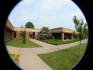
<span class="mw-page-title-main">Nashville State Community College</span> College in Nashville, Tennessee, U.S.

Nashville State Community College is a public community college in Nashville, Tennessee. It is operated by the Tennessee Board of Regents and shares a 109-acre (0.44 km2) campus with the Tennessee College of Applied Technology at Nashville. The Nashville State facilities include 239,000 square feet (22,200 m2) of space for classrooms, labs, offices, student services, and a library. Nashville State offers a wide array of programs and degrees including associate degree and technical certificate studies, university parallel transfer programs to four-year institutions, continuing education, adult education, two Early College High School programs, Dual Enrollment courses, and community service programs.

Antioch is a neighborhood of Nashville located approximately 12 miles southeast of Downtown Nashville. It is served by the Metropolitan Government of Nashville and Davidson County.

<span class="mw-page-title-main">Beverly Briley</span> American mayor

Clifton Beverly Briley was an American attorney and politician, the first mayor of the newly consolidated metropolitan government of Nashville and Davidson County in Tennessee. Elected to the mayor's position in 1962 as a Democrat, Briley served three terms from 1963 to 1975; he was prevented by term limits from running again. He had previously served as county judge of Davidson County for several terms, from 1950 to 1963.
<span class="mw-page-title-main">Tennessee State Route 155</span> Highway in Tennessee

State Route 155, mostly designated as Briley Parkway, is a major freeway and parkway beltway around Nashville, Tennessee. It is 35.1 miles (56.5 km) long.

<span class="mw-page-title-main">U.S. Route 31E</span> Highway in the United States

U.S. Route 31E (US 31E) is the eastern parallel route for U.S. Highway 31 from Nashville, Tennessee, to Louisville, Kentucky.

<span class="mw-page-title-main">Nashville metropolitan area</span> Metropolitan area in Tennessee, United States

The Nashville metropolitan area is a metropolitan statistical area. Its largest principal city is Nashville, Tennessee, the capital and largest city in Tennessee, in the United States. With a population of just over 2 million, it is the most populous metropolitan area in Tennessee. It is also the largest metropolitan area in Tennessee, in terms of land area.
<span class="mw-page-title-main">Nashville Metropolitan Transit Authority</span> Public transportation in Nashville, Tennessee

The Nashville Metropolitan Transit Authority, which does business as WeGo Public Transit, is a public transportation agency based in Nashville, Tennessee. Consisting of city buses and paratransit, the system serves Nashville and Davidson County. Most bus routes serve the downtown transit station, Music City Central. This makes the MTA the largest transit agency where most of the bus routes terminate in a central business district with no crosstown service. In 2022, the system had a ridership of 7,344,400, or about 26,700 per weekday as of the second quarter of 2023. For 2023, the Nashville MTA expected to collect $5.2 million in fare revenue and to spend $99.3 million in operation. To make up most of the difference, MTA expected to collect subsidies from the city, state, and national governments.

<span class="mw-page-title-main">Rivergate Mall</span> Shopping mall in Tennessee, United States

Rivergate Mall is a super-regional shopping mall located in Goodlettsville, United States, just outside of Nashville, the state capital of Tennessee. Opened in October 1971, the mall features 1,129,035 square feet (104,890.8 m2) of gross leasable area, with approximately 80 stores and restaurants, as well as a food court. Rivergate Mall has two anchor stores: Dillard's and JCPenney. There are two vacant anchor stores that were formerly Macy's and Sears. Its original anchor stores were Cain-Sloan, Castner Knott, and JCPenney. The mall sits in the core of a shopping district that is shared by the city of Goodlettsville and the Nashville neighborhood of Madison. This area is colloquially referred to by locals as "Rivergate," after the mall. Rivergate Mall is managed by Hendon Properties.
<span class="mw-page-title-main">Interstate 65 in Tennessee</span> Interstate Highway in Tennessee, United States

Interstate 65 (I-65) is part of the Interstate Highway System that runs 887.30 miles (1,427.97 km) north–south from Mobile, Alabama, to Gary, Indiana. In Tennessee, I-65 traverses the middle portion of the state, running from Ardmore at the Alabama border to the Kentucky border near Portland. The route serves the state capital and largest city of Nashville, along with many of its suburbs. Outside of urban areas, the Interstate bypasses most cities and towns that it serves, instead providing access via state and U.S. Highways. The Interstate passes through the Highland Rim and Nashville Basin physiographic regions of Tennessee, and is often used as the dividing line between the eastern and western portions of the former.

Old Hickory Boulevard is a historic road that encircles Nashville, Tennessee, lying entirely within Davidson County. Originally the road, aided by ferries, formed a nearly unbroken loop around the city. Today, it is interrupted by a lake and several rerouted sections, which consist of roughly 69 miles (111 km). Just over half the distance–36.2 miles (58.3 km)–is part of several Tennessee state highways, including SR 45, SR 171, SR 251, and SR 254. Unsigned concurrencies exist very briefly along US 31E, US 41/US 70S, and SR 100.

<span class="mw-page-title-main">Tennessee State Route 45</span> State highway in Tennessee, United States

State Route 45 is a west–east route in Davidson County, Tennessee. It connects US 431 in Whites Creek with I-40 in Hermitage.

<span class="mw-page-title-main">Bledsoe Creek State Park</span> State-protected area of Tennessee, United States

Bledsoe Creek State Park is a state park in Sumner County, Tennessee, in the southeastern United States. The park consists of 169 acres (0.68 km2) managed by the Tennessee Department of Environment and Conservation. The park spans much of the west shore of the Bledsoe Creek embayment of Old Hickory Lake, an impoundment of the Cumberland River created with the completion of Old Hickory Dam by the U.S. Army Corps of Engineers in 1954.

<span class="mw-page-title-main">U.S. Route 70 in Tennessee</span>

U.S. Route 70 enters the state of Tennessee from Arkansas via the Memphis & Arkansas Bridge in Memphis, and runs west to east across 21 counties in all three Grand Divisions of Tennessee, with a total length of 478.48 miles (770.04 km), to end at the North Carolina state line in eastern Cocke County. Along the route, US 70 is accompanied with various U.S. and state highways, including those in three of the state's four major cities.

<span class="mw-page-title-main">U.S. Route 431 in Tennessee</span>

U.S. Route 431 in Tennessee totals an estimated 116 miles (187 km) through Lincoln, Marshall, Maury, Williamson, Davidson, and Robertson counties in Middle Tennessee.

<span class="mw-page-title-main">Tennessee State Route 386</span> Highway in Tennessee

State Route 386 (SR 386) is a major east–west state route, signed north-south, located in Davidson and Sumner counties in Tennessee. It is known as Vietnam Veterans Boulevard and serves as a bypass for U.S. Highway 31E and a connector to Hendersonville and Gallatin from Nashville. A majority of the route is a four-lane controlled-access highway.
<span class="mw-page-title-main">East Nashville, Tennessee</span>

East Nashville is an area east of downtown Nashville in Tennessee across the Cumberland River. The area is mostly residential and mixed-use areas with businesses lining the main boulevards. The main thoroughfares are Gallatin Ave and Ellington Parkway, with smaller arteries interconnecting the neighborhoods. Some of these smaller arteries include Main Street, Shelby Avenue, Porter Road, Riverside Drive, Eastland Avenue, McFerrrin Avenue, and Woodland Street in no significant order. Ellington Parkway, which parallels Gallatin Ave and Main Street, bypasses I-24 and I-65 and connects Briley Parkway and downtown Nashville and many other secondary streets along the way. The Cumberland River confines most of the area with a semicircle design on the south, southwest and east. Since East Nashville has no defined boundaries on the west and north the exact perimeter is the cause of some debate. Some would say that Ellington Parkway creates a boundary on the west and northwest, while Cahal Avenue and Porter Road create the northern boundary, in the confines of zipcode 37206. Many would also state that with I-65 and I-24 as the western border and Briley Parkway as the northern boundary, this defines an area that constitutes Greater East Nashville. East Nashville is one of about 26 suburban neighborhoods in Nashville.
<span class="mw-page-title-main">U.S. Route 31 in Tennessee</span>

U.S. Route 31 (US 31) is a part of the United States Numbered Highway System that runs from Spanish Fort, Alabama, to Mackinaw City, Michigan. In the U.S. state of Tennessee, it runs concurrently with Interstate 65 (I-65) for the first mile northward from the Tennessee state line. There US 31 parallels I-65 to downtown Nashville. At Pulaski US 31 meets the southern terminus of US 31A in Tennessee. US 31 continues due north through Lynnville, Columbia, Spring Hill, Franklin and Brentwood to Nashville. The route splits into US 31E and US 31W in Nashville and go into Kentucky.

Let's Move Nashville was a local referendum in Nashville, Tennessee, on May 1, 2018, that would have funded the construction of a mass transit system under the Nashville Metropolitan Transit Authority in Davidson County. The $8.9 billion plan would have included several light rail and bus rapid transit lines along major corridors, to be built between 2018 and 2032. The plan was proposed in 2017 by Mayor Megan Barry under the Tennessee IMPROVE Act and supported by some Nashville politicians and businesses.

References

  1. "Madison". Geographic Names Information System . United States Geological Survey, United States Department of the Interior.
  2. "U.S. Census website". United States Census Bureau . Retrieved 2018-01-14.
  3. "Nashville > Planning Department > Community Planning & Design > Community Plans".
  4. "Nashville > Planning Department > Community Planning & Design > Community Plans > Madison".
  5. Madison Plan
  6. "Nashville Suburbs".
  7. Map of Davidson County Tennessee, from actual surveys made by order of the county court of Davidson County, 1871 New York: G.W. & C.B. Colton & Col., 1871.
  8. "Amqui Station & Visitor Center". Amqui Station & Visitor Center. Retrieved 2016-10-10.
  9. "Amqui Station & Visitor Center". Amqui Station & Visitor Center. Retrieved 2016-10-10.
  10. "Madison Branch | Nashville Public Library". library.nashville.org. Retrieved 2016-11-14.
  11. "Nashville National Cemetery--Civil War Era National Cemeteries: A Discover Our Shared Heritage Travel Itinerary". www.nps.gov. Retrieved 2016-09-18.
  12. "Madison, TN Household Income, Population & Demographics | Point2". www.point2homes.com. Retrieved 2022-04-28.
  13. "QuickFacts Madison County, Tennessee". United States Census Bureau. Retrieved 21 March 2017.
  14. "William Selby Harney (1800-1889)". www.oregonencyclopedia.org. Retrieved 2022-04-28.
  15. "Willett v. State". Justia Law. Retrieved 2023-07-05.
  16. "Tom Willett". IMDb. Retrieved 2022-04-28.
  17. "JIM REEVES' HOME FOR SALE". www.jim-reeves.com. Retrieved 2023-03-28.