Madison Heights, Virginia

Last updated
Madison Heights
U.S. Route 29 in Madison Heights.jpg
Looking towards U.S. 29 in Madison Heights
VAMap-doton-MadisonHeights.PNG
Location of Madison Heights, Virginia
Coordinates: 37°26′22″N79°7′2″W / 37.43944°N 79.11722°W / 37.43944; -79.11722
CountryUnited States
State Virginia
County Amherst
Area
  Total19.5 sq mi (50.6 km2)
  Land19.2 sq mi (49.7 km2)
  Water0.3 sq mi (0.8 km2)
Elevation
755 ft (230 m)
Population
 (2010)
  Total11,285
  Density580/sq mi (220/km2)
Time zone UTC−5 (Eastern (EST))
  Summer (DST) UTC−4 (EDT)
ZIP code
24572
Area code 434
FIPS code 51-48520 [1]
GNIS feature ID1495886 [2]

Madison Heights is a census-designated place (CDP) in Amherst County, Virginia, United States. The population was 10,893 at the 2020 census. [3] It is part of the Lynchburg Metropolitan Statistical Area.

Contents

History

Fort Riverview (44AH91 and 44AH195), Galt's Mill Complex, Oak Lawn, and Hanshill are listed on the National Register of Historic Places. [4]

Mt. Sinai Baptist Church is a historically Black church in Madison Heights. In 1974, the pastor was Rev. Roger Ford. [5]

Geography

Madison Heights is located at 37°26′22″N79°7′2″W / 37.43944°N 79.11722°W / 37.43944; -79.11722 (37.439406, 79.117259). [6]

According to the United States Census Bureau, the CDP has a total area of 19.5 square miles (50.6 km2), of which 19.2 square miles (49.7 km2) is land and 0.31 square miles (0.8 km2), or 1.67%, is water. [7]

Demographics

As of the census [1] of 2000, there were 11,584 people, 4,451 households, and 3,182 families residing in the CDP. The population density was 600.7 people per square mile (232.0/km2). There were 4,656 housing units at an average density of 241.5/sq mi (93.2/km2). The racial makeup of the CDP was 77.80% White, 19.57% African American, 0.66% Native American, 0.45% Asian, 0.58% from other races, and 0.94% from two or more races. Hispanic or Latino of any race were 0.89% of the population.

There were 4,451 households, out of which 30.1% had children under the age of 18 living with them, 53.2% were married couples living together, 14.1% had a female householder with no husband present, and 28.5% were non-families. 24.3% of all households were made up of individuals, and 10.0% had someone living alone who was 65 years of age or older. The average household size was 2.45 and the average family size was 2.88.

In the CDP, the population was spread out, with 21.9% under the age of 18, 7.6% from 18 to 24, 29.1% from 25 to 44, 26.1% from 45 to 64, and 15.2% who were 65 years of age or older. The median age was 40 years. For every 100 females, there were 91.9 males. For every 100 females age 18 and over, there were 90.2 males.

The median income for a household in the CDP was $32,359, and the median income for a family was $39,415. Males had a median income of $30,340 versus $22,009 for females. The per capita income for the CDP was $15,589. About 7.2% of families and 9.2% of the population were below the poverty line, including 10.6% of those under age 18 and 9.5% of those age 65 or over.

Education

Madison Heights is served by Amherst County Public Schools, with Monelison Middle School, Amelon Elementary School, and Madison Heights Elementary School located in Madison Heights. Temple Christian School is a private school located on the grounds of Temple Baptist Church.

Central Virginia Training Center

The Central Virginia Training Center is a state education facility in Madison Heights. Previously it was known as the Virginia State Colony for Epileptics and Feebleminded where forced sterilizations were conducted, 8,300 from 1924 to 1972 on those determined to be "unfit". [8]

Carrie Buck, the plaintiff in the United States Supreme Court case Buck v. Bell , was sterilized after being classified as "feeble-minded", as part of the state's eugenics program while she was a patient at the Colony. [9] The story of Carrie Buck's sterilization and the court case was made into a television drama in 1994, Against Her Will: The Carrie Buck Story . "Virginia State Epileptic Colony," a song by the Manic Street Preachers on their 2009 album Journal for Plague Lovers , addresses the state's program of eugenics.

Notable people

Related Research Articles

<span class="mw-page-title-main">Moores Mill, Alabama</span> Census-designated place in Alabama, United States

Moores Mill is an unincorporated community and census-designated place (CDP) in Madison County, Alabama, United States, and is included in the Huntsville-Decatur Combined Statistical Area. The population was 6,729 at the 2020 census, up from 5,682 at the 2010 census.

<span class="mw-page-title-main">Holden Heights, Florida</span> Census-designated place in Florida, United States

Holden Heights is a census-designated place and unincorporated area in Orange County, Florida, United States. The population was 3,679 at the 2010 census. The ZIP code serving the CDP is 32839. It is part of the Orlando–Kissimmee Metropolitan Statistical Area.

Rosewood Heights is an unincorporated community and census-designated place (CDP) in Madison County, Illinois, United States. The population was 3,971 at the 2020 census. It is part of the Metro East region of the Greater St. Louis metropolitan area.

<span class="mw-page-title-main">Benton Heights, Michigan</span> Census-designated place & unincorporated community in Michigan, United States

Benton Heights is an unincorporated community in Berrien County in the U.S. state of Michigan. It is also a census-designated place (CDP) for statistical purposes without any legal status as an incorporated municipality. Per the 2020 Census, the population was 3,652. The community is a part of Benton Charter Township and is adjacent to the city of Benton Harbor.

<span class="mw-page-title-main">Summerside, Ohio</span> Census-designated place in Ohio, United States

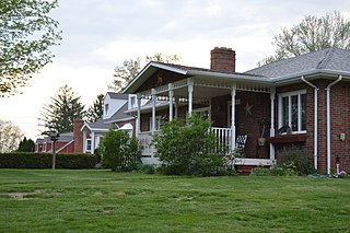
Summerside is a census-designated place (CDP) in Union Township, Clermont County, Ohio, United States. Its population was 4,941 as of the 2020 census.

<span class="mw-page-title-main">Lenape Heights, Pennsylvania</span> Census-designated place in Pennsylvania, United States

Lenape Heights is a census-designated place (CDP) in Armstrong County, Pennsylvania, United States. The population was 1,144 at the 2020 census.

Cornwells Heights-Eddington was a census-designated place (CDP) in Bucks County, Pennsylvania, United States. The population was 3,406 at the 2000 census. For the 2010 census, the area was split into two CDPs, Cornwells Heights and Eddington, that are adjacent unincorporated communities within Bensalem Township. Cornwells Heights is located a bit southwest of Eddington. Both communities use the Bensalem ZIP code, 19020.

<span class="mw-page-title-main">Meadowood, Pennsylvania</span> Census-designated place in Pennsylvania, United States

Meadowood is a census-designated place (CDP) in Butler County, Pennsylvania, United States. The population was 2,693 at the 2010 census.

<span class="mw-page-title-main">Shanor-Northvue, Pennsylvania</span> Census-designated place in Pennsylvania, United States

Shanor-Northvue is a census-designated place (CDP) in Butler County, Pennsylvania, United States. The population was 5,051 at the 2010 census.

Hasson Heights is a census-designated place (CDP) in Venango County, Pennsylvania, United States. The population was 1,351 at the 2010 census.

Woodland Heights is a census-designated place (CDP) in Venango County, Pennsylvania, United States. The population was 1,402 at the 2000 census.

Lawson Heights is a census-designated place (CDP) in Unity Township, Westmoreland County, Pennsylvania, United States. The population was 2,339 at the 2000 census.

<span class="mw-page-title-main">Buna, Texas</span> Census-designated place in Texas, United States

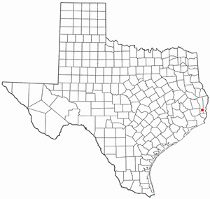
Buna is an unincorporated community and census-designated place (CDP) in Jasper County, Texas, United States. The population was 2,137 at the 2020 census.

<span class="mw-page-title-main">Jolivue, Virginia</span> Census-designated place in Virginia, United States

Jolivue is a census-designated place (CDP) in Augusta County, Virginia, United States. The population was 1,129 at the 2010 census. It is part of the Staunton–Waynesboro Micropolitan Statistical Area.

<span class="mw-page-title-main">Verona, Virginia</span> CDP in Virginia, United States

Verona is a census-designated place (CDP) in Augusta County, Virginia, United States. The population was 4,239 at the 2010 census. It is part of the Staunton–Waynesboro Micropolitan Statistical Area.

<span class="mw-page-title-main">Stanardsville, Virginia</span> Town in Virginia, United States

Stanardsville is a town in Greene County, Virginia, United States. The population was 349 at the 2020 census, down from 367 at the 2010 census. It is the county seat of Greene County. The name is from Robert Stanard, a benefactor who donated land for public use. It is part of the Charlottesville Metropolitan Statistical Area.

Villa Heights is a census-designated place (CDP) in Henry County, Virginia, United States. The population was 717 at the 2010 census. It is part of the Martinsville Micropolitan Statistical Area.

<span class="mw-page-title-main">Longview Heights, Washington</span> CDP in Washington, United States

Longview Heights is a census-designated place (CDP) in Cowlitz County, Washington, United States. The population was 3,851 at the 2010 Census. The CDP is known locally as Columbia Heights.

<span class="mw-page-title-main">Switzer, West Virginia</span> Census-designated place in West Virginia, United States

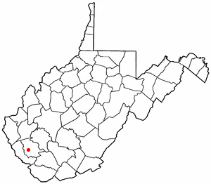
Switzer is an unincorporated community and census-designated place (CDP) in Logan County, West Virginia, United States. The CDP includes the neighboring unincorporated community of Micco. The total CDP population was 595 at the 2010 census.

<span class="mw-page-title-main">Woodstock (CDP), New York</span> CDP in New York, United States

Woodstock is a hamlet in Ulster County, New York, United States. The population was 2,088 according to the 2010 census. The community of Woodstock is in the eastern part of the Town of Woodstock and is northwest of Kingston. It is located along NY 212 near its junction with NY 375. Although the name of the community and the town lent its name to the Woodstock Festival, that event did not take place in Woodstock.

References

  1. 1 2 "U.S. Census website". United States Census Bureau . Retrieved 2008-01-31.
  2. "US Board on Geographic Names". United States Geological Survey. 2007-10-25. Retrieved 2008-01-31.
  3. "Profile of General Population and Housing Characteristics: 2010 Demographic Profile Data (DP-1): Madison Heights CDP, Virginia". United States Census Bureau . Retrieved February 14, 2012.
  4. "National Register Information System". National Register of Historic Places . National Park Service. July 9, 2010.
  5. Ford, Frances (December 5, 1974). "Esmont News". Charlottesville-Albemarle Tribune.
  6. "US Gazetteer files: 2010, 2000, and 1990". United States Census Bureau. 2011-02-12. Retrieved 2011-04-23.
  7. "Geographic Identifiers: 2010 Demographic Profile Data (G001): Madison Heights CDP, Virginia". United States Census Bureau . Retrieved February 14, 2012.
  8. "A Simple Act of Mothering", Poor Magazine/PNN Archived August 22, 2009, at the Wayback Machine
  9. 274 U.S. 200, at 207, Justia.com U.S. Supreme Court Center.