
Market Hill (aka the Market Square) is the location of the marketplace in central Cambridge, England. [1] [2] Operating as a marketplace since Saxon times, a daily outdoor market with stalls continues to run there. [3] [4] [5]
Market Hill (aka the Market Square) is the location of the marketplace in central Cambridge, England. [1] [2] Operating as a marketplace since Saxon times, a daily outdoor market with stalls continues to run there. [3] [4] [5]
The market square commands a central location in Cambridge. It is connected via the following streets (clockwise from the north):
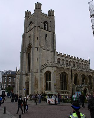
On the west side of Market Hill is Great St Mary's, the Cambridge University Church, with its tower on King's Parade. On the south side of the Market Square is the Cambridge Guildhall, built in the 1930s. To the southeast are the Grand Arcade and Lion Yard, two shopping centres.
The current Market Square was mainly filled with buildings originally and was not cleared until 1849 when a major fire occurred. [6]

The Market Place branch of Hobson's Conduit was completed in 1614. This branch brought fresh water to the Market fountain in the centre of the Market Place. Following the fire in 1849, the Market Square was redeveloped and in 1855 a Gothic Revival gabled fountain was erected and the original structure of Hobson's Conduit was moved to the corner of Lensfield Road and Trumpington Road in south Cambridge in 1856. [8] Most of the fountain was demolished in 1953. Flow to this branch was cut off in 1960 during construction of the Lion Yard shopping centre development and has never been restored. [9]
During the 1381 Peasants' Revolt, a mob led by the Mayor of Cambridge destroyed the university's ledgers in Market Square on 16 June. One Margery Starre led the crowd in a dance to the rallying cry "Away with the learning of clerks, away with it!". [10]

Thomas Hobson was an English carrier, best known as the origin of the expression Hobson's choice.
The Old Market Square is an open, pedestrianised city square in Nottingham, England, forming the heart of the city, and covering an area of approximately 12,000 square metres (130,000 sq ft), or about 3 acres (1.2 ha). It is one of the largest paved squares in the United Kingdom.
Swansea city centre in Swansea, Wales, contains the main shopping, leisure and nightlife district in Swansea. The city centre covers much of the Castle ward including the area around Oxford Street, Castle Square, and the Quadrant Shopping Centre; Alexandra Road, High Street, Wind Street and the Castle; Parc Tawe; and the Maritime Quarter extending down to the seafront.

Hobson's Conduit, also called Hobson's Brook, is a watercourse that was built from 1610 to 1614 by Thomas Hobson and others to bring fresh water into the city of Cambridge, England from springs at Nine Wells, a Local Nature Reserve, near the village of Great Shelford. It is now a Scheduled Ancient Monument and historical relic. The watercourse currently runs overground until Cambridge University Botanic Garden and Brookside, where it is at its widest. At the corner of Lensfield Road stands a hexagonal monument to Hobson, which once formed part of the market square fountain, and was moved to this location in 1856, after a fire in the Market. The flow of water runs under Lensfield Road, and subsequently runs along both sides of Trumpington Street in broad gutters towards Peterhouse and St Catharine's College, and also St Andrew's Street. The conduit currently ends at Silver Street.

High Street in Lincoln, England extends from the St Catherine's roundabout and ends approximately 1.2 miles further north at The Strait. The historic High Street has evolved through many changes over its 2000 year history, encompassing Roman roads and settlement, medieval buildings, markets, places of worship, civic buildings, bridges, the arrival of the railways and heavy industry.
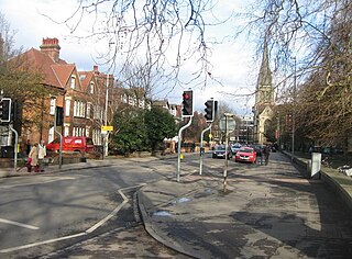
Trumpington Street is a major historic street in central Cambridge, England. At the north end it continues as King's Parade where King's College is located. To the south it continues as Trumpington Road, an arterial route out of Cambridge, at the junction with Lensfield Road.

Trumpington Road is an arterial road in southeast central Cambridge, England. It runs between the junction of Trumpington Street and Lensfield Road at the northern end to the junction of the High Street in the village of Trumpington and Long Road at the southern end. The Fen Causeway leads off to the west near the northern end, over Coe Fen and the River Cam.

Sidney Street is a major street in central Cambridge, England. It runs between Bridge Street at the junction with Jesus Lane to the northwest and St Andrew's Street at the junction with Hobson Street to the southeast.
St Mary's Street is a historic street in the centre of the University area in Cambridge, England. The street links with the junction of King's Parade and Trinity Street to the west, along which many of the University's oldest colleges are to be found. To the east is Market Hill, the location of the city's Market Square. The street continues as Market Street.

Wheeler Street is a street in central Cambridge, England. It runs between Bene't Street to the southwest and Guildhall Street and Corn Exchange Street to the northeast. To the east, Guildhall Place, a cul-de-sac, runs southeast from the junction with Guildhall Street, parallel with Corn Exchange Street at its northwestern end, as an extension of Guildhall Street.

St Andrew's Street is a major street in central Cambridge, England. It runs between Sidney Street, at the junction with Hobson Street, to the northwest and Regent Street to the southeast. Downing Street leads off to the west.

Regent Street is an arterial street in southeast central Cambridge, England. It runs between St Andrew's Street, at the junction with Park Terrace, to the northwest and Hills Road at the junction with the A603 to the southeast. Regent Terrace runs in parallel immediately to the northeast. Beyond that is Parker's Piece, a large grassed area with footpaths.
Peas Hill is a street in central Cambridge, England. It runs between Wheeler Street to the south and Market Hill to the north. King's Parade runs parallel with the street to the west. Guildhall Street runs parallel to the east.

Market Street is a shopping street in central Cambridge, England. It runs between Market Hill, location of the city's central Market Square to the west and Sidney Street to the east. On the other side of the market square, the street continues west as St Mary's Street, north of Great St Mary's, the University church. On the other side of Sidney Street is Hobson's Passage leading east to Hobson Street. To the north is Market Passage and to the south is Petty Cury, a pedestrianised shopping street.

Petty Cury is a pedestrianised shopping street in central Cambridge, England. It connects Market Hill, the location of Cambridge's central outdoor market, and Guildhall Street to the west with the shopping streets of Sidney Street and St Andrew's Street to the east. Hobson Street leads off north on the opposite side of the street at the eastern end, on the corner of Christ's College, one of the historic University of Cambridge colleges.

Guildhall Street is a street in central Cambridge, England. To the north is the southeast corner of Market Hill at the junction with the pedestrianised shopping street Petty Cury. To the south it continues as Guildhall Place, a cul-de-sac, at the junction with Wheeler Street, close to the northern end of Corn Exchange Street.
Lensfield Road is a road in southeast central Cambridge, England. It runs between the junction of Trumpington Street and Trumpington Road to the west and the junction of Regent Street and Hills Road to the west. It continues as Gonville Place to the northeast past Parker's Piece, a large grassed area with footpaths.

Norwich Market is an outdoor market consisting of around 200 stalls in central Norwich, England. Founded in the latter part of the 11th century to supply Norman merchants and settlers moving to the area following the Norman conquest of England, it replaced an earlier market a short distance away. It has been in operation on the present site for over 900 years.

Market Place is an open air urban space in Warwick, Warwickshire, England. It has for many centuries been the centre of the town taking on a number of functions during its history.

Parliament Street is a major shopping street in the city centre of York, in England. It was the site of the city's main street market from 1836 to 1955, and was largely pedestrianised in the 1980s.