Martinsville, Ohio

Last updated

Martinsville, Ohio
Martinsville-Main-St-oh.jpg
Main Street (SR 28)
OHMap-doton-Martinsville.png
Location of Martinsville, Ohio
Map of Clinton County Ohio Highlighting Martinsville Village.png
Location of Martinsville in Clinton County
Coordinates: 39°19′22″N83°48′42″W / 39.32278°N 83.81167°W / 39.32278; -83.81167
Country United States
State Ohio
County Clinton
Government
  MayorJedidiah Mountjoy[ citation needed ]
Area
[1]
  Total0.37 sq mi (0.96 km2)
  Land0.37 sq mi (0.96 km2)
  Water0.00 sq mi (0.00 km2)
Elevation
[2]
1,093 ft (333 m)
Population
 (2020)
  Total416
  Density1,127.37/sq mi (435.62/km2)
Time zone UTC-5 (Eastern (EST))
  Summer (DST) UTC-4 (EDT)
ZIP code
45146
Area code(s) 937, 326
FIPS code 39-48118 [3]
GNIS feature ID2399267 [2]

Martinsville is a village in Clinton County, Ohio, United States. The population was 416 at the 2020 census.

Contents

History

Martinsville was platted in 1816. [4] By 1833, Martinsville had 75 inhabitants. [5]

In 2013, prosecutors charged a former Martinsville council president and a village administrator with stealing more than $100,000 from the village. [6]

Geography

Martinsville lies along State Route 28 west of New Vienna and east of Midland. SR 28 intersects SR 134 just east of Martinsville, connecting the area to Wilmington a few miles to the north.

According to the United States Census Bureau, the village has a total area of 0.44 square miles (1.14 km2), all land. [7]

Demographics

Historical population
CensusPop.Note
1860 293
1870 264−9.9%
1880 35534.5%
1890 336−5.4%
1900 3380.6%
1910 334−1.2%
1920 39718.9%
1930 369−7.1%
1940 40910.8%
1950 399−2.4%
1960 48822.3%
1970 5002.5%
1980 5397.8%
1990 476−11.7%
2000 440−7.6%
2010 4635.2%
2020 416−10.2%
U.S. Decennial Census [8]

2010 census

As of the census [9] of 2010, there were 463 people, 149 households, and 118 families living in the village. The population density was 1,052.3 inhabitants per square mile (406.3/km2). There were 166 housing units at an average density of 377.3 per square mile (145.7/km2). The racial makeup of the village was 96.1% White, 1.3% African American, 0.2% Asian, and 2.4% from other races. Hispanic or Latino of any race were 2.8% of the population.

There were 149 households, of which 44.3% had children under the age of 18 living with them, 52.3% were married couples living together, 16.8% had a female householder with no husband present, 10.1% had a male householder with no wife present, and 20.8% were non-families. 15.4% of all households were made up of individuals, and 6.7% had someone living alone who was 65 years of age or older. The average household size was 3.11 and the average family size was 3.34.

The median age in the village was 32.8 years. 32.4% of residents were under the age of 18; 8.5% were between the ages of 18 and 24; 24.8% were from 25 to 44; 22.3% were from 45 to 64; and 12.1% were 65 years of age or older. The gender makeup of the village was 49.7% male and 50.3% female.

2000 census

As of the census [3] of 2000, there were 440 people, 160 households, and 127 families living in the village. The population density was 996.4 inhabitants per square mile (384.7/km2). There were 169 housing units at an average density of 382.7 per square mile (147.8/km2). The racial makeup of the village was 96.36% White, 0.91% African American, 0.45% Native American, 0.23% Asian, 0.45% from other races, and 1.59% from two or more races. Hispanic or Latino of any race were 0.23% of the population.

There were 160 households, out of which 33.8% had children under the age of 18 living with them, 59.4% were married couples living together, 11.9% had a female householder with no husband present, and 20.6% were non-families. 17.5% of all households were made up of individuals, and 9.4% had someone living alone who was 65 years of age or older. The average household size was 2.75 and the average family size was 3.06.

In the village, the population was spread out, with 27.5% under the age of 18, 10.0% from 18 to 24, 28.9% from 25 to 44, 24.3% from 45 to 64, and 9.3% who were 65 years of age or older. The median age was 35 years. For every 100 females there were 97.3 males. For every 100 females age 18 and over, there were 96.9 males.

The median income for a household in the village was $36,000, and the median income for a family was $38,750. Males had a median income of $26,406 versus $20,000 for females. The per capita income for the village was $13,288. About 9.4% of families and 8.5% of the population were below the poverty line, including 7.6% of those under age 18 and 21.3% of those age 65 or over.

Related Research Articles

<span class="mw-page-title-main">Aberdeen, Ohio</span> Village in Ohio, United States

Aberdeen is a village in Huntington Township, Brown County, Ohio, United States, along the Ohio River 50 miles (80 km) southeast of Cincinnati. The population was 1,515 at the 2020 census.

<span class="mw-page-title-main">Warsaw, Ohio</span> Village in Ohio, United States

Warsaw is a village in Coshocton County, Ohio, United States, along the Walhonding River. The population was 624 at the 2020 census.

<span class="mw-page-title-main">Gordon, Ohio</span> Village in Ohio, United States

Gordon is a village in Darke County, Ohio, United States. The population was 245 at the 2020 census.

<span class="mw-page-title-main">Brice, Ohio</span> Village in Ohio, United States

Brice is a village in Franklin County, Ohio, United States, on the southeast side of the Columbus metropolitan area. The population was 93 at the 2020 census.

<span class="mw-page-title-main">Lyons, Ohio</span> Village in Ohio, United States

Lyons is a village in Fulton County, Ohio, United States. The population was 602 at the 2020 census.

<span class="mw-page-title-main">Metamora, Ohio</span> Village in Ohio, United States

Metamora is a village in Fulton County, Ohio, United States. The population was 566 at the 2020 census.

<span class="mw-page-title-main">Addyston, Ohio</span> Village in Ohio, United States

Addyston is a village in Miami Township, Hamilton County, Ohio, United States. Located along the Ohio River, it is a western suburb of the neighboring city of Cincinnati. The population was 927 at the 2020 census.

<span class="mw-page-title-main">Cleves, Ohio</span> City in Ohio, United States

Cleves is a village in Miami Township, Hamilton County, Ohio, United States. Located along the Ohio River, it is a western suburb of Cincinnati. The population was 3,414 at the 2020 census.

<span class="mw-page-title-main">Evendale, Ohio</span> Village in Ohio, United States

Evendale is a village in Hamilton County, Ohio, United States, within the Cincinnati metropolitan area. The population was 2,669 at the 2020 census.

<span class="mw-page-title-main">North Bend, Ohio</span> Village in Ohio, United States

North Bend is a village in Miami Township, Hamilton County, Ohio, United States, along the Ohio River. It is a part of the Greater Cincinnati area. The population was 835 at the 2020 census.

<span class="mw-page-title-main">Mowrystown, Ohio</span> Village in Ohio, United States

Mowrystown is a village in Highland County, Ohio, United States. The population was 385 at the 2020 census.

<span class="mw-page-title-main">Montezuma, Ohio</span> Village in Ohio, United States

Montezuma is a village in Mercer County, Ohio, United States. The population was 152 at the 2020 census.

<span class="mw-page-title-main">Clarington, Ohio</span> Village in Ohio, United States

Clarington is a village in Monroe County, Ohio, United States, along the Ohio River. The population was 280 at the 2020 census.

<span class="mw-page-title-main">Tarlton, Ohio</span> Village in Ohio, United States

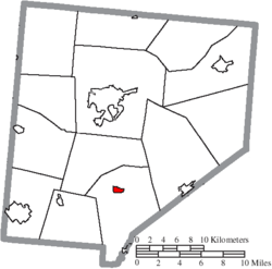
Tarlton is a village in Fairfield and Pickaway counties in the U.S. state of Ohio. The population was 254 at the 2020 census.

<span class="mw-page-title-main">Cloverdale, Ohio</span> Village in Ohio, United States

Cloverdale is a village in Perry Township, Putnam County, Ohio, United States. The population was 170 at the 2020 census.

<span class="mw-page-title-main">Limaville, Ohio</span> Census-designated place in Ohio, United States

Limaville is a census-designated place (CDP) and former village in Stark County, Ohio, United States. The population was 151 at the 2020 census. It is part of the Canton–Massillon Metropolitan Statistical Area.

<span class="mw-page-title-main">Port Washington, Ohio</span> Village in Ohio, United States

Port Washington is a village in Tuscarawas County, Ohio, United States. The population was 548 at the 2020 census.

<span class="mw-page-title-main">Macksburg, Ohio</span> Village in Ohio, United States

Macksburg is a village in Washington County, Ohio, United States, along the West Fork of Duck Creek. The population was 120 at the 2020 census. The village is about 28 miles (45 km) south of Cambridge, Ohio.

<span class="mw-page-title-main">New Martinsville, West Virginia</span> City in West Virginia, United States

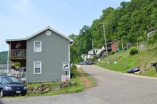
New Martinsville is a city in and the county seat of Wetzel County, West Virginia, United States, along the Ohio River. The population was 5,186 at the 2020 census.

<span class="mw-page-title-main">Gratiot, Ohio</span> Village in Ohio, United States

Gratiot is a village in Licking and Muskingum counties in the U.S. state of Ohio. The population was 215 at the 2020 census.

References

  1. "ArcGIS REST Services Directory". United States Census Bureau. Retrieved September 20, 2022.
  2. 1 2 U.S. Geological Survey Geographic Names Information System: Martinsville, Ohio
  3. 1 2 "U.S. Census website". United States Census Bureau . Retrieved January 31, 2008.
  4. Brown, Albert J. (1915). History of Clinton County, Ohio: Its People, Industries, and Institutions. B.F. Bowen. pp.  265.
  5. Kilbourn, John (1833). The Ohio Gazetteer, or, a Topographical Dictionary. Scott and Wright. pp.  300 . Retrieved December 12, 2013.
  6. Montoya, Allison (November 21, 2013). "Trio of Clinton Co. village's employees accused of theft". WLWT-TV. Retrieved March 30, 2014.
  7. "US Gazetteer files 2010". United States Census Bureau. Archived from the original on January 12, 2012. Retrieved January 6, 2013.
  8. "Census of Population and Housing". Census.gov. Retrieved June 4, 2015.
  9. "U.S. Census website". United States Census Bureau . Retrieved January 6, 2013.