McKenzie Lake is a suburban neighbourhood in southeast Calgary, Alberta. The community was in development from the mid-1980s through to present. The area is bordered by Deerfoot Trail on the east, Stoney Trail on the south, Fish Creek Provincial Park on the west, and 130th Ave SE on the north. The community is most known for its private lake and island in the centre of the community. Multimillion-dollar homes can be seen along both the ridge and the lake.

Downtown Calgary is a dense urban district in central Calgary, Alberta. It contains the second largest concentration of head offices in Canada, despite only being the country's fourth largest city in terms of population. The downtown is divided into several residential, commercial, corporate, and mixed-use neighbourhoods, including the Financial District (CBD), Eau Claire, Chinatown, East Village, Beltline, and the West End.
Lakeview is a residential community in the southwestern quadrant of Calgary, Alberta, Canada.
Lake Bonavista is a neighbourhood in Southeast Calgary, Alberta, Canada. It is bounded by Anderson Road to the north, Macleod Trail to the west, Canyon Meadows Drive to the south, and Bow Bottom Trail to the east. The small community of Bonavista Downs resides in the northeast corner of the neighbourhood.

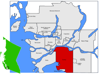
Renfrew–Collingwood is a large neighbourhood that lies on the eastern side of Vancouver, British Columbia, Canada, on its boundary with Burnaby and encompassing an area that was one of the earlier developed regions of the city. It is a diverse area that includes a substantial business community in several areas, as well as some of the fastest-growing residential sectors of Vancouver. In 2011, the neighbourhood had a population of 50,500, 38.4% of whom claim Chinese as their first language.
Beddington Heights is an established suburban neighbourhood in northwest Calgary, Alberta, Canada. The community is bounded by Berkshire Boulevard to the north, Beddington Trail to the east, Beddington Boulevard to the south and 14th Street W to the west.
Killarney, also known as Killarney/Glengarry, is a residential neighbourhood in the city of Calgary, Alberta, Canada. It is bounded by 17th Avenue S.W. on the north, 37th Street S.W. on the west, Richmond Road S.W. on the south, and 25A Street S.W. on the east. It was named after Glengarry County, Ontario, as the place the first settlers originated from.
Altadore is a residential neighbourhood in the inner-city portion of the southwest quadrant of Calgary, Alberta. It is bounded by 33rd Ave SW and the neighbourhood of South Calgary in the north, River Park and 14 St SW in the east, the Garrison Woods neighbourhood and Crowchild Trail SW in the west, and 50th Ave SW in the south. Altadore is part of the Marda Loop Communities Association (MLCA) along with Garrison Woods and South Calgary.

Signal Hill is a community in Calgary, Alberta. It contains the residential neighbourhoods of Sienna Hills and Signal Ridge. It is bounded by Sarcee Trail to the east, 17th Ave to the north, Stoney Trail to the south and 69th St to the west.

This is a list of neighbourhoods in the urban core of Greater Sudbury, Ontario. This list includes only those neighbourhoods that fall within the pre-2001 city limits of Sudbury — for communities within the former suburban municipalities, see the articles Capreol, Nickel Centre, Onaping Falls, Rayside-Balfour, Valley East and Walden.
Renfrew is a residential neighbourhood in the northeast quadrant of Calgary, Alberta. It is located south of the Trans-Canada Highway, and north of the inner city community of Bridgeland. To the east it is bordered by the Nose Hill Creek and the Deerfoot Trail and is separated from Crescent Heights to the west by Edmonton Trail.
Southwood is a residential neighbourhood in the southwest quadrant of Calgary, Alberta. It is bounded by 98th Avenue to the north, Macleod Trail to the east, Anderson Road to the south and 14th Street SW to the west. Southland Drive passes through the northern part of the community. A major roadway, Elbow Drive, bisects the community.
Tuxedo Park is a residential neighbourhood in the northeast and northwest quadrants of Calgary, Alberta. The inner city community is bounded to the north by 32 Avenue N, by Edmonton Trail to the east, the Trans-Canada Highway to the south and 2 Street NW to the west. The community is bisected by Centre Street from north to south.
West Springs is a residential neighbourhood in the southwest quadrant of Calgary, Alberta, Canada. It is located at the western edge of the city, and is bordered to the west by the acreages and estate homes of Springbank. To the east it is bounded by 69 Street W, to the south by Bow Trail and to the north by Old Banff Coach Road, the community of Cougar Ridge and the Canada Olympic Park.
Shawnessy is a suburban residential neighbourhood in the southwest quadrant of Calgary, Alberta. It is bounded by Shawnessy Boulevard to the north, MacLeod Trail to the east, 162 Avenue S to the south and James McKevitt Road to the west.
Eagle Ridge is an affluent residential neighbourhood situated on a peninsula in the Glenmore Reservoir in the southwest quadrant of Calgary, Alberta, Canada. The community is known for its unique proximity to green spaces and parks, recreational waterways, and Calgary's multi-use urban pathway system despite its relative proximity to the city's denser downtown core and adjoining communities. In 2014, Eagle Ridge was ranked the 18th wealthiest neighbourhood in Canada and 3rd wealthiest in Calgary. One of Calgary's smallest neighbourhoods by population, Eagle Ridge is physically secluded from other nearby communities due to the Glenmore Reservoir acting as natural boundary to its north, west, and south, while 14 Street W bounds the community to the east.
Fairview is a residential neighbourhood in the southeast quadrant of Calgary, Alberta. It is bounded to the north by Glenmore Trail to the east by Blackfoot Trail, to the south by Heritage Drive and to the west by Macleod Trail. Fairmount Drive bisects the neighbourhood from north to south and Chinook Centre is located northwest from the community. Fairview features homes built in the late 1950s and early 1960s on what are now considered large lots. Many are in the 1,000 sq ft range with most being bungalows. Many homes are still owned and occupied by the original owners. One of the smaller communities in Calgary with about 1,200 single family homes.
Saddle Ridge is a residential neighbourhood in the northeast quadrant of Calgary, Alberta. It is located at the northeastern edge of the city, and it is bounded to the north by Airport Trail NE, to the east by Stoney Trail NE, to the south by 80 Avenue NE and to the west by Métis Trail. The Saddle Ridge Industrial Area and Calgary International Airport are located west of the neighbourhood.
Sunnyside is a neighbourhood of South Surrey, which in turn is a region of Surrey, British Columbia, Canada.

Runnymede is a neighbourhood in Toronto, Ontario, Canada located north of Bloor Street West between Jane Street and Runnymede Road north to Dundas Street West. It is located directly north of the former village of Swansea and west of the High Park North neighbourhood. The immediate area around Bloor Street is commonly known as Bloor West Village after the shopping area along Bloor Street, whereas the area to the north is considered the Runnymede neighbourhood.
