MetroLink (Dublin)

Last updated

MetroLink
METROLINK-Logo-Outlined-RGB.png
Location Dublin, Ireland
Proposer Transport Infrastructure Ireland
Project website www.metrolink.ie
StatusDesign phase (pending approval of planning permission) [1]
Type Metro
Start dateUnknown [2]
Completion dateUnknown [3]

MetroLink is a proposed metro line for the city of Dublin. It replaces an earlier proposal called Metro North which was first recommended in the then Irish Government's 2005 Transport 21 transport plan.

Contents

The line is proposed to run from Estuary on Dublin's northside to Charlemont on the south of the city, with stops including Dublin Airport, O'Connell Street and St. Stephen's Green. The proposed route consists of mainly uncovered sub-surface track in the Swords area, a tunnel under Dublin Airport, further uncovered sub-surface track until the M50, with a deep bore tunnel running from Northwood to Charlemont.

While, as of March 2018, the line was planned to begin operation in 2027, [4] [5] as of September 2021, government representatives indicated that this target "was never likely to be achievable" with several reports indicating that the project would "not be completed until at least 2032". [6] [3] [7] As of July 2022, the project was proposed to begin construction in 2025 and that, "all going well" it could be in operation by 2035. [8]

History

Initial proposals

Metro North
BSicon uexKBHFa.svg
Belinstown
BSicon uexBHF.svg
Lissenhall
BSicon uexBHF.svg
Estuary
BSicon uexBHF.svg
Swords
BSicon PORTALf.svg
BSicon uexBHF.svg
Fosterstown BSicon PARKING.svg
BSicon uextBHF.svg
Airport BSicon FLUG.svg
BSicon PORTALg.svg
BSicon uexBHF.svg
Dardistown BSicon PARKING.svg
BSicon PORTALf.svg
BSicon uexBHF.svg
Northwood
BSicon uextBHF.svg
Ballymun
BSicon uextBHF.svg
Dublin City University
BSicon uextBHF.svg
Griffith Avenue
BSicon uextINT.svg
Drumcondra Irish Rail logo.svg
BSicon uextBHF.svg
Mater
BSicon uextBHF.svg
Parnell Square
BSicon uextINT.svg
O'Connell Bridge Luas simple logo.svg
BSicon uextKINTe.svg
St Stephen's Green Luas simple logo.svg
[9]

The original idea for the two Metro lines in Dublin can be attributed to the November 2001 "Platform for Change" report by the Dublin Transportation Office (now part of the National Transport Authority). [10] The purpose of the report was to come up with an integrated transportation strategy for the greater Dublin region. In its report, the DTO outlined plans for three Metro lines. The first was a north–south line which would run from Swords to Shanganagh via Dublin Airport, Finglas, Broadstone, the city centre, Ranelagh, Sandyford and Cherrywood. The second would link Tallaght West to Tallaght and then continue through the south-western suburbs of Dublin to the city centre. The third line would run in an orbital pattern, with a spur off the Swords-Shanganagh line at Finglas and then continue via Blanchardstown and Clondalkin to Tallaght, where it would connect with the other line.

Dublin Airport carried over 21 million passengers in 2006. This figure was projected to grow rapidly (as it did to 27.9 million by 2016). [11] As a result, Transport Infrastructure Ireland identified a medium-capacity public-transport link to Dublin Airport as one of the most important gaps in the Dublin rail network. Two options were seen as a solution to the problem:

The metro option emerged as the preferred option, as it provided both an airport link and a commuter link. It was described by Transport Infrastructure Ireland as "an important commuter link for the communities and institutions of North Dublin City and County". [12] Metro North (from Swords to St. Stephen's Green) and Metro West were adopted as government policy with the launch of the Transport 21 programme in 2005.

Three potential routes for the then called Metro North were published by the Railway Procurement Agency in February 2006. The first route option went through Finglas and made use of the former Broadstone railway alignment. The second route option went through Ballymun and was eventually adopted as the final route. The third route option went through Whitehall. After public consultation, the RPA announced in October 2006 [13] that they had selected a routing known as the 'East/Central Combined Route'. that ran through Ballymun. A slightly updated route, with changes in proposed station names, some modifications to station locations, and details of proposed overground and underground routes through Swords was released by the RPA in March 2008. [14]

On 22 March 2007, Transport Infrastructure Ireland began the procurement process for Metro North. In October 2007 it announced that it had a shortlist of four consortia interested in building Metro North. Draft Environmental Impact Statements were published in early 2008.

On 17 September 2008, the RPA applied for a railway order to An Bord Pleanála. [15] Oral hearings were heard during 2009 and 2010. [16]

On 5 October 2011, Metro North was granted planning permission by An Bord Pleanála. [17]

It was speculated by the media that the Metro North Project would be indefinitely deferred on 12 August 2011 following a review by Leo Varadkar, then Minister for Transport, Tourism and Sport. This was confirmed on 10 November 2011. [18]

In September 2015, it was announced that Metro North was being relaunched, with a revised opening date of 2027. [19]

In September 2021, government representatives indicated that the 2027 target would not be met and "was never likely to be achievable", [6] with some reports projecting that construction would not commence before 2027. [2] While included in the "National Development Plan 2021-2030", the plan included "no completion dates" for the proposed project. [3]

MetroLink
Possible route
BSicon KBHFa cerulean.svg
Estuary BSicon PARKING.svg
BSicon BHF cerulean.svg
Seatown
BSicon BHF cerulean.svg
Swords Central
BSicon PORTALf.svg
BSicon BHF cerulean.svg
Fosterstown BSicon PARKING.svg
BSicon tINT cerulean.svg
Airport BSicon FLUG.svg
BSicon PORTALg.svg
BSicon BHF cerulean.svg
Dardistown BSicon PARKING.svg
BSicon PORTALf.svg
BSicon BHF cerulean.svg
Northwood
BSicon tBHF cerulean.svg
Ballymun
BSicon tBHF cerulean.svg
Collins Avenue
BSicon tBHF cerulean.svg
Griffith Park
BSicon tINT cerulean.svg
Glasnevin Irish Rail logo.svg
BSicon tBHF cerulean.svg
Mater
BSicon tINT cerulean.svg
O'Connell Street Luas simple logo.svg
BSicon tINT cerulean.svg
Tara Street Irish Rail logo.svg
BSicon tINT cerulean.svg
St Stephen's Green Luas simple logo.svg
BSicon lINT.svg
BSicon tKINTe cerulean.svg
Charlemont Luas simple logo.svg

On 22 March 2018, the National Transport Authority announced revised proposals for the former Metro North railway line, now called 'MetroLink'. [20]

The new proposal incorporated considerable changes from the original. [21] MetroLink is intended to provide improved integration with heavy rail by including a new integrated heavy rail and metro interchange station at Glasnevin to provide transfers to and from the planned [22] DART+ West and South West lines. In addition the route was changed to provide an interchange with existing DART services at Tara Street station in the centre of the city. The tunnel construction method was changed from twin-bore to single bore to minimise disruption and reduce costs. Some of the MetroNorth stations would have required expensive mined construction while all MetroLink stations have been designed to be constructed using the simpler cut and cover method. MetroLink is to be driverless and platforms due to incorporate platform screen doors, while MetroNorth was designed to be manually operated by drivers by line-of-sight. Because higher frequencies are intended to be possible, MetroLink does not require the long platforms required by MetroNorth - simplifying station construction.[ original research? ] These plans were submitted to An Bord Pleanála in September 2022. [23]

Initially the route was to extend further south to Sandyford, subsuming the Luas Green Line tracks from Charlemont down to its final destination in Sandyford. According to those plans, Luas services on the Green Line would cease between Sandyford and Charlemont, and be replaced by Metro services. [24] In March 2018 public consultations were held [25] and the plan met with considerable opposition regarding the potential closure of the Green Line for an undetermined amount of time and issues regarding pedestrian and cyclist permeability along the line. [26] As a result, revised plans were published in March 2019, where the Metrolink line would be delivered in two phases, meaning the Green Line would not be upgraded during the first phase. [27] The Green Line Upgrade would happen as a second phase at a later date after Metrolink from Swords to Charlemont was operational. By developing in two phases the closure of the Green Line could be reduced and more time given to upgrading the existing pedestrian crossings to be fully grade separated through the use of underpasses. [28]

Before this opposition, a railway order was due to be sought for MetroLink in the third quarter of 2019. As of 2018, the revised MetroLink project was proposed to open in 2027. [4]

In December 2019, test drilling for boreholes began for the line. [29] Engineering consultant firm SNC-Lavalin was appointed by Transport Infrastructure Ireland in March 2020 as operations advisor for the project. [30] Due to the COVID-19 pandemic in the Republic of Ireland, work was halted, however in November 2020 ground investigation works resumed with work in Swords.

Originally the Railway Order was intended to be submitted in the first half of 2021 [1] but actual submission occurred in September 2022. [31] As of April 2023, a number of bodies (including Irish Rail, Dublin Airport, Abbey Theatre and Mater Hospital) raised concerns about aspects of the proposals outlined in the planning application. [32]

Operations

If opened as planned, MetroLink is due to operate a single line between Charlemont and Swords. All services are proposed to operate from Charlemont to the airport, with only some trains operating the full length of the line from Charlemont to Estuary. [30]

According to an initial planning report, the metro is proposed to operate for 19 hours per day, with services every 3 minutes at peak times. The planning report proposed a journey time to the city centre of 25 minutes from Swords and 20 minutes from Dublin Airport. [33] A single-bore tunnel has been decided upon for the underground section, in order to save on the cost of a twin-bore tunnel. [30]

Cost

Initially, the National Transport Authority projected that the cost of the project would be €3 billion. [4] As of March 2021, the Minister for Public Expenditure and Reform Michael McGrath reportedly "warned that existing budgets may not cover" the full costs of MetroLink and related projects. [34] It was estimated in July 2022 that the transport plan would cost €9.5 billion, with the most extreme figure putting it at €23 billion. [35]

Further potential plans

Metro South

In 2006, Eamon Ryan, then transport spokesperson for the Green Party, called for the underground section of Metro North to be extended south to Beechwood, where it would then surface and provide a direct link to the Luas Green Line. [36] This option would allow passengers to travel from the south of the city to the north, without having to change mode of transport.

The Luas Green Line is largely built on most of the former Harcourt Street railway line alingnment. When it was constructed, it was designed to allow metro trains to potentially operate on the line in the future, restoring heavy rail operations in the areas served. [37] In the National Transport Authority's Draft Transport Strategy for the Greater Dublin Area 2016–2035, it was proposed that the Metro North tunnel should be extended southwards to meet the Luas Green line in the Ranelagh area. The Luas Green line would be converted to a metro line, with Luas services on the line ending and being replaced by metro services. [38]

In March 2019, the revised plans were released with the intention to upgrade the Green Line after the northern section is operational. [39] As of 2016, it remained part of the transport strategy to upgrade the Green Line to be capable of running metro services, extending the metro to Sandyford and eventually to Bride's Glen. [38]

Metro South West

In 2020, it was reported that the NTA was assessing additional potential metro provision; with a southwest line serving Terenure, Rathfarnham and Knocklyon, or a southeastern line serving University College Dublin. [40]

Former plans

Metro West

Metro West (proposed)
BSicon KBHFa saffron.svg
Dardistown
BSicon PARKING.svg
BSicon BHF saffron.svg
Harristown
BSicon BHF saffron.svg
Silloge
BSicon BHF saffron.svg
Meakstown
BSicon eBHF saffron.svg
Kildonan
BSicon eBHF saffron.svg
Cappoge
BSicon BHF saffron.svg
Abbotstown
BSicon BHF saffron.svg
NAC
BSicon BHF saffron.svg
Blanchardstown
BSicon BHF saffron.svg
Millennium Park
BSicon INT saffron.svg
Porterstown
Irish Rail logo.svg
BSicon INT saffron.svg
Liffey Valley
Luas simple logo.svg
BSicon BHF saffron.svg
Rowlagh
BSicon INT saffron.svg
Fonthill
Irish Rail logo.svg
BSicon BHF saffron.svg
Clondalkin
BSicon BHF saffron.svg
St Brigids
BSicon eBHF saffron.svg
Newlands
BSicon INT saffron.svg
Belgard
Luas simple logo.svg
BSicon eBHF saffron.svg
Colbert's Fort
BSicon KINTe saffron.svg
Tallaght East
Luas simple logo.svg

Metro West (Irish: Meitreo Thiar) was proposed to run from an intersection with Metro North, just south of the airport at Santry, and from there pass through Blanchardstown, Liffey Valley, and Clondalkin before joining the Luas Red Line to continue towards Tallaght. Metro West was planned to be entirely above ground, at road level, and 25.5 kilometres long (15.8 mi). Planning on the Metro West Project was suspended in September 2011 following a review by Leo Varadkar, then Minister for Transport, Tourism and Sport, as money to construct the new railway would not be available in the foreseeable future. [41]

Two potential routes for Metro West had been published by the Railway Procurement Agency in January 2007. Following discussions and a public consultation process, a preferred route was announced in July 2007. This route started at Tallaght, running through Belgard, Clondalkin, Liffey Valley, Blanchardstown. Stops were also proposed for the National Aquatic Centre and Abbotstown, before continuing in the direction of Sillogue and Harristown. Following Harristown it would link with the proposed Metro North line, for a combined length of 25 km. [42]

Metro West plans, published in 2007, proposed lines which would run overground, with some tunnels and bridges to avoid major road junctions. [43] In addition to the proposed link with Metro North, the line was proposed to interchange with the Luas at Tallaght and Belgard, rail services at Fonthill and Porterstown and Dublin Bus services at a number of other stops. [44]

Route selection and funding

Metro West was proposed to serve the northern parts of Finglas via stops at the N2 and Meakstown. When developing options for Metro West, the Railway Procurement Agency (RPA) considered routes south of the M50, serving Finglas more directly. Ultimately, these routes were not deemed feasible. [45]

On 11 November 2008, the RPA chose their preferred route for Metro West, including indicative stops, depot and Park and Ride locations. The preferred route for Metro West ran from Tallaght to Metro North at Dardistown, via Clondalkin, Liffey Valley and Blanchardstown. The planned route would interchange with (from south to north) the Luas Red Line, Kildare Railway Line, Luas Line F (to Lucan), Maynooth Railway Line and Metro North Line, as well as local bus services. [46]

By 2016, Metro West had been excluded from the National Transport Authority's "Transport Strategy For The Greater Dublin Area 2016-2035". As of 2018, Metro West was not due to be considered for government funding until after 2035. [47]

See also

Related Research Articles

<span class="mw-page-title-main">Dublin Area Rapid Transit</span> Commuter rail network in Dublin, Ireland

The Dublin Area Rapid Transit system is an electrified commuter rail railway network serving the coastline and city of Dublin, Ireland. The service makes up the core of Dublin's suburban railway network, stretching from Greystones, County Wicklow, in the south to Howth and Malahide in north County Dublin. The DART serves 31 stations and consists of 53 route kilometres of electrified railway, and carries in the region of 20 million passengers per year. In a similar manner to the Berlin S-Bahn, the DART blends elements of a commuter rail service and a rapid transit system.

<span class="mw-page-title-main">Luas</span> Light rail system in Dublin, Ireland

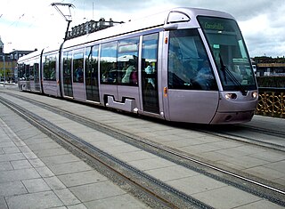
Luas is a tram system in Dublin, Ireland. There are two main lines: the Green Line, which began operating on 30 June 2004, and the Red Line which opened on 26 September 2004. Since then, the red line has been extended and split into different branches further out of the city and the green line has been extended north and south as a single line. Since the northern extension of the green line in 2017, the two lines intersect in the city centre. The system now has 67 stops and 42.5 kilometres (26.4 mi) of revenue track, which in 2023 carried 48.2 million passengers, an increase of 24% compared to 2022.

<span class="mw-page-title-main">Heuston railway station</span> Railway terminal in Dublin, Ireland

Heuston Station, also known as Dublin Heuston, is one of Dublin's largest railway stations and links the capital with the south, southwest and west of Ireland. It is operated by Iarnród Éireann (IÉ), the national railway operator. It also houses the head office of its parent company, Córas Iompair Éireann (CIÉ). The station is named in honour of Seán Heuston, an executed leader of the 1916 Easter Rising, who had worked in the station's offices.

<span class="mw-page-title-main">Stillorgan</span> Suburb of Dublin, in Dún Laoghaire–Rathdown, Ireland

Stillorgan, formerly a village in its own right, is now a suburban area of Dublin in Ireland. Stillorgan is located in Dún Laoghaire–Rathdown, and contains many housing estates, shops and other facilities, with the old village centre still present. Stillorgan is at least partly contiguous with Kilmacud and neighbours other southside districts such as Mount Merrion, Sandyford, Leopardstown, Dundrum, Blackrock, Goatstown and Foxrock.

<span class="mw-page-title-main">Dundrum, Dublin</span> Suburb of Dublin, Ireland

Dundrum, originally a village in its own right, is an outer suburb of Dublin, Ireland. The area is located in the postal districts of Dublin 14 and Dublin 16. Dundrum is home to the Dundrum Town Centre, the largest shopping centre in Ireland.

<span class="mw-page-title-main">Railway Procurement Agency</span> Defunct state agency in Ireland

The Railway Procurement Agency was a state agency of the Department of Transport, Tourism and Sport in the Republic of Ireland, charged with the development of light railway and the future metro infrastructure.

<span class="mw-page-title-main">Tara Street railway station</span> Train station in Dublin, Ireland

Tara Street is a railway station in central Dublin, Ireland. It is adjacent to the Loopline Bridge on George's Quay.

<span class="mw-page-title-main">The Square Tallaght</span> Large suburban retail facility in Tallaght southwest of Dublin

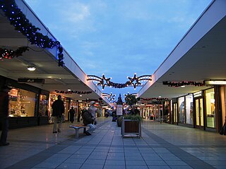
The Square Tallaght is a shopping centre located in Tallaght, Dublin, Ireland, opened in 1990. It is located 10 minutes from junction 11 of the M50 motorway on the Belgard Road and the N81.

<span class="mw-page-title-main">Transport 21</span> Irish road, bus and rail infrastructure plan

Transport 21 was an Irish infrastructure plan, announced in November 2005. Its aims were to greatly expand Ireland's transport network. A cost estimate of €34 billion was attached to the plan at the time.

<span class="mw-page-title-main">Red Line (Luas)</span>

The Red Line is one of the two lines of Dublin's Luas light rail system. The Red Line runs in an east–west direction through the city centre, north of the River Liffey, before travelling southwest to Tallaght, with a fork to Citywest and Saggart. The Red Line opened on 26 September 2004.

<span class="mw-page-title-main">Green Line (Luas)</span> Light rail system in Dublin, Ireland

The Green Line is one of the two lines of Dublin's Luas light rail system. The Green Line was formerly entirely in the south side of Dublin city. It mostly follows the route of the old Harcourt Street railway line, which was reserved for possible re-use when it closed in 1958. The Green Line allows for passengers to transfer at O’ Connell GPO and Marlborough to Luas Red Line services and also allows commuters to use Broombridge as an interchange station to reach outer suburbs such as Castleknock and Ongar as well as Iarnrod Éireann services.

DART Underground, also known as the Interconnector or DART+ Tunnel, is a proposed mainline-rail tunnel in Dublin, Ireland. First proposed in 1972, as of 2021 it was not funded or scheduled. While the Greater Dublin Transport Strategy 2016-2035 included the DART Underground as a proposed National Transport Authority project, the tunnel was not included in the National Development Plan published in 2018 or DART+ expansion plans published in August 2020.

<span class="mw-page-title-main">R136 road (Ireland)</span> Road in Ireland

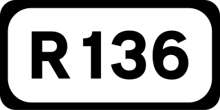
The R136 road is a regional road in Ireland, located in the southwest of Dublin. Named the Outer Ring Road, the route, which is dual carriageway, runs from the N4 at Lucan to the N81 at Tallaght, bypassing west of Clondalkin and crossing the N7 near Citywest. It was built as part of the planning for the new town of Adamstown.

<span class="mw-page-title-main">Transport in Dublin</span>

This article deals with transport in the Greater Dublin Area centred on the city of Dublin in Ireland.

<span class="mw-page-title-main">Docklands railway station</span>

Docklands Station is a terminus railway station serving the Dublin Docklands area in Ireland. It is owned and operated by Iarnród Éireann and was part of the Irish Government's Transport 21 initiative.

<span class="mw-page-title-main">Public transport in Ireland</span>

Public transport in Ireland exists in many of the Ireland's urban areas and rural areas, and takes a number of forms. Bus transport is the main form of public transport and is common in all cities. The cities, Dublin, Belfast, Cork, Limerick and Galway all have their own suburban rail networks, although Dublin is the only to have its own tram line, in the form of the Luas. Ireland has a population of 5 million people.

<span class="mw-page-title-main">St Stephen's Green station</span> Stop on the Luas (tram) system in Dublin, Ireland

St Stephen's Green is a stop on the Green Line of the Luas (tram) system in Dublin, Ireland. Originally opened in 2004, it was further developed as part of the Luas Cross City project between 2013 and 2017.

Porterstown station is a proposed transport interchange intended for the Porterstown area of Dublin. As proposed, the project was intended to form an interchange between heavy rail services operated by Iarnród Éireann and light rail operations on the proposed Dublin Metro's Metro West line.

<span class="mw-page-title-main">Charlemont Luas stop</span> Tram stop in Dublin, Ireland

Charlemont is a stop on the Luas light-rail tram system in Dublin, Ireland. It opened in 2004 on the Green Line from St Stephen's Green to Sandyford. It provides access to parts of the south inner city, including Portobello.

<span class="mw-page-title-main">Beechwood Luas stop</span> Tram/light rail stop in Dublin, Ireland

Beechwood is a stop on the Luas light rail tram system in Dublin, Ireland which serves the southern parts of Ranelagh and Rathmines. It opened in 2004 as a stop on the Green Line, which re-uses the alignment of the Harcourt Street railway line which closed in 1958. Beechwood Luas stop is located on the same site as a station on the old line called Rathmines and Ranelagh, although it is lower than the original station.

References

  1. 1 2 "Ground investigation works for Metrolink line begin in Swords". Independent.ie . 5 December 2020. Archived from the original on 7 December 2020. Retrieved 8 December 2020. Cllr Darragh Butler said he is optimistic the project will be delivered this decade [..] we expect to be in a position to apply for a Railway Order in the middle of 2021 [..] the planning application will go to An Bord Pleanála in the first half of [2021]
  2. 1 2 "Government says it hasn't decided to delay construction of Metrolink until 2027 but start date down to planning permission". Independent.ie . Independent News & Media. 21 September 2021. Archived from the original on 22 September 2021. Retrieved 26 September 2021. The Government [..] is unable to say when construction on the project will start
  3. 1 2 3 "No date for MetroLink, but Taoiseach says €165bn National Development Plan is 'not a wish list'". TheJournal.ie . Journal Media Ltd. 4 October 2021. Retrieved 4 October 2021. Metrolink and DART + West are included in the plan, but there are no completion dates for the projects
  4. 1 2 3 "Revealed: Preferred route for €3bn MetroLink from city centre to Dublin Airport unveiled". Independent.ie . Independent News & Media. 22 March 2018. Archived from the original on 27 March 2019. Retrieved 30 March 2018.
  5. "MetroLink Project Schedule" (PDF). tii.ie. MetroLink. Archived (PDF) from the original on 8 February 2021. Retrieved 29 January 2021.
  6. 1 2 "Dublin Metro Link will not be delivered by 2027 - Ryan". rte.ie. RTÉ. 26 September 2021. Archived from the original on 26 September 2021. Retrieved 26 September 2021.
  7. Kilraine, John (9 November 2021). "MetroLink postponed for ten years - NTA draft strategy". RTÉ News .
  8. "Long-delayed Dublin Metrolink to cost €9.5bn with first trains running by 2034". independent. 4 July 2022. Retrieved 5 July 2022.
  9. "Map - Metro North - St. Stephen's Green - Estuary" (PDF). rpa.ie. Rail Procurement Agency. February 2011. Archived from the original (PDF) on 7 August 2011.
  10. "The Dublin Transport Office's Platform for Change Report" (PDF). dto.ie. Archived from the original (PDF) on 19 November 2007.
  11. "RTÉ News: Residents to oppose Dublin runway plans". rte.ie. Raidió Teilifís Éireann. 12 October 2004. Archived from the original on 12 October 2012. Retrieved 15 October 2013.
  12. "Metro North: Frequently Asked Questions". rpa.ie. Rail Procurement Agency. Archived from the original on 14 March 2008.
  13. "RTÉ News: Cullen announces details of Metro route". rte.ie. Raidió Teilifís Éireann. 19 October 2006. Archived from the original on 29 September 2012. Retrieved 15 October 2013.
  14. "Metro North Route, March 2008" (PDF). rpa.ie. Archived from the original (PDF) on 30 May 2008.
  15. "Home - Transport Infrastructure Ireland -". Archived from the original on 15 June 2011.
  16. "An Bord Pleanála considers Dublin Metro". RTÉ News. 2 March 2009. Archived from the original on 19 July 2009. Retrieved 27 April 2010.
  17. "Metro North gets final Bord Pleanála go-ahead". rte.ie. 5 October 2011. Archived from the original on 31 March 2018. Retrieved 30 March 2018.
  18. "Metro North and Dart Underground deferred". The Irish Times. Archived from the original on 10 November 2011. Retrieved 10 November 2011.
  19. "Dublin's new Metro North: What is the plan?". newstalk.com. 29 September 2015. Archived from the original on 30 March 2018. Retrieved 30 March 2018.
  20. "Minister Ryan announces transformative MetroLink project". Gov.ie . Department of Transport. 5 July 2022. Retrieved 5 July 2022.
  21. "MetroLink Preferred Route Design Development Report" (PDF). March 2019.
  22. "DART+ West Railway Order - Dublin City to Maynooth and M3 Parkway". July 2022.
  23. "Railway (Metrolink - Estuary to Charlemont via Dublin Airport) Order [2022]". September 2022.
  24. "The 'Metro North' is now the MetroLink - here's what it'll look like". TheJournal.ie . Metrolink announcement. 22 March 2018. Archived from the original on 13 April 2018. Retrieved 22 March 2018.
  25. "Metrolink public consultation". metrolink.ie. 22 March 2018. Archived from the original on 31 March 2018. Retrieved 30 March 2018.
  26. "Opposition to Metrolink plan for south Dublin continues". The Irish Times .
  27. Kilraine, John (26 March 2019). "Luas Green line to remain open under new Metrolink plan". RTÉ. Archived from the original on 26 March 2019.
  28. "Constructability Report - Green Line Closure" (PDF). metrolink.ie. 16 April 2019. Archived (PDF) from the original on 1 October 2020. Retrieved 23 May 2019.
  29. "Test drilling of boreholes for MetroLink finally gets underway across the capital". Independent.ie . 11 December 2019. Retrieved 12 December 2019.
  30. 1 2 3 "Irish capital updates metro plan". International Railway Journal . 11 May 2020. Archived from the original on 22 May 2020. Retrieved 25 May 2020.
  31. "Minister Ryan welcomes planning application for MetroLink". www.gov.ie. 30 September 2022. Retrieved 2 October 2022.
  32. O'Brien, Tim (5 April 2023). "Closure of key railway lines during MetroLink build would cause 'significant disruption'". Irish Times. Retrieved 23 August 2023.
  33. "MetroLink Planning Report" (PDF). MetroLink.
  34. "Ibec calls for additional €70bn spend on vital infrastructure". irishtimes.com. Irish Times. 3 March 2021. Archived from the original on 3 March 2021. Retrieved 13 March 2021. Minister for Public Expenditure Michael McGrath has already warned that existing budgets may not cover the final cost of big infrastructure projects such as MetroLink
  35. O'Donnell, Dimitri (5 July 2022). "Trains every 3 minutes at peak times in €9.5bn MetroLink plan". RTÉ News and Current Affairs . Retrieved 5 July 2022.
  36. "Greens want Metro extended to Beechwood". The Irish Times. 19 October 2006. Archived from the original on 26 September 2021. Retrieved 7 March 2009.
  37. "Luas lines being built to different standards". The Irish Times. 28 June 2003. Archived from the original on 6 November 2020. Retrieved 31 March 2021.
  38. 1 2 "Transport Strategy for the Greater Dublin Area 2016 - 2035" (PDF). nationaltransport.ie. 2016. Archived (PDF) from the original on 20 January 2021. Retrieved 31 May 2021.
  39. Kilraine, John (26 March 2019). "Luas Green line to remain open under new Metrolink plan". Archived from the original on 26 March 2019. Retrieved 26 March 2019.
  40. "Rail line to Navan and Metro to south Dublin to be assessed as NTA asks for public views on transport strategy". TheJournal.ie . 26 November 2020. Archived from the original on 16 December 2020. Retrieved 8 December 2020.
  41. "Airport Metro link plan suspended". Irish Independent. 25 September 2011. Archived from the original on 27 September 2011. Retrieved 25 September 2011.
  42. "Dempsey unveils Metro West route". The Irish Times. 5 July 2007. Archived from the original on 26 September 2021. Retrieved 7 March 2009.
  43. "RTÉ News: Clondalkin wins out on Metro West route". Raidió Teilifís Éireann. 5 July 2007. Archived from the original on 7 July 2007.
  44. "Seven years down the line . . . Metro West stops unveiled". Irish Independent. 16 January 2007. Archived from the original on 9 February 2021. Retrieved 29 January 2021.
  45. "Line BXD - City/Broombridge - Outline Business Case - June 2009" (PDF). nationaltransport.ie. 2009. Archived (PDF) from the original on 4 December 2018. Retrieved 4 December 2018.
  46. "RPA – METRO ORBITAL (Metro West) Design Update No. 1 (PDF)" (PDF). rpa.ie. Archived from the original (PDF) on 3 March 2009. Retrieved 15 October 2013.
  47. Paul, Hosford (23 March 2018). "Dublin's Metrolink will only go north - south until at least 2035". TheJournal.ie. Archived from the original on 24 September 2020. Retrieved 5 July 2020.