Segesta was one of the major cities of the Elymians, one of the three indigenous peoples of Sicily. The other major cities of the Elymians were Eryx and Entella. It is located in the northwestern part of Sicily in Italy, near the modern commune of Calatafimi-Segesta in the province of Trapani. The hellenization of Segesta happened very early and had a profound effect on its people.
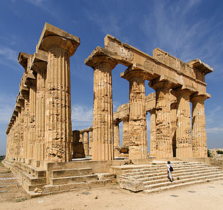
Selinunte was a rich and extensive ancient Greek city of Magna Graecia on the south-western coast of Sicily in Italy. It was situated between the valleys of the Cottone and Modione rivers. It now lies in the comune of Castelvetrano, between the frazioni of Triscina di Selinunte in the west and Marinella di Selinunte in the east.

Marsala is an Italian comune located in the Province of Trapani in the westernmost part of Sicily. Marsala is the most populated town in its province and the fifth in Sicily.
Agrigento is a city on the southern coast of Sicily, Italy and capital of the province of Agrigento.

Lipari is a comune including six of seven islands of the Aeolian Islands and it is located in the Tyrrhenian Sea off the northern coast of Sicily, southern Italy; it is administratively part of the Metropolitan City of Messina. Its population is 12,821, but during the May to September tourist season, the total population may reach up to 20,000. It is also the name of the biggest island in the archipelago, where the main urban area of the comune is located.
Cumae was the first ancient Greek colony of Magna Graecia on the mainland of Italy and was founded by settlers from Euboea in the 8th century BC. It became a rich Roman city, the remains of which lie near the modern village of Cuma, a frazione of the comune Bacoli and Pozzuoli in the Metropolitan City of Naples, Campania, Italy.
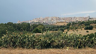
Sciacca is a town and comune in the province of Agrigento on the southwestern coast of Sicily, southern Italy. It has views of the Mediterranean Sea.

Gela is a city and comune (municipality) in the Autonomous Region of Sicily, Italy; in terms of area and population, it is the largest municipality on the southern coast of Sicily. Gela is part of the Province of Caltanissetta and is one of the few comuni in Italy with a population and area that exceed those of the provincial capital.

Morgantina is an archaeological site in east central Sicily, southern Italy. It is sixty kilometres from the coast of the Ionian Sea, in the province of Enna. The closest modern town is Aidone, two kilometres southwest of the site. The site consists of a two-kilometre-long ridge running southwest-northeast, known as Serra Orlando, and a neighbouring hill at the northeast called Cittadella. Morgantina was inhabited in several periods. The earliest major settlement was made at Cittadella and lasted from about 1000/900 to about 450 BCE. The other major settlement was located on Serra Orlando, and existed from about 450 BCE to about 50 CE in Magna Graecia. Morgantina has been the subject of archaeological investigation since the early 20th century.

Motya was an ancient and powerful city on San Pantaleo Island off the west coast of Sicily, in the Stagnone Lagoon between Drepanum and Lilybaeum. It is within the present-day commune of Marsala, Italy.

Centuripe is a town and comune in the province of Enna. The city is 61 kilometres (38 mi) from Enna in the hill country between the Rivers Dittaìno and Salso.
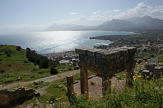
Soluntum or Solus was an ancient city on the Tyrrhenian coast of Sicily near present-day in the comune of Santa Flavia, Italy. The site is a major tourist attraction. The city was founded by the Phoenicians in the sixth century BC and was one of the three chief Phoenician settlements in Sicily in the archaic and classical periods. It was destroyed at the beginning of the fourth century BC and re-founded on its present site atop Monte Catalfano. At the end of the fourth century BC, Greek soldiers were settled there and in the 3rd century BC the city came under the control of the Roman Republic. Excavations took place in the 19th century and in the mid-20th century. Around half of the urban area has been uncovered and it is relatively well preserved. The remains provide a good example of an ancient city in which Greek, Roman and Punic traditions mixed.

Sambuca di Sicilia is a comune (municipality) in the Province of Agrigento in the Italian region Sicily, located about 68 kilometres (42 mi) southwest of Palermo and about 89 kilometres (55 mi) northwest of Agrigento. It is one of I Borghi più belli d'Italia.
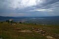
Monte Polizzo is an archaeological site located 6 km northwest of the town of Salemi, in the province of Trapani, western Sicily, southern Italy. It occupies an easily defended hilltop, from which a vast area of western Sicily can be seen, and consists of an interconnected group of ridges, the highest point of which is 725.9 m (2359 feet) above sea level. The settlement has been dated to c. 9th - 4th centuries BC.

Heraclea Minoa was an ancient Greek city of Magna Graecia situated on the southern coast of Sicily near the mouth of the river Halycus, 25 km west of Agrigentum. It is located near the modern town of the same name in the comune Cattolica Eraclea in Italy.

Akrai was a Greek colony of Magna Graecia founded in Sicily by the Syracusans in 663 BC. It was located near the modern Palazzolo Acreide.
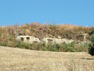
The archaeological park of Sabucina, located on the mountain of the same name near Caltanissetta, is an archaeological site in Sicily. The area contains settlements ranging from the Bronze Age to the Roman period.
Vincenzo Tusa was an Italian archeologist.
The History of Greek Sicily began with the foundation of the first Greek colonies around the mid 8th century BC. The Greeks of Sicily were known as Siceliotes.
Herbessos was an ancient city located at Montagna di Marzo, Sicily, a few kilometres north-west of Piazza Armerina.