Moosehead Lake

Last updated
Moosehead Lake
Mouth of Moose River from Mount Kineo.jpg
USA Maine relief location map.svg
Red pog.svg
Moosehead Lake
Location Northwest Piscataquis, Maine,
United States
Coordinates 45°38′N69°39′W / 45.633°N 69.650°W / 45.633; -69.650 Coordinates: 45°38′N69°39′W / 45.633°N 69.650°W / 45.633; -69.650
Type mesotrophic
Primary inflows Moose River
Primary outflows Kennebec River
Catchment area 1,268 square miles (3,280 km2)
Basin  countriesUnited States
Max. length40 miles (64 km)
Max. width10 miles (16 km)
Surface area75,451 acres (30,534 ha)
Average depth55 feet (17 m)
Max. depth246 feet (75 m)
Water volume4,210,000  acre⋅ft (5.19×10⁹ m3)
Residence time 3.1 years
Shore length1280.8 miles (451.9 km)
Surface elevation1,029 feet (314 m)
Islands >80 (Sugar Island)
1 Shore length is not a well-defined measure.

Moosehead Lake is a deep, coldwater lake located in Piscataquis County in Northwestern Maine. It is the second-largest lake in New England, and the largest mountain lake in the eastern United States. Situated in the mostly undeveloped Longfellow Mountains, the lake is the source of the Kennebec River. Several rural Townships border the lake. Greenville is by far the largest town on the lake, with a small downtown area that has banks, shops, and restaurants. There are over 80 islands in the lake, the largest being Sugar Island and Deer Island to the west being the second largest.

Contents

History

Mount Kineo, with 700-foot (210 m) cliffs rising straight up from Moosehead Lake, has attracted visitors for centuries, from early American Indians (Red Paint People), to later tribes seeking its rhyolite to make stone tools, Penobscots and Norridgewocks, the Abenaki bands who battled here with their enemy the Mohawks, to 19th-century "rusticators" traveling by railroad and steamboat and today's hotel guests. Various species dwell among its cliffs and talus slopes, including peregrine falcons and rare plants.

The Moosehead region includes the headwaters of the Kennebec, the West Branch of the Penobscot, the Piscataquis, the Pleasant, and the Saint John rivers. Henry David Thoreau and other 19th-century visitors remarked on the beauty of the area. The region has a large moose population; moose outnumber people 3:1. [1] However, the name of the region derives from the remarkable similarity between maps of the lake and an antlered moose.

Henry David Thoreau described the lake as “...a gleaming silver platter at the end of the table.” [2]

Hunters at Camp Russell, northeast of Moosehead Lake, 1888 Camp Russell Pond Maine.jpg
Hunters at Camp Russell, northeast of Moosehead Lake, 1888

Geography

Shoreline in 1912 Lake Shore at the Birches.jpg
Shoreline in 1912

Set at an elevation of 1,023 feet (312 m), Moosehead Lake is approx. 40 by 10 miles (64 by 16 km), with an area of nearly 118 mile² (approx. 303 km2), and over 400 miles (640 km) of shoreline. Its major inlet is the Moose River, which, east of Jackman, flows through Long Pond to Brassua Lake. To the east of Moosehead Lake, the Roach River is its second largest tributary. Flowing out of Moosehead Lake to the southwest are its east and west outlets—the Kennebec River.

The Moosehead Lake Region encompasses 4,400 square miles (11,000 km2) of North Central Maine, and includes 127 incorporated and unincorporated townships in addition to Moosehead Lake. The region is drained by 330 miles (530 km) of main stem rivers, into which flow 3,850 miles (6,200 km) of smaller tributaries. During the last glacial era, more than 1,200 natural lakes and ponds were carved into its landscape, varying in size from one acre (4,000 m2) ponds to Moosehead which, at 75,451 acres (305.34 km2), is one of the largest natural freshwater lakes in the United States. The total area of all standing surface waters in the region is more than 238,000 acres (960 km2) 24% of the total area of lakes and ponds in Maine.

Climate

There is a weather station in the unincorporated namesake community of Moosehead on the middle part of the western lakeshore. The area has a humid continental climate (Köppen Dfb). Winters are cold and snowy, whereas summers are mild due to its relative elevation. The annual temperature of about 40 °F (4 °C) are similar to Quebec City in the St. Lawrence River valley further north and much colder than Maine's and the nearby Canadian maritime provinces' coastal areas. Winter temperatures are similar to subarctic inland northern Sweden and Finland and as a result, boreal forests dominate the shoreline in spite of being in the mid-latitudes. Because of its cold climate, the lake becomes completely frozen over for about 5 months each year.

Climate data for Moosehead, Maine, 1991–2020 averages, extremes 1931–present
MonthJanFebMarAprMayJunJulAugSepOctNovDecYear
Record high °F (°C)58
(14)
64
(18)
77
(25)
87
(31)
91
(33)
97
(36)
93
(34)
96
(36)
95
(35)
84
(29)
73
(23)
68
(20)
96
(36)
Mean maximum °F (°C)43.3
(6.3)
45.1
(7.3)
53.1
(11.7)
71.6
(22.0)
83.8
(28.8)
87.1
(30.6)
88.2
(31.2)
86.8
(30.4)
83.6
(28.7)
73.9
(23.3)
61.0
(16.1)
49.3
(9.6)
90.5
(32.5)
Average high °F (°C)23.4
(−4.8)
26.5
(−3.1)
35.6
(2.0)
48.1
(8.9)
62.7
(17.1)
71.6
(22.0)
76.5
(24.7)
75.5
(24.2)
67.8
(19.9)
53.8
(12.1)
40.7
(4.8)
29.3
(−1.5)
51.0
(10.6)
Daily mean °F (°C)13.0
(−10.6)
14.3
(−9.8)
23.9
(−4.5)
37.2
(2.9)
50.8
(10.4)
60.0
(15.6)
65.3
(18.5)
63.3
(17.4)
56.0
(13.3)
43.8
(6.6)
32.4
(0.2)
20.6
(−6.3)
40.1
(4.5)
Average low °F (°C)2.6
(−16.3)
2.0
(−16.7)
12.2
(−11.0)
26.4
(−3.1)
38.9
(3.8)
48.4
(9.1)
54.2
(12.3)
51.2
(10.7)
44.2
(6.8)
33.8
(1.0)
24.1
(−4.4)
11.9
(−11.2)
29.2
(−1.6)
Mean minimum °F (°C)−18.5
(−28.1)
−17.8
(−27.7)
−12.2
(−24.6)
13.0
(−10.6)
25.0
(−3.9)
35.9
(2.2)
43.0
(6.1)
40.4
(4.7)
29.1
(−1.6)
21.9
(−5.6)
8.4
(−13.1)
−8.5
(−22.5)
−22.0
(−30.0)
Record low °F (°C)−33
(−36)
−30
(−34)
−29
(−34)
3
(−16)
19
(−7)
30
(−1)
34
(1)
30
(−1)
20
(−7)
14
(−10)
−10
(−23)
−28
(−33)
−33
(−36)
Average precipitation inches (mm)2.69
(68)
2.27
(58)
2.76
(70)
3.28
(83)
3.43
(87)
4.39
(112)
4.03
(102)
3.85
(98)
3.42
(87)
4.45
(113)
3.42
(87)
3.50
(89)
41.49
(1,054)
Average snowfall inches (cm)20.2
(51)
21.6
(55)
18.4
(47)
7.5
(19)
0.3
(0.76)
0.0
(0.0)
0.0
(0.0)
0.0
(0.0)
0.0
(0.0)
1.2
(3.0)
6.5
(17)
22.6
(57)
98.3
(249.76)
Average extreme snow depth inches (cm)18.9
(48)
22.3
(57)
26.2
(67)
17.5
(44)
0.4
(1.0)
0.0
(0.0)
0.0
(0.0)
0.0
(0.0)
0.0
(0.0)
0.8
(2.0)
3.7
(9.4)
12.8
(33)
28.9
(73)
Average precipitation days (≥ 0.01 in)12.110.811.312.014.113.814.612.910.713.312.513.9152.0
Average snowy days (≥ 0.1 in)11.310.28.73.80.20.00.00.00.00.74.910.850.6
Source 1: NOAA [3]
Source 2: National Weather Service [4]

Development plans

Seattle-based Plum Creek Real Estate Investment Corporation, the largest private United States landowner, submitted a development proposal for the Moosehead region in April 2005. It was the largest development ever proposed for the state of Maine. [5] The initial version of the scheme called for 975 house lots, two resorts, a golf course, a marina, three RV parks, and more than 100 rental cabins. [6] However, Plum Creek was defunct as of 2016 and all development plans have been cancelled.[ citation needed ]

In January 2021, a $75 million investment was made into developing the 1,700-acre Big Squaw Mountain Resort into a year-round tourist attraction that would include a new ski-lift system, a large hotel, lakefront condominiums, and a marina. The plans are being made by local developer Perry Williams, along with Louisiana-based developers at Provident Resources Group. [7]

Notes

    Related Research Articles

    <span class="mw-page-title-main">Mount Katahdin</span> Highest mountain in Maine, US

    Mount Katahdin is the highest mountain in the U.S. state of Maine at 5,269 feet (1,606 m). Named Katahdin, which means "Great Mountain", by the Penobscot Native Americans, it is within Northeast Piscataquis, Piscataquis County, and is the centerpiece of Baxter State Park. It is a steep, tall massif formed from a granite intrusion weathered to the surface. The flora and fauna on the mountain are typical of those found in northern New England.

    <span class="mw-page-title-main">Kennebec River</span> River in Maine, United States

    The Kennebec River is a 170-mile-long (270 km) river within the U.S. state of Maine. It rises in Moosehead Lake in west-central Maine. The East and West Outlets join at Indian Pond and the river flows southward. Harris Station Dam, the largest hydroelectric dam in the state, was constructed near that confluence. The river is joined at The Forks by its tributary the Dead River, also called the West Branch.

    <span class="mw-page-title-main">Greenville, Maine</span> Town in the state of Maine, United States

    Greenville is a town in Piscataquis County, Maine, United States. The population was 1,437 at the 2020 census. The town is centered on the lower end of Moosehead Lake, the largest body of fresh water in the state. Greenville is the historic gateway to the north country and a center for outdoor recreation in the area. Greenville High School, with 89 students, was ranked as the third best high school in Maine and one of the top 1,000 in the US in 2010.

    <span class="mw-page-title-main">Allagash River</span> River in northern Maine, United States

    The Allagash River is a tributary of the Saint John River, approximately 65 miles (105 km) long, in northern Maine in the United States. It drains in a remote and scenic area of wilderness in the Maine North Woods north of Mount Katahdin. The name "Allagash" comes from the Abenaki language, a dialect of the Algonquin languages, spoken by the Penobscot Tribe. The word, /walakéskʸihtəkʸ/, means "bark stream".

    <span class="mw-page-title-main">Maine Central Railroad</span> Defunct American Class I railway

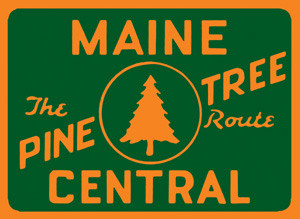
    The Maine Central Railroad was a U. S. class 1 railroad in central and southern Maine. It was chartered in 1856 and began operations in 1862. By 1884, Maine Central was the longest railroad in New England. Maine Central had expanded to 1,358 miles (2,185 km) when the United States Railroad Administration assumed control in 1917. The main line extended from South Portland, Maine, east to the Canada–United States border with New Brunswick, and a Mountain Division extended west from Portland to St. Johnsbury, Vermont, and north into Quebec. The main line was double track from South Portland to Royal Junction, where it split into a "lower road" through Brunswick and Augusta and a "back road" through Lewiston, which converged at Waterville into single track to Bangor and points east. Branch lines served the industrial center of Rumford, a resort hotel on Moosehead Lake and coastal communities from Bath to Eastport.

    <span class="mw-page-title-main">Scouting in Maine</span> Youth movements

    Scouting in Maine dates back to the creation of the Katahdin Area Council in 1920 and has continued prominently to the present day.

    <span class="mw-page-title-main">North Maine Woods</span> Northern geographic area of the state of Maine

    The North Maine Woods is the northern geographic area of the state of Maine in the United States. The thinly populated region is overseen by a combination of private individual and private industrial owners and state government agencies, and is divided into 155 unincorporated townships within the NMW management area. There are no towns or paved roads.

    Baker Mountain is a wild, trail-less mountain located in Beaver Cove, Piscataquis County, Maine. It is flanked to the northwest by Lily Bay Mountain. Elephant Mountain is about 2 miles (3 km) to the southwest, and White Cap Mountain is about 5 miles (8 km) to the east.

    Big Moose Mountain, previously named Big Squaw Mountain, is a mountain located in Piscataquis County, Maine. Big Moose Mountain is flanked to the southeast by Little Moose Mountain.

    Big Spencer Mountain is a mountain located in Piscataquis County, Maine. Big Spencer Mtn. is flanked to the west by Little Spencer Mountain.

    <span class="mw-page-title-main">Sebasticook River</span> River in the United States

    The Sebasticook River is a 76-mile-long (122 km) river in the central part of Maine, in the United States. From its source in Dexter, the upper "Main Stream" section flows generally west and south 30 miles (48 km) to Great Moose Lake. From the outlet of the lake in Hartland, the Sebasticook flows 41 miles (66 km) south to the Kennebec River in Winslow.

    Chesuncook Lake is a reservoir in Piscataquis County, Maine, within the North Maine Woods. The lake was formed by the damming of the West Branch Penobscot River by dams built in 1835, 1903, and 1916 respectively. It is approximately 22 miles (35 km) long and 1–4 miles wide, with a surface area of 25,183 acres (101.91 km2) and a maximum depth of 150 feet (46 m). It is the third-largest body of fresh water in Maine.

    <span class="mw-page-title-main">Pemadumcook Chain of Lakes</span> Body of water

    The Pemadumcook Chain of Lakes are a set of large lakes in north-central Maine in the United States.

    <span class="mw-page-title-main">Moose River (Maine)</span> River in Maine, United States

    The Moose River is an 83-mile-long (134 km) river in Maine. Its source is in Beattie, on the Canada–United States border, which runs along the height of land between the watersheds of the Kennebec River in Maine and the Chaudière River in Quebec. From there, the river runs east through Attean Pond and Wood Pond, past the town of Moose River, then through Long Pond and Brassua Lake. The Moose River empties into Moosehead Lake, the source of the Kennebec River, in Rockwood Strip. The International Railway of Maine was built along Moose River in 1889.

    The Roach River is a river in Piscataquis County, Maine. From the outlet of Third Roach Pond in Shawtown, the river runs 19.1 miles (30.7 km) west, through a chain of ponds. The Flow sequence through the ponds is from the Fourth Roach Pond through the Third Roach Pond, Second Roach Pond, and First Roach Pond to empty into Moosehead Lake, the source of the Kennebec River, in Spencer Bay. The Seventh Roach Pond drains through the Sixth Roach Pond in a separate tributary to the Third Roach Pond. No fifth Roach Pond is shown on modern maps.

    Elephant Mountain is a mountain located in Bowdoin College Grant West Piscataquis County, Maine. It is about 5 miles (8 km) southeast of Moosehead Lake, 2 miles southwest of Baker Mountain, and 5 miles west of White Cap Mountain.

    <span class="mw-page-title-main">Enchanted Pond</span> Body of water

    Enchanted Pond is a mountain pond in the U.S. state of Maine. Situated in the Western Maine Mountains in the Northwest Somerset Region, the pond is located in a deep mountain valley between Coburn Mountain and Shutdown Mountain. Near its southern end, the pond is distinguished by two rockslides from the exposed cliffs of these mountains that extend down into the water along both shores. Enchanted Pond is fed by mountain springs and Little Enchanted Pond, and is the primary source of Enchanted Stream which flows into the Dead River, a tributary of the Kennebec River. Development on the pond is limited to a small set of sporting camps at the northern end of the pond and one remote camp on the southwest shore, both a part of Bulldog Camps. There are no islands in the pond.

    <span class="mw-page-title-main">Natural Resources Council of Maine</span>

    The Natural Resources Council of Maine (NRCM) is a Maine-based, 501(c)(3) non-profit organization, with offices in Augusta, Maine. Founded in 1959 as a small, volunteer-based environmental advocacy group, NRCM has grown to be Maine's largest environmental advocacy organization, with more than 25,000 supporters and activists and a staff of 28, including science and policy experts.

    The Belgrade Lakes are a chain of lakes around Belgrade, Maine. The flow sequence is from East Pond to North Pond to Great Pond to Long Pond to Messalonskee Lake and thence via Messalonskee Stream to the Kennebec River at Waterville. The lakes have long been an important resort area for fishing, boating, and swimming; and shoreline development includes residences for individuals employed in the cities of Waterville and Augusta.

    References

    1. "Four-Star lodging at the Lodge at Moosehead Lake, Greenville, Maine". www.visitingnewengland.com. Retrieved 21 April 2018.
    2. Weber, Alan (2003-04-09). Because It's There: A Celebration of Mountaineering from 200 B.C. to Today. Taylor Trade Publications. ISBN   9780878333035.
    3. "U.S. Climate Normals Quick Access – Station: Moosehead, ME". National Oceanic and Atmospheric Administration. Retrieved March 15, 2023.
    4. "NOAA Online Weather Data – NWS Gray". National Weather Service. Retrieved March 15, 2023.
    5. "Plum Creek: An Update". Natural Resources Council of Maine. Archived from the original on 2013-04-15.
    6. Tanuki (September 29, 2008). "Another Act of Resistance to Plum Creek by Maine Earth First!". Maine Earth First. Archived from the original on July 23, 2011.
    7. "A $75 million ski resort could bring hundreds of jobs to Moosehead region". 20 January 2021.

    Further reading