North Down Borough Council

Last updated

North Down Borough
North Down Council Logo.jpg
North Down Borough Council logo
North Down in Northern Ireland.svg
Area81 km2 (31 sq mi) 
Ranked 26th of 26
District HQ Bangor
Catholic13.5%
Protestant73.2%
Country Northern Ireland
Sovereign state United Kingdom
Councillors
List of places
UK
Northern Ireland

North Down Borough Council was a Local Council in County Down in Northern Ireland. It merged with Ards Borough Council in May 2015 under local government reorganisation in Northern Ireland to become North Down and Ards District Council.

Contents

Its main town was Bangor, 12 miles east of Belfast with a population of approximately 68,000. The council was headquartered in Bangor. Its secondary centre was the former Urban District of Holywood, 8 km northeast of Belfast with a population of approximately 10,000. Most of the remainder of a total population was in suburban villages along the southern shore of Belfast Lough. The area of the former Borough is heavily suburbanised, railway links with Belfast are good and the area has been the domain of Belfast commuters since the mid-19th century. The former Borough is often held to be the wealthiest area in Northern Ireland, although there are pockets of deprivation in a string of overspill public housing estates along the Bangor Ring Road.

The borough consisted of 4 electoral areas: Abbey, Ballyholme and Groomsport, Bangor West and Holywood. In the 2011 election, 25 members were elected from the following political parties: 11 Democratic Unionist Party, 6 Alliance, 4 Ulster Unionists, 1 Green, and 2 Independents. North Down along with Carrickfergus Borough Council were the only councils in Northern Ireland without Nationalist political party representation.

The Borough of North Down was formed in 1973 in the local government reorganisation from the old Bangor Urban District, Holywood Urban District, North Down Rural District and part of Castlereagh Rural District.

In elections for the Westminster Parliament it was part of the slightly larger North Down constituency.

See Also: Districts of Northern Ireland

Summary of seats won 1973–2011

1973 1977 1981 1985 1989 1993 1997 2001 2005 2011
Ulster Unionist (UUP)9748566884
Alliance (APNI)7767456566
Vanguard (VUPP)22
Loyalist (Loy)2
Unionist Party of NI (UPNI)11
United Unionist (UUUP)1
Independent Unionist (IU)111121111
Democratic Unionist (DUP)564325811
Popular Unionist (UPUP)3222
NI Conservatives (Con)642
UK Unionist Party (UKUP)32
Progressive Unionist (PUP)2
Women's Coalition (NIWC)1
Green Party (GP)11
Independent/Other233312

Others include Ann Marie Hillen, who stood under the label Better Bangor Campaign in 1989, having been elected earlier that year in a by-election. Of the candidates elected in 1993, Jimmy White was elected as a Holywood Pool Campaigner and another as Action '93. Alan Chambers, elected at every election from 1993 to 2011, has usually been described on the ballot paper as an Independent, but describes himself on the council website as an Independent Unionist and stood under that label in 1997. [1] He is tallied as Independent Unionist above for all elections.

2011 Election results

Partyseatschange +/-
Democratic Unionist Party 11+3
Alliance Party of Northern Ireland 6
Ulster Unionist Party 4-4
Green Party in Northern Ireland 1
Independent 3+1

Mayor

YearNamePolitical affiliation
1981–82Mary O'Fee UPUP
1985–86Hazel Bradford Ulster Unionist
1990–92 Denny Vitty DUP
1992–93 Leslie Cree Ulster Unionist
1993–94 Brian Wilson Alliance
1994–95 Roy Bradford Ulster Unionist
1995–96Susan O'Brien Alliance
1996–97Irene Cree Ulster Unionist
1997–98Ruby Cooling DUP
1998–99Marsden Fitzsimons Alliance
1999–00Marion Smith Ulster Unionist
2000–01 Alan Chambers Independent
2001–02Ian Henry Ulster Unionist
2002–03Alan Graham DUP
2003–04Anne Wilson Alliance
2004–05Valerie Kinghan UK Unionist
2005–06Roberta Dunlop Ulster Unionist
2006–07Alan Leslie DUP
2007–08 Stephen Farry Alliance
2008–09 Leslie Cree Ulster Unionist
2009–10Tony Hill Alliance
2010–11John Montgomery DUP
2011–12James McKerrow Ulster Unionist
2012–13Wesley Irvine DUP
2013–14Andrew Muir Alliance
2014–15Peter Martin DUP

Review of Public Administration

Under the Review of Public Administration (RPA) the council was due to merge with Ards in 2011 to form a single council for the enlarged area totalling 451 km2 and a population of 149,567. [2] The next election was due to take place in May 2009, but on 25 April 2008, Shaun Woodward, Secretary of State for Northern Ireland announced that the scheduled 2009 district council elections were to be postponed until the introduction of the eleven new councils in 2011. [3] It took place in 2015.

Population

The area covered by North Down Borough Council had a population of 78,937 residents according to the 2011 Northern Ireland census. [4]

Related Research Articles

<span class="mw-page-title-main">County Down</span> County in Northern Ireland

County Down is one of the six counties of Northern Ireland, one of the nine counties of Ulster and one of the traditional thirty-two counties of Ireland. It covers an area of 961 sq mi (2,490 km2) and has a population of 531,665. It borders County Antrim to the north, the Irish Sea to the east, County Armagh to the west, and County Louth across Carlingford Lough to the southwest.

<span class="mw-page-title-main">Castlereagh (borough)</span> District of Northern Ireland (1973–2015)

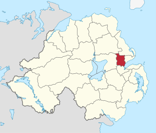
Castlereagh was a local government district with the status of borough in Northern Ireland. It merged with Lisburn City Council in May 2015 under local government reorganisation in Northern Ireland to become Lisburn and Castlereagh City Council, with a small amount being transferred to Belfast City Council.

<span class="mw-page-title-main">Magherafelt District Council</span> Human settlement in Northern Ireland

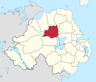
Magherafelt District Council was a district council in County Londonderry in Northern Ireland. It was merged with Cookstown District Council and Dungannon and South Tyrone Borough Council on 1 April 2015 under local government reorganisation in Northern Ireland becoming Mid-Ulster District Council.

<span class="mw-page-title-main">Ards (borough)</span> District of Northern Ireland (1973–2015)

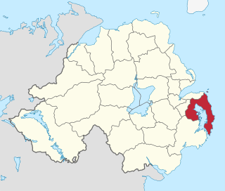
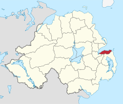
Ards was a local government district in Northern Ireland with the status of borough. It was one of twenty-six districts formed on 1 October 1973, and had its headquarters in Newtownards. It was merged with neighbouring North Down on 1 May 2015 to form the new Borough of Ards and North Down. Other towns in the defunct Borough included Portaferry, Comber, and Donaghadee, and the population of the area was 78,078 according to the 2011 census.

<span class="mw-page-title-main">Newtownabbey Borough Council</span> Human settlement in Northern Ireland

Newtownabbey Borough Council was a Local Authority in County Antrim in Northern Ireland, on the north shore of Belfast Lough just immediately north of Belfast. The Council merged with Antrim Borough Council in April 2015 under local government reform in Northern Ireland to form Antrim and Newtownabbey Borough Council.

<span class="mw-page-title-main">North Down (UK Parliament constituency)</span> Parliamentary constituency in the United Kingdom, 1950 onwards

North Down is a parliamentary constituency in the United Kingdom House of Commons. The current MP is Stephen Farry of the Alliance Party. Farry was elected to the position in the 2019 general election, replacing the incumbent Sylvia Hermon. Hermon had held the position since being elected to it in the 2001 general election, but chose not to contest in 2019.

The Green Party Northern Ireland is a political party in Northern Ireland. Like many green political parties around the world, its origins lie in the anti-nuclear, labour and peace movements of the 1970s and early 1980s.

<span class="mw-page-title-main">Armagh City and District Council</span> Human settlement in Northern Ireland

Armagh City and District Council was a district council in County Armagh in Northern Ireland. It merged with Banbridge District Council and Craigavon Borough Council in May 2015 under local government reorganisation in Northern Ireland to become Armagh, Banbridge and Craigavon District Council.

<span class="mw-page-title-main">Belfast City Council</span> Local authority in Northern Ireland

Belfast City Council is the local authority with responsibility for part of the city of Belfast, the capital and largest city of Northern Ireland. The council serves an estimated population of 341,877 (2019), the largest of any district council in Northern Ireland, while being the smallest by area. Belfast City Council is the primary council of the Belfast Metropolitan Area, a grouping of six former district councils with commuter towns and overspill from Belfast, containing a total population of 579,276.

<span class="mw-page-title-main">Craigavon Borough Council</span> Human settlement in Northern Ireland

Craigavon Borough Council was a local council in counties Armagh, Down and Antrim, in Northern Ireland. It merged with Armagh City and District Council and Banbridge District Council in May 2015 under local government reorganisation in Northern Ireland to become Armagh, Banbridge and Craigavon District Council.

<span class="mw-page-title-main">Lisburn City Council</span> Former city council in Counties Antrim and Down

Lisburn City Council was the local authority for an area partly in County Antrim and partly in County Down in Northern Ireland. As of May 2015 it was merged with Castlereagh Borough Council as part of the reform of local government in Northern Ireland to become Lisburn and Castlereagh City Council.

<span class="mw-page-title-main">Groomsport</span> Human settlement in Northern Ireland

Groomsport is a village and townland two miles north east of Bangor in County Down, Northern Ireland. It is on the south shore of Belfast Lough and on the north coast of the Ards Peninsula. Groomsport has a population of 3,005 people according to the 2011 Census. It is part of the Ards and North Down Borough.

<span class="mw-page-title-main">Helen's Bay</span> Human settlement in Northern Ireland

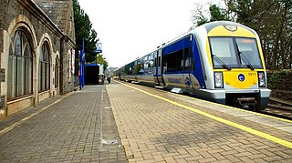
Helen's Bay is a village on the northern coast of County Down, Northern Ireland. It is within the townland of Ballygrot, between Holywood, Crawfordsburn and Bangor. It is served by a railway station and had a population of 1,390 in the 2011 Census. It is part of the Ards and North Down Borough Council area.

Alderman Robin Leslie Cree, MBE is a Unionist politician from Northern Ireland. He was an Ulster Unionist Party MLA for North Down from 2003 to 2016.

Ballymena Borough Council was the local authority of Ballymena in Northern Ireland. It merged with Carrickfergus Borough Council and Larne Borough Council in May 2015 under local government reorganisation in Northern Ireland to become Mid and East Antrim Borough Council.

David Rose is a unionist politician in Northern Ireland.

<span class="mw-page-title-main">2014 North Down and Ards District Council election</span>

The first election to North Down and Ards District Council, part of the Northern Ireland local elections on 22 May 2014, returned 40 members to the newly formed council via Single Transferable Vote. The Democratic Unionist Party won a plurality of first-preference votes and seats.

<span class="mw-page-title-main">Alan Chambers (Northern Ireland politician)</span> Politician from Northern Ireland (born 1947)

Alan Chambers is a politician from Northern Ireland. Since the 2016 election he has served as an Ulster Unionist Party (UUP) MLA for North Down.

Andrew Muir is a Northern Irish politician who is an Alliance Party Member of the Legislative Assembly (MLA) for North Down. He was appointed as an MLA following incumbent Alliance MLA Stephen Farry's election as MP for North Down in the 2019 UK general election, and elected in the constituency in the 2022 Northern Ireland Assembly election.

References

  1. North Down council election results 1993–2011, ARK, accessed 13 January 2013
  2. "Minister Foster announces decisions on Local Government Reform". DoE. Archived from the original on 18 July 2011. Retrieved 31 May 2008.
  3. Northern Ireland elections are postponed, BBC News, April 25, 2008, accessed April 27, 2008
  4. "NI Census 2011 - Key Statistics Summary Report, September 2014" (PDF). NI Statistics and Research Agency. Retrieved 28 September 2014.

54°37′34″N5°40′23″W / 54.626°N 5.673°W / 54.626; -5.673