Related Research Articles
The Levant is the area in Southwest Asia, south of the Taurus Mountains, bounded by the Mediterranean Sea in the west, the Arabian Desert in the south, and Mesopotamia in the east. It stretches roughly 400 mi (640 km) north to south, from the Taurus Mountains to the Sinai desert and Hejaz, and east to west between the Mediterranean Sea and the Khabur river. The term is often used to refer to the following regions or modern states: the Hatay Province of Turkey, Syria, Lebanon, Israel, Palestine, and Jordan. The term sometimes include Cilicia, Cyprus and the Sinai Peninsula.

The Levant is an approximate historical geographical term referring to a large area in the Eastern Mediterranean region of West Asia and core territory of the political term Middle East. In its narrowest sense, which is in use today in archaeology and other cultural contexts, it is equivalent to Cyprus and a stretch of land bordering the Mediterranean Sea in western Asia: i.e. the historical region of Syria, which includes present-day Israel, Jordan, Lebanon, Syria, the Palestinian territories and most of Turkey southwest of the middle Euphrates. Its overwhelming characteristic is that it represents the land bridge between Africa and Eurasia. In its widest historical sense, the Levant included all of the Eastern Mediterranean with its islands; that is, it included all of the countries along the Eastern Mediterranean shores, extending from Greece in Southern Europe to Cyrenaica, Eastern Libya in Northern Africa.

The Fertile Crescent is a crescent-shaped region in the Middle East, spanning modern-day Iraq, Israel, Jordan, Lebanon, Palestine, and Syria, together with northern Kuwait, south-eastern Turkey, and western Iran. Some authors also include Cyprus and northern Egypt.

Canaan was a Semitic-speaking civilization and region of the Southern Levant in the Ancient Near East during the late 2nd millennium BC. Canaan had significant geopolitical importance in the Late Bronze Age Amarna Period as the area where the spheres of interest of the Egyptian, Hittite, Mitanni, and Assyrian Empires converged or overlapped. Much of present-day knowledge about Canaan stems from archaeological excavation in this area at sites such as Tel Hazor, Tel Megiddo, En Esur, and Gezer.
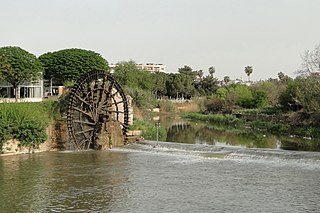
The Orontes or Asi is a 571 kilometres (355 mi) long river in Western Asia that begins in Lebanon, flowing northwards through Syria before entering the Mediterranean Sea near Samandağ in Hatay Province, Turkey.

The Southern Levant is a geographical region encompassing the southern half of the Levant. It corresponds approximately to modern-day Israel, Palestine, and Jordan; some definitions also include southern Lebanon, southern Syria and/or the Sinai Peninsula. As a strictly geographical description, it is sometimes used by archaeologists and historians to avoid the religious and political connotations of other names for the area.

Near Eastern archaeology is a regional branch of the wider, global discipline of archaeology. It refers generally to the excavation and study of artifacts and material culture of the Near East from antiquity to the recent past.

Tell Leilan is an archaeological site situated near the Wadi Jarrah in the Khabur River basin in Al-Hasakah Governorate, northeastern Syria. The site has been occupied since the 5th millennium BC. During the late third millennium, the site was known as Shekhna. During that time it was under control of the Akkadian Empire and was used as an administrative center. Around 1800 BC, the site was renamed "Shubat-Enlil" by the king Shamshi-Adad I, and it became his residential capital. Shubat-Enlil was abandoned around 1700 BC.

Jabal Amil, also spelled Jabal Amel and historically known as Jabal Amila, is a cultural and geographic region in Southern Lebanon largely associated with its long-established, predominantly Twelver Shia Muslim inhabitants. Its precise boundaries vary, but it is generally defined as the mostly highland region on either side of the Litani River, between the Mediterranean Sea in the west and the Wadi al-Taym, Beqaa and Hula valleys in the east.

The Upper Galilee is a geographical region located in northern Israel. Part of the larger Galilee region, it is characterized by its higher elevations and mountainous terrain. The term "Upper Galilee" is ancient, and has been in use since the end of the Second Temple period. From a political perspective, the Upper Galilee is situated within the administrative boundaries of the Northern District.

In the archaeology of Southwest Asia, the Late Neolithic, also known as the Ceramic Neolithic or Pottery Neolithic, is the final part of the Neolithic period, following on from the Pre-Pottery Neolithic and preceding the Chalcolithic. It is sometimes further divided into Pottery Neolithic A (PNA) and Pottery Neolithic B (PNB) phases.

Sunni Islam is a major religion in Palestine, being the religion of the majority of the Palestinian population. Muslims comprise 85% of the population of the West Bank, when including Israeli settlers, and 99% of the population of the Gaza Strip. The largest denomination among Palestinian Muslims are Sunnis, comprising 98–99% of the total Muslim population.
The Assyrian conquest of Aram concerns the series of conquests of largely Aramean, Phoenician, Sutean and Neo-Hittite states in the Levant by the Neo-Assyrian Empire. This region was known as Eber-Nari and Aram during the Middle Assyrian Empire and the Neo-Assyrian Empire.

Syria or Sham is a historical region located east of the Mediterranean Sea in West Asia, broadly synonymous with the Levant. Other synonyms are Greater Syria or Syria-Palestine. The region boundaries have changed throughout history. In modern times, the term "Syria" alone is used to refer to the Syrian Arab Republic.
Tel Burga is an archaeological site in the Sharon Plain 1 km east of Binyamina, Israel.

Abdashtart I was a king of the Phoenician city-state of Sidon who reigned from 365 BC to 352 BC following the death of his father, Baalshillem II.
Ain ez Zarqa is a natural artesian karst spring located south of Hermel in the Beqaa Governorate, in central Lebanon. Producing an average of 3,435 gallons per second, it is the main source of the Orontes River. Because of its heavy flow, it is characterized as a first-magnitude spring. It sits beneath the caves at Deir Mar Maroun, an ancient monastery carved into the cliffs that surround the spring. Melting snow from these nearby heights supplements the spring's large groundwater reservoir, in the Jurassic and Cretaceous strata. It is estimated that the spring's phreatic zone reservoir contains as much as 10 billion cubic metres of storage. As a result, its flow has been less affected by overpumping and drought than other springs in the Orontes river basin.
The Hittite Navy was the main naval force of the Hittites from ca. 16th–12th century BC. The navy took part in three land and sea military campaigns of the Hittite Kingdom against the Kingdom of Alashiya between 1275 and 1205 BC. It was also one of the main adversaries of the Egyptian Navy.

The Temple of the Obelisks, also known as the L-shaped Temple and Temple of Resheph was an important Bronze Age temple structure in the World Heritage Site of Byblos. It is considered "perhaps the most spectacular" of the ancient structures of Byblos. It is the best preserved building in the Byblos archaeological site.

The Temple of Baalat Gebal was an important Bronze Age temple structure in the World Heritage Site of Byblos. The temple was dedicated to Ba'alat Gebal, the goddess of the city of Byblos, known later to the Greeks as Atargatis. Built in 2800 BCE, it was the largest and most important sanctuary in ancient Byblos, and is considered to be "one of the first monumental structures of the Syro-Palestinian region". Two centuries after the construction of the Temple of Baalat Gebal, the Temple of the Obelisks was built approximately 100m to the east.