Orange Line (Washington Metro)

Last updated

WMATA Orange.svg Orange Line
WMATA Orange Line at Smithsonian.jpg
An Orange Line train at Smithsonian station in July 2019
Overview
StatusOperating
Locale Fairfax County
Arlington
Washington, D.C.
Prince George's County, MD
Termini
Stations26
Service
Type Rapid transit
System Washington Metro
Operator(s) Washington Metropolitan Area Transit Authority
Rolling stock 3000-series, 6000-series, 7000-series
History
OpenedNovember 20, 1978;45 years ago (November 20, 1978)
Technical
Line length26.4 mi (42.5 km)
Number of tracks2
CharacterAt-grade, elevated, and underground
Track gauge 4 ft 8+14 in (1,429 mm)
Electrification Third rail,  750 V DC
Route map
Orange Line (Washington Metro) Orange Line highlighted in orange
BSicon dRP4q.svg
BSicon vRP2yRP4+r.svg
BSicon KBHFa carrot.svg
BSicon vRP2BHF.svg
Vienna
BSicon BHF carrot.svg
BSicon vRP2HST.svg
Dunn Loring
BSicon hvSTRae~LL.svg
BSicon RP4e.svg
BSicon STR carrot.svg
BSicon lhvSTRae.svg
BSicon vRP2.svg
BSicon hvSTRae~RR.svg
BSicon RP4w.svg
BSicon uSTR+l.svg
BSicon STR carrot.svg
BSicon vRP2.svg
BSicon uYRDq.svg
Falls Church Yard
BSicon BHF carrot.svg
BSicon vRP2HST.svg
West Falls Church
BSicon STR+l grey.svg
BSicon STR carrot.svg
BSicon tSTR+l grey.svg
BSicon vRP2.svg
BSicon CONTfq grey.svg
WMATA Silver.svg to Ashburn
BSicon INT black.svg
BSicon vRP2BHF.svg
East Falls Church
BSicon STR black.svg
BSicon vRP2yRP4l.svg
BSicon RP4+r.svg
BSicon tBHFa@g black.svg
BSicon MFADEf.svg
BSicon LRP4.svg
Ballston–MU
BSicon tBHF black.svg
Virginia Square–GMU
BSicon tBHF black.svg
Clarendon
BSicon tBHF black.svg
Court House
BSicon tCONTgq denim.svg
BSicon tSTR black.svg
BSicon tSTR+r denim.svg
BSicon tINT black.svg
BSicon MFADEg.svg
BSicon LRP4.svg
Rosslyn
BSicon RP4+l.svg
BSicon tSKRZ-G4 black.svg
BSicon RP4rf.svg
BSicon bGRZq.svg
BSicon RP4oW.svg
BSicon tKRZW black.svg
VA
DC
BSicon MFADEf.svg
BSicon RP4.svg
BSicon tBHF black.svg
Foggy Bottom–GWU
BSicon tBHF black.svg
BSicon HUB2.svg
BSicon KGRZ2.svg
BSicon HUBc3.svg
Farragut West
BSicon tkSTRc2 red.svg
BSicon tkSTR3+l red.svg
BSicon HUBc1.svg
BSicon utdSTRc2.svg
BSicon tdSTR black.svg
BSicon utdSTR3+l.svg
BSicon tBHFq red.svg
BSicon HUB4.svg
BSicon KGRZ4.svg
BSicon tdCONTfq red.svg
BSicon tkSTR+1 red.svg
BSicon tdSTR black.svg
BSicon utdSTR+1.svg
BSicon utSTRc4.svg
BSicon tkSTR2 red.svg
BSicon tBHF black.svg
McPherson Square
BSicon tkSTRc1 red.svg
BSicon tINT black.svg
BSicon tkSTRl+4 red.svg
BSicon tCONTfq red.svg
Metro Center
( WMATA Red.svg to Glenmont )
BSicon tBHF black.svg
Federal Triangle
BSicon tBHF black.svg
Smithsonian
BSicon CONT4+l.svg
BSicon mtKRZ black+.svg
BSicon 3STR2+r.svg
RF&P Subdivision
to Virginia
BSicon tCONTgq black.svg
BSicon KGRZ2.svg
BSicon tINTq black.svg
BSicon HUB2.svg
BSicon tSTR black.svg
BSicon v-3STR.svg
BSicon HUBc3.svg
BSicon tSTRq black.svg
BSicon tdCONTfq black.svg
L'Enfant Plaza
( WMATA Green.svg WMATA Yellow.svg )
BSicon kSTRc2.svg
BSicon kSTR3+l.svg
BSicon HUBc1.svg
BSicon tSTR black.svg
BSicon 3HSTr+1.svg
BSicon HUB4.svg
BSicon KGRZ4.svg
BSicon kSTR+1.svg
BSicon tBHF black.svg
Federal Center SW
BSicon dRP4q.svg
BSicon PORTALl.svg
BSicon SKRZ-G4o.svg
BSicon tRP4q.svg
BSicon tSTR black.svg
BSicon tRP4q.svg
BSicon ABZgl.svg
BSicon tSTRa@gq.svg
BSicon tSTR black.svg
BSicon tCONTfq.svg
BSicon STR.svg
BSicon tBHF black.svg
Capitol South
BSicon dCONTgq.svg
BSicon STRr.svg
BSicon tSTR black.svg
BSicon tBHF black.svg
Eastern Market
BSicon tBHF black.svg
Potomac Avenue
BSicon tINT black.svg
Stadium–Armory
BSicon dWASSERq.svg
BSicon hPORTALg.svg
BSicon hKRZW black.svg
BSicon dWASSERq.svg
BSicon hPSLm black.svg
BSicon tdCONTgq black.svg
BSicon tSTReq black.svg
BSicon STR carrot.svg
BSicon STRr black.svg
BSicon lhABZgr.svg
BSicon RP4e.svg
BSicon hSKRZ-G4e carrot.svg
BSicon RP4w.svg
BSicon BHF carrot.svg
Minnesota Avenue
BSicon BHF carrot.svg
Deanwood
BSicon STR carrot+GRZq.svg
DC
MD
BSicon CONTgq.svg
BSicon mKRZ2+ro carrot+.svg
BSicon STRc3.svg
BSicon STRc1.svg
BSicon STR carrot.svg
BSicon ABZ4+fl.svg
BSicon dCONTfq.svg
BSicon STR carrot.svg
BSicon ABZg+l.svg
BSicon dCONTfq.svg
BSicon BHF carrot.svg
BSicon cSTRc2.svg
BSicon dSTR3.svg
Cheverly
BSicon BHF carrot.svg
BSicon dSTR+1.svg
BSicon STRc4.svg
Landover
BSicon RP4e.svg
BSicon dSKRZ-G4hl carrot.svg
BSicon dSKRZ-G4hr.svg
BSicon dRP4q.svg
BSicon dKINTe-L carrot.svg
BSicon udKINTa.svg
BSicon dINT-R.svg
New Carrollton
MARC train.svg BSicon LOGO Amtrak2.svg
BSicon STR~L.svg
BSicon uYRD.svg
BSicon STR~R.svg
New Carrollton Yard
BSicon STRl.svg
BSicon dCONTfq.svg
BSicon STRq black.svg
Multiple services sharing track

Wheelchair symbol.svg All stations are accessible
Washington Metro system map Washington Metro diagram sb.svg
Washington Metro system map

The Orange Line is a rapid transit line of the Washington Metro system, consisting of 26 stations in Fairfax County and Arlington in Northern Virginia; Washington, D.C.; and Prince George's County, Maryland, United States. The Orange Line runs from Vienna in Virginia to New Carrollton in Maryland. Half of the line's stations are shared with the Blue Line and over two thirds are shared with the Silver Line. Orange Line service began on November 20, 1978.

Contents

History

20th century

In 1955, planning for Metro began with the Mass Transportation Survey, which attempted to forecast both freeway and mass transit systems sufficient to meet the needs of transportation in 1980. [1] In 1959, the study's final report included two rapid transit lines which anticipated subways in downtown Washington. [2] Because the plan called for extensive freeway construction within Washington, D.C., alarmed residents lobbied for federal legislation creating a moratorium on freeway construction through July 1, 1962. [3] The National Capital Transportation Agency's 1962 Transportation in the National Capital Region report anticipated much of the present Orange Line route in Virginia with the route following the median strip of Interstate 66 both inside Arlington and beyond. [4] The route continued in rapid transit plans until the formation of the Washington Metropolitan Area Transit Authority (WMATA).

With the formation of WMATA in October 1966, planning of the system shifted from federal hands to a regional body with representatives of the District, Maryland and Virginia. Congressional route approval was no longer a key consideration. [5] Instead, routes had to serve each local suburban jurisdiction to assure that they would approve bond referendums to finance the system. [6] Because the least expensive way to build into the suburbs was to rely upon existing railroad right-of-ways, the Orange Line took much of its present form, except that it also featured a further extension along the railroad to Bowie, Maryland and along the Dulles Access Road to Dulles International Airport. [7]

By 1966, WMATA and Arlington County planners had agreed "to realign the rapid transit through high-density commercial-office-apartment areas in the vicinity of Wilson Boulevard instead of the freeway's median between the river and Glebe Road." [8] As a result of this agreement, the Orange Line follows in Arlington the former routes of an interurban electric trolley line, the Fairfax line and the North Arlington branch of the Washington, Arlington & Falls Church Railway, that had initially spurred those areas' development. [9]

In March 1968, WMATA approved its Adopted Regional System (ARS) plan that included suburban mass transit lines that followed the median of the proposed Interstate 66 through Virginia to Vienna and the CSX/Amtrak railroad right-of-way in Prince George's County, Maryland. [10] The construction of the downtown Washington sections of the Orange and Blue lines began simultaneously with the Red line. A joint ground-breaking ceremony was held on December 9, 1969. [10] Service on the joint downtown track was at first branded as just the Blue Line and commenced on July 1, 1977. [10]

In 1976, Robert Patricelli, federal Urban Mass Transportation Administrator, ordered Metro to conduct an alternatives analysis of the portion of its system that was not already under contract. [11] Because the Tysons area of Fairfax County developed significantly since the ARS was adopted in 1968, the analysis considered rerouting the Orange line to serve Tysons Corner at an additional cost of $60 million. However, because environmental impact statements had already been completed for the Vienna route, a change in the route would result in a five-year delay in the construction of the Orange Line west of Ballston. This prompted the City of Falls Church to sue WMATA for breach of contract. In the end, WMATA kept the Vienna route intact, leaving Tysons without Metrorail service until 2014. [12] [13]

Service on the Orange Line began on November 20, 1978 between National Airport and New Carrollton, with five new stations being added to the existing network from Stadium–Armory. When the line from Rosslyn to Ballston-MU was completed on December 11, 1979, Orange Line trains began following this route rather than going to the National Airport station. The line was completed on June 7, 1986, when it was extended by four stations to Vienna in the I-66 median. [10]

On January 13, 1982, an Orange Line train derailed as it was being backed up from an improperly closed rail switch between the Federal Triangle and Smithsonian stations, resulting in the deaths of three passengers. [14] It was the first incident within the Metro system that caused a fatality, [14] and the deadliest incident occurring in the system until the 2009 collision that resulted in nine fatalities. [15]

21st century

Between 2011 and 2013, service was interrupted at stations west of Ballston–MU station on designated weekends to accommodate the construction of the interconnection of the Silver Line with the existing Orange Line tracks. [16] [17] [18] As a part of this project, the train yard adjacent to the West Falls Church station on the Orange Line was expanded. [19] [20]

On July 26, 2014, Orange Line stations between East Falls Church and Stadium-Armory began to serve Silver Line trains.

From March 26, 2020 until June 28, 2020, trains were bypassing East Falls Church, Virginia Square–GMU, Clarendon, Federal Triangle, Smithsonian, Federal Center SW, and Cheverly stations due to the 2020 coronavirus pandemic. [21] [22] All stations reopened on June 28, 2020. [23]

From May 23 until August 15, 2020, trains terminated at Ballston–MU due to platform reconstruction at East Falls Church, West Falls Church, Dunn Loring, and Vienna. [24] [25] The original plan called for trains to terminate at West Falls Church, but this was instead changed to Ballston due to effects of the ongoing COVID-19 pandemic and low ridership. Shuttle buses were provided to the closed stations. On August 16, 2020, all Orange line trains began terminating at West Falls Church while bypassing East Falls Church. [26] East Falls Church reopened on August 23, 2020. [27] On September 8, 2020, Vienna and Dunn Loring stations reopened. [28]

Between May 28 and September 5, 2022, all Orange Line trains were terminating at Stadium–Armory station on weekdays and Ballston–MU station on weekends due to the Platform Improvement Project which closed stations north of Stadium–Armory station. Shuttle buses are provided to all closed stations. [29]

On June 3, 2023, service was suspended west of Ballston–MU station for track replacement. East Falls Church and West Falls Church reopened on June 26, 2023. Dunn Loring and Vienna reopened on July 17, 2023. [30]

Route

Vienna, the western terminus of the Orange Line 2018-10-23 12 15 37 View east along the eastbound lanes of Interstate 66 and the Orange Line of the Washington Metro from the overpass for Vaden Drive (Virginia State Route 6731) in Oakton, Fairfax County, Virginia.jpg
Vienna, the western terminus of the Orange Line

Starting at its western terminus at the Vienna/Fairfax-GMU station in Virginia, the tracks run on the median strip of Interstate 66 meeting up with the Silver Line immediately after West Falls Church until they enter a tunnel under Fairfax Drive just before the Ballston–MU station. [31] At the Clarendon station, the tunnel shifts to Wilson Blvd. and 16th Street North. [31] The tunnel then turns north and merges with the Blue Line just before entering the Rosslyn station which is located under North Lynn Street. [31] The tunnel continues under the Potomac River and bends to the east to travel under I Street NW in the District of Columbia towards Foggy Bottom–GWU. [31] The tunnel continues east under I Street and between Farragut West and McPherson Square stations There is a non-revenue branch track on the westbound track that connects to the Northwest bound track before Farragut North on the Red Line. The tunnel then turns south under 12th Street Northwest and enters the lower level of the Metro Center station underneath the Red Line. [31] After Smithsonian station, the tunnel turns east under D Street Southwest and then southeast under Pennsylvania Avenue Southeast before reaching L’Enfant Plaza underneath the Green and Yellow Lines. [31] Continuing east towards Potomac Avenue station, the tunnel briefly travels under G Street Southeast and then turns northwest under Potomac Avenue with a turn to the north to travel under 19th Street Southeast for the Stadium-Armory station. [31] The tunnel then travels under the RFK Stadium parking lots to surface near Benning Road. [31] The elevated tracks follow Benning Road across the Anacostia River and then would go on to part ways from the Blue and Silver Lines.

After parting with the Blue and Silver lines which descend back underground, the above ground tracks continue for the Orange Line only along DC Route 295 between Minnesota Avenue and Deanwood stations and then follow the CSX/Amtrak/MARC railroad in Prince George’s County to serve Cheverly then Landover before reaching the eastern terminus at New Carrollton. [31]

The route includes storage yards adjacent to West Falls Church and just beyond New Carrollton. [19] Orange Line service travels along the entirety of the K Route (from the terminus at Vienna/Fairfax-GMU to the C & K junction just south of Rosslyn), part of the C Route (from the C & K junction just south of Rosslyn to Metro Center), and the entire D Route (from Metro Center to New Carrollton). [32]

The Orange Line needs 30 trains (9 eight-car trains and 21 six-car trains, consisting of 198 rail cars) to run at peak capacity. [33]

Stations

The following stations are along the line, from west to east:

StationCodeOpenedTerrainOther Metro
Lines
Notes
Vienna K08June 7, 1986surface;
median of I-66
Western terminus
Dunn Loring K07
West Falls Church K06
East Falls Church K05 WMATA Silver.svg Transfer station for the Silver Line (western)
Ballston–MU K04December 11, 1979underground
Virginia Square–GMU K03
Clarendon K02
Court House K01
Rosslyn C05July 1, 1977 WMATA Silver.svg WMATA Blue.svg Transfer station for the Blue Line (western).
Foggy Bottom–GWU C04
Farragut West C03Walking transfer to Red Line at Farragut North (branded as "Farragut Crossing")
McPherson Square C02
Metro Center C01 WMATA Red.svg WMATA Orange.svg WMATA Blue.svg Transfer station for Red Line
Federal Triangle D01 WMATA Silver.svg WMATA Blue.svg
Smithsonian D02
L'Enfant Plaza D03 WMATA Silver.svg WMATA Blue.svg WMATA Yellow.svg WMATA Green.svg Virginia Railway Express.svg at L'Enfant
transfer station for the Yellow and Green Lines
Federal Center SW D04 WMATA Silver.svg WMATA Blue.svg
Capitol South D05
Eastern Market D06
Potomac Avenue D07
Stadium–Armory D08Transfer station for the Silver and Blue lines (east)
Minnesota Avenue D09November 20, 1978surface
Deanwood D10
Cheverly D11
Landover D12
New Carrollton D13 BSicon LOGO Amtrak2.svg Amtrak Northeast Regional, Palmetto, Vermonter
MARC train.svg MARC Penn Line
  MTA Purple Line (planned)
Eastern terminus
Unused bridge pier east of West Falls Church station, now used for a bridge connecting the Silver Line to the Orange Line. Silver Line bridge pier stub near West Falls Church station (2010).jpg
Unused bridge pier east of West Falls Church station, now used for a bridge connecting the Silver Line to the Orange Line.

Future

The Virginia Department of Transportation (VDOT) announced on January 18, 2008 that it and the Virginia Department of Rail and Public Transportation (VDPRT) had begun work on a draft environmental impact statement (EIS) for the I-66 corridor in Fairfax and Prince William counties. According to VDOT the EIS, officially named the I-66 Multimodal Transportation and Environment Study, would focus on improving mobility along I-66 from the Capital Beltway (I-495) interchange in Fairfax County to the interchange with U.S. Route 15 in Prince William County. The EIS also allegedly includes a four station extension of the Orange Line past Vienna. The extension would continue to run in the I-66 median and would have stations at Chain Bridge Road, Fair Oaks, Stringfellow Road and Centreville near Virginia Route 28 and U.S. Route 29. [34] [35] Also, plans to extend Orange Line to Bowie have been proposed. In its final report published June 8, 2012, the study and analysis revealed that an "extension would have a minimal impact on Metrorail ridership and volumes on study area roadways inside the Beltway and would therefore not relieve congestion in the study corridor." [36]

Related Research Articles

<span class="mw-page-title-main">Washington Metro</span> Rapid transit system serving the Washington metropolitan area

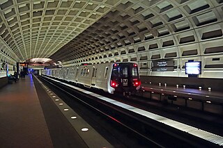
The Washington Metro, often abbreviated as the Metro and formally the Metrorail, is a rapid transit system serving the Washington metropolitan area of the United States. It is administered by the Washington Metropolitan Area Transit Authority (WMATA), which also operates the Metrobus service under the Metro name. Opened in 1976, the network now includes six lines, 98 stations, and 129 miles (208 km) of route.

<span class="mw-page-title-main">Blue Line (Washington Metro)</span> Washington Metro rapid transit line

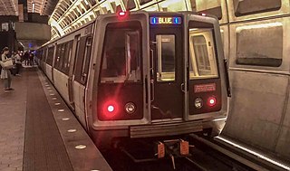
The Blue Line is a rapid transit line of the Washington Metro system, consisting of 28 stations in Fairfax County, Alexandria and Arlington, Virginia; Washington, D.C.; and Prince George's County, Maryland, United States. The Blue Line runs from Franconia–Springfield to Downtown Largo. The line shares track with the Orange Line for 13 stations, the Silver Line for 18, and the Yellow Line for 7. Only 3 stations are exclusive to the Blue Line.

<span class="mw-page-title-main">Red Line (Washington Metro)</span> Washington Metro rapid transit line

The Red Line is a rapid transit line of the Washington Metro system, consisting of 27 stations in Montgomery County, Maryland, and Washington, D.C., in the United States. It is a primary line through downtown Washington and the oldest and busiest line in the system. It forms a long, narrow "U," capped by its terminal stations at Shady Grove and Glenmont.

<span class="mw-page-title-main">Yellow Line (Washington Metro)</span> Washington Metro rapid transit line

The Yellow Line is a rapid transit line of the Washington Metro system that runs between Huntington in Virginia and Mount Vernon Square in Washington, D.C. It consists of 13 stations in Fairfax County, the city of Alexandria, and Arlington County in Virginia, and Washington, D.C. It is the shortest line in the system, and since its truncation to Mount Vernon Square, it is the only line that does not enter Maryland.

<span class="mw-page-title-main">Vienna station (Washington Metro)</span> Washington Metro station

Vienna station is a Washington Metro station on the Orange Line in Fairfax, Virginia. The station is in the median of Interstate 66 at Nutley Street, also known as Virginia State Route 243, in Fairfax.

<span class="mw-page-title-main">Dunn Loring station</span> Washington Metro station

Dunn Loring station is a Washington Metro station in Fairfax County, Virginia, on the Orange Line. The station is in Merrifield, with a Vienna mailing address. The station is in the median of Interstate 66 at Gallows Road, just outside the Capital Beltway, and is accessed by a footbridge over the eastbound lanes.

<span class="mw-page-title-main">West Falls Church station</span> Washington Metro station

West Falls Church station is a Washington Metro station in Idylwood, Virginia on the Orange Line, the first station inside the Capital Beltway on the Orange Line going east. It is one of only two stations in the system to have three tracks, the other being the National Airport station. The center track is used for storage and relaying trains to the adjacent Falls Church Yard.

<span class="mw-page-title-main">East Falls Church station</span> Washington Metro station

East Falls Church station is an island platformed Washington Metro station in Arlington County, Virginia, on the Orange and Silver Lines. East Falls Church station is the last aboveground, at-grade, or open-cut station for eastbound trains. East of this station, the trains enter tunnels.

<span class="mw-page-title-main">Ballston–MU station</span> Washington Metro station

Ballston–MU station is a side platformed Washington Metro station in the Ballston section of Arlington County, Virginia. The station opened on December 1, 1979, and is operated by the Washington Metropolitan Area Transit Authority (WMATA). The station is part of the Orange and Silver Lines and serves the transit-oriented community of Ballston, Ballston Quarter, and Marymount University (MU).

<span class="mw-page-title-main">Virginia Square–GMU station</span> Washington Metro station

Virginia Square–GMU station is a Washington Metro station in the Virginia Square neighborhood of Arlington, Virginia, United States. The side platformed station opened on December 1, 1979, and is operated by the Washington Metropolitan Area Transit Authority (WMATA). The station serves the Orange and Silver Lines. The station serves the Virginia Square neighborhood as well as the Arlington campus of George Mason University (GMU). The station entrance is located at the intersection of Fairfax Drive and North Monroe Street.

<span class="mw-page-title-main">Rosslyn station</span> Washington Metro station

Rosslyn station is the westernmost station on the shared segment of the Blue, Orange, and Silver lines of the Washington Metro. It is located in the Rosslyn neighborhood of Arlington County, Virginia. Rosslyn is the first station in Virginia heading westward from Washington, D.C. on the Orange and Silver Lines and southward on the Blue Line. It is one of four interchange points on the Metrorail system west of the Potomac River and located in a growing business district.

<span class="mw-page-title-main">Ballston, Virginia</span> Neighborhood in Arlington, Virginia

Ballston is a neighborhood in Arlington County, Virginia. Ballston is located at the western end of the Rosslyn-Ballston corridor. It is a major transportation hub and has one of the nation's highest concentrations of scientific research institutes and research and development agencies, including DARPA, the Office of Naval Research, the Advanced Research Institute of Virginia Tech, the Air Force Research Laboratory, and engineering, management, and public sector consulting firms. Ballston also includes a section known as Virginia Square and sometimes the area is collectively known as Ballston-Virginia Square.

<span class="mw-page-title-main">Silver Line (Washington Metro)</span> Washington Metro rapid transit line

The Silver Line is a rapid transit line of the Washington Metro system, consisting of 34 stations in Loudoun County, Fairfax County and Arlington County, Virginia, Washington, D.C., and Prince George's County, Maryland. The Silver Line runs from Ashburn in Virginia to Downtown Largo in Maryland. Five stations, from both lines' eastern terminus at Downtown Largo to Benning Road, are shared with the Blue Line alone; thirteen stations, from Stadium–Armory to Rosslyn, with both the Orange Line and Blue Lines; and five stations from Court House to East Falls Church with the Orange Line alone. Only the five stations of Phase 1, which began service on July 26, 2014, and the six stations of Phase 2, which began service on November 15, 2022, are exclusive to the Silver Line.

<span class="mw-page-title-main">McLean station</span> Washington Metro station


McLean station is a Washington Metro station in Fairfax County, Virginia, on the Silver Line. The station is located in Tysons, with a McLean postal address. It began operation on July 26, 2014.

<span class="mw-page-title-main">Tysons station</span> Washington Metro station

Tysons station is a rapid transit station on the Silver Line of the Washington Metro in Tysons, Virginia. One of four Metro stations in Tysons, it is one of the five stations comprising the first phase of the Silver Line. It opened as Tysons Corner on July 26, 2014.

<span class="mw-page-title-main">Greensboro station (Washington Metro)</span> Washington Metro station

Greensboro station is a Washington Metro station in Tysons, in Fairfax County, Virginia, on the Silver Line. It opened on July 26, 2014, as part of phase 1 of the Silver Line. Greensboro is one of four Metro stations in the Tysons area and is to be part of the massive regeneration of the district.

<span class="mw-page-title-main">Spring Hill station</span> Washington Metro station

Spring Hill station is a Washington Metro station in Fairfax County, Virginia, on the Silver Line. Located in Tysons, it began operation on July 26, 2014. The station is located in the central median of Leesburg Pike just west of Spring Hill Road.

<span class="mw-page-title-main">Wiehle–Reston East station</span> Washington Metro station

Wiehle–Reston East station is a Washington Metro station in Fairfax County, Virginia on the Silver Line. Located in Reston, the station is situated alongside Reston Station, a mixed-use urban center. Upon its opening, Wiehle–Reston East was the western terminus of the Silver Line with a pocket track just beyond the station for reversing trains until November 15, 2022, when service was extended to the new westernmost terminus at Ashburn station.

The Washington Blvd.–Dunn Loring Line, designated as Route 2A, is a daily bus route operated by the Washington Metropolitan Area Transit Authority between Dunn Loring station of the Orange Line of the Washington Metro and Ballston–MU station of the Orange and Silver lines of the Washington Metro.

References

  1. Schrag (2006), p. 33-38.
  2. Schrag (2006), p. 39.
  3. Schrag (2006), p. 42.
  4. Schrag (2006), p. 55.
  5. Schrag (2006), p. 104.
  6. Schrag (2006), p. 108.
  7. Schrag (2006), p. 110.
  8. Northern Virginia Transportation Commission, Potential Rail Transit Corridors at p. 1, quoted in Schrag at p. 224.
  9. (1) ""Lacey Car Barn" marker". HMdb.org: The Historical Marker Database. Archived from the original on July 2, 2017. Retrieved July 2, 2017. In 1896, the Washington, Arlington & Falls Church Railway began running electric trolleys from Rosslyn to Falls Church on the present routes of Fairfax Drive and I-66. By 1907, the line linked downtown Washington to Ballston, Vienna, and the Town of Fairfax. .... The line to Fairfax closed in 1939, but Metrorail's Orange Line follows its route through Arlington. ..... Marker is in Arlington, Virginia, in Arlington County. Marker is at the intersection of Fairfax Drive and Glebe Road (Virginia Route 120), on the right when traveling west on Fairfax Drive.
    (2) ""Ballston" marker". HMdb.org: The Historical Marker Database. Archived from the original on July 2, 2017. Retrieved July 2, 2017. By 1900 a well-defined village called Central Ballston had developed in the area bounded by the present Wilson Boulevard, Taylor Street, Washington Boulevard, and Pollard Street. More diffuse settlement extended westward to Lubber Run and southward along Glebe Road to Henderson Road. The track of the Washington, Arlington, and Falls Church Electric Railroad ran along what is now Fairfax Drive; the Ballston Station was at Ballston Avenue, now Stuart Street. ...
  10. 1 2 3 4 "Metro History" (PDF). WMATA. Archived from the original (PDF) on October 15, 2004. Retrieved December 15, 2010.
  11. Schrag (2006), p. 187.
  12. Schrag (2006), p. 238-239.
  13. "Dulles Metrorail – Silver Line Metrorail Service Begins". Metropolitan Washington Airports Authority. Archived from the original on July 31, 2014. Retrieved July 31, 2014.
  14. 1 2 Stephen J. Lynton (January 14, 1982). "Metro Train -Derails; 3 Die". The Washington Post.
  15. "At Least 7 Killed in Deadliest Collision in D.C. Metro History". NBC Washington. June 22, 2009. Archived from the original on July 14, 2011. Retrieved January 19, 2011.
  16. Rein, Lisa (December 4, 2009). "Extensive testing in new safety plan for Metro bridge". The Washington Post. p. B4. Retrieved January 19, 2011.
  17. "Construction of rail to Dulles International Airport to halt service between East Falls Church and West Falls Church during the weekends of March 11–13 and March 18–20". WMATA. March 9, 2011. Archived from the original on July 18, 2011. Retrieved March 10, 2011.
  18. Thomson, Robert (January 11, 2011). "Many Metrorail disruptions ahead". The Washington Post . Retrieved January 19, 2011.
  19. 1 2 Hosh, Kafia A. (February 22, 2010). "Rail yard's neighbors cringe over Silver Line staging, noise". The Washington Post . Retrieved January 19, 2011.
  20. Hosh, Kafia A. (January 16, 2011). "Falls Church community braces for rail yard expansion". The Washington Post . Retrieved January 19, 2011.
  21. "Special Covid-19 System Map" (PDF). Washington Metropolitan Area Transit Authority. Archived from the original (PDF) on March 27, 2020. Retrieved April 14, 2020.
  22. "Metrorail stations closed due to COVID-19 pandemic". Washington Metropolitan Area Transit Authority. March 23, 2020. Retrieved April 14, 2020.
  23. "Metro to reopen 15 stations, reallocate bus service to address crowding, starting Sunday | WMATA". www.wmata.com. Retrieved June 22, 2020.
  24. "Metro to use upcoming low-ridership summer to maximum effect, expands Orange, Silver line shutdown". www.wmata.com. Retrieved April 23, 2020.
  25. "Platform Improvement Project | WMATA". www.wmata.com. Retrieved May 24, 2020.
  26. "Silver Line service will return August 16, along with reopening of six stations in Fairfax County | WMATA". www.wmata.com. Retrieved July 11, 2020.
  27. "Metro announces reopening of East Falls Church and Arlington Cemetery stations on Aug. 23". WJLA. August 17, 2020. Retrieved September 8, 2020.
  28. "Two Arlington Metro Stations Set to Reopen This Weekend". ARLnow.com - Arlington, Va. Local News. August 18, 2020. Retrieved September 8, 2020.
  29. "Final phase of Metro's multi-year Platform Improvement Project begins this weekend, closing five Orange Line stations | WMATA". wmata.com. Retrieved May 28, 2022.
  30. "Vienna and Dunn Loring Orange Line stations reopen after months of track work". July 17, 2023.
  31. 1 2 3 4 5 6 7 8 9 Metro Washington D.C. Beltway (Map) (2000–2001 ed.). 1:38016. AAA. 2000.
  32. Schrag (2006), p. 188.
  33. "Approved Fiscal 2009 Annual Budget" (PDF). Washington Metropolitan Area Transit Authority. 2009. p. 80. Archived from the original (PDF) on July 23, 2012.
  34. "I-66 Multimodal Transportation and Environmental Study". Archived from the original on July 31, 2014. Retrieved December 7, 2014.
  35. "BeyondDC - Features - Transit". Archived from the original on August 9, 2011. Retrieved April 20, 2011.
  36. "Archived copy" (PDF). Archived from the original (PDF) on March 4, 2016. Retrieved July 20, 2013.{{cite web}}: CS1 maint: archived copy as title (link)

Further reading

Template:Attached KML/Orange Line (Washington Metro)
KML is from Wikidata