Santa Fe de Nuevo México was a province of the Spanish Empire and New Spain, and later a territory of independent Mexico. The first capital was San Juan de los Caballeros from 1598 until 1610, and from 1610 onward the capital was La Villa Real de la Santa Fe de San Francisco de Asís.

Santa Cruz, historically known as Santa Cruz de la Cañada, is a census-designated place (CDP) in Santa Fe County, New Mexico, United States. It is part of the Santa Fe, New Mexico Metropolitan Statistical Area. The population was 423 at the 2000 census.

Picuris Pueblo is a historic pueblo in Taos County, New Mexico, United States. It is also a census-designated place (CDP) and a federally recognized tribe of Native American Pueblo people. The 2010 census estimated that 68 people lived in the CDP, while 267 people in the U.S. reported being of the tribal group Picuris alone and 439 reported being of the tribal group Picuris alone or in combination with other groups. Picurís Pueblo is a member of the Eight Northern Pueblos. Their own name for their pueblo is P'įwweltha, meaning "mountain warrior place" or "mountain pass place." They speak the Picuris dialect of the Northern Tiwa language, part of the Kiowa-Tanoan language family.

Charles Bent was an American businessman and politician who served as the first civilian United States governor of the New Mexico Territory, newly invaded and occupied by the United States during the Mexican-American War by the Military Governor, Stephen Watts Kearny, in September 1846.

The Taos Revolt was a populist insurrection in January 1847 by Hispano and Pueblo allies against the United States' occupation of present-day northern New Mexico during the Mexican–American War. Provisional governor Charles Bent and several other Americans were killed by the rebels. In two short campaigns, United States troops and militia crushed the rebellion of the Hispano and Pueblo people. The New Mexicans, seeking better representation, regrouped and fought three more engagements, but after being defeated, they abandoned open warfare. Hatred of New Mexicans for the occupying American army combined with the oft-exercised rebelliousness of Taos residents against authority imposed on them from elsewhere were causes of the revolt. In the aftermath of the revolt the Americans executed at least 28 rebels. The Treaty of Guadalupe Hidalgo in 1850 guaranteed the property rights of New Mexico's Hispanic and American Indian residents.

The Palace of the Governors is an adobe structure built in the Territorial Style of Pueblo architecture on Palace Avenue in Santa Fe, New Mexico. Located within the Santa Fe Historic District along the Santa Fe Plaza between Lincoln and Washington avenues, it has served as the seat of government for New Mexico for centuries, having been established as the capitol building of Nuevo México in 1610.
The history of New Mexico is based on archaeological evidence, attesting to the varying cultures of humans occupying the area of New Mexico since approximately 9200 BCE, and written records. The earliest peoples had migrated from northern areas of North America after leaving Siberia via the Bering Land Bridge. Artifacts and architecture demonstrate ancient complex cultures in this region.
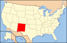
The following is an alphabetical list of articles related to the U.S. state of New Mexico.

Santa Fe is the capital of the U.S. state of New Mexico. The name "Santa Fe" means 'Holy Faith' in Spanish, and the city's full name as founded remains La Villa Real de la Santa Fe de San Francisco de Asís.
Polvadera is an unincorporated community and census-designated place in Socorro County in central New Mexico, United States. It is located on the west bank of the Rio Grande, near the mouth of the Rio Salado, and on the western spur of El Camino Real de Tierra Adentro.

The following outline is provided as an overview of and topical guide to the U.S. state of Oklahoma:

The following outline is provided as an overview of and topical guide to Texas:

The following outline is provided as an overview of and topical guide to the U.S. state of Wyoming:
The area currently occupied by the U.S. State of New Mexico has undergone numerous changes in occupancy and territorial claims and designations. This geographic chronology traces the territorial evolution of New Mexico.

The following timeline traces the territorial evolution of the U.S. State of Arizona.

The following timeline traces the territorial evolution of California, the thirty-first state admitted to the United States of America, including the process of removing Indigenous Peoples from their native lands, or restricting them to reservations.

Brigadier General Diego Archuleta, was a member of the Mexican Congress. He joined the Mexican Army to fight against the United States in the Mexican–American War. Later, he was appointed an Indian Agent by President Abraham Lincoln, and joined the Union Army during the American Civil War. Archuleta became the first Hispanic to reach the military rank of Brigadier General.
Auguste Sylvestre LaCome was a French settler and trader in the New Mexico Territory and brother of Jean Baptiste LaCome. He was an investigator to the White massacre.

Taos Downtown Historic District is a historic district in Taos, New Mexico. Taos "played a major role in the development of New Mexico, under Spanish, Mexican, and American governments." It is a key historical feature of the Enchanted Circle Scenic Byway of northern New Mexico.