Page, Arizona

Last updated

Page
Page AZ.jpg
View of Lake Powell Boulevard in Page
Flag of Page, Arizona.gif
Motto: 
"The Center of Canyon Country"
Page, Arizona
Location of Page in Coconino County, Arizona
Usa edcp location map.svg
Red pog.svg
Page
Location in the United States
Coordinates: 36°54′51″N111°30′12″W / 36.91417°N 111.50333°W / 36.91417; -111.50333
Country United States
State Arizona
County Coconino
Government
  Type Council-Manager
  MayorBill Diak [ citation needed ]
Area
[1]
  Total38.33 sq mi (99.27 km2)
  Land38.18 sq mi (98.89 km2)
  Water0.15 sq mi (0.38 km2)
Elevation
[2]
4,101 ft (1,250 m)
Population
 (2020)
  Total7,440
  Density194.86/sq mi (75.23/km2)
Time zone UTC−7 (MST)
  Summer (DST) UTC−7 (no DST/PDT)
ZIP codes
86036, 86040
Area code 928
FIPS code 04-51810
GNIS feature ID2411352 [2]
Website cityofpage.org

Page is a city in Coconino County, Arizona, United States, near the Glen Canyon Dam and Lake Powell. As of the 2010 census, the population of the city was 7,247. [3]

Contents

History

Page was founded in 1957 as a housing community for workers and their families during the construction of nearby Glen Canyon Dam on the Colorado River. Its 17-square-mile (44 km2) site was obtained in a land exchange with the Navajo Nation. The city is perched atop Manson Mesa at an elevation of 4,300 feet (1,300 m) above sea level and 600 feet (180 m) above Lake Powell.

The city was originally called Government Camp, but was later named for John C. Page, commissioner of the Bureau of Reclamation, 1936–1943. [4]

After the dam was completed in 1966, [5] Page officially incorporated as a town on March 1, 1975. [4] The city grew steadily to today's population over 7,000. Because of the new roads and bridge built for use during construction, it has become the gateway to the Glen Canyon National Recreation Area and Lake Powell, attracting more than 3 million visitors per year. Page is also the home of two of the largest electrical generation units in the western United States. Glen Canyon Dam has a 1,288,000-kilowatt capacity when fully online. The other power plant to the southeast is the Navajo Generating Station, which ceased operations in 2019. [6] It was a coal-fired steam plant with an output capability of 2,250,000 kilowatts. On December 18, 2020, the three smokestacks of the Navajo Generating Station were demolished. [7]

In 1997, Antelope Canyon was opened to tourism on Navajo land adjacent to Page. This natural slot canyon, formed by erosion, created a increased tourism for Page.[ citation needed ]

Geography

According to the United States Census Bureau, the city has a total area of 16.6 square miles (43 km2), of which 16.6 square miles (43 km2) are land and 0.04 square miles (0.10 km2), or 0.12%, is water.

Climate

Page has an arid climate (Köppen BWk) with hot, very dry summers and chilly winters with very little snow. It is located in the southern edge of the Great Basin Desert on the Colorado Plateau. It is very dry due to being in the rainshadow of the mountains of California and too far north to get consistent North American monsoons.

Climate data for Page, Arizona (1991–2020 normals, extremes 1997–present)
MonthJanFebMarAprMayJunJulAugSepOctNovDecYear
Record high °F (°C)65
(18)
73
(23)
84
(29)
93
(34)
102
(39)
110
(43)
111
(44)
108
(42)
105
(41)
95
(35)
77
(25)
69
(21)
111
(44)
Mean maximum °F (°C)56.8
(13.8)
64.6
(18.1)
77.3
(25.2)
85.8
(29.9)
95.0
(35.0)
102.7
(39.3)
105.7
(40.9)
101.3
(38.5)
96.5
(35.8)
86.1
(30.1)
69.8
(21.0)
57.5
(14.2)
106.2
(41.2)
Mean daily maximum °F (°C)44.6
(7.0)
51.3
(10.7)
61.8
(16.6)
70.5
(21.4)
80.7
(27.1)
92.2
(33.4)
96.5
(35.8)
93.5
(34.2)
84.9
(29.4)
70.9
(21.6)
55.2
(12.9)
43.8
(6.6)
70.5
(21.4)
Daily mean °F (°C)35.5
(1.9)
40.8
(4.9)
49.7
(9.8)
57.4
(14.1)
67.1
(19.5)
77.8
(25.4)
83.1
(28.4)
80.5
(26.9)
72.1
(22.3)
58.8
(14.9)
44.9
(7.2)
35.4
(1.9)
58.6
(14.8)
Mean daily minimum °F (°C)26.4
(−3.1)
30.4
(−0.9)
37.6
(3.1)
44.4
(6.9)
53.6
(12.0)
63.4
(17.4)
69.7
(20.9)
67.6
(19.8)
59.4
(15.2)
46.8
(8.2)
34.5
(1.4)
26.9
(−2.8)
46.7
(8.2)
Mean minimum °F (°C)19.6
(−6.9)
22.7
(−5.2)
29.8
(−1.2)
36.1
(2.3)
43.9
(6.6)
54.5
(12.5)
64.8
(18.2)
62.6
(17.0)
50.8
(10.4)
37.6
(3.1)
26.1
(−3.3)
19.1
(−7.2)
17.3
(−8.2)
Record low °F (°C)−11
(−24)
6
(−14)
18
(−8)
25
(−4)
31
(−1)
44
(7)
56
(13)
46
(8)
40
(4)
24
(−4)
16
(−9)
1
(−17)
−11
(−24)
Average precipitation inches (mm)0.65
(17)
0.51
(13)
0.54
(14)
0.38
(9.7)
0.44
(11)
0.13
(3.3)
0.58
(15)
0.93
(24)
0.93
(24)
0.92
(23)
0.45
(11)
0.42
(11)
6.88
(176)
Average snowfall inches (cm)1.4
(3.6)
0.4
(1.0)
0.2
(0.51)
0.1
(0.25)
0.0
(0.0)
0.0
(0.0)
0.0
(0.0)
0.0
(0.0)
0.0
(0.0)
0.0
(0.0)
0.0
(0.0)
1.0
(2.5)
3.1
(7.86)
Average precipitation days (≥ 0.01 in)4.15.34.53.62.71.43.56.54.64.12.94.247.4
Average snowy days (≥ 0.1 in)0.80.20.20.00.00.00.00.00.00.00.00.61.8
Source 1: NOAA [8]
Source 2: National Weather Service [9]

Demographics

Historical population
CensusPop.Note
1960 2,960
1970 1,439−51.4%
1980 4,907241.0%
1990 6,59834.5%
2000 6,8093.2%
2010 7,2476.4%
2020 7,4402.7%
U.S. Decennial Census [10]

As of the census [11] of 2010, 7,247 people, 2,518 households, and 1,822 families resided in the city. The population density was 426.3 inhabitants per square mile (164.6/km2). The 2,787 housing units averaged 163.9 per square mile (63.3/km2). The racial makeup of the city was 57.6% White, 0.3% African American, 34.0% Native American, 0.9% Asian, 2.1% from other races, and 5.0% from two or more races. About 7.3% of the population was Hispanic or Latino of any race.

Of the 2,518 households, 40.6% had children under the age of 18 living with them, 51.9% were married couples living together, 12.9% had a female householder with no husband present, and 27.6% were not families. Around 20.7% of all households were made up of individuals, and 7.7% had someone living alone who was 65 years of age or older. The average household size was 2.87, and the average family size was 3.32.

In the city, the population was distributed as 29.6% under the age of 18, 10.4% from 18 to 24, 26.2% from 25 to 44, 26.0% from 45 to 64, and 9% who were 65 years of age or older. The median age was 32.5 years. For every 100 females, there were 101.5 males. For every 100 females age 18 and over, there were 100.9 males.

As of the 2015 American Community Survey, [12] the median income for a household in the city was $57,161, and for a family was $64,135. Males had a median full-time income of $47,779 versus $37,656 for females. The per capita income for the city was $24,338. About 14.1% of families and 14.4% of the population were below the poverty line, including 18.7% of those under age 18 and 1.5% of those age 65 or over.

Satellite photo showing Page, Lake Powell, Glen Canyon Dam, Navajo Generating Station, and the Colorado River Page Arizona.jpg
Satellite photo showing Page, Lake Powell, Glen Canyon Dam, Navajo Generating Station, and the Colorado River
Aerial view of Page Page, Arizona.JPG
Aerial view of Page
Colorado River, Page city area on the right and Navajo Generating Station in the background Colorado, Page, Navajo generating station.JPG
Colorado River, Page city area on the right and Navajo Generating Station in the background

Economy

Top employers

According to Page's 2020 Comprehensive Annual Financial Report, [13] the top employers in the city are:

#Employer# of Employees
1 Aramark 1,100
2 Page Unified School District 728
3 Walmart 222
4 National Park Service 210
5Infinity of Page Home Health Services Llc150
6 Page Hospital 135
7City of Page126
8Gary Yamamoto Custom Baits Inc122
9Marpalm of Florida Inc99
10Page Steel Inc87

Education

Much of Page is served by the Page Unified School District. [14] The public schools are Lake View Primary School; Desert View Intermediate School, Page Middle School, Page High School, Manson Mesa High School, and Tse Yaato High School. The Glen Canyon Outdoor Academy is the only charter school.

Portions of Page are in the Fredonia-Moccasin Unified School District. [14]

Media

The Lake Powell Chronicle is the weekly newspaper in Page.

The 2001 movie Evolution was filmed in Page.

Infrastructure

Transportation

Page is located on U.S. Route 89. Arizona State Route 98 heads east into the Navajo Reservation.

Public transportation is provided by Helping Hands Agency, a local nonprofit, under the name Express, with service extending to Tuba City, Cameron, Shonto, and Wahweap. [15]

National Park Express provides a daily shuttle between Page and Las Vegas and Page and Grand Canyon Village. [16]

Page Municipal Airport serves Page with scheduled, charter, and general aviation.

Notable people

Related Research Articles

<span class="mw-page-title-main">Kane County, Utah</span> County in Utah, United States

Kane County is a county in the U.S. state of Utah. As of the 2020 United States Census, the population was 7,667. Its county seat and largest city is Kanab.

<span class="mw-page-title-main">San Juan County, Utah</span> County in Utah, United States

San Juan County is a county in the southeastern portion of the U.S. state of Utah. As of the 2020 United States Census, the population was 14,518. Its county seat is Monticello, while its most populous city is Blanding. The Utah State Legislature named the county for the San Juan River, itself named by Spanish explorers.

<span class="mw-page-title-main">Coconino County, Arizona</span> County in Arizona, United States

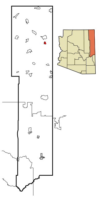
Coconino County is a county in the north-central part of the U.S. state of Arizona. Its population was 145,101 at the 2020 census. The county seat is Flagstaff. The county takes its name from Cohonino, a name applied to the Havasupai people. It is the second-largest county by area in the contiguous United States, behind San Bernardino County, California. It has 18,661 sq mi (48,300 km2), or 16.4% of Arizona's total area, and is larger than the nine smallest states in the U.S.

<span class="mw-page-title-main">Mohave County, Arizona</span> County in Arizona, United States

Mohave County is in the northwestern corner of the U.S. state of Arizona. As of the 2020 census, its population was 213,267. The county seat is Kingman, and the largest city is Lake Havasu City. It is the fifth largest county in the United States.

<span class="mw-page-title-main">Navajo County, Arizona</span> County in Arizona, United States

Navajo County is in the northern part of the U.S. state of Arizona. As of the 2020 census, its population was 106,717. The county seat is Holbrook.

<span class="mw-page-title-main">Yavapai County, Arizona</span> County in Arizona, United States

Yavapai County is near the center of the U.S. state of Arizona. As of the 2020 census, its population was 236,209, making it the fourth-most populous county in Arizona. The county seat is Prescott.

<span class="mw-page-title-main">Steamboat, Arizona</span> CDP in Apache County, Arizona

Steamboat is a census-designated place (CDP) in Apache County, Arizona, United States, that includes Steamboat Canyon and Steamboat Trading Post. The population was 284 at the 2010 census.

<span class="mw-page-title-main">Teec Nos Pos, Arizona</span> Census-designated place in Arizona, United States

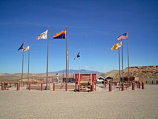
Teec Nos Pos is a census-designated place (CDP) in Apache County, Arizona, United States. The population was 507 at the 2020 census. It is the western terminus of U.S. Route 64.

<span class="mw-page-title-main">Tsaile, Arizona</span> Census-designated place in Arizona, United States

Tsaile is a census-designated place (CDP) in Apache County, Arizona, United States, on the Navajo Nation. The population was 1,205 at the 2010 census.

<span class="mw-page-title-main">Bitter Springs, Arizona</span> Census-designated place in Coconino County, Arizona

Bitter Springs is a native village and census-designated place (CDP) on the Navajo Nation in Coconino County, Arizona, United States. As of the 2020 census, the CDP population was 364

<span class="mw-page-title-main">Cameron, Arizona</span> Census-designated place in Coconino County, Arizona, United States

Cameron is a census-designated place (CDP) in Coconino County, Arizona, United States, on the Navajo Nation. The population was 885 at the 2010 census. Most of the town's economy is tourist food and craft stalls, restaurants, and other services for north–south traffic from Flagstaff and Page. There is a ranger station supplying information and hiking permits for the Navajo Nation. There is also a large craft store run by the Nation itself. It is named after Ralph H. Cameron, Arizona's first senator.

<span class="mw-page-title-main">Fredonia, Arizona</span> Community in Coconino County, Arizona

Fredonia is a town in Coconino County, Arizona, United States. As of the 2010 census it had a population of 1,314. Fredonia is the gateway to the North Rim of the Grand Canyon.

<span class="mw-page-title-main">Kaibito, Arizona</span> CDP in Coconino County, Arizona

Kaibeto is a census-designated place (CDP) in Coconino County, Arizona, United States. The population was 1,522 at the 2010 census.

<span class="mw-page-title-main">LeChee, Arizona</span> CDP in Coconino County, Arizona

LeChee is a census-designated place (CDP) in Coconino County, Arizona, United States. The population was 1,443 at the 2010 census.

<span class="mw-page-title-main">Tonalea, Arizona</span> CDP in Coconino County, Arizona

Tonalea is a census-designated place (CDP) in Coconino County, Arizona, United States. The population was 549 at the 2010 census. It has also been known as Red Lake.

<span class="mw-page-title-main">Tuba City, Arizona</span> Town in Coconino County, Arizona

Tuba City is an unincorporated town and census-designated place in Coconino County, Arizona, on the Navajo Nation, United States. It is the second-largest community in Coconino County. The population of the census-designated place (CDP) was 8,611 at the 2010 census.

<span class="mw-page-title-main">Williams, Arizona</span> City in Coconino County, Arizona

Williams is a city in Coconino County, Arizona, United States, located west of Flagstaff. Its population was 3,023 at the 2010 census. It lies on the routes of Historic Route 66 and Interstate 40. It is also the southern terminus of the Grand Canyon Railway, which takes visitors to Grand Canyon Village.

<span class="mw-page-title-main">Keams Canyon, Arizona</span> CDP in Navajo County, Arizona

Keams Canyon is a census-designated place (CDP) in Navajo County, Arizona, United States, on the Hopi Reservation. The population was 304 at the 2010 census.

<span class="mw-page-title-main">Shonto, Arizona</span> CDP in Navajo County, Arizona

Shonto is a census-designated place (CDP) in Navajo County, Arizona, United States, in the Navajo Nation. The population was 591 at the 2010 census.

<span class="mw-page-title-main">Arizona Strip</span> Part of Arizona north of the Colorado River

The Arizona Strip is the part of Arizona lying north of the Colorado River. Despite being larger in area than several U.S. states, the entire region has a population of fewer than 10,000 people. Consisting of northeastern Mohave County and northwestern Coconino County, the largest settlements in the Strip are Colorado City, Fredonia, and Beaver Dam, with smaller communities of Scenic, Littlefield and Desert Springs. The Kaibab Indian Reservation lies within the region. Lying along the North Rim of the Grand Canyon creates physical barriers to the rest of Arizona. Only three major roads traverse the region: I-15 crosses the northwestern corner, while Arizona State Route 389 and U.S. Route 89A cross the northeastern part of the strip, and US 89A crosses the Colorado River via the Navajo Bridge, providing the only direct road connection between the strip and the rest of the state. The nearest metropolitan area is the St. George, Utah metro area, to which the region is more connected than to the rest of Arizona.

References

  1. "2020 U.S. Gazetteer Files". United States Census Bureau. Retrieved October 29, 2021.
  2. 1 2 U.S. Geological Survey Geographic Names Information System: Page, Arizona
  3. "Profile of General Population and Housing Characteristics: 2010 Demographic Profile Data (DP-1): Page city, Arizona". United States Census Bureau . Retrieved December 7, 2011.
  4. 1 2 "City of Page History". City of Page. Archived from the original on August 18, 2021. Retrieved October 4, 2021.
  5. "Glen Canyon Dam". Projects & Facilities. US Bureau of Reclamation. Retrieved October 4, 2021.
  6. Locke, Katherine (November 18, 2019). "Navajo Generating Station shuts down permanently". Navajo-Hopi Oberserver. Retrieved November 19, 2019.
  7. Randazzo, Ryan (December 18, 2020). "3 massive coal stacks that long towered over Lake Powell demolished as crowds watched". AZ Central. Retrieved December 18, 2020.
  8. "U.S. Climate Normals Quick Access – Station: Page, AZ". National Oceanic and Atmospheric Administration. Retrieved December 30, 2022.
  9. "NOAA Online Weather Data – NWS Flagstaff". National Weather Service. Retrieved December 30, 2022.
  10. "Census of Population and Housing". Census.gov. Retrieved June 4, 2016.
  11. "U.S. Census website". United States Census Bureau . Retrieved January 31, 2008.
  12. Bureau, U.S. Census. "U.S. Census website". United States Census Bureau . Retrieved June 1, 2017.
  13. City of Page CAFR
  14. 1 2 "2020 Census – School District Reference Map: Coconino County, AZ" (PDF). U.S. Census Bureau. p. 2. Retrieved July 15, 2021.
  15. Express
  16. "Our Shuttle – National Park Express". April 13, 2024.
  17. "Player Bio: Matt Haryasz". Stanford University. Retrieved April 24, 2024.
  18. Stout, Larry (April 17, 2019). "Congressional Candidate Fred Keller". Webb Weekly.