Sedimentary rocks are types of rock that are formed by the accumulation or deposition of mineral or organic particles at Earth's surface, followed by cementation. Sedimentation is the collective name for processes that cause these particles to settle in place. The particles that form a sedimentary rock are called sediment, and may be composed of geological detritus (minerals) or biological detritus. The geological detritus originated from weathering and erosion of existing rocks, or from the solidification of molten lava blobs erupted by volcanoes. The geological detritus is transported to the place of deposition by water, wind, ice or mass movement, which are called agents of denudation. Biological detritus was formed by bodies and parts of dead aquatic organisms, as well as their fecal mass, suspended in water and slowly piling up on the floor of water bodies. Sedimentation may also occur as dissolved minerals precipitate from water solution.

The Green River Formation is an Eocene geologic formation that records the sedimentation in a group of intermountain lakes in three basins along the present-day Green River in Colorado, Wyoming, and Utah. The sediments are deposited in very fine layers, a dark layer during the growing season and a light-hue inorganic layer in the dry season. Each pair of layers is called a varve and represents one year. The sediments of the Green River Formation present a continuous record of six million years. The mean thickness of a varve here is 0.18 mm, with a minimum thickness of 0.014 mm and maximum of 9.8 mm.

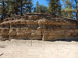
The Florissant Formation is a sedimentary geologic formation outcropping around Florissant, Teller County, Colorado. The formation is noted for the abundant and exceptionally preserved insect and plant fossils that are found in the mudstones and shales. Based on argon radiometric dating, the formation is Eocene in age and has been interpreted as a lake environment. The fossils have been preserved because of the interaction of the volcanic ash from the nearby Thirtynine Mile volcanic field with diatoms in the lake, causing a diatom bloom. As the diatoms fell to the bottom of the lake, any plants or animals that had recently died were preserved by the diatom falls. Fine layers of clays and muds interspersed with layers of ash form "paper shales" holding beautifully-preserved fossils. The Florissant Fossil Beds National Monument is a national monument established to preserve and study the geology and history of the area.

The Messel pit is a disused quarry near the village of Messel about 35 km (22 mi) southeast of Frankfurt am Main, Germany. Bituminous shale was mined there. Because of its abundance of well-preserved fossils of the Messel Formation dating from the middle of the Eocene, it has significant geological and scientific importance. Over 1000 species of plants and animals have been found at the site. After almost becoming a landfill, strong local resistance eventually stopped these plans and the Messel pit was declared a UNESCO World Heritage Site on 9 December 1995. Significant scientific discoveries about the early evolution of mammals and birds are still being made at the Messel pit, and the site has increasingly become a tourist site as well.

Kotelny Island is part of the Anzhu Islands subgroup of the New Siberian Islands located between the Laptev Sea and the East Siberian Sea in the Russian Arctic. It is administratively and municipally part of Bulunsky District of the Republic of Sakha (Yakutia).

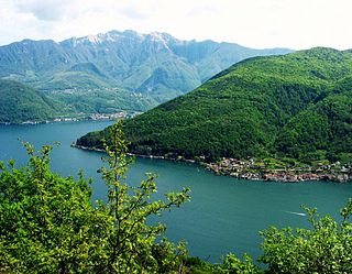
Monte San Giorgio is a Swiss mountain and UNESCO World Heritage Site near the border between Switzerland and Italy. It is part of the Lugano Prealps, overlooking Lake Lugano in the Swiss Canton of Ticino.

The geology of the Iberian Peninsula consists of the study of the rock formations on the Iberian Peninsula, which includes Spain, Portugal, Andorra, and Gibraltar. The peninsula contains rocks from every geological period from the Ediacaran to the Quaternary, and many types of rock are represented. World-class mineral deposits are also found there.

The Tremp Formation, alternatively described as Tremp Group, is a geological formation in the comarca Pallars Jussà, Lleida, Spain. The formation is restricted to the Tremp or Tremp-Graus Basin, a piggyback foreland basin in the Catalonian Pre-Pyrenees. The formation dates to the Maastrichtian to Thanetian, thus the formation includes the Cretaceous-Paleogene boundary that has been well studied in the area, using paleomagnetism and carbon and oxygen isotopes. The formation comprises several lithologies, from sandstone, conglomerates and shales to marls, siltstones, limestones and lignite and gypsum beds and ranges between 250 and 800 metres in thickness. The Tremp Formation was deposited in a continental to marginally marine fluvial-lacustrine environment characterized by estuarine to deltaic settings.
The Aquitaine Basin is the second largest Mesozoic and Cenozoic sedimentary basin in France after the Paris Basin, occupying a large part of the country's southwestern quadrant. Its surface area covers 66,000 km2 onshore. It formed on Variscan basement which was peneplained during the Permian and then started subsiding in the early Triassic. The basement is covered in the Parentis Basin and in the Subpyrenean Basin—both sub-basins of the main Aquitaine Basin—by 11,000 m of sediment.

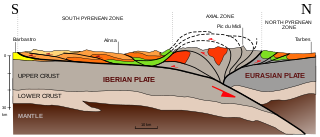
The Pyrenees are a 430-kilometre-long, roughly east–west striking, intracontinental mountain chain that divide France, Spain, and Andorra. The belt has an extended, polycyclic geological evolution dating back to the Precambrian. The chain's present configuration is due to the collision between the microcontinent Iberia and the southwestern promontory of the European Plate. The two continents were approaching each other since the onset of the Upper Cretaceous (Albian/Cenomanian) about 100 million years ago and were consequently colliding during the Paleogene (Eocene/Oligocene) 55 to 25 million years ago. After its uplift, the chain experienced intense erosion and isostatic readjustments. A cross-section through the chain shows an asymmetric flower-like structure with steeper dips on the French side. The Pyrenees are not solely the result of compressional forces, but also show an important sinistral shearing.
The Madygen Formation is a Late Triassic (Carnian) geologic formation and Lagerstätte in the Batken and Osh Regions of western Kyrgyzstan, with minor outcrops in neighboring Tajikistan and Uzbekistan. The conglomerates, sandstones and mudstones of the 560 m (1,840 ft) thick formation were deposited in terrestrial lacustrine, alluvial, fluvial and deltaic environments.

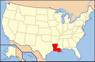
Paleontology in Louisiana refers to paleontological research occurring within or conducted by people from the U.S. state of Louisiana. Outcrops of fossil-bearing sediments and sedimentary rocks within Louisiana are quite rare. In part, this is because Louisiana’s semi-humid climate results in the rapid weathering and erosion of any exposures and the growth of thick vegetation that conceal any fossil-bearing strata. In addition, Holocene alluvial sediments left behind by rivers like the Mississippi, Red, and Ouachita, as well as marsh deposits, cover about 55% of Louisiana and deeply bury local fossiliferous strata.

The Messel Formation is a geologic formation in Hesse, central Germany, dating back to the Eocene epoch. Its geographic range is restricted to the Messel pit. There it unconformably overlies crystalline Variscan basement and its Permian cover (Rotliegend) as well as Eocene volcanic breccias derived from the basement rocks. The formation mainly comprises lacustrine laminated bituminous shale renowned for its content of fossils in exceptional preservation, particularly plants, arthropods and vertebrates.

Casaleia is an extinct genus of ants in the formicid subfamily Amblyoponinae described by Pagliano & Scaramozzino in 1990 from fossils found in Europe. The genus contains four species dating from the Eocene to Miocene, Casaleia eocenica, Casaleia inversa, Casaleia longiventris, Casaleia orientalis.

Kanapoi is a paleontological site in the Kenyan Rift Valley, to the southwest of Lake Turkana. Fossils were first found at Kanapoi in the 1960s by a Harvard expedition, and later by expeditions from the National Museums of Kenya.

The Gai-As Formation is an Early to Middle Permian geologic formation correlated with the Ecca Group and designated "Ecca" Group, because it does not belong to the Karoo, in the southwestern Kunene Region and northern Erongo Region of northwestern Namibia. The Gai-As Formation represents the second-oldest sedimentary unit of the Huab Basin, overlying the Huab Formation. The formation was deposited in a fluvial to lacustrine setting.
The Cañadón Asfalto Basin is an irregularly shaped sedimentary basin located in north-central Patagonia, Argentina. The basin stretches from and partly covers the North Patagonian Massif in the north, a high forming the boundary of the basin with the Neuquén Basin in the northwest, to the Cotricó High in the south, separating the basin from the Golfo San Jorge Basin. It is located in the southern part of Río Negro Province and northern part of Chubut Province. The eastern boundary of the basin is the North Patagonian Massif separating it from the offshore Valdés Basin and it is bound in the west by the Patagonian Andes, separating it from the small Ñirihuau Basin.

The Mawson Formation is a geological formation in Antarctica, dating to roughly between 182 and 177 million years ago and covering the Toarcian stages of the Jurassic Period in the Mesozoic Era. Vertebrate remains are known from the formation. The Mawson Formation is the South Victoria Land equivalent of the Karoo Large Igneous Province in South Africa, as well the Lonco Trapial Formation and the Cañadón Asfalto Formation of Argentina. The Volcanic material was likely sourced from the Antarctic Peninsula´s Ellsworth Land Volcanic Group.

The Itaboraí Formation is a highly fossiliferous geologic formation and Lagerstätte of the Itaboraí Basin in Rio de Janeiro, southeastern Brazil. The formation reaching a thickness of 100 metres (330 ft) is the defining unit for the Itaboraian South American land mammal age (SALMA), dating to the Early Eocene, approximately 53 to 50 Ma.

The Sergipe-Alagoas Basin is a continental margin basin in the Sergipe and Alagoas states of northeastern Brazil, about 20 to 50 kilometres wide onshore, but with its widest extension offshore, more precisely 13,000 km2 onshore and 40,000 km2 offshore. In general, "Sergipe-Alagoas Basin" refers to the Sergipe and Alagoas sub-basins, but it also consists of the Jacuípe and Cabo sub-basins. Studies of the basin's geology date back to the first half of the 19th century, when J. Henderson in 1821 published preliminary notes on the region's geology.


