
Kozhikode, also known as Calicut, is a city in Kerala, India and the headquarters of the Kozhikode district. The Kozhikode metropolitan area is the second largest urban agglomeration in Kerala with a population of 2 million as of 2011. The city lies about 276 km south west of Bangalore, 235 km south of Mangalore and 525 km south west of Chennai.

The Western Ghats, also known as Sahyadri, are a mountain range that covers an area of 140,000 square kilometres (54,000 sq mi) in a stretch of 1,600 kilometres (990 mi) parallel to the western coast of the Indian peninsula, traversing the states of Kerala, Tamil Nadu, Karnataka, Goa, Maharashtra and Gujarat. It is a UNESCO World Heritage Site and is one of the eight "hottest hot-spots" of biological diversity in the world. It is sometimes called the Great Escarpment of India. It contains a large proportion of the country's flora and fauna, many of which are only found in India and nowhere else in the world. According to UNESCO, the Western Ghats are older than the Himalayas. They influence Indian monsoon weather patterns by intercepting the rain-laden monsoon winds that sweep in from the south-west during late summer. The range runs north to south along the western edge of the Deccan Plateau, and separates the plateau from a narrow coastal plain, called Konkan, along the Arabian Sea. A total of thirty-nine areas in the Western Ghats, including national parks, wildlife sanctuaries and reserve forests, were designated as world heritage sites in 2012 – twenty in Kerala, ten in Karnataka, five in Tamil Nadu and four in Maharashtra.

Pathanamthitta District is a district in the southern part of Kerala, India. The district headquarters is in the town of Pathanamthitta. There are four municipalities in Pathanamthitta: Tiruvalla, Adoor, Pathanamthitta and Pandalam.

Wayanad is an Indian district in the north-east of Kerala state with administrative headquarters at the municipality of Kalpetta. It is set high on the Western Ghats with altitudes ranging from 700 to 2100. The district was formed on 1 November 1980 as the 12th district in Kerala by carving out areas from Kozhikode and Kannur districts. About 885.92 sq.km of area of the district is under forest. Wayanad has three municipal towns—Kalpetta, Mananthavady and Sulthan Bathery. There are many indigenous tribals in this area.

Vallam Kali is a traditional boat race in Kerala, India. It is a form of canoe racing, and uses paddled war canoes. It is mainly conducted during the season of the harvest festival Onam in autumn. Vallam kali includes races of many kinds of paddled longboats,and fame in kerala the traditional boats of Kerala. Each team spent about 6 lakh rupees for nehru trophy.

The Kerala backwaters are a network of brackish lagoons and lakes lying parallel to the Arabian Sea coast of Kerala state in southern India, as well as interconnected canals, rivers, and inlets, a labyrinthine system formed by more than 900 kilometres (560 mi) of waterways, and sometimes compared to American bayous. The network includes five large lakes linked by canals, both man made and natural, fed by 38 rivers, and extending virtually half the length of Kerala state. The backwaters were formed by the action of waves and shore currents creating low barrier islands across the mouths of the many rivers flowing down from the Western Ghats range. In the midst of this landscape there are a number of towns and cities, which serve as the starting and end points of backwater cruises.
Periyar is the longest river and the river with the largest discharge potential in the Indian state of Kerala. It is one of the few perennial rivers in the region and provides drinking water for several major towns. The Periyar is of utmost significance to the economy of Kerala. It generates a significant proportion of Kerala's electrical power via the Idukki Dam and flows along a region of industrial and commercial activity. The river also provides water for irrigation and domestic use throughout its course besides supporting a rich fishery. Due to these reasons, the river has been named the "Lifeline of Kerala". Kochi city, in the vicinity of the river mouth draws its water supply from Aluva, an upstream site sufficiently free of seawater intrusion. Twenty five percent of Kerala's industries are along the banks of river Periyar. These are mostly crowded within a stretch of 5 kilometres (3 mi) in the Eloor-Edayar region (Udhyogamandal), about 10 kilometres (6 mi) north of Kochi harbor.

Achankovil is a river in Kerala, India, created towards the southern tip of the peninsula by the confluence of the Rishimala, Pasukidamettu, and Ramakkalteri Rivers. The Anchankovil enriches the Pathanamthitta district of Kerala state. It joins with the Pamba River at Veeyapuram, in the Alappuzha district of Kerala. Achankovil is also the name of the forest area, which is the catchment area for this river, and of a small town situated in the Achenkovil forest area. The Achankovil village is not easily accessible; however, it can be reached through forest routes.

Chalakudy River or Chalakudy Puzha is the fifth longest river in Kerala, India. The river flows through Palakkad district, Thrissur District and Ernakulam District of Kerala. The total drainage area of the river is 1704 km². out of this 1404 km² lies in Kerala and the rest 300 km² in Tamil Nadu. The length of the river is 145.5 km. Though Chalakudy river in strict geological sense is a tributary of the Periyar river, for all practical purposes it is treated as a separate river by Government and other agencies. The River has gained its name, since it flows along the banks of the Chalakudy Town, the major settlement along the course of the river.

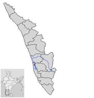
The Pamba River is the third longest river in the South Indian state of Kerala after Periyar and Bharathappuzha and the longest river in the erstwhile princely state of Travancore. Sabarimala temple dedicated to Lord Ayyappa is located on the banks of the river Pamba. In old Hindu Epics, Pampa was Lord Brahma's daughter, who was later married to Lord Shiva.

Kerala is situated between the Arabian Sea to the west and the Western Ghats to the east. Kerala’s coast runs some 580 km in length, while the state itself varies between 35–120 km in width. Geographically, Kerala roughly divides into three climatically distinct regions. These include the eastern highlands, the central midlands, and the western lowlands. Located at the extreme southern tip of the Indian subcontinent, Kerala lies near the center of the Indian tectonic plate ; as such most of the state is subject to comparatively little seismic or volcanic activity. Geologically, pre-Cambrian and Pleistocene formations comprise the bulk of Kerala’s terrain. The topography consists of a hot and wet coastal plain gradually rising in elevation to the high hills and mountains of the Western Ghats. Kerala lies between northern latitude of 8°.17'.30" N and 12°. 47'.40" N and east longitudes 74°.27'47" E and 77°.37'.12" E. Kerala's climate is mainly wet and maritime tropical, heavily influenced by the seasonal heavy rains brought up by the monsoon.

Kadalundi River (Kadalundipuzha) is one of the four most important rivers flowing through Malappuram district in the Indian state of Kerala. The other three are the Chaliyar, the Bharathappuzha and the Tirur River. This rain-fed river is 130 kilometres (81 mi) long and is one of the most important rivers in the district. It is formed by the confluence of the Olipuzha River and the Veliyar River.The Kadalundi originates from the Western Ghats at the western border of the Silent Valley and flows through the district of Malappuram. It has two main tributaries namely Olipuzha and Veliyar. The Kadalundi River drains an area of 1274 km² and has a length of 120 km. The Kadalundi Bird Sanctuary spreads over a cluster of islands where the Kadalundipuzha River flows into the Arabian Sea. There are over a hundred varieties of native birds and around 60 varieties of migratory birds that come here in large numbers annually.

Chinnar Wildlife Sanctuary (CWS) is located 18 km north of Marayoor on SH 17 in the Marayoor and Kanthalloor panchayats of Devikulam taluk in the Idukki district of Kerala state in South India. It is one of twelve wildlife sanctuaries among the protected areas of Kerala.
The Western Coastal Plains is a strip of coastal plain 50 kilometres (31 mi) in width between the west coast of India and the Western Ghats hills, which starts near the south of the Tapi River. The plains are located between the Western Ghats and the Arabian Sea. The plains begin at Gujarat in the north and end at Kerala in the south. It includes the states of Maharashtra, Goa, Karnataka and Kerala. The region consists of three sections: the Northern part of the coast is called the Konkan (Mumbai-Goa), the central stretch is called the Kanara, while the southern stretch is referred to as the Malabar Coast. On its northern side there are two gulfs: the Gulf of Khambat and the Gulf of Kutch. The rivers along the coast form estuaries and provide conditions ideal for pisciculture. because of the presence of less coastal land in this part, it will be affected more by the global warming.

Kasaragod District is one of the 14 districts in the southern Indian state of Kerala. Kasaragod became part of Kannur district following the reorganisation of states due to predominance of Malayalam speakers. Kasaragod was declared as a district on 24 May 1984.

The Siruvani River is a river near Coimbatore, India. It is tributary of Bhavani river, which in turn is a tributary of Kaveri. Part of the Siruvani River is near Mannarkkad in the Indian District of Palakkad, Kerala. The river leads into two big tourist attractions in Southern India, namely, the Siruvani Dam and the Siruvani Waterfalls. The dam is also near The Banan Fort. Banan Fort and the Siruvani Dam, are 15 to 25 kilometres west of Coimbatore city. The river has a village named after it, or possibly vice versa.

Karapuzha Dam located in the Wayanad district of Kerala, is one of the biggest earth dams in India. Karapuzha Dam is located in the greenish and natural regions of Wayanad, Kerala on the Karapuzha River, a tributary of the Kabini River. Construction on the dam began in 1977 and it was complete in 2004. The purpose of the dam is irrigation and it left and right bank canals are still under construction.
On 16 August 2018, severe floods affected the south Indian state of Kerala, due to unusually high rainfall during the monsoon season. It was the worst flood in Kerala in nearly a century. Over 483 people died, and 140 are missing. About a million people were evacuated, mainly from Chengannur, Pandanad, Edanad, Aranmula, Kozhencherry, Ayiroor, Ranni, Pandalam, Kuttanad, Malappuram, Aluva, Chalakudy, Thrissur, Thiruvalla, Eraviperoor, Vallamkulam, North Paravur, Vypin Island and Palakkad Chellanam. All 14 districts of the state were placed on red alert. According to the Kerala government, one-sixth of the total population of Kerala had been directly affected by the floods and related incidents. The Indian government had declared it a Level 3 Calamity, or "calamity of a severe nature". It is the worst flood in Kerala after the great flood of 99 that took place in 1924.


