Paris metropolitan area

Last updated
Paris metropolitan area
aire d'attraction de Paris
Tour Eiffel - night (2016).jpg
Paris, the most populated city in the metropolitan area
75-Paris-AAV2020.png
Map showing the extent of the Paris metropolitan area as of 2020, when it included 1,929 communes and covered 18,941 km2.
   Central commune
   Primary urban cluster
   Secondary urban cluster
   Peripheral commune
   Peripheral commune of a functional area with less than 200,000 inhabitants
Country Flag of France.svg  France
Largest city Paris (2,165,423)
Area
  Metro
18,941 km2 (7,313 sq mi)
Population
   Metro
13,064,617
  Metro density690/km2 (1,800/sq mi)
GDP
[1]
  Metro€764.8 billion (2021)
Time zone UTC+01:00 (CET)

The Paris metropolitan area (French : aire d'attraction de Paris) is a statistical area that describes the reach of commuter movement to and from Paris, France and its surrounding suburbs.

Contents

Overview

In 2020, France's national INSEE statistical bureau introduced the concept "aire d'attraction d'une ville" (functional area), replacing the former "aire urbaine" (urban area). [2] A functional area consists of an urban cluster [3] and the surrounding commuting zone. [2] This concept is consistent with the functional urban area as defined by Eurostat. [4]

Created and used from 1996 by France's national INSEE statistical bureau to match international demographic standards, [5] the aire urbaine (literally: 'urban area') was a statistical unit that described the suburban development around centres of urban growth. [6] In 2011, the INSEE reclassified its largest aires urbaines into aires métropolitaines (literally: metropolitan areas) and grandes aires urbaines ('large urban areas'). [7] With this change, the Paris metropolitan area became the largest in France. [8]

In France, use of the term 'Paris metropolitan area' is limited to demographic and statistical studies, and, to date, it is not used in economic statistics — the traditional administrative subdivisions commune, département, and région are still referenced for this — though the media will employ it when referring to the electoral tendencies of France's largest cities[ citation needed ]. In 2010 the government passed a law that invited France's largest city 'metropoles' to work together as an intercommunitary entities (more or less described by the INSEE concept), [9] but the lack of response by the following year moved the government to make the cooperation for many of France's largest cities obligatory, and Paris became a case study all on its own. [10]

This latter initiative created the "Métropole du Grand Paris" (official translation: 'Greater Paris metropolitan authority'), a Paris-centred intercommunal cooperation effort enacted from January 1, 2016. [11] The territory it covers is much smaller than the INSEE 'Paris metropolitan area' statistical area: it includes Paris, its neighbouring three departments (or 'petite couronne'), and a few bordering communes in the departments beyond. [12]

Extent

Map showing the extent of the Paris metropolitan area at the 1999 census, when it included 1,584 communes and covered 14,518 km . Paris uu ua jms.png
Map showing the extent of the Paris metropolitan area at the 1999 census, when it included 1,584 communes and covered 14,518 km .
False-color satellite image of the Parisian metropolitan area. Paris and vicinities, LandSat-5 false color satellite image, 2006-07-16.jpg
False-color satellite image of the Parisian metropolitan area.

As of 2022, the INSEE statistical Paris metropolitan area covers 1,929 communes. [13] With its 18,941 km2 (7,313 sq mi), it extends significantly beyond Paris' administrative Île-de-France region (12,012 km2 (4,638 sq mi)). [14] Outside the Île-de-France region, it covers part of the departments Aisne, Aube, Eure, Eure-et-Loir, Loiret, Marne, Oise, Seine-Maritime and Yonne. [13]

The Paris metropolitan area expands at each population census due to the rapid population growth in the Paris area. New communes (municipalities) surrounding Paris are included when they meet the commuter threshold required. At the 1968 census, the earliest date for which population figures were retrospectively computed for French aire urbaines, the Paris metropolitan area had 8,368,459 inhabitants in an area that only encompassed 279 communes in central Île-de-France. [15]

By the 1999 census the Paris metropolitan area was slightly larger than Île-de-France and had 11,174,743 inhabitants in 14,518 km2. At the 2010 revision, the aire urbaine of Paris had 1,751 communes. [16]

Population

The area had a population of 13,064,617 as of 2018. [14] Nearly 20% of France's population resides in the region.

The table below shows the population growth of the Paris metropolitan area (aire urbaine), i.e. the urban area (pôle urbain) and the commuter belt (couronne périurbaine) surrounding it. (Note: the area shown in red and pink in the map above):

See also

Related Research Articles

<span class="mw-page-title-main">Pantin</span> Commune in Île-de-France, France

Pantin is a commune in the northeastern suburbs of Paris, Île-de-France, France. It is located 6.4 km (4.0 mi) from the centre of Paris. In 2019 its population was estimated to be 59,846. Pantin is located on the edge of the city of Paris and is mainly formed by a plain crossed by national roadway 2 and 3, the Paris–Strasbourg railway line and the canal de l'Ourcq.

<span class="mw-page-title-main">Urban area (France)</span> Statistical area in France

An aire urbaine is an INSEE statistical concept describing a core of urban development and the extent of its commuter activity. It was replaced by the concept "functional area", which uses the same definition as Eurostat's functional urban areas, in 2020.

<span class="mw-page-title-main">Demographics of Paris</span>

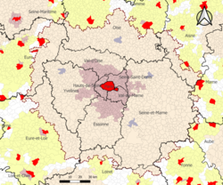
The city of Paris had a population of 2,165,423 people within its administrative city limits as of January 1, 2019. It is surrounded by the Paris unité urbaine, or urban area, the most populous urban area in the European Union. In 2018 the unité urbaine had a population of 10,816,803 in 2,854 km2 (1,102 sq mi). The Paris Region, or Île-de-France, covers 12,012 km2 (4,638 sq mi), and has its own regional council and president. It has a population of 12,213,447 as of January 2018, or 18.3 percent of the population of France. The metropolitan or functional area of Paris covers 18,941 km2 (7,313 sq mi) and has 13,064,617 inhabitants (2018).

<span class="mw-page-title-main">Nantes Metropolis</span> Métropole in Pays de la Loire, France

The Nantes Metropolis is the métropole, an intercommunal structure, centred on the city of Nantes. It is located in the Loire-Atlantique department, in the Pays de la Loire region, western France. It was created in January 2015, replacing the previous Communauté urbaine de Nantes. Its area is 523.4 km2. Its population was 636,013 in 2018, of which 314,138 in Nantes proper.

<span class="mw-page-title-main">Toulouse Métropole</span> Métropole in Occitania, France

Toulouse Métropole is one of 20 French metropolises, an intercommunal structure, centred on the city of Toulouse. Located in the Haute-Garonne department, in the Occitanie region, southern France. Created in January 2015, it replaced the previous Communauté urbaine de Toulouse. With an area of 458.2 km2, and a population of 783,353 in 2018, of which 486,828 are in Toulouse proper. It is the 5th largest metropolis after Greater Paris, Aix-Marseille-Provence, Lille-Europe and Bordeaux. The annual budget is €1,4 billion (2015).

<span class="mw-page-title-main">Le Kremlin-Bicêtre</span> Commune in Île-de-France, France

Le Kremlin-Bicêtre is a commune in the southern suburbs of Paris, France. It is 4.5 km (2.8 mi) from the center of Paris. It is one of the most densely populated municipalities in Europe.

<span class="mw-page-title-main">Urban unit</span> A French statistical area

In France, an urban unit is a statistical area defined by INSEE, the French national statistics office, for the measurement of contiguously built-up areas. According to the INSEE definition, an "unité urbaine" is a commune alone or a grouping of communes which: a) form a single unbroken spread of urban development, with no distance between habitations greater than 200 m and b) have all together a population greater than 2,000 inhabitants. Communes not belonging to an unité urbaine are considered rural.

<span class="mw-page-title-main">Saint-Galmier</span> Commune in Auvergne-Rhône-Alpes, France

Saint-Galmier is a city in eastern France. It is a commune in Loire department, and belongs to the arrondissement of Montbrison. Saint-Galmier covers an area of 19.5 square kilometers. As of January 2021, it had a population of 5,842.

<span class="mw-page-title-main">Nice metropolitan area</span> Metropolitan area in France

Nice metropolitan area as defined by INSEE in 2021 is the functional urban area or commuting zone of the city of Nice, southeastern France. It covers 100 communes, has 1,103,527 inhabitants (2021) and an area of 2,073 km2. It partly overlaps with the urban unit of Nice, which covers some cities, e.g. Antibes, Grasse and Cannes, that are part of the functional area Cannes-Antibes.

<span class="mw-page-title-main">Chambon, Cher</span> Commune in Centre-Val de Loire, France

Chambon is a commune in the Cher department in the Centre-Val de Loire region of France.

<span class="mw-page-title-main">Marcilly-sur-Tille</span> Commune in Bourgogne-Franche-Comté, France

Marcilly-sur-Tille is a commune in the Côte-d'Or department in eastern France.

Talasani is a rural commune and village on the eastern seaboard of Corsica, in the Haute-Corse department of France. The area has a very low population density and mainly comprises forests and farmland. As a coastal municipality, Talasani enforces strict urban planning provisions in order to preserve the ecological balance of the coast.

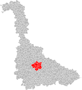
Champvoisy is a commune in the Marne department in north-eastern France. It is a rural municipality, with a very low population density. The municipality is part of the functional area of Reims, which is composed of 294 municipalities.

<span class="mw-page-title-main">Bonneuil-en-France</span> Commune in Île-de-France, France

Bonneuil-en-France is a commune in the Val-d'Oise department in Île-de-France in northern France.

Pomps is a commune in the Pyrénées-Atlantiques département in south-western France.

<span class="mw-page-title-main">Métropole du Grand Nancy</span> Métropole in Grand Est, France

Métropole du Grand Nancy is the métropole, an intercommunal structure, centred on the city of Nancy. It is located in the Meurthe-et-Moselle department, in the Grand Est region, northeastern France. It was created in July 2016, replacing the previous Communauté urbaine du Grand Nancy. Its area is 142.3 km2. Its population was 257,431 in 2018, of which 104,885 in Nancy proper.

<span class="mw-page-title-main">Grand Paris</span> Métropole covering Paris and its nearest surrounding suburbs

Sarkozy's renovation of Paris, also known as the Grand Paris, is a vast public works programme commissioned by French president Nicolas Sarkozy between 2016 and 2030.

<span class="mw-page-title-main">Grenoble metropolitan area</span> Urban area of Grenoble

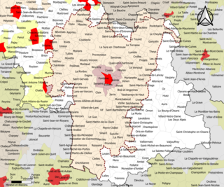
Grenoble metropolitan area as defined by INSEE in 2020 is the functional urban area of the city of Grenoble, southeastern France. It covers 204 communes, all in the Isère department. It has 714,799 inhabitants (2018) in an area of 2,876 km2 (1,110 sq mi), which is 39% of the Isère department. Grenoble and 15 other communes form the pôle urbain or urban cluster, the other 188 communes form the couronne or commuter belt. The most populous communes in the functional area are Grenoble, Échirolles, Fontaine, Meylan, Le Pont-de-Claix, Saint-Égrève, Saint-Martin-d'Hères, Sassenage, Seyssinet-Pariset and Voiron, all except Voiron part of the pôle urbain. It is the 11th-most populous functional urban area in France.

<span class="mw-page-title-main">Cherbourg-en-Cotentin</span> Subprefecture and commune in Normandy, France

Cherbourg-en-Cotentin is a port city in the department of Manche, Normandy, northwestern France, established on 1 January 2016. The commune takes its name from Cherbourg, the main town of the commune, and the Cotentin Peninsula. Cherbourg is an important commercial, ferry and military port on the English Channel. Cherbourg-en-Cotentin is a Maritime prefecture and sub-prefecture of Manche. Due to its union, it is the most populous commune in its department with 79,144 inhabitants as of 2018, making it the first city of the department before the Saint-Lô prefecture and the second in the region after Caen. Its urban unit is composed of three communes, and has 81,963 inhabitants (2018). Its larger functional area has 152,630 inhabitants (2018).

<span class="mw-page-title-main">Functional area (France)</span> Statistical area in France

An aire d'attraction d'une ville is a statistical area used by France's national statistics office INSEE since 2020, officially translated as functional area in English by INSEE, which consists of a densely populated urban agglomeration and the surrounding exurbs, towns and intervening rural areas that are socioeconomically tied to the central urban agglomeration, as measured by commuting patterns. INSEE's functional area (AAV) is therefore akin to what is most often called metropolitan area in English.

References

  1. "Gross domestic product (GDP) at current market prices by metropolitan regions". ec.europa.eu. Retrieved 2023-12-07.
  2. 1 2 "Definition: Functional areas". INSEE. 18 February 2021.
  3. "Definition: Urban cluster". INSEE. 19 February 2020.
  4. "En France, neuf personnes sur dix vivent dans l'aire d'attraction d'une ville" (in French). INSEE. 21 October 2020.
  5. Joubert, Guillaume; Lebrun, Vanessa (Jul 2, 2014). Histoire-Géographie Éducation civique 3e - Prépabrevet Cours & entraînement (in French). Hatier. p. 117. ISBN   978-2218962431 . Retrieved 5 April 2017.
  6. "Definition: Urban area". INSEE. 13 October 2016.
  7. "An administrative segmentation of French territory: 12 metropolitan areas, 29 large urban areas". INSEE. Retrieved 5 April 2017.
  8. "Un maillage du territoire français" (PDF). Insee Premiere (in French). 1333: 2. January 2011. Retrieved 5 April 2017.
  9. "LOI n° 2010-1563 du 16 décembre 2010 de réforme des collectivités territoriales". legifrance.gouv.fr. Retrieved 5 April 2017.
  10. "Affirmation des Metropoles et Grand Paris" (PDF) (in French). May 2014. p. 1.1. Archived from the original (PDF) on 3 March 2016. Retrieved 5 April 2017.
  11. "Métropole du Grand Paris - English version". Métropole du Grand Paris. Retrieved 5 April 2017.
  12. "Carte des territoires". Métropole du Grand Paris. Retrieved 5 April 2017.
  13. 1 2 Aire d'attraction des villes 2020 de Paris (001), INSEE
  14. 1 2 3 "Comparateur de territoire: Aire d'attraction des villes 2020 de Paris (001), Île-de-France (11)" (in French). INSEE. 2022-01-17. Archived from the original on 2022-06-15. Retrieved 2022-10-16.
  15. 1 2 3 Julien, Philippe (2000). "Mesurer un univers urbain en expansion" (PDF). Économie et statistique (in French). 336: 13–14. doi:10.3406/estat.2000.7508.
  16. Aire urbaine 2010 de Paris (001), INSEE
  17. Évolution et structure de la population en 2010: Aire urbaine 2010 de Paris (001), INSEE