Taliparamba is a Municipality in Taliparamba taluk of Kannur district, Kerala, India. The municipal town spreads over an area of 18.96 square kilometres (7.32 sq mi) and is inhabited by 44,247 number of people.

Payyanur, IPA: [pɐjːɐn̺ːuːɾ], is a municipal town and a taluk, a sub-district administrative unit, in the Kannur district of Kerala, India. On 10 March 2018, Kerala Chief Minister Pinarayi Vijayan inaugurated Payyanur as the fifth taluk in the district. Payyanur taluk comprises 22 villages including 16 de-linked from the Taliparamba taluk and six from the Kannur taluk. The town is situated on the banks of the Perumba River.

Kannur University is a multi-campus public university established in 1996 to provide development of higher education in Kasaragod, Kannur, Wayanad districts of Kerala, India. It serves the region of North Malabar. It was established after the passing of Act No. 22 of 1996 of the Kerala Legislative Assembly. A university by the name of "Malabar University" had come into existence even earlier by the passing of an ordinance by the Governor of Kerala, on 9 November 1995.
Pariyaram is a Grama Panchayat consisting of two villages viz. Pariyaram census town and Kuttiyeri village. Pariyaram is a suburb of Taliparamba on National Highway between Taliparamba and Payyanur in Kerala state of India. Mini villages of Thiruvattoor, Koran Peedika, Mukkunnu & Chithappile Poyil are parts of Pariyaram.
Pazhayangadi, is a small township, approximately 23 km (14 mi) north of district headquarters Kannur, 13.6 km (8.5 mi) south of Payyanur and 13.6 km (8.5 mi) west of Taliparamba in the Indian state of Kerala. In the local language of Malayalam it literally means "Old Market". The town is bounded by the Madayi Hills (Madayippara) on the west and by the Pazhayangadi River on the south. Ezhimala, a range of hills, that is believed to be home to a variety of medical herbs including mrithasanjeevini, and a very ancient recorded history, is situated nearly 8 km west of Pazhayangadi. Pazhayangadi town is spread over Madayi and Ezhome Grama Panchayats. Madayi Hill offers a splendid scene of Ezhimala which means a chain of seven mountains, where the Indian Naval Academy is situated.
Cheruthazham is a Census Town and Grama Panchayat in Kannur district in the state of Kerala, India. It is the location of the famous Hanumarambalam, dedicated to Sri Rama and Hanuman. Cheruthazham is also the birthplace of Kalamandalam Krishnan Nair who gave a new dimension to the art of Kathakali. There are many artists in Cherutazham who are experts in the traditional musical items like "panchavadyam", "taayambaka", "chenda melam" etc. The new generation of Cherutazham is also getting trained in these art forms.

Pappinisseri is a census town and a suburb of Kannur city in Kannur district in the Indian state of Kerala. Pappinissery have consistently won the Swaraj Trophy for best Grama Panchayat from 2017-2018 to 2021. Pappinisseri Panchayat also bagged the third position in the Swaraj Trophy during 2015-2016. Also, Pappinissery has been declared as the best Grama Panchayat in Kerala by Kerala government. Pappinisseri Panchayat comprises two villages viz Pappinisseri and Aroli. Pappinisseri better known for visha chikitsa kendram

Cherupuzha is a town in Kannur district, Kerala, India. It is the headquarters of the Cherupuzha Panchayat which is a special grade panchayat in Kerala.

Cherukunnu is a census town in Kannur district in the Indian state of Kerala. Cherukunnu town is located on Valapattanam-Pappinisseri-Pazhayangadi main road, situated to the south of the Pazhayangadi in Kannur District of North Malabar region in Kerala.
Eramam is a village in Kannur district in Indian state of Kerala.

Ezhome is a census town in Kannur district in the Indian state of Kerala.
Kadannapalli is a census town in Kannur district of Kerala state, India.

Ramanthali is a village in Kannur district in the Indian state of Kerala. It boasts the gateway for Indian Naval Academy in Ezhiamala.

Thirumeni is a village in Kannur district in the Kerala state of India. It is known for its hill station Chathamangalam Hills. The village has several recently migrated families from various parts of the erstwhile political entity (state) of Travancore who settled here in the famed "Malabar migration period" in the nineteenth century. Most of the inhabitants of the village reside in the valley of three major hills by name Chathamangalam Theruvamala alias Alumbumala, Kottathalachimala and Thevarkunnumala. Thirumeni is a small junction with a few government institutions, religious institutions and small shops in int. and is subdivided into smaller villages like Kokkadave, Prapoyil, Chathamangalam (Kannur), Thabore, Muthuvom, Korali, Chattivayal, Thannichal, Paruthikallu etc.
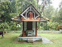
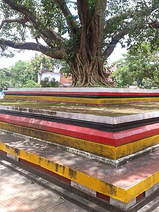
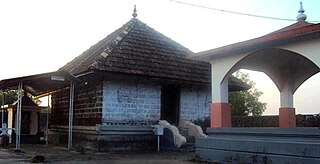
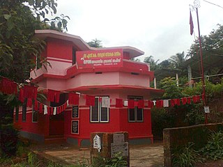
There are places of worship considered important in the Kannur district. Kannur District is one of the 14 districts in the state of Kerala, India. The town of Kannur is the district headquarters, and gives the district its name.
Aduthila is a village between Ezhome and Madayi Panchayath, in the Indian state of Kerala. Aduthila literally means the nearest home.

Olayambadi is a small village about 21 km from Payyanur town in the Kannur district of Kerala state, South India.
Mathamangalam or M.M.Bazar is a small town in Kannur district of Kerala state, India. Mathamagalam is a main trading centre, especially for hill products.
Kuttur is a village in Payyanur Taluk of Kannur district in the Indian state of Kerala.