
Gaighata is a community development block that forms an administrative division in Bangaon subdivision of North 24 Parganas district in the Indian state of West Bengal.
Dhakuria is a census town in Gaighata CD Block in Bangaon subdivision in North 24 Parganas district in the state of West Bengal, India.
Bangaon subdivision is an administrative subdivision of the North 24 Parganas district in the Indian state of West Bengal.
Swarupnagar is a community development block that forms an administrative division in Basirhat subdivision of North 24 Parganas district in the Indian state of West Bengal.
Barasat I is a community development block that forms an administrative division in Barasat Sadar subdivision of North 24 Parganas district in the Indian state of West Bengal.
Habra I is a community development block that forms an administrative division in Barasat Sadar subdivision of North 24 Parganas district in the Indian state of West Bengal.
Baduria is a community development block that forms an administrative division in Basirhat subdivision of North 24 Parganas district in the Indian state of West Bengal.
Hasnabad is a village and a gram panchayat in Hasnabad CD Block in Basirhat subdivision of North 24 Parganas district in the state of West Bengal, India.
Bangaon is a community development block that forms an administrative division in Bangaon subdivision of North 24 Parganas district in the Indian state of West Bengal.
Barrackpore I is a community development block that forms an administrative division in the Barrackpore subdivision of North 24 Parganas district in the Indian state of West Bengal.

Chandpara is a census town in Gaighata CD Block in Bangaon subdivision of North 24 Parganas district in the state of West Bengal, India.
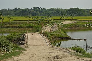
Manikhira is a village near Thakurnagar in Gaighata CD Block in Bangaon subdivision of the North Twenty Four Parganas district in the West Bengal state of India.
Chikanpara is a census town in Gaighata CD Block in Bangaon subdivision of North 24 Parganas district in state of West Bengal, India.
Helencha is a village in Bagdah CD Block in Bangaon subdivision of North 24 Parganas district in the state of West Bengal, India.
Gaighata is a village in Gaighata CD Block in Bangaon subdivision of North 24 Parganas district in the state of West Bengal, India.
Swarupnagar is a village in Swarupnagar CD Block in Basirhat subdivision of North 24 Parganas district in the state of West Bengal, India. Swarupnagar Banglani forms a gram panchayat.
Hingalganj is a census town in Hingalganj CD Block in Basirhat subdivision of North 24 Parganas district in the state of West Bengal, India.
Hemnagar is a village in Hingalganj CD Block in Basirhat subdivision of North 24 Parganas district in the state of West Bengal, India. It is the southernmost habitation in North 24 Parganas district, beyond which the Sunderbans are spread.
Deganga is a village and a gram panchayat in Deganga CD Block in Barasat Sadar subdivision of North 24 Parganas district in the state of West Bengal, India. Berachampa and Deulia are located nearby.
Chhota Jagulia is a village and a gram panchayat in Barasat I CD Block in Barasat Sadar subdivision of North 24 Parganas district in the state of West Bengal, India. It is around 10 km from Barasat

