Plymouth, Connecticut

Last updated

Plymouth, Connecticut
Town of Plymouth
FirstCongregationalChurchPlymouthCT.jpg
First Congregational Church in Plymouth
PlymouthCTseal.gif
Litchfield County Connecticut Incorporated and Unincorporated areas Plymouth Highlighted 2010.svg
Plymouth, Connecticut
Coordinates: 41°40′19″N73°03′10″W / 41.67194°N 73.05278°W / 41.67194; -73.05278
CountryFlag of the United States.svg  United States
U.S. state Flag of Connecticut.svg  Connecticut
County Litchfield
Region Naugatuck Valley
Incorporated1795 [1]
Government
  Type Mayor-council
  MayorJoseph T. Kilduff (R) [2]
  Town Council [3] Roxanne McCann (R)
Daniel Gentile (R)
Ron Tiscia (R)
Nate Brown (R)
Joe Green (R)
Area
  Total22.4 sq mi (57.9 km2)
  Land21.7 sq mi (56.1 km2)
  Water0.4 sq mi (1.1 km2)
Elevation
873 ft (266 m)
Population
 (2020)
  Total11,671
  Density539/sq mi (208.0/km2)
Time zone UTC-5 (Eastern)
  Summer (DST) UTC-4 (Eastern)
ZIP code
06782, 06786
Area code(s) 860/959
FIPS code 09-60750
GNIS feature ID0213489
Website www.plymouthct.us

Plymouth is a town in Litchfield County, Connecticut, United States, located within the Naugatuck Valley Planning Region. It is named after Plymouth, Devon, England. The population was 11,671 at the 2020 census, [4] down from 12,243 at the 2010 census. The town of Plymouth includes the villages of Plymouth Center, Terryville and Pequabuck.

Contents

History

The town was incorporated in 1795 [5] and became known nationally for the manufacture of clocks. [1] The town was named after Plymouth, Massachusetts. [6] Plymouth (formerly Northbury, a section of Waterbury) was originally used as a burying ground for Waterbury. History records show that it was founded by a group of people who believed they had found a large deposit of lead. This fabled "lead mine" never actually existed (or is still yet to be discovered). The oldest home in the community is on Route 6, and dates to 1690–1700.

In the 1790s, George Washington traveled through here, both to visit relatives and to stay away from the coastline.

The Terry family participated in a great deal of Plymouth's history. Eli Terry became partners with Seth Thomas and Silas Hoadley to manufacture clocks in the Greystone section of town. Terry gave the factory to Hoadley and Thomas, and opened his own clock factory near Carter Road in Plymouth Center, while Thomas moved to Plymouth Hollow. Eli Terry, Jr. (son of Eli Terry) joined with another man who was interested in the cabinet and lock industry, and they opened the Eagle Lock Company. In the 1880s, the Plymouth Hollow section of Plymouth decided to split off and become the town of Thomaston, named after Seth Thomas. The Eagle Lock Company closed in the 1970s, and in 1975 the entire abandoned site burned, leaving one building left undamaged. The rest of the buildings were torn down or had floors removed.

The Main Street School was located on the green (Baldwin Park) in Terryville. It was demolished in the 1930s, and the new Terryville High School was constructed behind the green on North Main Street. In the mid-2000s, Prospect Street School and Main Street School (previously called East Main Street) were left abandoned, so the construction of the new Terryville High School could begin in the Holt section of town. The Harry S. Fisher Middle School was turned into the Harry S. Fisher Elementary School, and the old Terryville High School was turned into the Eli Terry Jr. Middle School. [7]

Geography

Plymouth is in southeastern Litchfield County and is bordered to the east by the city of Bristol in Hartford County and to the south by the city of Waterbury in New Haven County. Terryville, the largest community in Plymouth, is in the eastern part of town, while Plymouth Center is in the west. The community of Pequabuck is on the eastern border of the town, southeast of Terryville.

According to the United States Census Bureau, the town of Plymouth has a total area of 22.4 square miles (57.9 km2), of which 21.9 square miles (56.7 km2) are land and 0.4 square miles (1.1 km2), or 1.99%, are water. [8] Part of Mattatuck State Forest is in the southwest corner of the town.

Principal communities

Demographics

Historical population
CensusPop.Note
1820 1,758
1840 2,205
1850 2,56816.5%
1860 3,24426.3%
1870 4,14027.6%
1880 2,350−43.2%
1890 2,147−8.6%
1900 2,82831.7%
1910 5,02177.5%
1920 5,94218.3%
1930 6,0702.2%
1940 6,043−0.4%
1950 6,77112.0%
1960 8,98132.6%
1970 10,32114.9%
1980 10,7324.0%
1990 11,82210.2%
2000 11,634−1.6%
2010 12,2435.2%
2020 11,671−4.7%
U.S. Decennial Census [9]

As of the census [10] of 2000, there were 11,634 people, 4,453 households, and 3,228 families residing in the town. The population density was 535.6 inhabitants per square mile (206.8/km2). There were 4,646 housing units at an average density of 213.9 per square mile (82.6/km2). The racial makeup of the town was 97.34% White, 0.78% African American, 0.15% Native American, 0.42% Asian, 0.01% Pacific Islander, 0.32% from other races, and 0.97% from two or more races. Hispanic or Latino of any race were 1.26% of the population.

There were 4,453 households, out of which 34.2% had children under the age of 18 living with them, 58.7% were married couples living together, 9.7% had a female householder with no husband present, and 27.5% were non-families. 22.8% of all households were made up of individuals, and 9.2% had someone living alone who was 65 years of age or older. The average household size was 2.60 and the average family size was 3.06.

In the town, the population was spread out, with 25.8% under the age of 18, 6.5% from 18 to 24, 31.8% from 25 to 44, 23.3% from 45 to 64, and 12.7% who were 65 years of age or older. The median age was 38 years. For every 100 females, there were 99.1 males. For every 100 females age 18 and over, there were 95.6 males.

The median income for a household in the town was $53,750, and the median income for a family was $62,610. Males had a median income of $41,985 versus $32,359 for females. The per capita income for the town was $23,244. About 2.7% of families and 4.1% of the population were below the poverty line, including 2.9% of those under age 18 and 5.3% of those age 65 or over.

Education

Plymouth is served by the Plymouth Public Schools District. There are four schools in the district and students attend Terryville High School.

Transportation

The town is served by U.S. Route 6, Connecticut Route 72, and Connecticut Route 262. Route 6 passes through Terryville and Plymouth Center, leading east through Bristol 22 miles (35 km) to Hartford, the state capital, and west through Thomaston, 8 miles (13 km) to Watertown. Route 72 least southeast 3 miles (5 km) to Bristol and north 9 miles (14 km) to Harwinton, while Route 262 south and west via a circuitous route to Oakville and Watertown.

Notable people

Related Research Articles

<span class="mw-page-title-main">Hartford County, Connecticut</span> County in Connecticut, United States

Hartford County is a county located in the north central part of the U.S. state of Connecticut. According to the 2020 census, the population was 899,498, making it the second-most populous county in Connecticut. Hartford County contains the city of Hartford, the state capital of Connecticut and the county's most populous city, with 121,054 residents at the 2020 census. Hartford County is included in the Hartford-East Hartford-Middletown metropolitan statistical area.

<span class="mw-page-title-main">Litchfield County, Connecticut</span> County in Connecticut, United States

Litchfield County is in northwestern Connecticut, United States. As of the 2020 census, the population was 185,186. The county was named after Lichfield, in England. Litchfield County has the lowest population density of any county in Connecticut and is the state's largest county by area.

<span class="mw-page-title-main">Bantam, Connecticut</span> Borough in Connecticut, United States

Bantam is a borough in Litchfield County, Connecticut, United States. The population was 720 at the 2020 census. It is part of the town of Litchfield.

<span class="mw-page-title-main">Bethlehem, Connecticut</span> Town in Connecticut, United States

Bethlehem is a town in Litchfield County, Connecticut, United States. The population was 3,385 at the 2020 census, down from 3,607 at the 2010 census. The town is part of the Naugatuck Valley Planning Region. The town center is a historic district and a census-designated place (CDP).

<span class="mw-page-title-main">Bridgewater, Connecticut</span> Town in Connecticut, United States

Bridgewater is a town in Litchfield County, Connecticut, United States. The population was 1,662 at the 2020 census, down from 1,727 at the 2010 census. The town is part of the Western Connecticut Planning Region.

<span class="mw-page-title-main">Harwinton, Connecticut</span> Town in Connecticut, United States

Harwinton is a town in Litchfield County, Connecticut, United States. The population was 5,484 at the 2020 census. The town is part of the Northwest Hills Planning Region. The high school is Lewis S. Mills.

<span class="mw-page-title-main">Oakville, Connecticut</span> Census-designated place in Connecticut, United States

Oakville is a census-designated place (CDP) and neighborhood section of Watertown, in Litchfield County, Connecticut, United States. The population was 9,047 as of the 2010 census. It is the most populous community in Watertown, with more than twice as many people as the center village of Watertown. The ZIP code for Oakville is 06779.

<span class="mw-page-title-main">Roxbury, Connecticut</span> Town in Connecticut, United States

Roxbury is a town in Litchfield County, Connecticut, United States. The population was 2,260 at the 2020 census. The town is located 65 miles (105 km) northeast of New York City, and is part of the Northwest Hills Planning Region.

<span class="mw-page-title-main">Terryville, Connecticut</span> Census-designated place in Plymouth, Connecticut, US

Terryville is a census-designated place (CDP) in Litchfield County, Connecticut, United States, and is the largest village within the town of Plymouth. In the 2010 census, Terryville had a population of 5,387, out of 12,243 in the entire town of Plymouth. The village is named for Eli Terry Jr., the son of the well-known clockmaker Eli Terry Sr. Terryville is also home to the Lock Museum of America. There is a water wheel located in downtown Terryville that is dedicated to the son of Eli Terry Sr.

<span class="mw-page-title-main">Thomaston, Connecticut</span> Town in Connecticut, United States

Thomaston is a town in Litchfield County, Connecticut, United States. The town is part of the Naugatuck Valley Planning Region. The population was 7,442 at the 2020 census. The urban center of the town is the Thomaston census-designated place, with a population of 1,928 at the 2020 census.

<span class="mw-page-title-main">Warren, Connecticut</span> Town in Connecticut, United States

Warren is a town in Litchfield County, Connecticut, United States. The population was 1,351 at the 2020 census. The town is part of the Northwest Hills Planning Region. The town was named for Revolutionary War General Joseph Warren.

<span class="mw-page-title-main">Watertown, Connecticut</span> Town in Connecticut, United States

Watertown is a town in Litchfield County, Connecticut, United States. The town is part of the Naugatuck Valley Planning Region. The population was 22,105 at the 2020 census. The ZIP Codes for Watertown are 06795 and 06779. It is a suburb of Waterbury. The urban center of the town is the Watertown census-designated place, with a population of 3,938 at the 2020 census.

<span class="mw-page-title-main">Winchester, Connecticut</span> Town in Connecticut, United States

Winchester is a town in Litchfield County, Connecticut, United States. The population was 10,224 at the 2020 census. The city of Winsted is located in Winchester. The town is part of the Northwest Hills Planning Region.

<span class="mw-page-title-main">Middlebury, Connecticut</span> Town in Connecticut, United States

Middlebury is a town in New Haven County, Connecticut, United States. The population was 7,574 at the 2020 census. The town is part of the Naugatuck Valley Planning Region. It is a suburb of the nearby city of Waterbury to its south, and is on the northern fringe of the New York metropolitan area.

<span class="mw-page-title-main">Eli Terry</span> American inventor

Eli Terry Sr. was an inventor and clockmaker in Connecticut. He received a United States patent for a shelf clock mechanism. He introduced mass production to the art of clockmaking, which made clocks affordable for the average American citizen. Terry occupies an important place in the beginnings of the development of interchangeable parts manufacturing. Terry is considered the first person in American history to actually accomplish interchangeable parts with no government funding. Terry became one of the most accomplished mechanics in New England during the early part of the nineteenth century. The village of Terryville, Connecticut is named for his son, Eli Terry Jr.
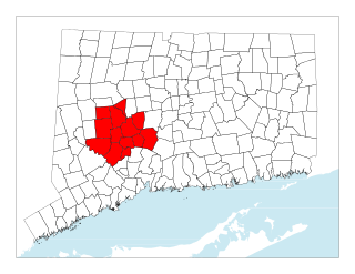
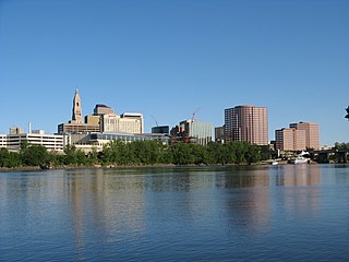
<span class="mw-page-title-main">Central Naugatuck Valley</span> Place in Connecticut, United States

The Central Naugatuck Valley is a region of Connecticut in New Haven and Litchfield counties located approximately 70 miles (110 km) northeast of New York City and 110 miles (180 km) southwest of Boston, United States. The region comprises 13 towns: Beacon Falls, Bethlehem, Cheshire, Middlebury, Naugatuck, Oxford, Prospect, Southbury, Thomaston, Waterbury, Watertown, Wolcott, and Woodbury.
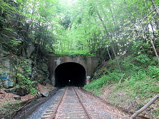
<span class="mw-page-title-main">Pequabuck Tunnel</span>

The Pequabuck Tunnel, also known as the Terryville Tunnel, is a railroad tunnel in Plymouth and Pequabuck, Connecticut. It is located on a still-active segment of the Hartford, Providence and Fishkill Railroad used by freight trains running between New Britain and Waterbury. Although locally known as the Mile Long Tunnel, the Pequabuck Tunnel is just 3,580 feet long – 0.68 miles. The tunnel is 32 feet wide and 26 feet tall, with regularly spaced recesses in the walls to allow a person to seek safety while a train passes.
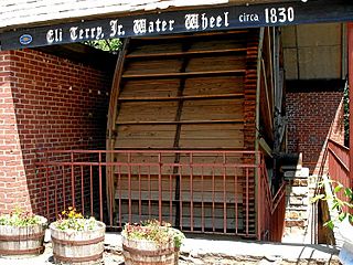
<span class="mw-page-title-main">Terryville Waterwheel</span> United States historic place

The Terryville Waterwheel is a historic industrial water wheel at the Pequabuck River and Main Street in the Terryville section of Plymouth, Connecticut. Probably built in 1851 for a local clockmaker, it is one of three surviving 19th-century water wheels in the state. It was listed on the National Register of Historic Places listings in 2002.

<span class="mw-page-title-main">Watertown (CDP), Connecticut</span> Census-designated place in Connecticut, United States

Watertown is a census-designated place (CDP) in Litchfield County, Connecticut, United States. It comprises the central village of the town of Watertown. As of the 2010 census, the population of the CDP was 3,574, out of 22,514 in the entire town. As of the 2020 Census, the population was 22,105.
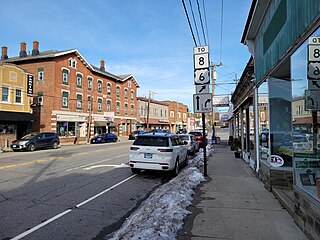
<span class="mw-page-title-main">Thomaston (CDP), Connecticut</span> Census-designated place in Connecticut, United States

Thomaston is a census-designated place (CDP) in Litchfield County, Connecticut, United States. It comprises the downtown portion of the town of Thomaston. As of the 2010 census, the population of the CDP was 1,910, out of 7,887 in the entire town.

References

  1. 1 2 "Plymouth Town History". Plymouth Town History. Retrieved December 3, 2012.
  2. "Plymouth, CT Municipal Election Results 2021".
  3. "Town Council". Town of Plymouth, CT. Retrieved September 16, 2015.
  4. "Census - Geography Profile: Plymouth town, Litchfield County, Connecticut". United States Census Bureau . Retrieved December 20, 2021.
  5. "Plymouth, Connecticut". City-Data.com. Retrieved December 3, 2012.
  6. The Connecticut Magazine: An Illustrated Monthly. Connecticut Magazine Company. 1903. p. 334.
  7. Giguere, Judy. Plymouth Revisited. Charleston, SC: Arcadia Pub., 2011. Print.
  8. "Geographic Identifiers: 2010 Census Summary File 1 (G001), Plymouth town, Litchfield County, Connecticut". American FactFinder. U.S. Census Bureau. Archived from the original on February 13, 2020. Retrieved October 10, 2019.
  9. "Census of Population and Housing". Census.gov. Retrieved June 4, 2015.
  10. "U.S. Census website". United States Census Bureau . Retrieved January 31, 2008.
  11. Who Was Who in America, Historical Volume, 1607-1896. Marquis Who's Who. 1967.
  12. "atwater « Search Results « plymouth historical society". plymouthhistoricalsociety.org. Retrieved July 28, 2015.
  13. text : Plymouth 1776-1976
  14. "Henry Dutton". National Governors Association. Retrieved December 1, 2012.
  15. http://plymouthhistoricalsociety.files.wordpress.com/2012/12/walking-tour-6-27-low-res.pdf [ bare URL PDF ]
  16. Taylor, William Harrison (1910). Legislative History and Souvenir of Connecticut: Volume 7. p. 62.PD-icon.svg This article incorporates text from this source, which is in the public domain .
  17. "Articles by our Town Historian". plymouthct.us. Retrieved July 28, 2015.

Further reading