
The Ottawa River is a river in the Canadian provinces of Ontario and Quebec. It is named in honour of the Algonquin word 'to trade', as it was the major trade route of Eastern Canada at the time. For most of its length, it defines the border between these two provinces. It is a major tributary of the St. Lawrence River and the longest river in Quebec.

Carleton Place is a town in Eastern Ontario, Canada, in Lanark County, about 46 kilometres (29 mi) west of downtown Ottawa. It is located at the crossroads of Highway 15 and Highway 7, halfway between the towns of Perth, Almonte, Smiths Falls, and the nation's capital, Ottawa. Canada's Mississippi River, a tributary of the Ottawa River flows through the town. Mississippi Lake is just upstream by boat, as well as by car.

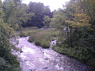
The Mississippi River is a tributary of the Ottawa River in Eastern Ontario, Canada which has no relation with the Mississippi River in the United States. It is 200 kilometres (120 mi) in length from its source at Mackavoy Lake, has a drainage area of 4,450 square kilometres (1,720 sq mi), and has a mean discharge of 40 cubic metres per second (1,400 cu ft/s). There are more than 250 lakes in the watershed.
The Indian River is a river in Lanark County in Eastern Ontario, Canada. It is in the Saint Lawrence River drainage basin and is a left tributary of the Mississippi River.

Lanark County is a county located in the Canadian province of Ontario. Its county seat is Perth, which was first settled in 1816. Most European settlements of the county began in 1816, when Drummond, Beckwith and Bathurst townships were named and initially surveyed. The first farm north of the Rideau was cleared and settled somewhat earlier, in 1790. The county took its name from the town of Lanark in Scotland. Nearly all the townships were named after British public and military figures from the era of early settlement.
The Fall River is a river in Frontenac and Lanark Counties in Eastern Ontario, Canada. It is part of the Ottawa River drainage basin, and flows from Sharbot Lake and through Bennett Lake to join the Mississippi River. The river is named after settlers of the late 17th century.

Almonte is a former mill town in Lanark County, in the eastern portion of Ontario, Canada. Formerly a separate municipality, Almonte is a ward of the town of Mississippi Mills, which was created on January 1, 1998, by the merging of Almonte with Ramsay and Pakenham townships. Almonte is 46 kilometres (29 mi) south-west of downtown Ottawa. Its population as recorded in the 2016 Canadian Census was 5,039.

The Jock River, known locally as the Mighty Jock, is a river in Ottawa and Lanark County in Eastern Ontario, Canada. It is in the Saint Lawrence River drainage basin and is a left tributary of the Rideau River. The river is named after Jacques, a French man who drowned in it in the early 19th century, and it was once known as the Goodwood River. The River is supported by a community-volunteer organization known as the Friends of the Jock River.
Herron's Mills, originally known as Gillies Mills, is a ghost town in the municipality of Lanark Highlands, Lanark County in Eastern Ontario, Canada, near the community of Lanark. It is located on highway 511 between Perth and Calabogie, Ontario.

The Tay River is a river in Lanark County in Eastern Ontario, Canada. It is in the Saint Lawrence River drainage basin and is a left tributary of the Rideau River.
The Clyde River is a river in Lanark County in Eastern Ontario, Canada. It is in the Saint Lawrence River drainage basin, is a left tributary of the Mississippi River, and was named after the River Clyde in Scotland.

Conservation Ontario is the umbrella organization which represents all of the conservation authorities in Ontario. This nonprofit organization was founded in 1980/81. Conservation Ontario is the network of 36 Conservation Authorities.
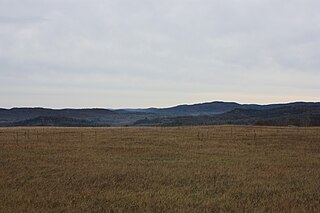
The Opeongo Hills are a range of hills in Southern Ontario, near Algonquin Provincial Park. The hills stretch from Opeongo Lake in Algonquin Park in the west, along the Madawaska and Opeongo Rivers, towards the Opeongo Colonization Road, and extending towards the Deacon Escarpment, Bonnechere, Ontario, and Dacre in the east. To the east of the Opeongo Hills lie the Madawaska River valley, the Mississippi River Valley, and the Ottawa-Bonnechere Graben along the Ottawa River. The hills continue into Quebec across the Ottawa River as the Laurentian Highlands and the Laurentian Mountains. Its tallest peak is roughly 7 km northeast of Highway 60. At roughly 586 meters, it is the tallest point in Southern Ontario. The community of Foymount is one of the highest settlements in Southern Ontario.

Mississippi Lake is a lake in Lanark County in Ontario, Canada. Ontario's Mississippi River flows northeast and north through the lake. Several small creeks including Cranberry Creek, McCrearys Creek, and McGibbon Creek drain into the lake from adjoining forest and agricultural land. The lake is distinctive for having one side that is part of the Canadian shield, while the other is mostly limestone. The lake is a remnant of the old Champlain Sea, which flooded eastern Ontario at the end of last ice age. The former shoreline of the sea can still be traced inland from the north shore of the lake.
The Mississippi Valley Conservation Authority (MVCA) is a conservation authority in the province of Ontario. It is headquartered in Carleton Place, Ontario and serves a 4450 km2 watershed located across eleven municipalities. The organization is responsible for both the Mississippi River watershed and the Carp River watershed.

The Mill of Kintail Conservation Area is a 152 acres (62 ha) preserve operated by the Mississippi Valley Conservation Authority, in Mississippi Mills, Ontario, Canada.

The Morris Island Conservation Area is operated by the Mississippi Valley Conservation Authority.
Ethel O'Neil (1880–1952) was a Canadian poet and musician who married Robert Tait McKenzie, a Canadian sculptor and educator, in 1907.
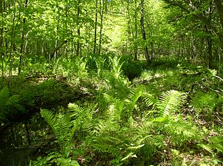
Scotch Corners Wetland is a provincially significant wetland complex located in Lanark County, Ontario, Canada. The 202 hectares area has a wide array of wetland types including swamps, marshes, vernal pools, beaver ponds and seepage areas. It forms the headwaters of several creeks that drain into Mississippi Lake.
The Cataraqui Region Conservation Authority is one of 36 conservation authorities in the Canadian province of Ontario. It is headquartered in Kingston, Ontario The authority was established by an Order in Council in December 1964 via the Conservation Authorities Act, and is a member authority of Conservation Ontario.

