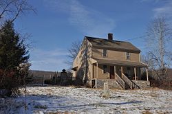
Aspetuck is a village, which in Connecticut is an unincorporated community on the Aspetuck River, in Fairfield County, Connecticut, mostly in the town of Easton but extending also into Weston. It is significant for being the location of the Aspectuck Historic District, a well-preserved collection of houses from the 18th and 19th centuries. The area was settled in the 17th century. It was a long-time home of Helen Keller. According to a New York Times real estate section article, "The district gets its name from the Aspetuck Indians, who lived along the river. In 1670, they sold the land to English settlers for cloth, winter wheat and maize valued at $.36." Weston was incorporated in 1787, and Easton was split out and incorporated in 1845.

Jordan is a village in the town of Waterford, Connecticut, and the historic center of the town. It was named from the Jordan River. The village was listed on the National Register of Historic Places as Jordan Village Historic District in 1990.

The Noank Historic District is a historic district encompassing the historic main part of the village of Noank in the town of Groton, Connecticut. The district contains a distinctive assortment of mid-to-late 19th-century residential architecture that is notable for its often picturesque woodwork. At the time of their construction, the village was primarily a worker village for nearby shipyards. The district was listed on the National Register of Historic Places in 1979.
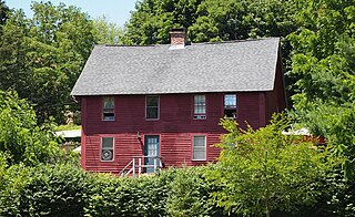
The Quaker Hill Historic District encompasses the center a mainly residential village in northeastern Waterford, Connecticut. Running in a mostly linear fashion along Old Norwich Road between Connecticut Route 32 and Richard Grove Road, the area first grew as a settlement of religious non-conformists in the 17th century, developed in the 19th century as a small industrial village, and became more suburban in character in the 20th century. Its architecture is reflective of these changes, and it was listed on the National Register of Historic Places in 2002.

Brooklyn Green Historic District is a historic district on Route 169, Route 205, U.S. Route 6, Wolf Den, Brown, Prince Hill, and Hyde Roads in the town of Brooklyn, Connecticut. The district is notable for its Greek Revival, Colonial, and Federal architecture. It was added to the National Register of Historic Places in 1982.

The Clinton Village Historic District encompasses the historic portion of the town center of Clinton, Connecticut. It is roughly linear and extends along East Main Street from the Indian River in the west to Old Post Road in the east. The area represents a well-preserved mid-19th century town center, with architecture dating from the late 17th to mid-20th centuries. The district was listed on the National Register of Historic Places in 1994.

The Middle Haddam Historic District is a historic district in the town of East Hampton, Connecticut. It encompasses the village center of Middle Haddam, a riverfront community founded in the 17th century on the east bank of the Connecticut River. It was an important port on the river between about 1730 and 1880. Its layout and architecture are reflective of this history, and by the geographic constraints of the local terrain. The district was listed on the National Register of Historic Places in 1984.

The Tariffville Historic District is a 93 acres (38 ha) historic district in the town of Simsbury, Connecticut. It was listed on the National Register of Historic Places in 1993. It is part of the Tariffville section of Simsbury. The district includes 165 contributing buildings and two contributing sites. It also includes 26 non-contributing buildings and 4 non-contributing sites. There are several houses in the district of Gothic Revival style, probably following designs from pattern books of architect Andrew Jackson Downing. The Trinity Episcopal Church is the only building in the district designed by an architect of national standing, namely Henry C. Dudley. Many of the homes in the area were built by the Tariff Manufacturing Company, which opened a carpet mill along the Farmington River, and needed housing for workers.
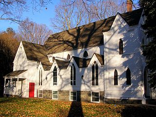
The Pine Meadow Historic District encompasses most of the historic 19th-century village of Pine Meadow in New Hartford, Connecticut. Located at a bend in the West Branch of the Farmington River southeast of New Hartford center, it is a well-preserved example of a rural industrial village. The district was listed on the National Register of Historic Places in 1996.

The East Plymouth Historic District is a historic district in the town of Plymouth, Connecticut. It encompasses a small rural village in the northeastern part of the town, whose main focus is the 1792 St. Matthew's Church, one of the oldest surviving Episcopal church buildings in the state. The district runs along East Plymouth Road on either side of its junction with Marsh Road, and includes predominantly Greek Revival residential buildings erected in the early to mid-19th century. The district was listed on the National Register of Historic Places in 1985.

The Milton Center Historic District encompasses the historic 19th-century village center of Milton in the northwestern part of the town of Litchfield, Connecticut. Basically linear, it stretches from Milton Cemetery in the west to the junction of Milton and Shearshop Roads in the east, including houses, churches, schools, and the remains of industrial sites. The district was listed on the National Register of Historic Places in 1986.

St. Andrew's is a historic Episcopal church at 247 New Milford Turnpike, in the Marbledale village of Washington, Litchfield County, Connecticut. Built in 1822, it is believed to be one of the first Gothic Revival style churches to be built in rural Connecticut. It was listed on the National Register of Historic Places in 1994.

The New Preston Hill Historic District encompasses a small rural 19th-century village center in the New Preston area of the town of Washington, in Litchfield County, Connecticut. Settled in the late 18th century, it is distinctive for its examples of stone architecture, include a rare Federal period stone church. The district, located at the junction of New Preston Road with Gunn Hill and Findlay Roads, was listed on the National Register of Historic Places in 1985.

The Calhoun–Ives Historic District, or more formally the Calhoun Street–Ives Road Historic District, is a locally and nationally designated rural agricultural historic district in the town of Washington, Connecticut. It is located a mile north of the village of Washington Depot, Connecticut. It runs along Calhoun Street and Ives Road. It is characterized by modestly scaled 18th and 19th century farmhouses, together with accompanying agricultural outbuildings, farm fields, and fruit orchards, set along roads lined by stone walls. The district was listed on the National Register of Historic Places in 1995.
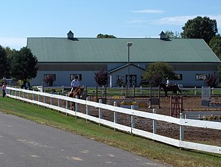
The East Weatogue Historic District is a 490-acre (200 ha) historic district in the town of Simsbury, Connecticut that was listed on the National Register of Historic Places in 1990. It then included 102 contributing buildings, 10 contributing sites, 11 contributing structures, and one other contributing object. The district encompasses a largely agrarian rural village centered at the junction of Hartford Road and East Weatogue Street, whose early development dates to the late 17th century, with the oldest surviving buildings dating to 1730. Most of the properties in the district are Colonial, Federal, or Greek Revival in character, with only a few later Victorian houses. In the early 20th century Colonial Revival houses sympathetic to the earlier buildings.
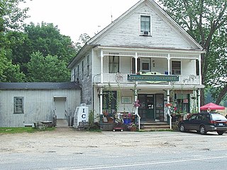
The Mansfield Center Historic District encompasses the historic early village center of Mansfield, Connecticut. First settled about 1692, it is one of the oldest settlements in Tolland County, and retains a strong sense of 18th century colonial layout. It extends along Storrs Street extending from Chaffeeville Road in the north to Centre Street in the south, and was listed on the National Register of Historic Places in 1972.

The Spring Hill Historic District encompasses a rural 19th-century village stretching along Storrs Road in Mansfield, Connecticut. Spring Hill developed as a rural waystation on an early 19th-century turnpike, and has seen only modest development since the late 19th century. The district was listed on the National Register of Historic Places in 1979.
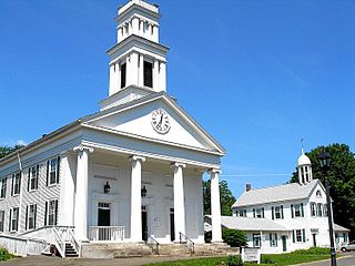
The Plymouth Center Historic District encompasses historic early village center of Plymouth, Connecticut. Stretching along Main, North and South Streets from their junction, it flourished in the 19th century with small-scale industries, but declined late in the century with the separation of Thomaston and the more significant industrial development at Terryville. The district features colonial, Federal, and Greek Revival architecture and was added to the National Register of Historic Places in 1999, with a slight enlargement the following year.
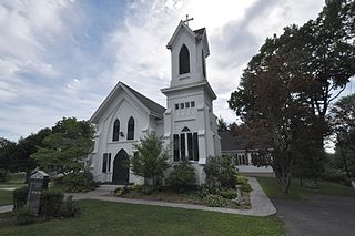
Bridgewater Center Historic District encompasses the traditional town center of Bridgewater, Connecticut. Centered at the junction of Main Street with Clapboard and Hat Shop Hill Roads, it developed in the early 19th century as a civic center, even before the town's 1856 incorporation from New Milford. The architecture of the center is largely reflective of the first half of the 19th century, including Greek Revival and Federal style buildings. It was listed on the National Register of Historic Places in 2000.

The Watertown Center Historic District encompasses the historic village center of Watertown, Connecticut. It exhibits architectural and historic changes from the early 1700s into the 20th century. It is roughly bounded by Main, Warren, North, Woodbury, Woodruff, and Academy Hill Roads, and was listed on the National Register of Historic Places in 2001.
