ECHELON, originally a secret government code name, is a surveillance program operated by the five signatory states to the UKUSA Security Agreement: Australia, Canada, New Zealand, the United Kingdom and the United States, also known as the Five Eyes.

The European Space Operations Centre (ESOC) serves as the main mission control centre for the European Space Agency (ESA) and is located in Darmstadt, Germany. ESOC's primary function is the operation of uncrewed spacecraft on behalf of ESA and the launch and early orbit phases (LEOP) of ESA and third-party missions. The Centre is also responsible for a range of operations-related activities within ESA and in cooperation with ESA's industry and international partners, including ground systems engineering, software development, flight dynamics and navigation, development of mission control tools and techniques and space debris studies.

A satellite or artificial satellite is an object intentionally placed into orbit around a celestial body. Satellites have a variety of uses, including communication relay, weather forecasting, navigation (GPS), broadcasting, scientific research, and Earth observation. Additional military uses are reconnaissance, early warning, signals intelligence and, potentially, weapon delivery. Other satellites include the final rocket stages that place satellites in orbit and formerly useful satellites that later become defunct.
A communications satellite is an artificial satellite that relays and amplifies radio telecommunication signals via a transponder; it creates a communication channel between a source transmitter and a receiver at different locations on Earth. Communications satellites are used for television, telephone, radio, internet, and military applications. Many communications satellites are in geostationary orbit 22,300 miles (35,900 km) above the equator, so that the satellite appears stationary at the same point in the sky; therefore the satellite dish antennas of ground stations can be aimed permanently at that spot and do not have to move to track the satellite. Others form satellite constellations in low Earth orbit, where antennas on the ground have to follow the position of the satellites and switch between satellites frequently.

Spaceflight is an application of astronautics to fly objects, usually spacecraft, into or through outer space, either with or without humans on board. Most spaceflight is uncrewed and conducted mainly with spacecraft such as satellites in orbit around Earth, but also includes space probes for flights beyond Earth orbit. Such spaceflight operate either by telerobotic or autonomous control. The more complex human spaceflight has been pursued soon after the first orbital satellites and has reached the Moon and permanent human presence in space around Earth, particularly with the use of space stations. Human spaceflight programs include the Soyuz, Shenzhou, the past Apollo Moon landing and the Space Shuttle programs. Other current spaceflight are conducted to the International Space Station and to China's Tiangong Space Station.

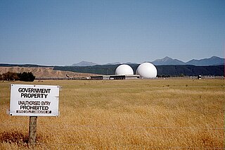
A radome is a structural, weatherproof enclosure that protects a radar antenna. The radome is constructed of material transparent to radio waves. Radomes protect the antenna from weather and conceal antenna electronic equipment from view. They also protect nearby personnel from being accidentally struck by quickly rotating antennas.

The Swedish Space Corporation, SSC, also registered as Svenska rymdaktiebolaget, is a Swedish space services company. SSC operations consist of launches of sounding rockets and stratospheric balloons, tests of future generation rocket engines and new rocket fuels, operation and maintenance of space and aviation systems, as well as satellite communications through the use of SSC ground stations deployed around the world. SSC is also working on developing its Space Surveillance Tracking (SST) and Space Traffic Management (STM) programs with the aim to identify, assess and minimize risks of collisions and disruptions associated with space debris.

Andover Earth Station was one of the first satellite earth stations, located at Andover in the US state of Maine. It was built by AT&T in 1961 to communicate with the Telstar 1 satellite, the first direct relay communications satellite. It provided the first experimental satellite telephone and television service between North America and Europe. It was also used with the Relay satellite. The giant horn was dismantled in the mid 1980s along with the visitor center.
ORBCOMM is an American company that offers industrial internet and machine to machine (M2M) communications hardware, software and services designed to track, monitor, and control fixed and mobile assets in markets including transportation, heavy equipment, maritime, oil and gas, utilities and government. The company provides hardware devices, modems, web applications, and data services delivered over multiple satellite and cellular networks.

SAR-Lupe is Germany's first reconnaissance satellite system and is used for military purposes. SAR is an abbreviation for synthetic-aperture radar, and "Lupe" is German for magnifying glass. The SAR-Lupe program consists of five identical (770 kg) satellites, developed by the German aeronautics company OHB-System, which are controlled by a ground station responsible for controlling the system and analysing the retrieved data. A large data archive of images will be kept in a former Cold War bunker belonging to the Kommando Strategische Aufklärung of the Bundeswehr. The total price of the satellites was over 250 million Euro.

Commercial use of space is the provision of goods or services of commercial value by using equipment sent into Earth orbit or outer space. This phenomenon – aka Space Economy – is accelerating cross-sector innovation processes combining the most advanced space and digital technologies to develop a broad portfolio of space-based services. The use of space technologies and of the data they collect, combined with the most advanced enabling digital technologies is generating a multitude of business opportunities that include the development of new products and services all the way to the creation of new business models, and the reconfiguration of value networks and relationships between companies. If well leveraged such technology and business opportunities can contribute to the creation of tangible and intangible value, through new forms and sources of revenue, operating efficiency and the start of new projects leading to multidimensional positive impact. Examples of the commercial use of space include satellite navigation, satellite television and commercial satellite imagery. Operators of such services typically contract the manufacturing of satellites and their launch to private or public companies, which form an integral part of the space economy. Some commercial ventures have long-term plans to exploit natural resources originating outside Earth, for example asteroid mining. Space tourism, currently an exceptional activity, could also be an area of future growth, as new businesses strive to reduce the costs and risks of human spaceflight.

Raisting is a municipality in the Weilheim-Schongau district, in Bavaria, Germany.
Signals intelligence operational platforms are employed by nations to collect signals intelligence, which is intelligence-gathering by interception of signals, whether between people or between machines, or mixtures of the two. As sensitive information is often encrypted, signals intelligence often involves the use of cryptanalysis. However, traffic analysis—the study of who is signalling whom and in what quantity—can often produce valuable information, even when the messages themselves cannot be decrypted.
The European Data Relay System (EDRS) system is a European constellation of GEO satellites that relay information and data between satellites, spacecraft, UAVs, and ground stations. The first components were launched in 2016 and 2019.

Telstar is the name of various communications satellites. The first two Telstar satellites were experimental and nearly identical. Telstar 1 launched on top of a Thor-Delta rocket on July 10, 1962. It successfully relayed through space the first television pictures, telephone calls, and telegraph images, and provided the first live transatlantic television feed. Telstar 2 was launched May 7, 1963. Telstar 1 and 2—though no longer functional—still orbit the Earth.

Svalbard Satellite Station or SvalSat is a satellite ground station located on Platåberget near Longyearbyen in Svalbard, Norway. Opened in 1997, it is operated by Kongsberg Satellite Services (KSAT), a joint venture between Kongsberg Defence & Aerospace and the Norwegian Space Centre (NSC). SvalSat and KSAT's Troll Satellite Station (TrollSat) in Antarctica are the only ground stations that can see a low altitude polar orbiting satellite on every revolution as the Earth rotates. As of 2021, the facility consists of 100 multi-mission and customer-dedicated antennas which operate in the C, L, S, X and K bands. The station provides ground services to more satellites than any other facility in the world.

Troll Satellite Station, commonly abbreviated TrollSat, is a satellite ground station located at Troll in Queen Maud Land, Antarctica. The earth station is owned by Kongsberg Satellite Services (KSAT), a joint venture between the Kongsberg Group and the Norwegian Space Center. The radomes are located on top of Jutulsessen, a nunatak area next to the research station at Troll. The research station is operated by the Norwegian Polar Institute, which also maintains the earth station. TrollSat started operations on 1 March 2007 and was officially opened on 20 January 2008.

Laser communication in space is the use of free-space optical communication in outer space. Communication may be fully in space or in a ground-to-satellite or satellite-to-ground application. The main advantage of using laser communications over radio waves is increased bandwidth, enabling the transfer of more data in less time.

Pleumeur-Bodou Ground Station was an early ground station in north-west France, and one of the first in the world. It was the site of the first satellite transmission between the US and Europe in the early morning of 11 July 1962, lasting 19 minutes on the satellite's seventh orbit.