Ramat Eshkol

Last updated

View of Ramat Eshkol apartment buildings Mishmar hagvul st.jpg
View of Ramat Eshkol apartment buildings

Ramat Eshkol ( רמת אשכול ) (also Ramot Eshkol Hebrew : רמות אשכול) is an Israeli settlement and neighborhood in northern East Jerusalem. [1] It was built on land captured from Jordan in the Six-Day War and occupied by Israel since 1967, and was the first settlement built in East Jerusalem beyond the Green Line by Israel. [2] The international community considers Israeli settlements in East Jerusalem illegal under international law, but the Israeli government disputes this. [3] As of 2017, about 8,975 people live in the neighborhood.

Contents

History

Paran Street in Ramat Eshkol Paran Street Jerusalem July 10 2009 035.jpg
Paran Street in Ramat Eshkol

In 1966, the border with Jordan ran parallel to Shmuel HaNavi Street. Beyond was a no man's land and the bunkers and fortifications of Ammunition Hill, the site of fierce battles between Jordanian and Israeli forces in the 1967 war.[ citation needed ]

According to ARIJ, Israel confiscated 416 dunams of land from the Palestinian neighbourhood of Shuafat in order to construct Ramat Eshkol. [4]

Ramat Eshkol (lit. "Eshkol Heights") was the first new neighborhood built in Jerusalem after the Six Day War, along the route to Mount Scopus, Hadassah Hospital and the Hebrew University. [5]

Plans were drawn up for tree-lined streets, small parks, a neighborhood health clinic and a commercial center with a supermarket. Most of the new apartment buildings were limited to four floors. The architecture included prefab elements, but outside walls were faced with a veneer of Jerusalem stone. [6] Ramat Eshkol was designed as a middle-class neighborhood. [7]

Levi Eshkol Levi Eshkol.jpg
Levi Eshkol

Construction on Sderot Eshkol (Eshkol Boulevard), named for Israeli prime minister Levi Eshkol, began in 1968 [8]

Israel Levitt of the Israel Defense Forces Engineering Corps cleared the mines on what is now Etzion Gaver street. Levitt, also a trained architect, designed the first buildings there. In January 1970, the first occupants moved in. There were no roads, and the nearest bus was on Shmuel Hanavi. The first minyan was held in an air raid shelter on Etzion Gaver street, before the completion of a synagogue.

Government policy at the time was to create a contiguous link from Shmuel Hanavi to French Hill and the campus of Hebrew University of Jerusalem on Mount Scopus. [9] A new bus line, number 9, was inaugurated to link the Mount Scopus campus with the campus in Givat Ram, built when the road to Mount Scopus was blocked by the Jordanians. The route of the bus followed the route of the convoy attacked on April 13, 1948, killing doctors and nurses of Hadassah Hospital.

Building also began at this time in Givat HaMivtar. Plots were raffled off for the construction of single-family homes. A time limit was imposed on construction and access was difficult. The only access was via a muddy track. The construction of private homes on Ramat Hagolan Street in Ramat Eshkol also employed the lottery method.

Parks and memorials

Ammunition Hill park Ammunition Hill P1000984.JPG
Ammunition Hill park

After the Six-Day War, Ammunition Hill was restored and turned into a park and memorial site. Ramat Eshkol also has a park dedicated to Raoul Wallenberg, the Swedish diplomat who saved many Jews during World War II. The neighborhood's largest park is Gan HaHamishah Asar (Park of the Fifteen) commemorating fifteen soldiers killed in 1969 in one day of fighting during the War of Attrition.it also has a park named Gan Eshkolot which is named after a tomb inside with two grape cluster designs on both sides of the tomb's entrance which are called in Hebrew eshkol .

Archaeology

The Eshkolot Tomb in Ramat Eshkol was discovered in 1897. It was the burial site of a prosperous Jerusalem family in the 1st century, part of a large necropolis that surrounded Jerusalem in the Second Temple period. [10] Eshkolot is the plural of eshkol, meaning "cluster of grapes"; the tomb is named for the stone carving of a cluster of grapes over the entrance. [11] Three ossuaries with Hebrew and Aramaic inscriptions were also recovered from a rock-hewn single chamber cave on Ramat Hagolan Street in Ramat Eshkol. [12]

Aerial view of Shmuel Hanavi, Givat Hamivtar and Ramat Eshkol ShmuelHabaviGivatHamivtarRamotEshkol.JPG
Aerial view of Shmuel Hanavi, Givat Hamivtar and Ramat Eshkol

Related Research Articles

<span class="mw-page-title-main">Levi Eshkol</span> Prime Minister of Israel from 1963 to 1969

Levi Eshkol, born Levi Yitzhak Shkolnik, was an Israeli statesman who served as the third Prime Minister of Israel from 1963 until his death from a heart attack in 1969. A founder of the Israeli Labor Party, he served in numerous senior roles, including Minister of Defense (1963–1967) and Minister of Finance (1952–1963).

<span class="mw-page-title-main">Mount Scopus</span> Mountain in northeast Jerusalem

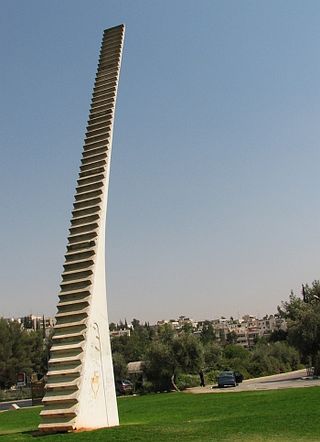
Mount Scopus is a mountain in northeast Jerusalem.

<span class="mw-page-title-main">Efrat (Israeli settlement)</span> Israeli settlement in the West Bank

Efrat, or previously officially Efrata, is an Israeli settlement in the West Bank, established in 1983 in the Judean Mountains. Efrat is located 12 kilometers (7.5 mi) south of Jerusalem, between Bethlehem and Hebron, 6.5 km (4 mi) east of the Green Line, at the Palestinian side of the West Bank wall. The settlement stands at an altitude of up to 960 metres above sea level and covers about 6,000 dunam. Israeli settlements in the West Bank are illegal under international law.

<span class="mw-page-title-main">French Hill (settlement)</span> Israeli settlement in East Jerusalem

French Hill, also Giv'at Shapira, is an Israeli settlement in northern East Jerusalem. It is located on territory that has been occupied since the Six-Day War in 1967 and later unilaterally annexed by Israel under the Jerusalem Law, in a move internationally condemned as illegal, "null and void" under international law, in 1980. The international community considers Israeli settlements in East Jerusalem, such as French Hill, illegal under international law, which the Israeli government disputes.

<span class="mw-page-title-main">Kfar Etzion</span> Israeli settlement in the West Bank

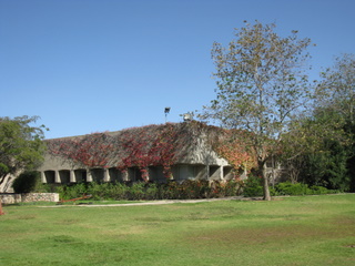
Kfar Etzion is an Israeli settlement in the West Bank, organized as a religious kibbutz located in the Judean Hills between Jerusalem and Hebron in the southern West Bank, established in 1927, depopulated in 1948 and re-established in 1967. It is located 4.7 km east of the Green Line and falls under the jurisdiction of Gush Etzion Regional Council. In 2022, Kfar Etzion had a population of 1,371.

<span class="mw-page-title-main">Highway 50 (Israel–Palestine)</span> Highway in Israel and Palestine

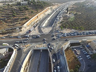
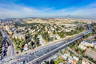
Highway 50, officially called Begin Boulevard and also referred to as Menachem Begin Expressway or Begin Highway, is a north-south urban freeway, through western Jerusalem, named after Israel's sixth Prime Minister, Menachem Begin. Local Jerusalemites simply refer to it as 'Begin'. It enters Area C of the West Bank on the north end and East Jerusalem on both ends.

<span class="mw-page-title-main">Givat Mordechai</span> Neighborhood in Jerusalem, Israel

Givat Mordechai is a Jewish neighborhood in southwest-central Jerusalem, midway between the neighborhoods of Nayot and Malcha. The neighborhood was named after an American philanthropist, Maxwell (Mordechai) Abbell of Chicago.

<span class="mw-page-title-main">Ramat Shlomo</span> Israeli settlement in East Jerusalem

Ramat Shlomo is an Israeli settlement in East Jerusalem. The population, mostly ultra-Orthodox, is 21,000.

<span class="mw-page-title-main">East Talpiot</span> Israeli settlement in East Jerusalem

East Talpiot or Armon HaNetziv is an Israeli settlement in southern East Jerusalem, established by Israel in 1973 on land captured in the Six-Day War and occupied since then. The international community considers East Talpiot to be an Israeli settlement that is illegal under international law. With a population of over 15,000 Israeli settlers, East Talpiot is one of Jerusalem's Ring Neighborhoods.

<span class="mw-page-title-main">Issawiya</span> Palestinian neighborhood in East Jerusalem

Al-Issawiya is a Palestinian neighborhood in East Jerusalem. It is located on the eastern slopes of the Mount Scopus ridge. To the east and north, it is bordered by Road 1, which connects Jerusalem with the settlement of Ma’ale Adumim; immediately adjoining it to the north, west and southwest are the Hadassah Medical Center, the Hebrew University campus, the Jewish settlement of French Hill and the Ofarit military base; to the south, there is a planned park, the Mount Scopus slopes national park.

<span class="mw-page-title-main">Sanhedria</span> Neighborhood in Jerusalem

Sanhedria is a neighborhood in northern Jerusalem. It lies east of Golda Meir Street, adjacent to Ramat Eshkol, Shmuel HaNavi, Maalot Dafna and the Sanhedria Cemetery.

<span class="mw-page-title-main">Shmuel HaNavi (neighborhood)</span> Neighbourhood in Jerusalem

Shmuel HaNavi is a neighborhood in north-central Jerusalem. It is bordered by the Sanhedria Cemetery to the north, Maalot Dafna to the east, Arzei HaBira to the south, and the Bukharan Quarter to the west. It is named after Shmuel HaNavi Street, which runs along its western border and is the main road leading to the tomb of Samuel the prophet just outside Jerusalem's city limits.

<span class="mw-page-title-main">Givat HaMivtar</span> Settlement and neighborhood in East Jerusalem, Israel

Givat HaMivtar is an Israeli settlement and a neighborhood in East Jerusalem established in 1970 between Ramat Eshkol and French Hill. It is located on a hill where an important battle took place in the Six Day War. Archaeological excavations have revealed important ancient Jewish tombs in the region. Givat Hamivtar was one of the first "Build Your Own Home" neighborhoods in Jerusalem.

<span class="mw-page-title-main">Ma'alot Dafna</span> Israeli settlement in the West Bank

Ma'alot Dafna is an Israeli settlement and a neighborhood in East Jerusalem. It borders the neighborhood of Shmuel HaNavi to the west, Ammunition Hill to the east, Ramat Eshkol to the north and Arzei HaBira to the south.

<span class="mw-page-title-main">1948 in Mandatory Palestine</span>

Events in the year 1948 in the British Mandate of Palestine.

<span class="mw-page-title-main">Route 417 (Israel–Palestine)</span> Road in Israel and Palestine

Route 417 is an intercity road in Israel and the West Bank that stretches from the west side of Jerusalem to Ma'ale Adumim and Highway 1 east to the Jordan Valley.

<span class="mw-page-title-main">Shmuel HaNavi Street</span> Street in Jerusalem

Shmuel HaNavi Street is a main road in north-central Jerusalem. It starts at the intersection of St. George and Shivtei Israel Streets near Highway 60, and merges into Golda Meir Boulevard just past the intersection of Bar-Ilan and Hativat Harel Streets. The continuation of the street winds up to the tomb of Samuel the prophet, after whom the street is named.

<span class="mw-page-title-main">City Line (Jerusalem)</span> Temporary boundary within Jerusalem, 1948–1967

City Line is the name given to a segment of the Green Line that divided the city of Jerusalem from 1948 to 1967. It was 7 km in length, and constituted a temporary boundary line in accordance with Israel's Armistice Agreement with Jordan, which divided the city between East Jerusalem which was part of the Kingdom of Jordan, and West Jerusalem, the capital of the State of Israel. The Old City bordered the City line on the east side, and thus had been part of the "Jordanian Jerusalem". On both sides of the City line fortifications and obstacles were deployed, and different buildings in the city along the line were used as military posts.

References

  1. "Settlements in East Jerusalem". Foundation for Middle East Peace.[ permanent dead link ]
  2. Foreign Operations, Export Financing, and Related Programs Appropriations for 1993: Hearings Before a Subcommittee of the Committee on Appropriations, House of Representatives, One Hundred Second Congress, Second Session. Foreign Operations, Export Financing, and Related Programs Appropriations for 1993: Hearings Before a Subcommittee of the Committee on Appropriations, House of Representatives, One Hundred Second Congress, Second Session. U.S. Government Printing Office. 1992. p. 191. Retrieved 15 February 2024.
  3. "The Geneva Convention". BBC News. 10 December 2009. Retrieved 27 November 2010.
  4. Shu’fat Town Profile, ARIJ, 2013 p. 14
  5. Governing Jerusalem: Again on the World's Agenda, Ira Sharkansky
  6. "Jerusalem architecture since 1948". Jewish Virtual Library.
  7. Critical Essays on Israeli Society, Religion, and Government: Books on Israel, edited by Kevin Avruch, Walter P. Zenner
  8. "Ramat Eshkol - Eli Joseph's Jerusalem Real Estate Homepage and Buyer's Guide". A Jerusalem Home. Archived from the original on 25 December 2007.
  9. "Understanding Jerusalem". Middle East Quarterly.
  10. Doris Weiler Garden
  11. "1712-5-Eshkoloth-cave.jpg :: Zev Radovan's Gallery". Biblel and Pictures.
  12. Corpus Inscriptionum Judaeae/Palaestinae, Jerusalem, Part 1:1-704

31°48′07″N35°13′22″E / 31.80194°N 35.22278°E / 31.80194; 35.22278