This article contains too many pictures for its overall length.(October 2023) |
This article contains too many charts, tables, or data .(October 2023) |
Rice County | |
---|---|
Coordinates: 44°22′N93°18′W / 44.36°N 93.3°W | |
Country | United States |
State | Minnesota |
Founded | March 5, 1853 |
Named for | Henry Mower Rice |
Seat | Faribault |
Largest city | Faribault |
Area | |
• Total | 516 sq mi (1,340 km2) |
• Land | 496 sq mi (1,280 km2) |
• Water | 20 sq mi (50 km2) 3.9% |
Population (2020) | |
• Total | 67,097 |
• Estimate (2023) | 67,948 |
• Density | 135.3/sq mi (52.2/km2) |
Time zone | UTC−6 (Central) |
• Summer (DST) | UTC−5 (CDT) |
Congressional districts | 1st, 2nd |
Website | www |
Rice County is a county located in the south central portion of the U.S. state of Minnesota. As of the 2020 census, the population was 67,097. [1] Its county seat is Faribault. [2]
Rice County comprises the Faribault-Northfield, MN Micropolitan Statistical Area , which is included in the Minneapolis-St. Paul, MN-WI Combined Statistical Area.
Rice County was founded on March 5, 1853. [3] It was named for Henry Mower Rice, a fur trader who became instrumental in creation of the Minnesota Territory and its subsequent growth and development. [4]
The Cannon River flows northeasterly through the center of the county, on its way to discharge into the Mississippi River at Red Wing. The Straight River flows northerly into the county from Steele County to its discharge point into the Cannon River at Faribault. The North Fork of the Zumbro River rises in south-central Rice County, and flows eastward into Goodhue County on its way to discharge into the Mississippi east of Kellogg.
The county terrain consists of low, rolling hills, entirely devoted to agriculture, and dotted with lakes. [5] The county slopes to the east and north; its highest point is near its SE corner, at 1,263 ft (385 m) ASL. [6] The county has an area of 516 square miles (1,340 km2), of which 496 square miles (1,280 km2) is land and 20 square miles (52 km2) (3.9%) is water. [7] The Cannon River flows northeastwardly through the county, collecting the Straight River in Faribault. The North Fork of the Zumbro River has its headwaters in the county's southeastern part. [8] Rice is one of 17 Minnesota savanna counties with more savanna soils than either prairie or forest soils.
Census | Pop. | Note | %± |
---|---|---|---|
1860 | 7,543 | — | |
1870 | 16,083 | 113.2% | |
1880 | 22,481 | 39.8% | |
1890 | 23,968 | 6.6% | |
1900 | 26,080 | 8.8% | |
1910 | 25,911 | −0.6% | |
1920 | 28,307 | 9.2% | |
1930 | 29,974 | 5.9% | |
1940 | 32,160 | 7.3% | |
1950 | 36,235 | 12.7% | |
1960 | 38,988 | 7.6% | |
1970 | 41,582 | 6.7% | |
1980 | 46,087 | 10.8% | |
1990 | 49,183 | 6.7% | |
2000 | 56,665 | 15.2% | |
2010 | 64,142 | 13.2% | |
2020 | 67,097 | 4.6% | |
2023 (est.) | 67,948 | [10] | 1.3% |
U.S. Decennial Census [11] 1790-1960 [12] 1900-1990 [13] 1990-2000 [14] 2010-2020 [1] |
Race | Num. | Perc. |
---|---|---|
White (NH) | 51,523 | 76.8% |
Black or African American (NH) | 4,353 | 6.5% |
Native American (NH) | 297 | 0.44% |
Asian (NH) | 1,554 | 2.32% |
Pacific Islander (NH) | 10 | 0.02% |
Other/Mixed (NH) | 2,577 | 3.84% |
Hispanic or Latino | 6,783 | 10.11% |
As of the census of 2000, there were 56,665 people, 18,888 households, and 13,353 families in the county. The population density was 114 per square mile (44/km2). There were 20,061 housing units at an average density of 40.4 per square mile (15.6/km2). The racial makeup of the county was 93.59% White, 1.31% Black or African American, 0.43% Native American, 1.46% Asian, 0.04% Pacific Islander, 1.87% from other races, and 1.30% from two or more races. 5.50% of the population were Hispanic or Latino of any race. 32.1% were of German, 14.7% Norwegian, 7.2% Irish and 5.3% Czech ancestry.
There were 18,888 households, out of which 36.50% had children under the age of 18 living with them, 58.10% were married couples living together, 8.60% had a female householder with no husband present, and 29.30% were non-families. 23.90% of all households were made up of individuals, and 9.10% had someone living alone who was 65 years of age or older. The average household size was 2.65 and the average family size was 3.14.
The county population contained 25.30% under the age of 18, 15.80% from 18 to 24, 27.40% from 25 to 44, 20.20% from 45 to 64, and 11.40% who were 65 years of age or older. The median age was 33 years. For every 100 females there were 101.80 males. For every 100 females age 18 and over, there were 100.30 males.
The median income for a household in the county was $48,651, and the median income for a family was $56,407. Males had a median income of $36,771 versus $26,151 for females. The per capita income for the county was $19,695. About 4.00% of families and 6.90% of the population were below the poverty line, including 5.70% of those under age 18 and 10.70% of those age 65 or over.
From its first participating election in 1860 through 1960, Rice County was traditionally Republican, voting for the Republican nominee in every election save 1912 (when it voted for Bull Moose nominee and former Republican president Theodore Roosevelt) and Franklin Roosevelt's 1932 and 1936 landslides. [16] From 1964 through 2012, it became a Democratic stronghold, voting for the Democratic nominee in every election save Richard Nixon's 1972 landslide. In 2016, it voted for a Republican for the first time since 1972 (and for a Republican who was not winning a majority of the national popular vote for the first time since 1960), although it gave him only a plurality, with 7.9% voting third party. However, in 2020, with the third party vote sinking to 2.3%, it voted Republican again, making it the first time since 1956 and 1960 that the county has voted Republican two elections in a row (although the Republican margin was only 62 votes out of over 35,000 cast).
Year | Republican | Democratic | Third party | |||
---|---|---|---|---|---|---|
No. | % | No. | % | No. | % | |
2020 | 17,464 | 48.94% | 17,402 | 48.76% | 820 | 2.30% |
2016 | 15,429 | 47.56% | 14,437 | 44.50% | 2,577 | 7.94% |
2012 | 14,384 | 44.58% | 17,054 | 52.85% | 829 | 2.57% |
2008 | 13,723 | 43.16% | 17,381 | 54.66% | 695 | 2.19% |
2004 | 13,881 | 45.15% | 16,425 | 53.42% | 439 | 1.43% |
2000 | 10,876 | 41.80% | 13,140 | 50.50% | 2,005 | 7.71% |
1996 | 7,016 | 30.09% | 12,821 | 54.98% | 3,483 | 14.94% |
1992 | 7,015 | 29.09% | 10,908 | 45.24% | 6,190 | 25.67% |
1988 | 9,460 | 44.48% | 11,570 | 54.40% | 237 | 1.11% |
1984 | 10,456 | 48.58% | 10,880 | 50.55% | 189 | 0.88% |
1980 | 8,168 | 39.51% | 9,531 | 46.10% | 2,974 | 14.39% |
1976 | 8,311 | 42.39% | 10,590 | 54.01% | 706 | 3.60% |
1972 | 9,195 | 52.62% | 8,065 | 46.15% | 215 | 1.23% |
1968 | 7,037 | 45.94% | 7,785 | 50.82% | 497 | 3.24% |
1964 | 5,518 | 37.18% | 9,299 | 62.65% | 26 | 0.18% |
1960 | 8,248 | 54.87% | 6,752 | 44.92% | 31 | 0.21% |
1956 | 8,471 | 65.24% | 4,489 | 34.57% | 24 | 0.18% |
1952 | 9,334 | 68.17% | 4,330 | 31.62% | 29 | 0.21% |
1948 | 6,301 | 51.14% | 5,832 | 47.33% | 188 | 1.53% |
1944 | 6,824 | 60.27% | 4,470 | 39.48% | 28 | 0.25% |
1940 | 8,143 | 63.25% | 4,687 | 36.40% | 45 | 0.35% |
1936 | 4,888 | 39.65% | 5,928 | 48.09% | 1,511 | 12.26% |
1932 | 4,743 | 42.29% | 6,289 | 56.08% | 183 | 1.63% |
1928 | 6,576 | 56.50% | 5,014 | 43.08% | 49 | 0.42% |
1924 | 5,883 | 61.26% | 1,199 | 12.49% | 2,521 | 26.25% |
1920 | 6,500 | 74.58% | 2,040 | 23.41% | 175 | 2.01% |
1916 | 2,408 | 51.66% | 2,083 | 44.69% | 170 | 3.65% |
1912 | 1,020 | 22.19% | 1,613 | 35.09% | 1,964 | 42.72% |
1908 | 2,821 | 61.46% | 1,614 | 35.16% | 155 | 3.38% |
1904 | 3,160 | 71.36% | 1,063 | 24.01% | 205 | 4.63% |
1900 | 2,924 | 60.36% | 1,688 | 34.85% | 232 | 4.79% |
1896 | 3,483 | 60.99% | 2,002 | 35.06% | 226 | 3.96% |
1892 | 2,245 | 48.29% | 1,794 | 38.59% | 610 | 13.12% |
Position | Name | District | Next Election | |
---|---|---|---|---|
Commissioner | Jim Purfeerst | District 1 | 2024 | |
Commissioner | Galen Malecha | District 2 | 2024 | |
Commissioner | Gerry Hoisington | District 3 | 2026 | |
Commissioner | Steve Underdahl | District 4 | 2026 | |
Commissioner | Jeff Docken | District 5 | 2024 |
Position | Name | Affiliation | District | |
---|---|---|---|---|
Senate | Rich Draheim [19] | Republican | District 20 | |
Senate | John Jasinski [20] | Republican | District 24 | |
House of Representatives | Todd Lippert [21] | Democrat | District 20B | |
House of Representatives | Brian Daniels [22] | Republican | District 24B |
Position | Name | Affiliation | District | |
---|---|---|---|---|
House of Representatives | Brad Finstad [23] | Republican | 1st | |
House of Representatives | Angie Craig [24] | Democrat | 2nd | |
Senate | Amy Klobuchar [25] | Democrat | N/A | |
Senate | Tina Smith [26] | Democrat | N/A |
Yellow Medicine County is a county in the southwestern part of the U.S. state of Minnesota. Its eastern border is formed by the Minnesota River. As of the 2020 census, the population was 9,528. Its county seat is Granite Falls.
Waseca County is a county in the U.S. state of Minnesota. As of the 2020 census, the population was 18,968. Its county seat is Waseca.
Olmsted County is a county in the U.S. state of Minnesota. As of the 2020 census, the population is 162,847. Its county seat and most populous city is Rochester.
Norman County is a county in the northwestern part of the U.S. state of Minnesota. As of the 2020 census, the population was 6,441. Its county seat is Ada. The county is in Minnesota's Red River Valley region.
Nicollet County is a county in the U.S. state of Minnesota. As of the 2020 census, the population was 34,454. Its county seat is St. Peter.
Martin County is a county in Minnesota, United States. As of the 2020 census, the population was 20,025. Its county seat is Fairmont.
Houston County is a county in the U.S. state of Minnesota. At the 2020 census, the population was 18,843. Its county seat is Caledonia.
Goodhue County is a county in the U.S. state of Minnesota. As of the 2020 census, the population was 47,582. Its county seat is Red Wing. Nearly all of Prairie Island Indian Community is within the county.
Freeborn County is a county in the state of Minnesota. As of the 2020 census, the population was 30,895. Its county seat is Albert Lea. Freeborn County comprises the Albert Lea Micropolitan Statistical Area.
Faribault County is a county in the U.S. state of Minnesota. As of the 2020 census, the population was 13,921. Its county seat is Blue Earth.
Clearwater County is a county in the northwestern part of the U.S. state of Minnesota. As of the 2020 census, the population was 8,524. Its county seat is Bagley.
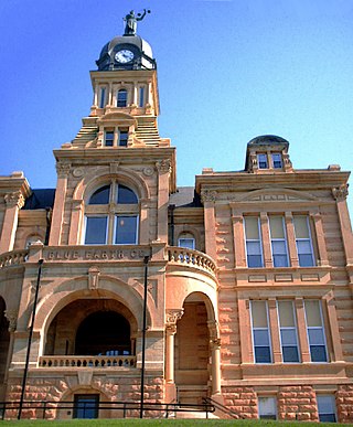
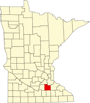
Blue Earth County is a county in the State of Minnesota. As of the 2020 census, the population was 69,112. Its county seat is Mankato. The county is named for the Blue Earth River and for the deposits of blue-green clay once evident along the banks of the Blue Earth River. Blue Earth County is part of the Mankato-North Mankato metropolitan area.
Aitkin County is a county in the U.S. state of Minnesota. As of the 2020 census, the population was 15,697. Its county seat is Aitkin. Part of the Mille Lacs Indian Reservation is in the county. The county was created in 1857 and organized in 1871.
Faribault is a city in, and the county seat of, Rice County, Minnesota, United States. The population was 24,453 at the 2020 census. Faribault is approximately 50 miles (80 km) south of Minneapolis–Saint Paul.
Nerstrand is a city in Rice County, Minnesota, United States.
The Cannon River a tributary of the Mississippi River flows 112 miles (180 km) from Shields Lake near Shieldsville to Red Wing in the U.S. state of Minnesota, where it joins the Mississippi River. It drains a watershed approximately 1460 square miles (3,780 km²) in size. The river flows through the counties of Le Sueur, Rice, Dakota, and Goodhue.
Stanton is an unincorporated community in Stanton Township, Goodhue County, Minnesota, United States.
Minnesota State Highway 246 (MN 246) is a 18.221-mile-long (29.324 km) highway in southeast Minnesota, which runs from its intersection with State Highway 3 in the city of Northfield and continues south and east to its eastern terminus at its intersection with State Highway 56 in Holden Township near Kenyon.
Shieldsville is an unincorporated community in Shieldsville Township, Rice County, Minnesota, United States.
Epsom is an unincorporated community in Richland Township, Rice County, Minnesota, United States.