Ross River, Yukon

Last updated

Ross River Rossriverwelcome.jpg
Ross River
Ferry across Pelly River FerryacrossPellyRiverYukon09.jpg
Ferry across Pelly River
Ross River School Ross-river=yukon school.jpg
Ross River School
Trapper's cabin in Ross river county
.mw-parser-output .geo-default,.mw-parser-output .geo-dms,.mw-parser-output .geo-dec{display:inline}.mw-parser-output .geo-nondefault,.mw-parser-output .geo-multi-punct{display:none}.mw-parser-output .longitude,.mw-parser-output .latitude{white-space:nowrap}
61deg45'10.15''N 131deg6'48.29''W / 61.7528194degN 131.1134139degW / 61.7528194; -131.1134139 Cabin in the bush near Ross River.JPG
Trapper's cabin in Ross river county 61°45′10.15″N131°6′48.29″W / 61.7528194°N 131.1134139°W / 61.7528194; -131.1134139
Ross River service centre Rossriver010Hotel.jpg
Ross River service centre

Ross River is an unincorporated community in Yukon, Canada. It lies at the junction of the Ross River and the Pelly River, along the Canol Road, not far from the Campbell Highway. Primary access to the Campbell Highway is via a nine-mile access road. Formerly it was accessed along a six-mile Canol Road section that is no longer maintained. It is serviced by Ross River Airport, used mainly for charter and scheduled flights to and from Whitehorse and Watson Lake.

Contents

It is the home of the Ross River Dena Council, a First Nation in eastern Yukon. [1]

History

The confluence of the Ross and Pelly rivers had long been used as a gathering place for First Nation peoples, particularly in the late summer. The first permanent settlement was established in 1901 when Tom Smith started a small fur trading post on the north bank of the Pelly and called the spot Smiths Landing. That winter approximately 15 First Nation families overwintered near the post, creating the beginnings of the permanent community of Ross River. By 1903 a second, rival trading post was set up on the south bank of the Pelly opposite Smiths Landing. The settlement attracted an increasing number of people, mostly the Kaska but including many First Nation people from the Mackenzie River region who would travel over the divide to meet others, trade, and sometimes stay. By 1914 over 1,000 people were gathering at Ross River in the late summer. But a severe influenza epidemic in 1916 hit the community's First Nation people hard, and increasing economic activity and new trading posts along the Mackenzie River reduced the population. [2] [3]

World War II and the years immediately following brought massive changes to Ross River. The building of the Canol Road and pipeline between 1942 and 1944 brought a massive, but temporary, influx of newcomers and the new road made the community more accessible, although the road closed in 1946 and did not reopen until 1958. [4] The late 1940s and early 1950s also saw a collapse of fur prices and the permanent closure of most of the region's fur trading posts — including Pelly Banks, Sheldon Lake, Rose Point, Frances Lake and Macmillan River. By 1952 Ross River had the only remaining trading post in the region. The Canol Road shifted the commercial centre of the community to the south bank of the Pelly River at the new ferry crossing point and the federal government began pressuring the First Nation to move across the river from the Old Village. By the mid 1960s the community of Ross River assumed the shape it has today.

Geography

Climate

Ross River has subarctic climate (Dfc) with long, severely cold winters and short but mild summers. [5]

Climate data for Ross River Airport
MonthJanFebMarAprMayJunJulAugSepOctNovDecYear
Average precipitation mm (inches)11.6
(0.46)
10.7
(0.42)
8.1
(0.32)
16.4
(0.65)
31.9
(1.26)
46.9
(1.85)
35.5
(1.40)
24.7
(0.97)
18.3
(0.72)
18.5
(0.73)
14.6
(0.57)
Average rainfall mm (inches)0
(0)
0
(0)
0
(0)
3.4
(0.13)
16.1
(0.63)
31.9
(1.26)
46.9
(1.85)
34.9
(1.37)
22.6
(0.89)
5.3
(0.21)
0.2
(0.01)
0
(0)
161.3
(6.35)
Average snowfall mm (inches)11.6
(0.46)
10.7
(0.42)
4.7
(0.19)
0.4
(0.02)
0
(0)
0
(0)
0.5
(0.02)
2
(0.1)
13.0
(0.51)
18.2
(0.72)
14.6
(0.57)
Average precipitation days (≥ 0.2 mm)5427913119787
Average rainy days (≥ 0.2 mm)00069131192050
Average snowy days (≥ 0.2 cm)54200587
Source: 1961-1990 Environment Canada [6]

Demographics

Federal census population history of Ross River
YearPop.±%
194153    
195188+66.0%
1981294+234.1%
1986352+19.7%
1991 324−8.0%
1996 352+8.6%
2001 337−4.3%
2006 313−7.1%
2011 352+12.5%
2016 293−16.8%
2021 355+21.2%
Source: Statistics Canada
[7] [8] [9] [10] [11] [12] [13] [14] [15]

In the 2021 Census of Population conducted by Statistics Canada, Ross River had a population of 355 living in 160 of its 184 total private dwellings, a change of

Economy

Mining exploration increased in the region around Ross River through the 1950s and an exploration and mining boom occurred in the 1960s and 1970s with the discovery and development of the Faro mine.

In 1950 and 1951 Al Kulan, who was inducted into the Canadian Mining Hall of Fame in 2005, prospected the Pelly Range. [16] In 1952 he located mineralization in the Anvil district. In 1953 Ross River Dena citizen Jack Sterriah mentioned a heavy concentration of rust in Vangorda Creek that he had known about as a boy. That year Kulan, Peter Thompson along with Dena citizens Arthur John, China Sterriah, Jack Ladue and Robert Etzel prospected Vangorda Creek and found the first significant mineralization in the area on July 2. They, along with Dena members Joe Etzel and Jack Steriah, were issued shares in the company formed as a result of the discovery, Vangorda Mines Ltd. The property was optioned to Prospectors Airways, headquartered in Toronto.

Arthur John, a Dena elder, learned prospecting from, and worked with, Kulan in the early 1950s and his fluency in English enabled him to serve as an intermediary between Kulan and other Ross River Dena members who also learned to identify minerals. [17] John had a long career prospecting with Conwest Exploration as well as Kulan's companies Spartan Exploration and Welcome North Mines.

From 1954 to 1957 Kulan prospected north-west of the Vangorda and discovered a rusty area. Geochemical and geophysical surveys resulted in several drill targets. Propspectors Airways would only pay for a packsack drill. The first drill hole was attempted over the No. 2 orebody of what, a decade later, would become Canada's largest lead-zinc mine. This hole could not reach the bedrock due to heavy overburden. The program was discontinued. In 1964 the property was re-staked by Dynasty Explorations which Kulan was a director and officer of. Dynasty staked large tracts of the district and identified many drill targets. Due to lack of funds they joined forces with Cyprus Mines Corporation of Los Angeles. The joint venture was running over budget when a move was made to one of the mineralized sites selected by Kulan, which was one of the last hopes for the discovery of a successful body of ore. In the summer of 1965 the discovery of the mine was made and resulted in the biggest staking rush the Yukon Territory had ever seen. The mine closed permanently in 1997. [17] [18]

Media

The Ross River community was too small to get a satellite-serviced transmitter for CBC and did not even have radio – residents would drive to Faro to listen to the Canada-Russia hockey series. The first television service arrived after intervention from Al Kulan, who hired a helicopter and pilot from Whitehorse and flew from mountaintop to mountaintop on a bitterly cold night to find the signal from Faro's five watt TV transmitter. After a signal was detected on Grew Creek Hill, Kulan paid for the equipment, and the community's men volunteered their work, bulldozing a road up the mountain. The transmitter caught the government's attention, but the residents steadfastly refused to shut it down and requested a licence. In early 1975, radio was finally installed. Ross River's community effort led to other similar projects that brought TV to every community; Teslin installed their own satellite dish (illegal until 1979), and the Yukon government attempted to negotiate a lower lease price with Telesat Canada which had a monopoly on satellite earth stations until 1979.[ citation needed ]

See also

Related Research Articles

<span class="mw-page-title-main">Yukon</span> Territory of Canada

Yukon is the smallest and westernmost of Canada's three territories. It also is the second-least populated province or territory in Canada, with a population of 43,964 as of March 2022. Whitehorse, the territorial capital, is the largest settlement in any of the three territories.

<span class="mw-page-title-main">Beaver Creek, Yukon</span> Place in Yukon, Canada

Beaver Creek is a community in Yukon, Canada. Located at kilometre 1870.6 of the Alaska Highway, 1 NM southeast of Beaver Creek Airport and close to the Alcan - Beaver Creek Border Crossing, it is Canada's westernmost community. The community's main employers are a Canada Border Services Agency port, the White River First Nation and a number of tourist lodges.

<span class="mw-page-title-main">Faro, Yukon</span> Town in Yukon, Canada

Faro is a town in the central Yukon, Canada, the home of the now abandoned Faro Mine. It was the largest open-pit lead–zinc mine in the world as well as a significant producer of silver and other natural resources. The mine was built by the Ralph M. Parsons Construction Company of the United States with General Enterprises Ltd. of Whitehorse being the main subcontractor. As of 2021, the population is 440, down from its peak population of 1,652 in 1981. Faro was named after the card game of the same name.

<span class="mw-page-title-main">Carcross</span> Place in Yukon, Canada

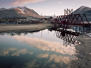
Carcross, originally known as Caribou Crossing, is an unincorporated community in Yukon, Canada, on Bennett Lake and Nares Lake. It is home to the Carcross/Tagish First Nation.

<span class="mw-page-title-main">Haines Junction, Yukon</span> Village in Yukon, Canada

Haines Junction is a village in Yukon, Canada. It is at Kilometre 1,632 of the Alaska Highway at its junction with the Haines Highway, hence the name of the community. According to the 2021 Census, the population was 688. However, the Yukon Bureau of Statistics lists the population count for 2022 as 1,018.

<span class="mw-page-title-main">Old Crow, Yukon</span> Place in Yukon, Canada

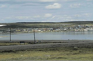
Old Crow is a community in the Canadian territory of Yukon.

<span class="mw-page-title-main">Baker Lake, Nunavut</span> Hamlet in Nunavut, Canada

Baker Lake is a hamlet in the Kivalliq Region, in Nunavut on mainland Canada. Located 320 km (200 mi) inland from Hudson Bay, it is near the nation's geographical centre, and is notable for being Nunavut's sole inland community. The hamlet is located at the mouth of the Thelon River on the shore of Baker Lake. The community was given its English name in 1761 from Captain William Christopher who named it after Sir William Baker, the 11th Governor of the Hudson's Bay Company.

<span class="mw-page-title-main">Carmacks, Yukon</span> Village in Yukon, Canada

Carmacks is a village in Yukon, Canada, on the Yukon River along the Klondike Highway, and at the west end of the Robert Campbell Highway from Watson Lake. The population is 493. It is the home of the Little Salmon/Carmacks First Nation, a Northern Tutchone-speaking people.

<span class="mw-page-title-main">Watson Lake, Yukon</span> Town in Yukon, Canada

Watson Lake is a town in Yukon, Canada, located at mile 635 on the Alaska Highway close to the British Columbia border. It has a population of 790 in 2016. The town is named for Frank Watson, an American-born trapper and prospector, who settled in the area at the end of the 19th century.

<span class="mw-page-title-main">Keno City</span> Place in Yukon, Canada

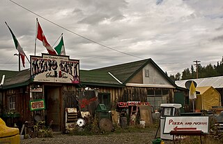
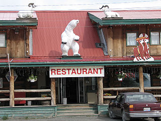
Keno City is a small community in Yukon, Canada at the end of the Silver Trail highway. Keno City was the site of a former silver-lead mining area proximal to Keno Hill. Keno City is 13 kilometres away from Elsa, Yukon, which is owned by Hecla mining who currently own and operate the various Ag-Pb-Zn deposits in the Keno Hill area. Rich silver and lead ore deposits were found on Keno Hill in 1919, and since then the population of the community has fluctuated in response to the mining activity in the area. When in 1989 United Keno Hill closed the mines, literally overnight, the people in the Keno area who decided to stay chose a more sustainable economy: tourism. They successfully marketed Keno City as a quiet, tranquil community.

<span class="mw-page-title-main">Mayo, Yukon</span> Village in Yukon, Canada

Mayo is a village in Yukon, Canada, along the Silver Trail and the Stewart River. It had a population of 200 in 2016. The Yukon Bureau of Statistics estimated a population of 496 in 2019. It is also the home of the First Nation of Na-Cho Nyäk Dun, whose primary language is Northern Tutchone. Na-Cho Nyäk Dun translates into "big river people."

Pelly Crossing is a community in Yukon, Canada. It lies where the Klondike Highway crosses the Pelly River.

<span class="mw-page-title-main">Tagish, Yukon</span> Place in Yukon, Canada

Tagish is an unincorporated community in Yukon, Canada. It is 30 kilometres (19 mi) east of Carcross, Yukon, on the Tagish Road at the northern end of Tagish Lake. The greater Tagish area also includes the Tagish Estates, Tagish Beach and Taku subdivisions, the latter two developed for cottages but now serving for many year-round homes. Tagish Beach and Taku have their own community hall. The Tagish Road was built in 1942 as part of an oil pipeline project, and the community sprouted around a bridge built over the narrow water between Tagish Lake and Marsh Lake.

Marsh Lake is an unincorporated community on the Alaska Highway on the shores of Marsh Lake southeast of Whitehorse in Canada's Yukon. The area was organized in 2001, as a local area council to help the residents with some form of municipal government.

<span class="mw-page-title-main">Johnsons Crossing</span> Settlement in Yukon, Canada

Johnsons Crossing or Johnson's Crossing is a settlement in Yukon, Canada. It is located at historical mile 836 of the Alaska Highway, at the junction of the Canol Road where the highway crosses the Teslin River.

<span class="mw-page-title-main">Norman Wells</span> Town in Northwest Territories, Canada

Norman Wells is a town located in the Sahtu Region, Northwest Territories, Canada. The town, which hosts the Sahtu Regional office, is situated on the north side of the Mackenzie River and provides a view down the valley of the Franklin and Richardson mountains.

Faro was an electoral district that returned a member to the Legislative Assembly of the Yukon Territory in Canada between 1978 and 2002. It was created out of the riding of Pelly River and encompassed the community of Faro. It was situated on the traditional territory of the Ross River Dena Council of the Kaska Dena.

<span class="mw-page-title-main">Stewart Crossing</span> Settlement in Yukon, Canada

Stewart Crossing is a settlement in Yukon, Canada located on the Stewart River. It is about 179 km east of Dawson City on the Klondike Highway, near the junction with the Silver Trail, from which it is about 53 km (33 mi) southwest of Mayo. A Yukon government highway maintenance camp and a highway lodge are the most prominent facilities at Stewart Crossing. The settlement is named for where the Klondike Highway, crossed the Stewart River by means of a ferry from 1950 until completion of a bridge in the mid-1950s.

<span class="mw-page-title-main">Unorganized Yukon</span> Unorganized area in Yukon, Canada

Unorganized Yukon, or Yukon, Unorganized, is the unorganized area covering the majority of Yukon, Canada. It represents 98% of Yukon's 474,712.64 km2 (183,287.57 sq mi) land mass, and is recognized as a census subdivision by Statistics Canada.

References

  1. "Home". rrdc.ca.
  2. "Sights and Sites of the Yukon: Central Yukon". sightsandsites.ca.
  3. "The History of Ross River, Yukon". explorenorth.com.
  4. "Gravel Travel Canada - Gravel Travel Canada". graveltravel.ca.
  5. "Ross River, Yukon Travel Weather Averages (Weatherbase)". Weatherbase. Retrieved 2020-06-10.
  6. Environment CanadaCanadian Climate Normals 1961–1990. Retrieved 22 June 2011.
  7. Ninth Census of Canada, 1951 (PDF). Vol. SP-7 (Population: Unincorporated villages and hamlets). Dominion Bureau of Statistics. March 31, 1954. Retrieved February 2, 2022.
  8. "1986 Census: Population - Census Divisions and Census Subdivisions" (PDF). Statistics Canada. September 1987. Retrieved January 30, 2022.
  9. "91 Census: Census Divisions and Census Subdivisions - Population and Dwelling Counts" (PDF). Statistics Canada. April 1992. Retrieved January 30, 2022.
  10. "96 Census: A National Overview - Population and Dwelling Counts" (PDF). Statistics Canada. April 1997. Retrieved January 30, 2022.
  11. "Population and Dwelling Counts, for Canada, Provinces and Territories, and Census Subdivisions (Municipalities), 2001 and 1996 Censuses - 100% Data (Yukon Territory)". Statistics Canada. August 15, 2012. Retrieved January 30, 2022.
  12. "Population and dwelling counts, for Canada, provinces and territories, and census subdivisions (municipalities), 2006 and 2001 censuses - 100% data (Yukon Territory)". Statistics Canada. August 20, 2021. Retrieved January 30, 2022.
  13. "Population and dwelling counts, for Canada, provinces and territories, and census subdivisions (municipalities), 2011 and 2006 censuses (Yukon)". Statistics Canada. July 25, 2021. Retrieved January 30, 2022.
  14. "Population and dwelling counts, for Canada, provinces and territories, and census subdivisions (municipalities), 2016 and 2011 censuses – 100% data (Yukon)". Statistics Canada. February 8, 2017. Retrieved January 30, 2022.
  15. 1 2 "Population and dwelling counts: Canada, provinces and territories, and census subdivisions (municipalities), Yukon". Statistics Canada. February 9, 2022. Retrieved February 18, 2022.
  16. "Al Kulan Welcomed Into Canadian Mining Hall of Fame".
  17. 1 2 "Sights and Sites of the Yukon: Central Yukon". sightsandsites.ca.
  18. Canada, Government of Canada; Indigenous and Northern Affairs (November 24, 2016). "Faro Mine Remediation Project: Yukon" via www.rcaanc-cirnac.gc.ca.

Coordinates: 61°59′N132°27′W / 61.983°N 132.450°W / 61.983; -132.450