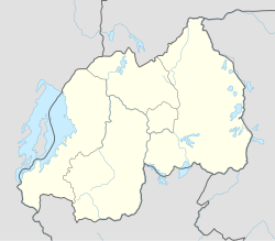
Rwanda, officially the Republic of Rwanda, is a landlocked country in the Great Rift Valley of Central Africa, where the African Great Lakes region and Southeast Africa converge. Located a few degrees south of the Equator, Rwanda is bordered by Uganda, Tanzania, Burundi, and the Democratic Republic of the Congo. It is highly elevated, giving it the soubriquet "land of a thousand hills", with its geography dominated by mountains in the west and savanna to the southeast, with numerous lakes throughout the country. The climate is temperate to subtropical, with two rainy seasons and two dry seasons each year. It is the most densely populated mainland African country; among countries larger than 10,000 km2, it is the fifth most densely populated country in the world. Its capital and largest city is Kigali.

The transport system in Rwanda centres primarily around the road network. Paved roads lie between the capital, Kigali, and most other major cities and towns in the country. Rwanda is also linked by road with other countries in the African Great Lakes, via which the majority of the country's imports and exports are made.

Kigali is the capital and largest city of Rwanda. It is near the nation's geographic centre in a region of rolling hills, with a series of valleys and ridges joined by steep slopes. As a primate city, Kigali is a relatively new city. It has been Rwanda's economic, cultural, and transport hub since it was founded as an administrative outpost in 1907, and became the capital of the country at independence in 1962, shifting focus away from Huye.

Kibungo is a town in the Republic of Rwanda. It is the political, administrative and commercial capital of Ngoma District. In 1998, Kibungo became the site of at least four of Rwanda's last 22 executions. All of the convicts were executed for crimes related to the 1994 genocide.
Nyagatare is a town in the North East of Rwanda. With a population of more than 100,000, it is one of the most populous settlements in the Eastern Province along with Rwamagana and Kibungo.

Rwamagana is a district (akarere) in Eastern Province, Rwanda. Its capital is Rwamagana city, which is also the provincial capital.it has 14 sectors which are Gishali,fumbwe,mwurire, Kigabiro,...it is found in eastern province of Rwanda.

Muhanga is a district (akarere) in Rwanda. It is found in southern province and its administrative centre is located in the city of Muhanga.

Gasabo is a district (akarere) in Kigali city, the capital of Rwanda. The headquarter of Gasabo is located in Remera Sector. The district also includes large areas of the city itself, including Kacyiru, Kimironko, Remera, Nyarutarama and Kimihurura.

Lake Muhazi is a long thin shallow lake in the east of Rwanda. The bulk of the lake lies in the Eastern Province, with the western end forming the border between the Northern and Kigali Provinces. It is a flooded valley lake, lying predominantly in an east to west direction, but with numerous offshoots in a north to south direction, formerly the location of tributaries. The lake has a concrete dam at the western end, constructed in 1999 to replace an earth dam which had existed since time immemorial. The lake empties into the Nyabugogo River, which flows southwards to Kigali where it meets the Nyabarongo River, part of the upper Nile.

I&M Bank Rwanda Plc., is a commercial bank in Rwanda that is licensed by the National Bank of Rwanda. It is the second largest bank in Rwanda.
Kabarore is a sector and town in Rwanda. It is the headquarters of Gatsibo District.
Kabarondo is a sector and town in the Republic of Rwanda.
Rwamagana Solar Power Station is an 8.5MW solar power plant in Rwanda, the fourth-largest economy in the East African Community.
Rusumo, is a town in Kirehe District in the Eastern Province of Rwanda.
The Isaka–Kigali Standard Gauge Railway is a planned railway line linking the town of Isaka in Tanzania to the city of Kigali in Rwanda.
Masaka is a populated neighborhood within the city of Kigali, the capital and largest city of Rwanda.
The Rwanda Standard Gauge Railway is a standard gauge railway (SGR) system, under development, linking the country to the neighboring countries of Tanzania and Uganda. It is intended to ease the transfer of goods between the Indian Ocean ports of Dar es Salaam and Mombasa, and the Rwandan capital Kigali. The system is expected to link, in the future, to Rwanda's two other neighbors, Burundi and the Democratic Republic of the Congo, as part of the East African Railway Master Plan. With no previously existing railway network, Rwanda is developing its railway system from scratch. The project is dependent on the construction of the Tanzanian and Ugandan SGR lines to the Rwandan border, which have not been completed as of October 2023.
Masaka Hospital, Rwanda, commonly known as Masaka Hospital, is a hospital in Rwanda. It is an urban, general hospital built between 2008 and 2011, with funding from the Government of China, as a gift to the Government of Rwanda.
Karenge Drinking Water Supply System (KDWSS), also Karenge Water Supply System is a water intake, purification, and distribution system in Rwanda. The system supplies water to parts of the capital city of Kigali and the neighboring Rwamagana District.