Salinas, Ecuador

Last updated
Salinas
City
Salinasecuador.jpg
Salinas beach
Ecuador location map.svg
Red pog.svg
Salinas
Location in Ecuador
Coordinates: 2°13′00.12″S80°57′00.24″W / 2.2167000°S 80.9500667°W / -2.2167000; -80.9500667
Country Flag of Ecuador.svg  Ecuador
Province Santa Elena
Canton Salinas
Parishes
List of urban parishes
  • Alberto Enriquez Gallo
  • Carlos Espinoza Larrea
  • Santa Rosa
  • Vicente Rocafuerte
Government
  MayorDennis Córdova
Area
  City13.38 km2 (5.17 sq mi)
  Metro
73.5 km2 (28.4 sq mi)
Population
 (2022 census) [1]
  City35,066
  Density2,600/km2 (6,800/sq mi)
   Metro
200,000
 (incl. La Libertad and Santa Elena)
Time zone UTC-5 (ECT)
Climate BWh
Website http://www.salinas.gob.ec/

Salinas is a coastal city located in the Province of Santa Elena, Ecuador. It is the seat of the canton that bears its name. The westernmost city on mainland Ecuador, Salinas is an important tourist center. Salinas, Ecuador's largest coastal resort, offers one of the country's best real estate investment markets and most popular and most upscale beach lifestyle. It was the site of the ISA World Junior Surfing Games Ecuador in 2009. There are two major yacht clubs in Salinas, the first is Salinas Yacht Club, which is smaller than the Puerto Lucia Yacht Club, in Santa Elena, in an area known as 'La Libertad' which, in Spanish means 'The Freedom Town'. Puerto Lucia boasts a hotel, several restaurants, a private beach and apartment buildings, as well as the large marina and port.

Contents

It was a small fishing village until June 30, 1929, when it was established as the rural parish of Santa Elena. On December 22, 1937, an official decree was signed by the Commander in Chief, General Alberto Enriquez Gallo and published in Official Gazette No. 52 of December 27 of that year, that elevated the parish to the rank of canton. Its cantonal head is the town of Salinas, and is composed of the rural parishes Ancon, and Jose Luis Tamayo Anconcito (Muey).

Part of map of the coast of Ecuador in the eighteenth century Siglo XVIII.jpg
Part of map of the coast of Ecuador in the eighteenth century
The beach at Salinas Ecuador Salinas beach view in ecuador south america.jpg
The beach at Salinas Ecuador

Political division

Salinas is divided into four urban parishes. They are:

Photo of the beach in Salinas The beach at salinas.jpg
Photo of the beach in Salinas
Sun setting in Salinas Sunset salinas.jpg
Sun setting in Salinas

Economy and attractions

Salinas Museum 21st Century

The museum is located in Salinas Guayas, Malecon and Quil streets and is known as "The Museum of the Great Peninsula". It has an archaeological room, a temporary exhibition hall, a lounge, and a naval parade.

The Archaeological room has a complete sample of the cultures that settled in this large peninsula. Represented are the Valdivia culture (3500 - 1500 BC), the Machalilla culture (1500 - 1100 BC), and the later Engoroy variant of the Chorrera culture. Also the Jambelí Guangala Regional Development period (500 BC - 500), and maintenance-Integration Guancavilca period (500-1530) are represented. The finds shown include human and animal figurines, ceremonial and utilitarian vessels, bottles, whistles, stone axes, beads and necklaces made of Spondylus shells, horns, and a variety of both cylindrical and flat seals.

On displays is a model of a raft - Guancavilca Manteña - reproduced according to the description of Samano 1526. The Guancavilcas large rafts were in their black-colored vessels, hands and stone metate for grinding grains, spherical stone weights for nets and pointed to the divers who were also used to hit and release Spondylus shells attached to rocks; copper objects such as axes and hatchets handle coins and Spondylus shell accounts, circular and rectangular shapes that were marketed along with the copper material, in Mexico and Peru, are evidence of the last thousand years of navigation our country. A model that reproduces the galleon Jesus Maria de la Limpia Concepcion known as "The Captain" takes us back to colonial times and the exhibit showcases the salvage in that galleon wrecked in 1654 off the coast of Chanduy.

Coins of 1, 2, 4 and 8 reales (cobs or crushed calls)? were made in silver and transported on ships to Panama and from there to the Caribbean to be transported to Europe, fragments of silver cutlery and plates and pottery is known as majolica bars, tin, silver, cannonballs both bronze, and iron and lead for muskets.

A gold cross with Latin inscriptions, an earring with pearl bases, burner and silver candelabra, a buckle, metal earrings agate and correspond to the material used for personal use by the passengers on this ship that ran aground off the coast of the town of El Real.

Punta Carnero Beach

People travel from all over the world because the surfing in Ecuador offers an ideal climate all year round. Punta Carnero is a beach located approximately ten minutes south of Salinas. Its name, "Ram Point" in English, stems from the rocky headland located at the southeast end of the beach. Punta Carnero Beach has been chosen many times to be the venue of not just national surf competitions, but also at an international level.

The beach extends for approximately 1.6 miles (2.6 km) and is relatively wide, with white to gray sand, medium waves and a prevalent inland breeze.

Many who travel to Punta Carnero also visit other famous beaches which are found just off the coast of Ecuador by 972 kilometres (604 mi) is known the world over, the Galápagos Islands an area of volcanic islands distributed around the equator in the Pacific Ocean.

Other attractions

Other attractions of popular activities include:

Sea lions at La Chocolatera LaChocolatera.jpg
Sea lions at La Chocolatera

Geography

Climate

Salinas has a warm and dry hot arid climate (Köppen BWh). Although the city is located in a tropical zone near the Equator, the weather closely resembles a subtropical climate, being very warm and dry rather than hot, humid, and rainy. This is due to the Humboldt Current, which lower temperatures for most of the year, except in the southern summer months, when the temperature rises.

Climate data for Salinas
MonthJanFebMarAprMayJunJulAugSepOctNovDecYear
Average high °C (°F)28.0
(82.4)
29.0
(84.2)
29.4
(84.9)
28.6
(83.5)
27.0
(80.6)
25.4
(77.7)
24.3
(75.7)
24.1
(75.4)
24.3
(75.7)
24.3
(75.7)
24.9
(76.8)
26.5
(79.7)
26.3
(79.4)
Average low °C (°F)23.1
(73.6)
23.9
(75.0)
23.7
(74.7)
22.9
(73.2)
22.3
(72.1)
21.4
(70.5)
20.3
(68.5)
19.9
(67.8)
20.0
(68.0)
20.5
(68.9)
21.1
(70.0)
21.8
(71.2)
21.7
(71.1)
Average rainfall mm (inches)16
(0.6)
41
(1.6)
37
(1.5)
16
(0.6)
2
(0.1)
1
(0.0)
0
(0)
1
(0.0)
1
(0.0)
1
(0.0)
0
(0)
1
(0.0)
117
(4.4)
Source: Climate-data.org [2]

Related Research Articles

<span class="mw-page-title-main">Guayaquil</span> City of Ecuador

Guayaquil, officially Santiago de Guayaquil, is the largest city in Ecuador and also the nation's economic capital and main port. The city is the capital of Guayas Province and the seat of Guayaquil Canton. The city is located on the west bank of the Guayas River, which flows into the Pacific Ocean at the Gulf of Guayaquil.

<span class="mw-page-title-main">Manta, Ecuador</span> City in Manabí, Ecuador

Manta, also known as San Pablo de Manta, is a city in Ecuador, cantonal head of the Manta Canton, as well as the largest and most populated city in the Manabí Province. It is the seventh most populous in the country. Manta has existed since Pre-Columbian times. It was a trading post for the Manta, also known as Manteños.

<span class="mw-page-title-main">La Punta District</span> District in Callao, Peru

La Punta is a district of the Constitutional Province of Callao in Peru, and one of the seven districts that make up the port city of Callao. It is located in a peninsula in the western part of the province and is almost entirely surrounded by the Pacific Ocean, except on its northeastern side, where it is bordered by downtown Callao.

<span class="mw-page-title-main">Santa Elena, Ecuador</span> Town in Santa Elena, Ecuador

Santa Elena is a town in southwestern Ecuador, and is the capital of both the province and the canton of the same name. Santa Elena, originally called Sumpa, is located on the Ecuadorian peninsula near the city of Guayaquil. It is regarded as the location of the most important and best documented archaeological site in the country, predominantly due to the discovery of the Lovers of Sumpa.

<span class="mw-page-title-main">Montañita</span> Town in Santa Elena, Ecuador

Montañita is a small coastal town in Ecuador located in the parish of Manglaralto, province of Santa Elena, about 180 kilometers northwest of Guayaquil. Its name means "small mountain." In the mid 20th century it was known as a surfing beach, with only a few fishermen's huts, and one or two surfers tents in summer, erected at the site. But in 1960, Montañita, foreigners linked to the hippie movement decided to settle there permanently. It is now a popular destination for surfers from around the world and considered one of the best surfing beaches in Ecuador's south coast.

Xavier Blum Pinto is an Ecuadorian artist. From 1974 to 1976 he studied architecture at the Universidad Catolica Santiago de Guayaquil, in Ecuador. In 1981, obtained his MA in Fine Arts from the Universitė of Paris VIII, France.

<span class="mw-page-title-main">Las Vegas culture (archaeology)</span> Large number of Archaic settlements

"Las Vegas culture" is the name given to many Archaic settlements which flourished between 8000 BCE and 4600 BCE near the coast of present-day Ecuador. The name comes from the location of the most prominent settlement, Site No. 80, near the Las Vegas River and now within the city of Santa Elena. The Las Vegas culture represents "an early, sedentary adjustment to an ecologically complex coastal environment."

<span class="mw-page-title-main">Machalilla culture</span>

The Machalilla were a prehistoric people in Ecuador, in southern Manabí and the Santa Elena Peninsula. The dates when the culture thrived are uncertain, but are generally agreed to encompass 1500 BCE to 1100 BCE.

<span class="mw-page-title-main">Pre-Columbian Ecuador</span> Ecuador before Spanish colonization

Pre-Columbian Ecuador included numerous indigenous cultures, who thrived for thousands of years before the ascent of the Incan Empire. Las Vegas culture of coastal Ecuador, flourishing between 8000 and 4600 BC, is one of the oldest cultures in the Americas. The subsequent Valdivia culture in the Pacific coast region is another well-known early Ecuadorian culture. Ancient Valdivian artifacts from as early as 3500 BC have been found along the coast north of the Guayas Province in the modern city of Santa Elena.

<span class="mw-page-title-main">Chorrera culture</span>

The Chorrera culture or Chorrera tradition is a Late Formative indigenous culture that flourished between 1300 BCE and 300 BCE in Ecuador. Chorrera culture was one of the most widespread cultures in pre-Columbian Ecuador, spanning the Pacific lowlands to the Andean highlands, and even into southern Colombia.

<span class="mw-page-title-main">2009 Bolivarian Games</span>

The XVI Bolivarian Games were a multi-sport event held in 2009 in Sucre, Bolivia. The competitions in Sucre took place from 15–26 November. A number of Bolivian cities hosted some of the sporting events, including Cochabamba, Santa Cruz and Tarija. Also, events were held outside of Bolivia, with Guayaquil, Lima, Quito and Salinas hosting a number of competitions. The Games were organized by the Bolivarian Sports Organization (ODEBO).

<span class="mw-page-title-main">El Guabo Canton</span> Canton in El Oro Province, Ecuador

The Guabo is a canton in the province of El Oro in Ecuador. Its capital is the city cantonal Guabo. Its population in the 2010 census was 50,009 inhabitants. The date of canton of El Guabo was September 7, 1978. The mayor for the period 2009-2014 was John Franco Aguilar.

<span class="mw-page-title-main">Playas Canton</span> Canton in Guayas Province, Ecuador

General Villamil, also known as Playas, is a Guayas canton in Ecuador. The Playas canton is located at the south western area of the Guayas Province. Its Canton Capital is General José de Villamil, also known as Playas. It is located 96 kilómeters from the capital of the Guayas Province, Guayaquil. It borders to the north and east with Guayaquil Canton, on the west with Santa Elena Province, and to south with the Pacific Ocean. Its territory has an area of 280 square kilometres and has a population of 31,000 citizens, with 25,000 of them living in the canton's capital.

<span class="mw-page-title-main">Punta Carnero, Ecuador</span>

Punta Carneros is an island located in the Salinas County, in the Santa Elena Province of Ecuador.

<span class="mw-page-title-main">Surfing in Ecuador</span>

Ecuador has many beaches for surfing: the coast of Ecuador is 2,237 km long. Surfable waves are available in Ecuador year-round, and surfers enjoy the mild year-round weather, especially in the northern region where the weather conditions attract many surfers from all over the world. Within this part of South America, Ecuador's neighbors Chile and Peru also offer great surfing. Many surfers in Ecuador use a protective wetsuit. Surf tourism is very important to the local economy, and the beaches offer significant enjoyment because of top quality waves combined with affordable prices for lodging and food compared to other surf destinations. There's also a national marine reserve off the coast, which has a gigantic whale population.

<i>The Amazing Race 6</i> (Latin American season) Season of television series

The Amazing Race 6 is the sixth season of the Latin American version of the American reality show The Amazing Race. As in seasons prior, the show consisted of 11 teams of different nationalities competing, though this season took place entirely in Ecuador. The program was broadcast throughout Latin America on cable network Space, and in Ecuador on TC Televisión. The prize for the winning team was US$100,000, which was less than the prize given in previous seasons.

Ecuador is a country with vast natural and cultural wealth. The diversity of its four regions has resulted in hundreds of thousands of species of flora and fauna. It has about 1640 species of birds. The species of butterflies line the 4,500, the 345 reptiles, 358 amphibians and 258 mammals, among others. Ecuador is considered one of the 17 countries where the greatest biodiversity of the planet is concentrated. Most of its flora and fauna live in 26 areas protected by the State. It also offers historical attractions such as Quito, food and a variety of cultures and traditions.

<span class="mw-page-title-main">Universidad Estatal Península de Santa Elena</span> Public university of Ecuador

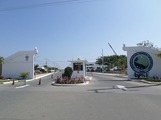
The State University Santa Elena Peninsula is a public university located in the canton freedom of the province of Santa Elena in the Republic of Ecuador, is the first autonomous center of teaching and which has the largest student population in the area.

<span class="mw-page-title-main">Roman Catholic Diocese of Santa Elena</span> Roman Catholic diocese in Ecuador

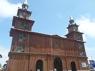
The Roman Catholic Diocese of Santa Elena is a diocese located in the town of Santa Elena in the Ecclesiastical province of Guayaquil in Ecuador.

References

Specific
  1. Citypopulation.de Population and area of Salinas
  2. "Climate: Salinas". Climate-data.org.