
Mangotsfield is an urban area and former village in the unitary authority area of South Gloucestershire, in the ceremonial county of Gloucestershire, England, to the north-east of Bristol.
Littleton-upon-Severn is a village and former civil parish, now in the parish of Aust, in the South Gloucestershire district, in the ceremonial county of Gloucestershire, England, near the mouth of the River Severn and is located to the west of Thornbury. Historically it belonged to the Hundred of Langley and Swinehead. In 1931 the parish had a population of 179. On 1 April 1935 the parish was abolished and merged with Aust.

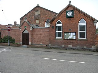
Wigtoft is a village and civil parish in Lincolnshire, England. It is situated on the A17 road, 6 miles (10 km) geographically south-west from Boston, Lincolnshire, and 1 mile (1.6 km) west from Sutterton. Included in Wigtoft civil parish are the hamlets of Asperton and Burtoft.

Stapleford is a village and former civil parish, now in the parish of Freeby, in the Melton district of Leicestershire, England, east of Melton Mowbray. It is just south of the River Eye. In 1931 the parish had a population of 145. On 1 April 1936 the parish was abolished and merged with Freeby.

Sproxton is a village and civil parish within the Borough of Melton in Leicestershire, England, close to the border with Lincolnshire. It has approximately 80 occupied dwellings (2021) and a population of 480, rising to 658 at the 2011 census.
Croxton Kerrial is a village and civil parish in the Melton borough of Leicestershire, England, 6.6 miles (10.6 km) south-west of Grantham, 7.9 miles (12.7 km) north-east of Melton Mowbray, and 0.5 miles (0.8 km) west of Leicestershire's border with Lincolnshire. The civil parish includes the village of Branston and had a population of 530 at the 2011 census.

Great Dalby is a village and former civil parish, now in the parish of Burton and Dalby, in the Melton district, in the county of Leicestershire, England, with a population of between 300 and 400. It is referred to in some UK census records as Dalby Magna. It is 3 miles south of Melton Mowbray.

Little Barrington is a village and former civil parish, now in the parish of Barrington, in the Cotswold district of Gloucestershire, England. It lies on the south bank of the River Windrush, 3 miles (4.8 km) west of the town of Burford. In 1931 the parish had a population of 84.
Bexwell is a small village and former civil parish near Downham Market, now in the parish of Ryston, in the King's Lynn and West Norfolk district, in the county of Norfolk, England. In 1931 the parish had a population of 60. On 1 April 1935 the parish was abolished and merged with Ryston.

Stonesby is a village and former civil parish, now in the parish of Sproxton, within the Melton borough of Leicestershire, England. It is 6 miles (9.7 km) northeast of Melton Mowbray, and 1.5 miles (2.4 km) southeast of Waltham on the Wolds. In 1931 the parish had a population of 140.
Horndon on the Hill is a village, former civil parish and Church of England parish in the unitary authority of Thurrock, in the county of Essex, England. It is located close to the A13, around one mile northwest of Stanford-le-Hope and around two miles northeast of Orsett. The village area falls within the Orsett ward of Thurrock District Council. In 2019 it had an estimated population of 1517. In 1931 the parish had a population of 1052.

Muston is an village and former civil parish, now in the parish of Bottesford, in the Melton district, in north-east Leicestershire, England. It is 18.6 miles (30 km) east of Nottingham, five miles (8 km) west of Grantham on the A52 and 12.5 miles (20 km) north of Melton Mowbray. It lies on the Leicestershire/Lincolnshire county border, two miles east of Bottesford. The River Devon flows through the village. In 1931 the parish had a population of 218. On 1 April 1936 the parish was abolished and merged with Bottesford.

Twyford is a village and former civil parish, now in the parish of Twyford and Thorpe, in the Melton district, in the county of Leicestershire, England. The name is derived from the two fords in the village. There are two churches in the village; St Andrew, which is a Grade I listed building with some parts dated from the 12th century, and a Methodist church. The village is in the south of the parish of Twyford and Thorpe. In 1931 the parish had a population of 282. On 1 April 1936 the parish was abolished to from "Twyford and Thorpe".

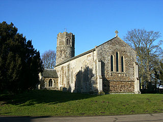
Ousden is a village and civil parish in the West Suffolk district of Suffolk in eastern England. It is located around six miles west of Bury St Edmunds and 72 miles north of London, and as of 2011, its population is 266. The village has an Anglican church of St Peter's and a chapel in the cemetery dedicated to St Barnabas.

Coston is a village and former civil parish, now in the parish of Garthorpe in the Melton district, in the eastern part of Leicestershire, England. In 1931 the parish had a population of 74.
Nether Broughton is a village and former civil parish, now in the parish of Broughton and Old Dalby, in the Melton district, in Leicestershire, England. Broughton and Old Dalby's parish council is based in Nether Broughton. The village lies on the main A606 road between Melton Mowbray and Nottingham. The neighbouring village of Upper Broughton is on the same road, but within Nottinghamshire county. In 1931 the parish had a population of 345. On 1 April 1936 the parish was abolished to form "Broughton and Old Dalby".

Nedging is a village and former civil parish on the B1115 road, now in the parish of Nedging-with-Naughton, in the Babergh district, in the county of Suffolk, England. The nearest town is Hadleigh, there is also the hamlet of Nedging Tye nearby. In 1931 the civil parish had a population of 155. On 1 April 1935 it was merged with Naughton to create Nedging-with-Naughton.

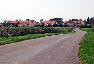
East Keal is a village and civil parish in the East Lindsey district of Lincolnshire, England. It is situated approximately 13 miles (21 km) north from the town of Boston, 2 miles (3 km) south from the town of Spilsby, and on the edge of the Lincolnshire Wolds, an Area of Outstanding Natural Beauty.

Knossington is a village and former civil parish, now in the parish of Knossington and Cold Overton, in the Melton borough of Leicestershire, England. It is located close to the border with Rutland, around 4 miles (6.4 km) west of Oakham. The population of the civil parish of "Knossington and Cold Overton" at the 2011 census was 316.

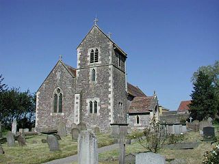
Harnhill is a village and former civil parish now in the parish of Driffield, in the Cotswold district, in the county of Gloucestershire, England. It is about 3 miles [CONVERT] from the town of Cirencester. In 1931 the parish had a population of 74. Harnhill has a church called St Michaels Church which is grade II* listed, the Harnhill Centre of Christian Healing is north of the village.


