
San Marcos is a department in northwestern Guatemala, on the Pacific Ocean and along the western Guatemala-Mexico border.

San Rafael Pie de la Cuesta is a municipality in the San Marcos department of Guatemala.
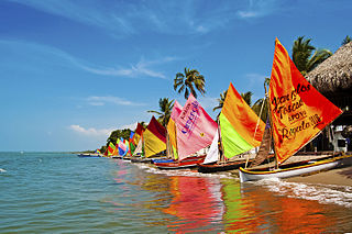
Tolú is a small town in Sucre Department, northern Colombia on the Caribbean coast. The municipality has an area of 500 km². It is named after the Tolú, one the pre-Columbian indigenous people of the North Colombia lowlands.

Sincé is a town and municipality located in the Department of Sucre, northern Colombia.

El Carmen de Bolívar is a municipality in the department of Bolívar, Colombia, 114 km southeast of Cartagena de Indias. It is located in the orographic system of the Montes de María, being the largest population, as well as the one that concentrates the economic and commercial movement of the subregion. It is the third most populated municipality in the department and an important agricultural center, considered "the agricultural and food pantry of the department of Bolívar" for being a great supplier to the entire department of products, especially avocado, tobacco, cocoa, banana, yam and sesame. This is how it is known as the Sweet City of Colombia since a part of its economy is based on food processing such as Chepacorinas Cookies, Coco Casadilla, Panochas, among others.

Achí is one of the 46 municipalities of the Bolívar department in the Caribbean Region of Colombia. It is crossed by the Cauca River and borders the Sucre department in the so-called Momposina Depression.
María La Baja is a town and municipality located in the Bolívar Department, northern Colombia.

Ayapel is a town and municipality located in the Córdoba Department, northern Colombia.
San Pelayo is a town and municipality located in the Córdoba Department, northern Colombia.

Caimito is a town and municipality located in the Sucre Department, northern Colombia.

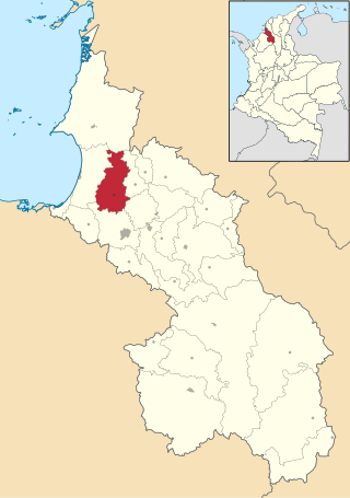
Galeras is a town and municipality located in the Sucre Department, northern Colombia. The main economic activities are agriculture and cattle raising. Galeras is 50 km away from the department's capital, Sincelejo.

Guaranda is a town and municipality located in the Sucre Department, northern Colombia.

La Unión is a town and municipality located in the Sucre Department, northern Colombia.
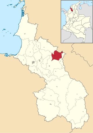
Sampués is a town and municipality located in the Sucre Department, northern Colombia.

San Benito Abad is a town and municipality located in the Sucre Department, northern Colombia.

San Juan Betulia is a town and municipality located in the Sucre Department, northern Colombia.

San Onofre is a town and municipality located in the Sucre Department, northern Colombia.
San Pedro is a town and municipality located in the Sucre Department, northern Colombia.
Toluviejo is a town and municipality located in the Sucre Department, northern Colombia.
The Gulf of Morrosquillo is a gulf of the Caribbean Sea bounded by the Colombian Departments of Sucre and Córdoba. From West to East it runs approximately 80 kilometres (50 mi) from Boca de Tinajones, mouth of Sinú River, in Córdoba, to Punta San Bernardo in Sucre.

