
The Q Second Avenue/Broadway Express/Brighton Local is a rapid transit service in the B Division of the New York City Subway. Its route emblem, or "bullet", is colored yellow since it is a part of the BMT Broadway Line in Manhattan.

The Independent Subway System was a rapid transit rail system in New York City that is now part of the New York City Subway. It was first constructed as the Eighth Avenue Line in Manhattan in 1932. It was originally also known as the Independent City-Owned Subway System (ICOSS) or the Independent City-Owned Rapid Transit Railroad (ICORTR).
The Franklin Avenue station is a station complex shared by the BMT Franklin Avenue Line and the IND Fulton Street Line of the New York City Subway, located at Franklin Avenue and Fulton Street in Bedford–Stuyvesant, Brooklyn. It is served by the:
The BMT Lexington Avenue Line was the first standard elevated railway in Brooklyn, New York, operated in its later days by the Brooklyn Rapid Transit Company, the Brooklyn–Manhattan Transit Corporation, and then the City of New York.
The Nassau Street Loop, also called the Nassau Loop, was a service pattern of the Brooklyn–Manhattan Transit Corporation (BMT) inaugurated in 1931 when the BMT Nassau Street Line was completed, providing a physical link that allowed a train to originate in Brooklyn, run through Lower Manhattan and return to Brooklyn without having to terminate and reverse the direction of the train. Nassau Loop services have not been able to operate since 1967, when the Loop line's connection to the Manhattan Bridge was severed.
The Myrtle Avenue Line, also called the Myrtle Avenue Elevated, is a fully elevated line of the New York City Subway as part of the BMT division. The line is the last surviving remnant of one of the original Brooklyn elevated railroads. The remnant line operates as a spur branch from the Jamaica Line to Bushwick, Ridgewood, and Middle Village, terminating at its original eastern terminal across the street from Lutheran Cemetery. Until 1969, the line continued west into Downtown Brooklyn and, until 1944, over the Brooklyn Bridge to the Park Row Terminal in Manhattan.

The Park Row station was a major elevated railway terminal constructed on the Manhattan side of the Brooklyn Bridge, across from New York City Hall and the IRT's elevated City Hall station. It served as the terminal for BMT services operating over the Brooklyn Bridge Elevated Line from the BMT Fulton Street Line, BMT Myrtle Avenue Line, and their feeders. Until the opening of the nearby Williamsburg Bridge to elevated train traffic in 1913, it was the only Manhattan station available for elevated trains from Brooklyn and the only elevated station in Manhattan to be owned by a company other than the IRT or its predecessors.
Starting in 1899, the Brooklyn Rapid Transit Company and Brooklyn–Manhattan Transit Corporation operated rapid transit lines in New York City — at first only elevated railways and later also subways.
The IND Fulton Street Line is a rapid transit line of the IND Division of the New York City Subway, running from the Cranberry Street Tunnel under the East River through central Brooklyn to a terminus in Ozone Park, Queens. The IND Rockaway Line branches from it just east of Rockaway Boulevard. The A train runs express during daytime hours and local at night on the underground portion of the line; it runs local on the elevated portion of the line at all times. The C train runs local on the underground portion of the line at all times except late nights.
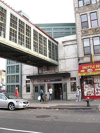
The Myrtle Avenue station is a New York City Subway express station on the BMT Jamaica Line. Located at the intersection of Myrtle Avenue and Broadway in Bushwick, Brooklyn. It is served by the J and M trains at all times, and by the Z during rush hours in peak direction.

The Myrtle–Wyckoff Avenues station is a New York City Subway station complex formed by the intersecting stations of the BMT Canarsie Line and the BMT Myrtle Avenue Line, served by the L and M trains at all times. It is located at Myrtle Avenue and Wyckoff Avenue in the Bushwick neighborhood of Brooklyn and the Ridgewood neighborhood of Queens. The complex is connected by a set of stairs and several elevators and escalators between the elevated and underground levels. The station was renovated completely from 2004 to 2008.
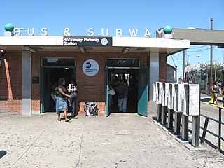
The Canarsie–Rockaway Parkway station is the southern terminal station of the BMT Canarsie Line of the New York City Subway, and is one of the few grade-level stations in the system. Located at the intersection of Rockaway Parkway and Glenwood Road in the Canarsie neighborhood of Brooklyn, it is served by the L train at all times.

The Broadway Junction station is a New York City Subway station complex shared by the elevated BMT Canarsie Line and BMT Jamaica Line, and the underground IND Fulton Street Line. It was also served by trains of the Fulton Street Elevated until that line closed in 1956. It is located roughly at the intersection of Broadway, Fulton Street and Van Sinderen Avenue at the border of Bedford–Stuyvesant and East New York, Brooklyn. The complex is served by the A, J, and L trains at all times; the C train at all times except late nights; and the Z train during rush hours in the peak direction only.
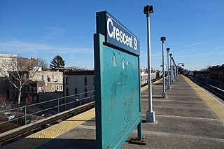
The Crescent Street station is a station on the BMT Jamaica Line of the New York City Subway. Located at the intersection of Crescent and Fulton Streets in Cypress Hills, Brooklyn, it is served by the J train at all times and the Z during rush hours in the peak direction.

The 62nd Street/New Utrecht Avenue station is a New York City Subway station complex shared by the open-cut BMT Sea Beach Line and the elevated BMT West End Line. It is located at New Utrecht Avenue and 62nd Street in Borough Park and Bensonhurst, Brooklyn, and is served by the D and N trains at all times. During rush hours, several W trains also serve this station.

The Fifth Avenue Line, also called the Fifth Avenue Elevated or Fifth Avenue–Bay Ridge Line, was an elevated rail line in Brooklyn, New York City, United States. It ran above Hudson Avenue, Flatbush Avenue, Fifth Avenue, 38th Street, and Third Avenue from Downtown Brooklyn south to Bay Ridge. The portion on Third Avenue was called the Third Avenue Elevated to distinguish service from the elevated BMT West End Line; it was separate from the elevated IRT Third Avenue Line in Manhattan and the Bronx.


