Sausar

Last updated

Sausar
Saunsar
Saunsar
town
Madhya Pradesh location map.svg
Red pog.svg
Sausar
Location in Madhya Pradesh, India
India location map 3.png
Red pog.svg
Sausar
Sausar (India)
Coordinates: 21°39′N78°47′E / 21.65°N 78.78°E / 21.65; 78.78
CountryFlag of India.svg  India
State Madhya Pradesh
District pandhurna
Government
  TypeNagar palika
Elevation
352 m (1,155 ft)
Population
 (2011) [1]
  Total67,459
Time zone UTC+5:30 (IST)
Pin Code
480106
Vehicle registration MP-28

Sausar (Saunsar) is a Municipal Council in the central India in the state of Madhya Pradesh. Sausar lies in Vidharbha region, Nagpur is the center for all the economic activities in this region which is just 72 km from Sausar. More than 90 per cent of farmers produce oranges. Cotton is grown in large quantities in the local area.

Contents

forests in sausar Lush forests.jpg
forests in sausar

Industry

Sausar tehsil is home to numerous industries after the arrival of Raymond textiles in Borgaon in the 1990s, since then the industrial area called AKVN Borgaon-khairitaigaon (Audyogik Kendra Vikas Nigam) (Industrial center development Corporation) has seen a number of small and large industries of which major are Jindal Gas pipe industries and a few alloy processing units, chemical units, plastic products units, paper box and much highlighted Food park within the Industrial area which comprises food processing units in which renowned names like Britannia(Sobisco), Sunder, Suruchi (safal foods) are operational along with other dozen small scale units. The area is a hotspot for manufacturers mainly due to its location as it lies just 10 km within MP state from Maharashtra and the highway is connected to every part of India as now it has been declared a National Highway 547. Maharashtra states winter Capital Nagpur lies at a distance of just 72 km and Bhopal lies at a distance of just 300 km and Chhindwara at 55 km.

As the industrial development plan proposed by Government of India, Sausar has been gifted with a multi product SEZ near the existing industrial area.

A textile park is also about to be set up between Sausar and Pandhurna, near Rajna village, where industries related to textile and clothing will enjoy special benefits, it may become one of the largest textile parks in the nation. Shree Gayatri Industries Established on 1998 and expended in 2013 Fully Automated Ginning & Pressing Unit, His Mainly Cotton Manufacturing Unit Distributed Material in all over India.

A new wood industry is emerging in this region,(Sausar being surrounded with forests) High quality Sagwan (Teak) furniture comes from here.

A large number of people are involved in weaving sector.

Neighbourhood

Towns in Sausar Tehsil

Language and culture

Natives speak Hindi and Marathi and a blend of both the languages as Sausar is situated near Madhya pradesh and Maharastra border .Sausar has a great Marathi influence on its culture.

Education

The city has government schools and two government colleges for science and art commerce. Raymond textiles mills had started their own CBSE pattern school for the children of their employees and the general public. Kailashpath Singhania High School similar to Bhansali Vidya Mandir Public School started by the Bhansali Engineering Polymers Ltd. in satnoor. Bhansali Vidya Mandir was first CBSE school in this area followed by Kailashpat Singhania which is located in Lodhikheda.

Transport

Air The nearest International airport is 72 km away in Nagpur, Dr. Babasaheb Ambedkar International Airport ( IATA : NAG, ICAO : VANP). The nearest airstrip is 55 km away in Chhindwara.

Rail Sausar Railway station SASR has regular trains from Nagpur Junction to Chhindwara making it reachable from every part of the country.

Road Sausar is connected with Nagpur via NH-547 which is a linking highway of NH-44 and NH-47 connecting it with the rest of the country.

Geography

Sausar is located at 21°39′N78°47′E / 21.65°N 78.78°E / 21.65; 78.78 in central India. [2] It has an average elevation of 352 metres (1,154 feet). The Jam and Kanhan Rivers are the main rivers in Sausar. The city is situated between the two rivers.

Demography

At the 2001 census of India, Sausar had a population of 24,312. [3] Males constituted 52% of the population and females 48%. Sausar has an average literacy rate of 71% higher than the national average of 59.5 percent; male literacy is 77% and female literacy is 65%. In Sausar, 13% of the population is under 6 years of age.

See Also

Related Research Articles

Wardha is a city and a municipal council in Wardha district in the Indian state of Maharashtra. The administrative headquarter of Wardha district is situated here. Wardha gets its name from the Wardha River which flows on the northern, western and southern boundaries of the district. Founded in 1866, the town is now an important centre for cotton trade. Wardha was an important part of the Gandhian era.

Chhindwara is a city in India and a Municipal Corporation in Chhindwara district in the Indian state of Madhya Pradesh. The city is the administrative headquarters of Chhindwara District. Chhindwara is reachable by rail or road from adjacent cities Betul, Jabalpur and Nagpur. The nearest airport is in Nagpur (130 km); however there is a small airport located in the city which is not serviceable for passenger planes.

<span class="mw-page-title-main">Hinganghat</span> City in Maharashtra, India

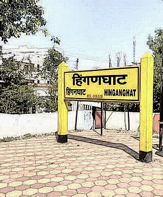
Hinganghat is a city in Wardha district of the Indian state of Maharashtra. The city is administered by a Municipal Council and is located about 35 km (22 mi) from Wardha and 72 km (45 mi) from Maharashtra's second capital Nagpur.

<span class="mw-page-title-main">Chhindwara district</span> District of Madhya Pradesh, India

Chhindwara district is one of the major districts of Madhya Pradesh state of India, and Chhindwara town is the district headquarters. Chhindwara was the largest district in Madhya Pradesh with an area of 10,293 square km before the bifurcation of Pandhurna district. The district is part of Jabalpur division.

<span class="mw-page-title-main">Seoni, Madhya Pradesh</span> City in Madhya Pradesh, India

Seoni is a city and a municipality in Seoni district in the Indian state of Madhya Pradesh. This tribal household dominated district was formed in the year 1956.

<span class="mw-page-title-main">Chopda</span> City in Maharashtra, India

Chopda is a city and municipal council in the Jalgaon district in the state of Maharashtra, India.

<span class="mw-page-title-main">Kalameshwar</span> City in Maharashtra, India

Kalameshwar-Bramhani is a city and a municipal council also a major Industrial hub in Nagpur district in the Indian state of Maharashtra. It is connected to National Highways NH-353I, NH-353J & NH-547E.

Karera is a municipality or Nagar Parishad in the Shivpuri district of the Indian state of Madhya Pradesh.

<span class="mw-page-title-main">Lodhikheda</span> City in Madhya Pradesh, India

Lodhikheda is a town and a nagar parishad in Chhindwara district in the Indian state of Madhya Pradesh. It is famous for its oranges. More than 90 per cent of farmers produce oranges. Cotton is grown in large quantities in the local area.

Multai is a town and a Nagar Palika in Betul district in the Indian state of Madhya Pradesh. Multai is one of the southern cities of Madhya Pradesh, occupying almost half of the Satpura plateau. Considering the small villages around, it occupies a large area in width of the Satpura range between the valley of the Narmada on the north and the barer plains on the south. Forests lie to the west of the city between the districts of East Nimar and Amaraoti. It lies on the Northern bank of the Tapti and the place is also known for being the origin of the Tapti river.

<span class="mw-page-title-main">Pandhurna</span> City in Madhya Pradesh, India

Pandhurna is the administrative headquarter of the Pandhurna District in Madhya Pradesh, India. Pandhurna city is an important city from the business point of view. The famous Gotmar Fair is organized every year on the banks of Jam River. Pandhurna is also famous for its orange fields. Pandhurna also has a multinational company called drytech situated at Nagpur road.

<span class="mw-page-title-main">Renukoot</span> Village in Uttar Pradesh, India

Renukoot is a town and a nagar panchayat in Sonbhadra district in the Indian state of Uttar Pradesh. It is 68 km south from the district headquarters Robertsganj.

<span class="mw-page-title-main">Wani, Yavatmal</span> City in Maharashtra, India

Wani is a 3rd largest city in Yavatmal district in the Indian state of Maharashtra.

<span class="mw-page-title-main">Dabra, Madhya Pradesh</span> Town in Madhya Pradesh, India

Dabra is a town and municipality in Gwalior district in the state of Madhya Pradesh, India located near NH-44 national highway. It serves the headquarters for both a tehsil and a coterminous community development block.

<span class="mw-page-title-main">Kanhan River</span> River in Maharashtra, India

The Kanhan River is an important right bank tributary of the Wainganga River draining a large area lying south of Satpura range in central India. Along its 275 km run through the Indian States of Maharashtra and Madhya Pradesh, it receives its largest tributary - Pench River, a major water source for the metropolis of Nagpur.

Junnardeo, formerly known as Jamai, is a city and a municipality in Chhindwara district in the Indian state of Madhya Pradesh, India. Junnardeo is the head office of the Kanhan area of WCL. It has Asia's largest Coal Wash Plant.

<span class="mw-page-title-main">Lodhikheda railway station</span> Railway station in Madhya Pradesh, India

Lodhikheda railway station is a railway station in Lodhikheda, in the Indian state of Madhya Pradesh.It situated at the junction of Nagpur–Jabalpur and Nagpur–Chhindwara main lines.

<span class="mw-page-title-main">Pandhurna District</span> District of Madhya Pradesh in India

Pandhurna is the 55th district of Madhya Pradesh state and 9th district of Jabalpur division, which came into existence in the year 2023 after separating from Chhindwara district. Its administrative headquarter is in Pandhurna city.

Borgaon is a Census town in Chhindwara District of Madhya Pradesh in India. Its Loceted on Chhindwara Nagpur road.

Piplanarayanwar is a Nagar Panchayat city in district of Chhindwara in Madhya Pradesh. Jam River flows near the Town. 480109 is the pin code of Piplanarayanwar.

References

  1. "Census of India Search details". censusindia.gov.in. Retrieved 10 May 2015.
  2. Falling Rain Genomics, Inc - Sausar
  3. "Census of India 2001: Data from the 2001 Census, including cities, villages and towns (Provisional)". Census Commission of India. Archived from the original on 16 June 2004. Retrieved 1 November 2008.