Schell City, Missouri

Last updated
Schell City, Missouri
Vernon County Missouri Incorporated and Unincorporated areas Schell City Highlighted.svg
Location of Schell City, Missouri
Coordinates: 38°01′09″N94°07′00″W / 38.01917°N 94.11667°W / 38.01917; -94.11667 Coordinates: 38°01′09″N94°07′00″W / 38.01917°N 94.11667°W / 38.01917; -94.11667
Country United States
State Missouri
County Vernon
Founded1871
Incorporated1871
Named for Augustus Schell
Area
[1]
  Total0.63 sq mi (1.63 km2)
  Land0.62 sq mi (1.61 km2)
  Water0.01 sq mi (0.02 km2)
Elevation
[2]
768 ft (234 m)
Population
 (2020)
  Total228
  Density367.15/sq mi (141.74/km2)
Time zone UTC-6 (Central (CST))
  Summer (DST) UTC-5 (CDT)
ZIP code
64783
Area code 417
FIPS code 29-66134 [3]
GNIS feature ID2396553 [2]

Schell City is a city in northeast Vernon County, Missouri, United States. The population was 249 at the 2010 census.

Contents

History

Schell City was laid out in 1871. [4] The city was named for one of its original proprietors, Augustus Schell of New York. [5] A post office has been in operation at Schell City since 1871. [6]

Geography

Schell City is located at the intersection of Missouri routes C and AA approximately 1.5 miles south of the Osage River channel. The Schell-Osage Conservation Area lies adjacent to the east side of the community. Nevada lies approximately 17 miles to the southwest. [7]

According to the United States Census Bureau, the city has a total area of 0.63 square miles (1.63 km2), of which 0.62 square miles (1.61 km2) is land and 0.01 square miles (0.03 km2) is water. [8]

Demographics

Historical population
CensusPop.Note
1880 676
1890 84725.3%
1900 668−21.1%
1910 562−15.9%
1920 5966.0%
1930 413−30.7%
1940 4549.9%
1950 400−11.9%
1960 343−14.2%
1970 3677.0%
1980 327−10.9%
1990 292−10.7%
2000 286−2.1%
2010 249−12.9%
2020 228−8.4%
U.S. Decennial Census [9]

2010 census

As of the census [10] of 2010, there were 249 people, 115 households, and 66 families living in the city. The population density was 401.6 inhabitants per square mile (155.1/km2). There were 133 housing units at an average density of 214.5 per square mile (82.8/km2). The racial makeup of the city was 97.6% White, 1.6% Native American, and 0.8% from two or more races. Hispanic or Latino of any race were 1.6% of the population.

There were 115 households, of which 28.7% had children under the age of 18 living with them, 36.5% were married couples living together, 11.3% had a female householder with no husband present, 9.6% had a male householder with no wife present, and 42.6% were non-families. 40.0% of all households were made up of individuals, and 20% had someone living alone who was 65 years of age or older. The average household size was 2.17 and the average family size was 2.89.

The median age in the city was 39.9 years. 27.3% of residents were under the age of 18; 9.5% were between the ages of 18 and 24; 19.2% were from 25 to 44; 24.4% were from 45 to 64; and 19.3% were 65 years of age or older. The gender makeup of the city was 49.8% male and 50.2% female.

2000 census

As of the census [3] of 2000, there were 286 people, 128 households, and 84 families living in the city. The population density was 454.3 inhabitants per square mile (175.4/km2). There were 161 housing units at an average density of 255.7 per square mile (98.7/km2). The racial makeup of the city was 100.00% White. Hispanic or Latino of any race were 1.05% of the population.

There were 128 households, out of which 27.3% had children under the age of 18 living with them, 55.5% were married couples living together, 7.0% had a female householder with no husband present, and 33.6% were non-families. 32.8% of all households were made up of individuals, and 14.8% had someone living alone who was 65 years of age or older. The average household size was 2.23 and the average family size was 2.78.

In the city the population was spread out, with 25.5% under the age of 18, 5.6% from 18 to 24, 22.7% from 25 to 44, 29.0% from 45 to 64, and 17.1% who were 65 years of age or older. The median age was 42 years. For every 100 females there were 98.6 males. For every 100 females age 18 and over, there were 93.6 males.

The median income for a household in the city was $20,500, and the median income for a family was $27,813. Males had a median income of $20,000 versus $16,094 for females. The per capita income for the city was $11,027. About 19.8% of families and 25.7% of the population were below the poverty line, including 30.0% of those under the age of eighteen and 21.3% of those 65 or over.

See also

Related Research Articles

<span class="mw-page-title-main">Rockville, Missouri</span> City in Missouri, United States

Rockville is a city in Bates County, Missouri, and is part of the Kansas City metropolitan area within the United States. The population was 135 at the 2020 census.

<span class="mw-page-title-main">Mosby, Missouri</span> City in Missouri, United States

Mosby is a city in Clay County, Missouri, United States, along the Fishing River. The population was 101 at the 2020 census. It is part of the Kansas City metropolitan area.

<span class="mw-page-title-main">Calhoun, Missouri</span> City in Missouri, United States

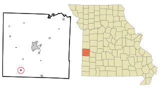
Calhoun is a city in Henry County, Missouri, United States. The population was 469 at the 2010 census.

<span class="mw-page-title-main">Urich, Missouri</span> City in Missouri, United States

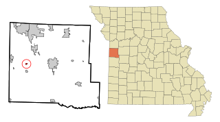
Urich is a city in Henry County, Missouri, United States. The population was 505 at the 2010 census.

<span class="mw-page-title-main">Linneus, Missouri</span> City in Missouri, United States

Linneus is a small city in Linn County, Missouri, United States. The population was 281 at the 2020 census. It is the county seat of Linn County.

<span class="mw-page-title-main">Elmer, Missouri</span> City in Missouri, United States

Elmer is a city in Macon County, Missouri, United States. The population was 51 at the 2020 census.

<span class="mw-page-title-main">Cooter, Missouri</span> City in Missouri, United States

Cooter is a city in Pemiscot County, Missouri, United States. The population was 343 at the 2020 census.

<span class="mw-page-title-main">Hayti Heights, Missouri</span> City in Missouri, United States

Hayti Heights is a city in eastern Pemiscot County in the bootheel of southeast Missouri, United States. The population was 515 at the 2020 census.

<span class="mw-page-title-main">Pleasant Hope, Missouri</span> City in Missouri, United States

Pleasant Hope is a city in Polk County, Missouri, United States. The population was 614 at the 2010 census. It is part of the Springfield, Missouri Metropolitan Statistical Area.

<span class="mw-page-title-main">Nelson, Missouri</span> City in Missouri, United States

Nelson is a city in Saline County, Missouri, United States. The population was 152 at the 2020 census.

<span class="mw-page-title-main">Shelbyville, Missouri</span> City in Missouri, United States

Shelbyville is a city in Shelby County, Missouri, United States. The population was 518 at the 2020 census. It is the county seat of Shelby County.

<span class="mw-page-title-main">Velda City, Missouri</span> City in Missouri, United States

Velda City is a city in St. Louis County, Missouri, United States. The population was 1,420 at the 2010 census.

<span class="mw-page-title-main">Winchester, Missouri</span> City in Missouri, United States

Winchester is a city in St. Louis County, Missouri, United States. The population was 1,447 at the 2020 census.

<span class="mw-page-title-main">Dudley, Missouri</span> City in Missouri, United States

Dudley is a city in Stoddard County, Missouri, United States. The population was 232 at the 2010 census.

<span class="mw-page-title-main">Bronaugh, Missouri</span> City in Missouri, United States

Bronaugh is a city in southwest Vernon County, Missouri, United States. The population was 249 at the 2010 census.

<span class="mw-page-title-main">Harwood, Missouri</span> Village in Missouri, United States

Harwood is a village in northeast Vernon County, Missouri, United States. The population was 47 at the 2010 census. It was estimated to be 45 by the City of Harwood as of July 1, 2019.

<span class="mw-page-title-main">Lake Annette, Missouri</span> City in Missouri, United States

Lake Annette is a city in Cass County, Missouri, United States. The population was 100 at the 2010 census. It is part of the Kansas City metropolitan area.

<span class="mw-page-title-main">Clarkson Valley, Missouri</span> City in Missouri, United States

Clarkson Valley is a city in St. Louis County, Missouri, United States. The population was 2,609 at the 2020 census.

<span class="mw-page-title-main">Shell Knob, Missouri</span> Census-designated place in Missouri, United States

Shell Knob is a census-designated place (CDP) located within White River Township, Barry County, Missouri. The population was 1,254 at the 2020 census.

<span class="mw-page-title-main">Blackburn, Missouri</span> City in Missouri, United States

Blackburn is a city in Lafayette and Saline counties in the U.S. state of Missouri and is part of the Kansas City metropolitan area. The population was 249 at the 2010 census.

References

  1. "ArcGIS REST Services Directory". United States Census Bureau. Retrieved August 28, 2022.
  2. 1 2 U.S. Geological Survey Geographic Names Information System: Schell City, Missouri
  3. 1 2 "U.S. Census website". United States Census Bureau . Retrieved 2008-01-31.
  4. "Area towns approaching 100". The Nevada Daily Mail. Aug 14, 1970. p. 10. Retrieved 28 October 2015.
  5. Eaton, David Wolfe (1918). How Missouri Counties, Towns and Streams Were Named. The State Historical Society of Missouri. p. 369.
  6. "Vernon County". Jim Forte Postal History. Retrieved 14 April 2015.
  7. Missouri Atlas & Gazetteer, DeLorme, 1998, First edition, p. 42, ISBN   0-89933-224-2
  8. "US Gazetteer files 2010". United States Census Bureau. Archived from the original on 2012-01-25. Retrieved 2012-07-08.
  9. "Census of Population and Housing". Census.gov. Retrieved June 4, 2015.
  10. "U.S. Census website". United States Census Bureau . Retrieved 2012-07-08.