Scio Township, Michigan

Last updated

Scio Township, Michigan
Scio township hall.JPG
Township Hall on N. Zeeb Road
Scio Township, MI location.png
Location within Washtenaw County
USA Michigan location map.svg
Red pog.svg
Scio Township
Location within the state of Michigan
Usa edcp location map.svg
Red pog.svg
Scio Township
Location within the United States
Coordinates: 42°18′12″N83°50′10″W / 42.30333°N 83.83611°W / 42.30333; -83.83611
CountryUnited States
State Michigan
County Washtenaw
Established1832
Government
  SupervisorJack Knowles
   Clerk Jessica Flintoft
Area
  Total34.21 sq mi (88.60 km2)
  Land33.73 sq mi (87.36 km2)
  Water0.48 sq mi (1.24 km2)
Elevation
873 ft (266 m)
Population
 (2010)
  Total20,081
  Density595.3/sq mi (229.8/km2)
Time zone UTC-5 (Eastern (EST))
  Summer (DST) UTC-4 (EDT)
ZIP code(s)
48103, 48105 (Ann Arbor)
48130 (Dexter)
Area code 734
FIPS code 26-71940 [1]
GNIS feature ID1627050 [2]
Website Official website

Scio Township is a civil township of Washtenaw County in the U.S. state of Michigan. The population was 20,081 at the 2010 census. [3]

Contents

Communities

History

Samuel W. Foster bought a mill site on the Huron River at what is now Scio in 1835. The community was platted by Dr. Cyril Nichols from Vermont. A post office was established in 1835. The office was moved to Delhi Mills and renamed in February 1871, though the Scio office was re-established in September 1871. The post office took its name from the township; however, early township records were destroyed by fire, and it is uncertain why "Scio" was chosen. [7] There are at least three origins suggested for the name. The first suggests it derives from the Greek island of Chios, and the second that it was named after Scio, New York, although that town was also named for Chios. [9] Thirdly, by coincidence scio also means "I know" in Latin, so following the American Civil War some people assumed this was the origin of the name.[ citation needed ]

Documents regarding the naming of townships in the State of Michigan archives indicate that Scio Township and its northern neighbor Webster Township were named on the same date, unlike other townships in Washtenaw County. This date followed the establishment by the United States of America of diplomatic relations with the modern nation of Greece, following the Greek War of Independence (1821–1830). U.S. Senator Daniel Webster had introduced a resolution, recorded in the Congressional Record , that is widely considered one of his better orations (printed in the Collected Works of Daniel Webster). He advocated that the USA be the first nation to diplomatically recognize Greece. Webster referred to the 1822 destruction of Scio, the then-current French translation of Chios (Greek: Χίος, pronounced /ˈçio̞s/), derived from the Genoese dialect. In Webster's era, French was the language of international diplomacy. Eugène Delacroix's 1824 painting The Massacre at Chios and numerous publications brought the Greek cause to the attention of Americans. Ypsilanti Township was named after the first leader of the secret organization that coordinated the beginning of the revolution, Alexander Ypsilanti (Greek: Αλέξανδρος Υψηλάντης).[ citation needed ] The City of Ypsilanti was named after the victor of the final battle of the revolution, Alexander's brother Demetrius. [10] The sister townships of Scio and Webster were named as a monument to the birth of the new Greek republic, the end of its citizen's subjection, and the first American senator to support their nation.

Delhi Mills was platted as "Michigan Village" by Jacob Doremus in 1836, but was renamed Delhi. In 1842, Norman C. Goodale, known as the founder of Delhi Mills, acquired all the unsold lots. The Scio post office was transferred here in 1871 and operated until 1903. [5]

Geography

According to the U.S. Census Bureau at the 2010 census, the township has a total area of 34.21 square miles (88.60 km2), of which 33.73 square miles (87.36 km2) is land and 0.48 square miles (1.24 km2) (1.40%) is water. [11] A portion of Scio Township's area and population decreased slightly after the census when the village of Dexter incorporated as an autonomous city in 2014.

Scio Township contains two metro parks along the Huron River: Dexter–Huron Metropark and Delhi Metropark. The Border-to-Border Trail runs through the township. [12]

Major highways

Demographics

As of the census [1] of 2000, there were 15,759 people, 6,070 households, and 4,425 families residing in the township. The population density was 463.0 inhabitants per square mile (178.8/km2). There were 6,338 housing units at an average density of 186.2 per square mile (71.9/km2). The racial makeup of the township was 89.53% White, 4.13% African American, 0.27% Native American, 3.70% Asian, 0.03% Pacific Islander, 0.40% from other races, and 1.94% from two or more races. Hispanic or Latino of any race were 1.53% of the population.

There were 6,070 households, out of which 37.4% had children under the age of 18 living with them, 60.8% were married couples living together, 9.1% had a female householder with no husband present, and 27.1% were non-families. 20.7% of all households were made up of individuals, and 5.0% had someone living alone who was 65 years of age or older. The average household size was 2.59 and the average family size was 3.03.

In the township the population was spread out, with 27.2% under the age of 18, 6.9% from 18 to 24, 30.7% from 25 to 44, 26.9% from 45 to 64, and 8.4% who were 65 years of age or older. The median age was 37 years. For every 100 females, there were 95.4 males. For every 100 females age 18 and over, there were 92.4 males.

The median income for a household in the township was $73,705, and the median income for a family was $87,498. Males had a median income of $60,313 versus $38,000 for females. The per capita income for the township was $36,837. About 1.8% of families and 2.9% of the population were below the poverty line, including 1.5% of those under age 18 and 4.6% of those age 65 or over.

Education

Scio Township is served by two public school districts. The eastern section of the township is served by Ann Arbor Public Schools, while the western section of the township is served by Dexter Community School District. [13]

Images

Related Research Articles

<span class="mw-page-title-main">Washtenaw County, Michigan</span> County in Michigan, United States

Washtenaw County is a county located in the U.S. state of Michigan. At the 2020 census, the population was 372,258. The county seat and largest city is Ann Arbor. The county was authorized by legislation in 1822 and organized as a county in 1826. Washtenaw County comprises the Ann Arbor Metropolitan Statistical Area. The county is home to the University of Michigan, Eastern Michigan University, Washtenaw Community College, and Concordia University Ann Arbor.

<span class="mw-page-title-main">London Township, Michigan</span> Civil township in Michigan, United States

London Township is a civil township of Monroe County in the U.S. state of Michigan. The population was 2,984 at the 2020 census.

<span class="mw-page-title-main">Milan Township, Michigan</span> Civil township in Michigan, United States

Milan Township is a civil township of Monroe County in the U.S. state of Michigan. The population was 1,571 at the 2020 census. The township was organized in 1836. The city of Milan borders the township on the north, but the two are administrated autonomously since Milan incorporated as a city in 1967.

<span class="mw-page-title-main">White Lake Township, Michigan</span> Charter township in Michigan, United States

White Lake Charter Township is a charter township of Oakland County in the U.S. state of Michigan. Together with its two unincorporated communities, the township makes up part of the Detroit metropolitan area outskirts. As of the 2010 census, the township population was 30,019.

<span class="mw-page-title-main">Ann Arbor Charter Township, Michigan</span> Charter township in Michigan, United States

Ann Arbor Charter Township is a charter township of Washtenaw County in the U.S. state of Michigan. The population was 4,673 at the 2020 census. The township borders the city of Ann Arbor and contains numerous exclaves, but the two are administered autonomously.

<span class="mw-page-title-main">Augusta Charter Township, Michigan</span> Charter township in Michigan, United States

Augusta Charter Township is a charter township of Washtenaw County in the U.S. state of Michigan. The population was 6,745 at the 2010 census.

<span class="mw-page-title-main">Dexter, Michigan</span> City in Michigan, United States

Dexter is a city situated in Washtenaw County, Michigan, in the United States. As of the 2020 United States census, the city's population was recorded at 4,500.

<span class="mw-page-title-main">Dexter Township, Michigan</span> Civil township in Michigan, United States

Dexter Township is a civil township of Washtenaw County in the U.S. state of Michigan. The population was 6,042 at the 2010 census. The city of Dexter is located to the southeast but does not border the township, and the two are administered autonomously.

<span class="mw-page-title-main">Lima Township, Michigan</span> Civil township in Michigan, United States

Lima Township is a civil township of Washtenaw County in the U.S. state of Michigan. The population was 3,307 at the 2010 census.

<span class="mw-page-title-main">Superior Township, Washtenaw County, Michigan</span> Charter township in Michigan, United States

Superior Charter Township is a charter township of Washtenaw County in the U.S. state of Michigan. The population was 13,058 at the 2010 census.

<span class="mw-page-title-main">Webster Township, Michigan</span> Civil township in Michigan, United States

Webster Township is a civil township of Washtenaw County in the U.S. state of Michigan. The population was 6,784 at the 2010 census.

<span class="mw-page-title-main">Ypsilanti Charter Township, Michigan</span> Charter township in Michigan, United States

Ypsilanti Charter Township is a charter township of Washtenaw County in the U.S. state of Michigan. The population was 53,362 at the 2010 census. The city of Ypsilanti is mostly surrounded by the township, but the two are administered autonomously.

<span class="mw-page-title-main">Huron Charter Township, Michigan</span> Charter township in Michigan, United States

Huron Charter Township is a charter township of Wayne County in the U.S. state of Michigan. The population was 15,879 at the 2010 census. Huron Charter Township is named after the Huron River, which flows southeast through the township. The township is home to three divisions of the Huron–Clinton Metroparks system: Lower Huron, Oakwoods, and Willow.

<span class="mw-page-title-main">Van Buren Township, Michigan</span> American township in Michigan

Van Buren Township is a charter township in Wayne County in the U.S. state of Michigan. A western suburb of Detroit, Van Buren Township is located roughly 28 miles (45.1 km) southwest of downtown Detroit, and 17 miles (27.4 km) southeast of Ann Arbor. As of the 2020 census, the township had a population of 30,375. It surrounds, but is independent of, the city of Belleville.

<span class="mw-page-title-main">Northfield Township, Michigan</span> Civil township in Michigan, United States

Northfield Township is a civil township of Washtenaw County in the U.S. state of Michigan. The population was 8,514 at the 2020 census.

<span class="mw-page-title-main">Huron River</span> River in Michigan, United States

The Huron River is a 130-mile-long (210 km) river in southeastern Michigan, rising out of the Huron Swamp in Springfield Township in northern Oakland County and flowing into Lake Erie, as it forms the boundary between present-day Wayne and Monroe counties. Thirteen parks, game areas, and recreation areas are associated with the river, which passes through the cities of Dexter, Ann Arbor, Ypsilanti, Belleville, Flat Rock and Rockwood that were developed along its banks.

<span class="mw-page-title-main">Huron–Clinton Metroparks</span> A regional park system around Detroit, Michigan

The Huron–Clinton Metroparks system is a regional park system in Metro Detroit in the U.S. state of Michigan. The park system includes 13 parks totaling more than 24,000 acres (97 km2) arranged along the Huron River and Clinton River forming a partial ring around the metro area. Plans are in development to finish the ring by building hike/bike trails to connect all the parks as a green belt. The parks draw about 7.5 million visitors a year, down from a peak of 10 million in 2009. The park system is primarily tax-funded with a $50 million annual budget. The system provides employment for 200 full-time and part-time employees year-round and 1,000 additional summer workers. The rivers are prime fishing and canoeing streams with Delhi Metropark including a short rapids, which while runnable, is the only point other than dams on either stream normally portaged.
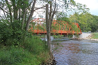
<span class="mw-page-title-main">Delhi Metropark</span> Park in Washtenaw County, Michigan, United States

Delhi Metropark is a park in the Huron-Clinton system of metro parks. It is an 81-acre (330,000 m2) park on the Huron River located five miles (8 km) northwest of Ann Arbor. It has picnic areas, two picnic shelters, swings and slides, river fishing, canoe rental and softball diamonds. A children's playground features an adventure playship, ride-on toys and swings. A Metropark daily or annual vehicle permit is required for entry to the park. The park will eventually be linked to Dexter-Huron Metropark and Hudson Mills Metropark via the Border-to-Border Trail.

The Border-to-Border (B2B) Trail is a partially constructed non-motorized trail in Washtenaw County, Michigan. The trail is planned to cover approximately 35 miles (56 km) from Livingston County to Wayne County along the Huron River.

<span class="mw-page-title-main">Paint Creek (Washtenaw County, Michigan)</span> River in Michigan, United States

Paint Creek is a stream mostly located within Washtenaw County in the U.S. state of Michigan. The stream flows south before entering as a tributary to Stony Creek along the county line with Monroe County.

References

  1. 1 2 "U.S. Census website". United States Census Bureau . Retrieved January 31, 2008.
  2. U.S. Geological Survey Geographic Names Information System: Scio Township, Michigan
  3. "Profile of General Population and Housing Characteristics: 2010 Demographic Profile Data (DP-1): Scio township, Washtenaw County, Michigan". United States Census Bureau . Retrieved July 10, 2012.
  4. U.S. Geological Survey Geographic Names Information System: Delhi Mills, Michigan
  5. 1 2 Romig 1986, pp. 151–152.
  6. U.S. Geological Survey Geographic Names Information System: Scio, Michigan
  7. 1 2 Romig 1986, p. 502.
  8. Romig 1986, p. 588.
  9. "History", About Scio Township, Scio Township, Michigan
  10. How Did Michigan Cities Get Their Names? Part 7, State of Michigan, March 9, 2012, retrieved January 31, 2013, Like Pigeon, Ypsilanti wasn't always known by the name it has today. The city was originally a trading post set up in 1809 and called Woodruff's Grove after Major Thomas Woodruff. The name was later changed to Ypsilanti in 1829 in honor of Demetrius Ypsilanti. Ypsilanti was a hero in the Greek War of Independence from the Ottoman Empire.
  11. "Geographic Identifiers: 2010 Demographic Profile Data (G001): Scio township, Washtenaw County, Michigan". United States Census Bureau . Retrieved July 10, 2012.
  12. Border to Border (2022). "Explore the Border to Border Trail" . Retrieved July 12, 2022.
  13. Michigan Geographic Framework (November 15, 2013). "Washtenaw County School Districts" (PDF). Archived (PDF) from the original on August 21, 2014. Retrieved July 22, 2021.

Sources