New Jersey Transit Corporation, branded as NJ Transit or NJTransit and often shortened to NJT, is a state-owned public transportation system that serves the U.S. state of New Jersey and portions of the states of New York and Pennsylvania. It operates bus, light rail, and commuter rail services throughout the state, connecting to major commercial and employment centers both within the state and in its two adjacent major cities, New York City and Philadelphia. In 2023, the system had a ridership of 209,259,800.

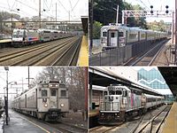
NJ Transit Rail Operations is the rail division of NJ Transit. It operates commuter rail service in New Jersey, with most service centered on transportation to and from New York City, Hoboken, and Newark. NJ Transit also operates rail service in Orange and Rockland counties in New York under contract to Metro-North Railroad. The commuter rail lines saw 57,179,000 riders in 2023, making it the third-busiest commuter railroad in North America and the longest commuter rail system in North America by route length.
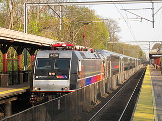
The North Jersey Coast Line is a commuter rail line running from Rahway to Bay Head, New Jersey, traversing through the Jersey Shore region. Operated by New Jersey Transit, the line is electrified as far south as Long Branch. On rail system maps it is colored light blue, and its symbol is a sailboat. The line runs along the former New York & Long Branch Railroad, which was co-owned by the Central Railroad of New Jersey and the Pennsylvania Railroad.

A moveable bridge, or movable bridge, is a bridge that moves to allow passage for boats or barges. In American English, the term is synonymous with drawbridge, and the latter is the common term, but drawbridge can be limited to the narrower, historical definition used in some other forms of English, in which drawbridge refers to only a specific type of moveable bridge often found in castles.

The Newark Bay Bridge of the Central Railroad of New Jersey (CNJ) was a railroad bridge in New Jersey that connected Elizabethport and Bayonne at the southern end of Newark Bay. Its third and final incarnation was a four-track vertical-lift design that opened in 1926, replacing a bascule bridge from 1904 which superseded the original swing bridge from 1887. The bridge served the main line of the CNJ, carrying daily interstate trains as well as commuter trains.

The Raritan Bay Drawbridge, also known as River-Draw, Raritan Bay Swing Bridge, and Raritan River Railroad Bridge, is a railroad swing bridge crossing the Raritan River 0.5 miles (0.8 km) from where it empties into the Raritan Bay in Middlesex County, New Jersey, United States. It connects Perth Amboy to the north and South Amboy to the south.

The Glimmer Glass Bridge is a county owned bridge in Monmouth County, New Jersey, United States. It carries traffic from Brielle Road over the Glimmer Glass, a navigable tidal inlet of the Manasquan River, between Manasquan and Brielle. It has also been on the National Register of Historic Places, since 2008. Due to its age, Commercial vehicles cannot be driven over it. It also allows Bicycles and pedestrians to walk on the wooden sidewalk.

Upper Hack Lift is a lift bridge carrying the New Jersey Transit Main Line across the Hackensack River at mile 6.9 between Secaucus, New Jersey and Lyndhurst.

The HX Draw is a bascule bridge carrying the New Jersey Transit Bergen County Line and Pascack Valley Line across the Hackensack River between Secaucus, New Jersey and East Rutherford. The bridge is also known as The Jack-Knife because of its unusual method of opening.

Dock Bridge is a pair of vertical lift bridges crossing the Passaic River at Newark, Essex County and Harrison, Hudson County, New Jersey, United States, used exclusively for railroad traffic. It is the seventh crossing from the river's mouth at Newark Bay and is 5.0 miles (8.0 km) upstream from it. Also known as the Amtrak Dock Vertical Lift, it carries Amtrak, NJ Transit, and PATH trains. It is listed on the state and federal registers of historic places.

The Newark and New York Railroad was a passenger rail line that ran between Downtown Newark and the Communipaw Terminal at the mouth of the North River in Jersey City, bridging the Hackensack River and Passaic River just north of their mouths at the Newark Bay in northeastern New Jersey. The Central Railroad of New Jersey operated it from its opening in 1869. Though operations ended in 1946; portions remained in use until 1967.

The NX Draw is an out-of-service railroad bridge on the Passaic River between Newark and Kearny, New Jersey. It is the 13th bridge from the river's mouth at Newark Bay and is 6.5 miles (10.5 km) upstream from it. The bascule bridge, built by the Erie Railroad and once part of its Newark Branch, has been abandoned in the raised position.

The Newark Drawbridge, also known as the Morristown Line Bridge, is a railroad bridge on the Passaic River between Newark and Harrison, New Jersey. The swing bridge is the 11th bridge from the river's mouth at Newark Bay and is 5.85 miles (9.41 km) upstream from it. Opened in 1903, it is owned and operated by New Jersey Transit.

The Lyndhurst Draw is a railroad bridge crossing the Passaic River between Clifton and Lyndhurst in northeastern New Jersey. Built in 1903, it is owned and operated by New Jersey Transit Rail Operations (NJT).
Morgan Draw is railroad moveable bridge over the Cheesequake Creek between the Morgan section of Sayreville and Laurence Harbor in Old Bridge in Middlesex County, New Jersey, United States. Located at MP 0.2 near the mouth on the Raritan Bay, the bascule bridge lies just upstream of the New Jersey Route 35 crossing. It is owned and operated by New Jersey Transit Rail Operations (NJT) and substantially rehabilitated in 2005-2008. A storm surge during Hurricane Sandy in 2012 caused severe damage to the bridge.
Brielle Draw is a railroad bascule bridge over Manasquan River in Brielle and Point Pleasant Beach, Monmouth County, New Jersey, United States west of the Manasquan Inlet to the Atlantic Ocean. It carries a single track of the New Jersey Transit Rail Operations (NJT) North Jersey Coast Line between Manasquan and Point Pleasant Beach stations. It had once been part of Central Railroad of New Jersey (CNJ), New York & Long Branch Railroad (NYLB) and Pennsylvania Railroad (PRR) operations. The line is also served by the River Draw over the Raritan River, the Morgan Draw over Cheesequake Creek, the Oceanport Draw over Oceanport Creek and the Shark River Draw.
Oceanport Draw is railroad moveable bridge over the Oceanport Creek, a tributary of the Shrewsbury River, in Oceanport in Monmouth County, New Jersey, United States. It is owned and operated by New Jersey Transit Rail Operations (NJT).