Sheldon, Iowa | |
---|---|
Motto: Families Come First | |
Coordinates: 43°10′52″N95°50′53″W / 43.18111°N 95.84806°W | |
Country | United States |
State | Iowa |
Counties | O'Brien, Sioux |
Government | |
• Type | Mayor-council |
• Mayor | Greg Geels |
Area | |
• Total | 4.75 sq mi (12.29 km2) |
• Land | 4.75 sq mi (12.29 km2) |
• Water | 0.00 sq mi (0.00 km2) |
Elevation | 1,427 ft (435 m) |
Population (2020) | |
• Total | 5,512 |
• Density | 1,161.64/sq mi (448.48/km2) |
Time zone | UTC-6 (Central (CST)) |
• Summer (DST) | UTC-5 (CDT) |
ZIP code | 51201 |
Area code | 712 |
FIPS code | 19-72390 |
GNIS feature ID | 0461558 |
Website | www |
Sheldon is a city in O'Brien and Sioux counties in the U.S. state of Iowa, along the Floyd River. The population was 5,512 at the time of the 2020 census; it is the largest city in O'Brien County. [2]
Sheldon got its start in the year 1873, following construction of the Sioux City & St. Paul Railroad through that territory. [3] It was named for Israel Sheldon, a railroad promoter. [4] It was a strategic location on the rail for businesses from as far away as Minneapolis and Omaha, after the addition of the intersection with the Chicago, Milwaukee and St. Paul Railway in 1878. [5]
The growth in infrastructure has continued. Today, the city lies at the crossroads of Iowa Highway 60 and U.S. Route 18. Eastbound and westbound rail service is provided by IC&E Railroad (since 2008 a subsidiary of Canadian Pacific Railway), while northbound and southbound service is provided by Union Pacific Railroad. [6]
The city's first financial institution, the Sheldon State Bank, closed in 1903. [7] In 1961, the city made headlines when it was revealed that Burnice Geiger had embezzled more than two million dollars from the Sheldon National Bank, operated by her father. [8] [9] [10] [11] She was sentenced to fifteen years in prison in the same year, but paroled in 1966. [12] [13]
Today, the city is most known for its annual display of marigolds and the moniker of its local schools' athletic teams—the Orabs. The name stands for the school colors orange and black. Sheldon High School also hosts the Sheldon High School Summer Theatre program. Sheldon is the home of Northwest Iowa Community College and the Carnegie Library, which was placed on the National Register of Historic Places in 1977.
Sheldon was mentioned on page 13 of the Tim O'Brien book If I Die in a Combat Zone, Box Me Up and Ship Me Home : "Together we watched trombones and crepe-paper floats move down mainstreet. The bands and floats represented Sheldon, Tyler, Sibley, Jackson, and a dozen other neighboring towns".
Ken Snyder (born 1949), pastor of the Parkview Assembly of God in Sheldon, self-released a record album entitled Ken: By Request Only in 1976. [14] The record jacket—featuring Snyder in now-outdated hair and clothes—has made the LP popular on websites that highlight unusual-looking album covers. (Snyder retired as pastor in 2018 and was elected to the Sheldon city council in 2021.) [15]
Sheldon is located at 43°10′52″N95°50′53″W / 43.18111°N 95.84806°W (43.181180, −95.848123). [16]
According to the United States Census Bureau, the city has a total area of 4.50 square miles (11.65 km2), all land. [17]
Climate data for Sheldon, Iowa (1991−2020 normals, extremes 1899−2019) | |||||||||||||
---|---|---|---|---|---|---|---|---|---|---|---|---|---|
Month | Jan | Feb | Mar | Apr | May | Jun | Jul | Aug | Sep | Oct | Nov | Dec | Year |
Record high °F (°C) | 69 (21) | 66 (19) | 86 (30) | 98 (37) | 107 (42) | 104 (40) | 110 (43) | 107 (42) | 104 (40) | 94 (34) | 77 (25) | 66 (19) | 110 (43) |
Mean maximum °F (°C) | 46.0 (7.8) | 51.9 (11.1) | 69.2 (20.7) | 82.7 (28.2) | 88.2 (31.2) | 92.2 (33.4) | 93.6 (34.2) | 92.0 (33.3) | 88.2 (31.2) | 81.5 (27.5) | 65.1 (18.4) | 48.4 (9.1) | 95.2 (35.1) |
Mean daily maximum °F (°C) | 24.6 (−4.1) | 29.5 (−1.4) | 42.5 (5.8) | 57.0 (13.9) | 69.0 (20.6) | 79.2 (26.2) | 82.7 (28.2) | 80.3 (26.8) | 74.0 (23.3) | 60.5 (15.8) | 43.9 (6.6) | 29.6 (−1.3) | 56.1 (13.4) |
Daily mean °F (°C) | 14.9 (−9.5) | 19.3 (−7.1) | 31.9 (−0.1) | 44.7 (7.1) | 57.6 (14.2) | 68.2 (20.1) | 71.5 (21.9) | 68.9 (20.5) | 60.9 (16.1) | 47.5 (8.6) | 32.8 (0.4) | 20.3 (−6.5) | 44.9 (7.2) |
Mean daily minimum °F (°C) | 5.2 (−14.9) | 9.1 (−12.7) | 21.3 (−5.9) | 32.4 (0.2) | 46.2 (7.9) | 57.2 (14.0) | 60.4 (15.8) | 57.5 (14.2) | 47.9 (8.8) | 34.6 (1.4) | 21.6 (−5.8) | 11.0 (−11.7) | 33.7 (0.9) |
Mean minimum °F (°C) | −17.3 (−27.4) | −12.6 (−24.8) | 0.3 (−17.6) | 17.4 (−8.1) | 31.2 (−0.4) | 42.7 (5.9) | 48.0 (8.9) | 44.9 (7.2) | 30.8 (−0.7) | 18.9 (−7.3) | 3.2 (−16.0) | −12.6 (−24.8) | −22.0 (−30.0) |
Record low °F (°C) | −32 (−36) | −35 (−37) | −24 (−31) | 2 (−17) | 17 (−8) | 33 (1) | 41 (5) | 33 (1) | 15 (−9) | −9 (−23) | −20 (−29) | −28 (−33) | −35 (−37) |
Average precipitation inches (mm) | 0.88 (22) | 1.00 (25) | 1.91 (49) | 3.22 (82) | 4.03 (102) | 4.67 (119) | 3.61 (92) | 3.26 (83) | 3.39 (86) | 2.43 (62) | 1.52 (39) | 1.17 (30) | 31.09 (790) |
Average snowfall inches (cm) | 8.7 (22) | 7.2 (18) | 6.6 (17) | 3.3 (8.4) | 0.2 (0.51) | 0.0 (0.0) | 0.0 (0.0) | 0.0 (0.0) | 0.0 (0.0) | 0.5 (1.3) | 4.7 (12) | 9.6 (24) | 40.8 (104) |
Average precipitation days (≥ 0.01 in) | 7.0 | 6.5 | 7.8 | 10.2 | 13.2 | 11.7 | 8.6 | 9.2 | 8.6 | 7.8 | 5.9 | 7.1 | 103.6 |
Average snowy days (≥ 0.1 in) | 6.0 | 5.2 | 3.5 | 1.5 | 0.1 | 0.0 | 0.0 | 0.0 | 0.0 | 0.7 | 2.6 | 5.8 | 25.4 |
Source: NOAA (mean maxima/minima 1981–2010) [18] [19] |
Census | Pop. | Note | %± |
---|---|---|---|
1880 | 730 | — | |
1890 | 1,478 | 102.5% | |
1900 | 2,282 | 54.4% | |
1910 | 2,941 | 28.9% | |
1920 | 3,488 | 18.6% | |
1930 | 3,820 | 9.5% | |
1940 | 3,768 | −1.4% | |
1950 | 4,001 | 6.2% | |
1960 | 4,251 | 6.2% | |
1970 | 4,535 | 6.7% | |
1980 | 5,003 | 10.3% | |
1990 | 4,937 | −1.3% | |
2000 | 4,914 | −0.5% | |
2010 | 5,188 | 5.6% | |
2020 | 5,512 | 6.2% | |
U.S. Decennial Census [20] [2] |
As of the census of 2020, [21] there were 5,512 people, 2,186 households, and 1,325 families residing in the city. The population density was 1,161.6 inhabitants per square mile (448.5/km2). There were 2,421 housing units at an average density of 510.2 per square mile (197.0/km2). The racial makeup of the city was 85.2% White, 1.4% Black or African American, 0.9% Native American, 1.0% Asian, 0.2% Pacific Islander, 5.0% from other races and 6.5% from two or more races. Hispanic or Latino persons of any race comprised 11.7% of the population.
Of the 2,186 households, 28.3% of which had children under the age of 18 living with them, 48.4% were married couples living together, 5.9% were cohabitating couples, 24.6% had a female householder with no spouse or partner present and 21.1% had a male householder with no spouse or partner present. 39.4% of all households were non-families. 34.1% of all households were made up of individuals, 14.9% had someone living alone who was 65 years old or older.
The median age in the city was 37.0 years. 27.7% of the residents were under the age of 20; 7.1% were between the ages of 20 and 24; 24.2% were from 25 and 44; 21.3% were from 45 and 64; and 19.7% were 65 years of age or older. The gender makeup of the city was 50.5% male and 49.5% female.
At the 2010 census there were 5,188 people, 2,213 households, and 1,300 families living in the city. The population density was 1,152.9 inhabitants per square mile (445.1/km2). There were 2,365 housing units at an average density of 525.6 per square mile (202.9/km2). The racial makeup of the city was 93.7% White, 0.6% African American, 1.1% Asian, 3.7% from other races, and 0.8% from two or more races. Hispanic or Latino of any race were 6.5%. [22]
Of the 2,213 households 26.3% had children under the age of 18 living with them, 49.6% were married couples living together, 6.3% had a female householder with no husband present, 2.9% had a male householder with no wife present, and 41.3% were non-families. 35.0% of households were one person and 17.5% were one person aged 65 or older. The average household size was 2.28 and the average family size was 2.96.
The median age was 39.4 years. 23.1% of residents were under the age of 18; 9.5% were between the ages of 18 and 24; 24.1% were from 25 to 44; 24.8% were from 45 to 64; and 18.6% were 65 or older. The gender makeup of the city was 50.7% male and 49.3% female.
At the 2000 census there were 4,914 people, 2,006 households, and 1,285 families living in the city. The population density was 1,119.6 inhabitants per square mile (432.3/km2). There were 2,126 housing units at an average density of 484.4 per square mile (187.0/km2). The racial makeup of the city was 97.48% White, 0.43% African American, 0.06% Native American, 0.77% Asian, 0.81% from other races, and 0.45% from two or more races. Hispanic or Latino of any race were 2.56%. [23]
Of the 2,006 households 29.0% had children under the age of 18 living with them, 56.5% were married couples living together, 4.9% had a female householder with no husband present, and 35.9% were non-families. 31.2% of households were one person and 13.0% were one person aged 65 or older. The average household size was 2.34 and the average family size was 2.96.
Age spread: 23.6% under the age of 18, 10.8% from 18 to 24, 24.9% from 25 to 44, 21.2% from 45 to 64, and 19.5% 65 or older. The median age was 38 years. For every 100 females, there were 95.9 males. For every 100 females age 18 and over, there were 94.1 males.
The median household income was $34,058 and the median family income was $43,346. Males had a median income of $31,026 versus $20,604 for females. The per capita income for the city was $18,254. About 3.6% of families and 7.6% of the population were below the poverty line, including 8.1% of those under age 18 and 6.2% of those age 65 or over.
Sheldon is served by the Sheldon Community School District, which include Sheldon High School. [24] There are two private schools, both of which offer preschool services through the eighth grade, the Sheldon Christian School [25] and the St. Patrick's Catholic School. [26]
Sheldon is also home to Northwest Iowa Community College, a two-year associate degree community college. [27]
Sheldon is home to a KIWA (AM) and KIWA-FM.
Iowa Information, Inc., publishes The Sheldon Mail-Sun and The N'West Iowa REVIEW. The N'West Iowa REVIEW has been named the state's Newspaper of the Year 17 [35] times, and named the best weekly in the United States by the National Newspaper Association from 2000 to 2005, and again in 2007.
Lenox is a city in Taylor and Adams counties in the U.S. state of Iowa. The population was 1,339 at the time of the 2020 census.
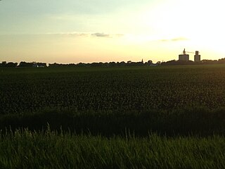
Somers is a city in Calhoun County, Iowa, United States. The population was 128 at the time of the 2020 census.
Plymouth is a city in Cerro Gordo County, Iowa, United States, along the Shell Rock River. The population was 375 at the time of the 2020 census. It is part of the Mason City Micropolitan Statistical Area.
Gillett Grove is a city in Clay County, Iowa, United States. The population was 30 in the 2020 census, a decline from 55 in 2000.
Deloit is a city in Crawford County, Iowa, along the Boyer River. The population was 250 at the time of the 2020 census.
De Soto is a city in Dallas County, Iowa, United States. The population was 915 at the time of the 2020 census. It is part of the Des Moines–West Des Moines Metropolitan Statistical Area.
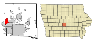
Grimes is a city in Polk and Dallas counties in the U.S. state of Iowa. The population was 15,392 at the time of the 2020 Census. Grimes is part of the Des Moines-West Des Moines metropolitan area.
Earlville is a city in Delaware County, Iowa, United States. The population was 716 at the time of the 2020 census.
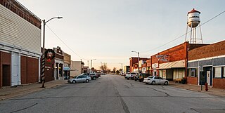
Farragut is a city in Fremont County, Iowa, United States. The population was 490 at the time of the 2020 census.
Corwith is a city in Hancock County, Iowa, United States. The population was 266 at the time of the 2020 census.
Magnolia is a city in Harrison County, Iowa, United States. The population was 190 at the time of the 2020 census.
Bode is a city in Humboldt County, Iowa, United States. The population was 302 at the 2020 census.
Tiffin is a city in Johnson County, Iowa, United States. It is part of the Iowa City, Iowa Metropolitan Statistical Area. The population was 4,512 at the time of the 2020 census. F. W. Kent County Park is located just to the west of Tiffin, and is a popular site for outdoor recreation in Johnson County, being noted for its lake, camping facilities, resident whitetail deer herd and wild turkeys, and its cross-country ski trails through rolling acres of oak and hickory forest.
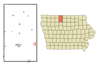
Wesley is a city in Kossuth County, Iowa, United States. The population was 391 at the time of the 2020 census.
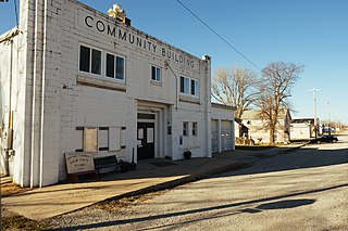
Hastings is a city in Mills County, Iowa, United States. The population was 152 at the time of the 2020 census.
Archer is a city in O'Brien County, Iowa, United States. The population was 117 at the 2020 census.
Ashton is a city in Osceola County, Iowa, United States. The population was 436 at the 2020 census.
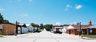
Panama is a city in Shelby County, Iowa, United States. The population was 235 at the time of the 2020 census.
Boyden is a city in Sioux County, Iowa, United States. The population was 701 at the 2020 census.
Matlock is a city in Sioux County, Iowa, United States. The population was 74 at the time of the 2020 census.