Sintra Line

Last updated
Sintra Line
Rossio train station interior.jpg
Overview
Native nameLinha de Sintra
StatusOperational
Locale Lisbon, Amadora and Sintra, Portugal
Termini
Connecting lines Cintura Line, Oeste Line
Stations15
Service
Type Heavy rail
Technical
Line length27.2 km (16.9 mi)
Number of tracks Double-track (From Rossio to Campolide, from Agualva-Cacém to Sintra) and Quadruple-track (From Campolide to Agualva-Cacém)
Track gauge 1,668 mm (5 ft 5+2132 in) Iberian gauge
Electrification 25 kV / 50 Hz Overhead line
Route map

Contents

00,000
BSicon exCONTg.svg
R. Cacilhas
Barreiro (cancelled proj.)
BSicon GRZq.svg
BSicon exhKRZWae.svg
BSicon utXBHF-L.svg
BSicon KXBHFxa-R.svg
00,000
Lisboa-Rossio
BSicon STR.svg
BSicon tSTRa.svg
00,194
Rossio tunnel (south entrance) [1]
BSicon umtKRZtq.svg
BSicon tSTR.svg
BSicon umtKRZtq.svg
BSicon utSTR+r.svg
× Metropolitano Lisboa logo.svg Yellow
BSicon etXBHF-L.svg
BSicon utXBHF-R.svg
Rato (Lisbon Metro)
(canc. pj.)
⇄̸ Metropolitano Lisboa logo.svg Rato
BSicon tSTR.svg
2613 m
BSicon tRP4q.svg
BSicon tRP4q.svg
BSicon tSTR.svg
BSicon tRP2s.svg
BSicon tRP4q.svg
BSicon tSTR.svg
BSicon tRP2e.svg
BSicon lENDE@F.svg
BSicon tRP2r.svg
emergency road access
BSicon tSTR.svg
BSicon uexSPLa.svg
BSicon ucvSTRq.svg
BSicon uvSTR+rf-.svg
BSicon uSTRq-.svg
BSicon tSTR.svg
BSicon uSTRq-.svg
BSicon uv-STR+rg.svg
BSicon uexvSTR.svg
× Carris: Amoreiras–Campolide
BSicon uSTR.svg
BSicon tVNT.svg
BSicon uevSTR.svg
ventilation shaft
BSicon uexvSTRq.svg
BSicon u-STRl.svg
BSicon uexvSTRrg-.svg
BSicon uexvSTRq.svg
BSicon tSTR.svg
BSicon uxvSTRq.svg
BSicon uevSTRr.svg
BSicon uexvSTRq.svg
× Carris: Mq. Fronteira
BSicon tSTR.svg
BSicon CONTg.svg
00,000
L. Cintura/L. Sul Alcântara-T./Tunes
BSicon tSTRe.svg
BSicon STR.svg
02,807
Rossio tunnel (north entrance) [1]
BSicon XBHF-L.svg
BSicon BHFSPLa.svg
BSicon XPLTeq.svg
03,100
Campolide
BSicon KDSTa.svg
BSicon SHI3+l.svg
BSicon SHI3gl.svg
BSicon vSHI3+r-.svg
BSicon vSHI3gr-STR.svg
EMEF Campolide
BSicon CONTg.svg
BSicon KRWl.svg
BSicon KRWg+r.svg
BSicon vSTR-SHI3gl.svg
BSicon SHI3+r.svg
00,000
L. Cintura Braço de Prata
BSicon SPLa.svg
BSicon SPLa.svg
BSicon SPLe.svg
BSicon SKRZ-G4u.svg
× IP7 (Eixo N.–S.)
BSicon vUSTr.svg
BSicon hRP4aq.svg
BSicon vSKRZ-G4h.svg
BSicon SKRZ-G4h.svg
BSicon SKRZ-G4hr.svg
× Av. Correia Barreto
BSicon vBHF.svg
BSicon vENDEe-SHI1r.svg
BSicon STR.svg
BSicon num3l.svg
BSicon STR.svg
(Sete Rios)
BSicon num1r.svg
BSicon vSTR2-.svg
BSicon STRl.svg
BSicon cSTRc3.svg
BSicon cdLSTRq.svg
BSicon KRZu.svg
BSicon STRr.svg
BSicon SKRZ-G4u.svg
× Av. Correia Barreto
BSicon STRc1.svg
BSicon LSTR+4.svg
BSicon ABZgl.svg
BSicon SKRZ-G4uq.svg
BSicon ABZg+r.svg
× IP7 (Eixo N.–S.)
BSicon ABZgl.svg
BSicon KRZu.svg
BSicon num1m!.svg
BSicon STR+r.svg
BSicon kSTR3.svg
C. Sete Rios (1)
(old route)(2)
BSicon ENDEe.svg
BSicon num2le!.svg
BSicon exKRWl.svg
BSicon ABZg+l.svg
BSicon exKRW+r.svg
BSicon STRr.svg
BSicon kSTRr+1.svg
BSicon num3r.svg
BSicon kSTRc4.svg
c. Benfica-Camp.-A (3)
BSicon eHST.svg
04,237
Cruz da Pedra
(dem.)
BSicon SBRUCKE.svg
overpass
BSicon SBRUCKE.svg
overpass
BSicon BRUCKE2.svg
× Tv. S. D. Benfica
BSicon eHST.svg
05,000
S. D. de Benfica
(dem.)
BSicon SBRUCKE.svg
overpass
BSicon SKRZ-G2o.svg
× Estr. Calh. Benfica
BSicon SKRZ-G4u.svg
× IC19 Seg. Circ., Av. N. Matos
BSicon BHF.svg
06,275
Benfica
BSicon exlGRZal.svg
BSicon eHST.svg
00,000
Buraca
(dem.)
BSicon exlGRZ.svg
BSicon STR.svg
 0LSB0   0AMD0  (old border, 1991)
BSicon exlGRZ.svg
BSicon SKRZ-G2u.svg
× R. Issan Sartawi
BSicon STR.svg
BSicon exlGRZe.svg
BSicon GRZq.svg
BSicon tRP4q.svg
× CRIL
BSicon SBRUCKE.svg
overpass
BSicon eHST.svg
Santa Cruz de Benfica
(dem.)
BSicon BHF.svg
07,468
Santa Cruz-Damaia
BSicon lhdSTRae+L.svg
BSicon dRP2q.svg
BSicon dRP2.svg
BSicon dSTR.svg
BSicon lhdSTRae+R.svg
BSicon dRP2q.svg
∥ R. Conde Tomar; × Av. D. Pedro V
BSicon SBRUCKE.svg
overpass
BSicon eHST.svg
07,900,000
Damaia
(dem.)
BSicon SBRUCKE.svg
overpass
BSicon KDSTaq.svg
BSicon BUEq.svg
BSicon ABZgr.svg
07,982
Ramal Amadora-Sorefame
BSicon eHST.svg
“J. Pimenta”
(closed, dem.)
BSicon BHF.svg
08,400
Reboleira
BSicon hSTRq cerulean.svg
BSicon WVIADUKT1-R.svg
BSicon tSTRq cerulean.svg
BSicon dSTRq cerulean.svg
BSicon SKRZ-G4o.svg
× Av. Brasil
BSicon SBRUCKE.svg
overpass
BSicon SKRZ-G4o.svg
× Est. Salvador Allende
BSicon SBRUCKE.svg
overpass
BSicon BHF.svg
10,010
Amadora
BSicon RP2ensRP2.svg
BSicon SKRZ-G2u.svg
BSicon RP2wnsRP2.svg
├ Av. Gago Coutinho; ┤ Av. Cardoso Lopes
BSicon RP2wnsRP2.svg
BSicon STR.svg
BSicon RP2ensRP2.svg
∥ Av. António Feijó; ∥ Av. Álvares Cabral
BSicon RP2ensRP2.svg
BSicon SKRZ-G2u.svg
BSicon RP2wnsRP2.svg
├ Av. Sacadura Cabral; ┤ Av. Ultramar
BSicon SKRZ-G4o.svg
× Av. Humberto Delgado
BSicon GRZq.svg
BSicon hKRZWa.svg
BSicon hSKRZ-G4e.svg
× Est. Águas Livres
BSicon BHF.svg
12,054
Queluz-Belas
BSicon hKRZWae.svg
BSicon SKRZ-G4o.svg
× Av. Duarte Pacheco
BSicon SBRUCKE.svg
overpass
BSicon SKRZ-G2o.svg
× Pct. Paz
BSicon BHF.svg
12,975
Monte Abraão
(formerly Queluz-Massamá)
BSicon SKRZ-G4o.svg
× Av. Sá Carneiro
BSicon BS2c2.svg
BSicon STR.svg
BSicon BS2lr.svg
BSicon BS2c3.svg
BSicon BS2c1.svg
BSicon lENDE@G.svg
BSicon BS2+lr.svg
BSicon BS2c4.svg
BSicon GRZal.svg
BSicon SKRZ-G2o.svg
× R. Carlos Lopes ⇠  0SNT0   0OER0 
BSicon GRZ.svg
BSicon SKRZ-G4u.svg
× A9 (IC18, CREL)
BSicon GRZ.svg
BSicon SKRZ-G2o.svg
× Av. Inf. D. Henrique
BSicon GRZ.svg
BSicon BHF.svg
15,110
Massamá-Barcarena
(formerly Barcarena-Tercena)
BSicon GRZel.svg
BSicon STR.svg
BSicon SKRZ-G2o.svg
× acesso ao IC19 / Cacém
BSicon BHF.svg
17,343
Agualva-Cacém
BSicon SKRZ-G4o.svg
× Av. Bons Amigos
BSicon SBRUCKE.svg
overpass
BSicon SKRZ-G2o.svg
BSicon SBRUCKE.svg
overpass
BSicon KRWgl.svg
BSicon kABZg3.svg
BSicon KRW+r.svg
17,840
Bifurcação de Meleças
BSicon CONTgq.svg
BSicon kABZq1.svg
BSicon kSTRc4.svg
BSicon hKRZa.svg
BSicon STRr.svg
00,000
L. Oeste Figueira da Foz
BSicon hKRZWe.svg
BSicon SKRZ-G4u.svg
× R. Pôr do Sol
BSicon SKRZ-G4o.svg
× Av. Descobertas
BSicon BHF.svg
20,740
Rio de Mouro
BSicon SBRUCKE.svg
overpass
BSicon SKRZ-G2o.svg
× R. Fonte Velha
BSicon BHF.svg
21,860
Mercês
BSicon SKRZ-G4o.svg
× R. Vitorino Nemésio
BSicon BHF.svg
23,100
Algueirão-Mem Martins
BSicon SBRUCKE.svg
overpass
BSicon BS2c2.svg
BSicon SHI2gr.svg
BSicon vDST-STR.svg
24,565
Algueirão-Parque
BSicon vSKRZ-G4u.svg
× IC16 (EN9)
BSicon BS2c1.svg
BSicon SHI2g+r.svg
BSicon BHF.svg
26,307
Portela de Sintra
BSicon SKRZ-G2o.svg
× R. Tribunal
BSicon SBRUCKE.svg
overpass
BSicon RP2q.svg
BSicon TUNNEL1.svg
Sintra tunnel
× Estr. Chão de Meninos
BSicon uENDE+lxa.svg
BSicon uexSTR+r.svg
BSicon SBRUCKE.svg
overpass
BSicon uCONTf.svg
BSicon uexABZg+l.svg
BSicon emKRZ.svg
BSicon uexKBSTeq.svg
Tram
BSicon uexXBHF-L.svg
BSicon KXBHFe-R.svg
27,170
Sintra
BSicon uexCONTf.svg
Tram
→ Vila Velha
Location on the network
PlusCM128 (009900).svg
MarkeKreuzBlau.svg
Pt ferv.png

+ Rossio × Sintra (🔎)

Linha de Sintra is a railway line that connects the stations of Rossio and Sintra, Portugal. and is operated by Comboios de Portugal.

History

Sintra from Castle of the Moors, with station visible at lower left Sintra from Castle of the Moors.jpg
Sintra from Castle of the Moors, with station visible at lower left

The railway, one of the first to be planned in Portugal, was opened on 2 April 1887. [2] [3] The southern terminus was changed from Alcântara-Terra to Rossio, after the station was inaugurated in June 1891. [2] The duplication works were completed on 20 January 1949, and during the 1950s, the line was electrified. [2] [4] New rolling stock was introduced in the 1990s. [5] Quadruple-tracking between Benfica and Amadora had been completed by September 1999. [6]

See also

Related Research Articles

<span class="mw-page-title-main">Sabor line</span> Portuguese closed railway line

The Sabor line(Linha do Sabor) was a 1,000 mmmetre gauge railway in north-east Portugal. It ran for nearly 106 km between Pocinho and Duas Igrejas, near Miranda do Douro. It closed in 1988.

<span class="mw-page-title-main">Linha do Sul</span> Portuguese railway line

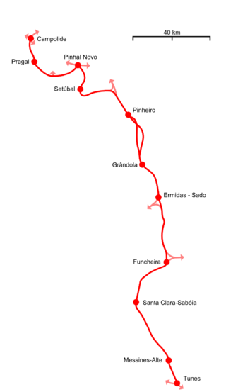
Linha do Sul is a Portuguese railway line which connects Campolide A, in Lisbon, and Tunes, in the Algarve. The first section, from Pinhal Novo to Setúbal, was opened in 1861. The route to Funcheira opened on 25 May 1920. In 2003 it was linked to Lisbon, crossing the Tagus River on the 25 de Abril Bridge.

<span class="mw-page-title-main">Ramal de Braga</span> Railway line in Portugal

Ramal de Braga is a branch line in Portugal, which connects Nine railway station on the Linha do Minho, with Braga. It was opened on 21 May 1875. and modernised in 2004.

<span class="mw-page-title-main">Cintura Line</span> Railway line in Portugal

The Cintura line is a railway line in Lisbon, Portugal. The half circle route was opened in 1888 and serves as a connection between all railway lines in Lisbon: The Cascais, Sul, Sintra, and Norte Lines. There are two railway triangles, one in Sete Rios, and another in Xabregas. It crosses all four Lisbon Metro lines, and connects to three of those at four stations.

<span class="mw-page-title-main">Linha de Leixões</span> Portuguese railway line

Linha de Leixões, also known as Linha de Cintura do Porto, is a freight railway line which connects Contumil railway station, on the Linha do Minho, and Leixões, in Matosinhos, Portugal. It was opened in 1938, and electrified in 1998. Passenger services ran until 1987 and from 2009 to 2011.

<span class="mw-page-title-main">Linha do Leste</span> Portuguese railway line

Linha do Leste is a Portuguese railway line which connects Abrantes railway station to the border with Spain, near to Elvas. The connection to Spain was opened on 24 September 1863.

<span class="mw-page-title-main">Ramal do Louriçal</span> Portuguese railway line

Ramal do Louriçal is a Portuguese railway line managed by Infraestruturas de Portugal which connects Louriçal railway station, on the Linha do Oeste, to two paper factories: Celbi and The Navigator Company. The electrified freight line was opened in 1993.

<span class="mw-page-title-main">Ramal de Viana-Doca</span> Portuguese railway line

Ramal de Viana-Doca is a closed Portuguese railway branch line which connected the station of Viana do Castelo to the city's port. It was opened on 20 March 1924 and closed in mid-1988.

<span class="mw-page-title-main">Barreiro railway station</span> Station in Lisbon, Portugal

Barreiro is a railway station on the Alentejo Line that serves as a connection between rail services on the South Bank of the Tagus and Soflusa's river transport to Lisbon, Portugal. The first Barreiro station began operating on June 15, 1857, although it was not inaugurated until February 1, 1861. Since it was too far from the river pier, a new station was built and inaugurated in 1884. This station included an important workshop hub, which underwent extension work during the 1900s, but the facilities were becoming insufficient for the demand by the following decade. However, political and social instability, which was reflected in the administration of the railroads, dragged out the process. It was not until the 1930s that the new workshops were completed. Meanwhile, in 1923 the Ramal do Seixal branch line went into service, and in 1935 the railway between Barreiro and Lavradio was duplicated. The Barreiro station was remodeled and expanded in 1943, and in the 1950s the workshops began to house diesel locomotives from other lines that had been electrified. On December 14, 2008, a new Barreiro station was inaugurated, and the old one was closed.

<span class="mw-page-title-main">Régua railway station</span> Railway station in Peso da Régua, Portugal

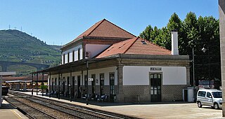
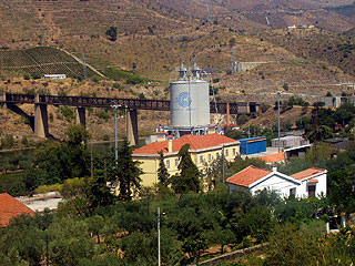
The Régua railway station previously known as Regoa railway station, is a station on the Douro Line, which serves the town of Peso da Régua, in the District of Vila Real, in Portugal. It opened in 1879, and served as a junction point with the Corgo Line, which operated between 1906 and 2009.

<span class="mw-page-title-main">Vila Real de Santo António railway station</span> Railway station in southeast Portugal

The Vila Real de Santo António railway station is a station on the Algarve line that serves the city of Vila Real de Santo António, in the district of Faro, Portugal. The original station went into service on 14 April 1906, and the new building was inaugurated on 4 September 1945.

<span class="mw-page-title-main">Zimbro halt</span> Discontinued halt in northeast Portugal

The Zimbro halt was a station on the Sabor line, located in the municipality of Torre de Moncorvo in Portugal.

<span class="mw-page-title-main">Larinho halt</span> Closed halt in northern Portugal

The Larinho halt was a station on the Sabor line that served the town of Larinho, in the municipality of Torre de Moncorvo, Portugal.

<span class="mw-page-title-main">Urrós halt</span> Closed halt in northeast Portugal

The Urrós halt was a station on the Sabor line that served the town of Urrós, in the municipality of Mogadouro, Portugal.

<span class="mw-page-title-main">Coa halt</span> Closed halt in northern Portugal

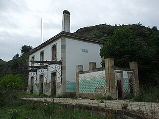
The Coa halt, is a closed interface of the Douro line, which used to serve the town of Vila Nova de Foz Côa, in the Guarda District, in Portugal. The halt started operating on 5 May 1887, and was closed in 2 October 1988.

<span class="mw-page-title-main">Fonte de Aldeia halt</span> Closed halt in northeast Portugal

The Fonte de Aldeia halt, originally called Fonte de Aldeia stop, was a station on the Sabor line that served the town of Fonte de Aldeia, in the municipality of Miranda do Douro, Portugal.

<span class="mw-page-title-main">Maiorca halt</span> Closed halt in Portugal

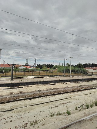
The Maiorca halt was a railway halt of the shut down Ramal da Figueira da Foz, which served the town of Maiorca, Coimbra, Portugal, and closed in 2009.

<span class="mw-page-title-main">Sendim railway station</span> Former railway station in northeast Portugal

The Sendim railway station once operated as a stop along the Sabor line, serving the town of Sendim in the Bragança District of Portugal.

<span class="mw-page-title-main">Mira Sintra-Meleças railway station</span> Railway station in Sintra, Portugal

Mira Sintra-Meleças Station is a railway station located in the city of Sintra, Portugal. Located in the Western line, it is served by all Western line services as well as a CP Lisboa Sintra Line commuter service connecting to Rossio. It is operated by CP and managed by Infraestruturas de Portugal.

<span class="mw-page-title-main">Mogadouro railway station</span> Closed railway station in Mogadouro, Portugal

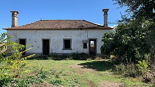
The Mogadouro railway station, part of the now closed Sabor Line, was a rail interface that served the town of Mogadouro, Bragança District, Portugal.

References

  1. 1 2 Sepúlveda, Jacinto: Túnel do Rossio – Parte II. Retrieved 4 February 2019
  2. 1 2 3 Torres, Carlos Manitto (1 February 1958). "A evolução das linhas portuguesas e o seu significado ferroviário" (PDF). Gazeta dos Caminhos de Ferro. Retrieved 3 February 2019.
  3. Martins et al., p. 257
  4. Reis, et al. p. 102
  5. Brazão, Carlos (1993). "Nuevas unidades eléctricas". Maquetren (in Spanish). Madrid: Resistor.
  6. "Cronologia | IP Patrimonio | Infraestruturas de Portugal". www.ippatrimonio.pt. Retrieved 2023-08-04.

Sources