Skerray

Last updated

Skerray
Skerray Free Church - geograph.org.uk - 577738.jpg
Skerray Free Church
Sutherland UK location map.svg
Red pog.svg
Skerray
Location within the Sutherland area
OS grid reference NC661628
Council area
Lieutenancy area
Country Scotland
Sovereign state United Kingdom
Post town THURSO
Postcode district KW14
Dialling code 01641
Police Scotland
Fire Scottish
Ambulance Scottish
UK Parliament
Scottish Parliament
List of places
UK
Scotland
58°31′58″N4°18′03″W / 58.53287°N 4.3008°W / 58.53287; -4.3008

Skerray (Scottish Gaelic : Sgeirea) is a remote small crofting hamlet and fishing port on the north coast of Sutherland, Scotland. [1] It is located 7+34 miles (12.5 kilometres) by road northeast of Tongue and 40+14 miles (65 kilometres) by road west of Thurso. [2] Skerray is home to a community of artists and a group of tree planters.

Contents

Geography

Skerray harbour Skerray harbour - geograph.org.uk - 24563.jpg
Skerray harbour

Skerray, whose name means "between the rocks and the sea", is so called because it is situated on a rocky promontory on the Atlantic Ocean between Tongue to the southwest and Bettyhill to the east. [3] There is an additional location called Skerray one mile (1.5 kilometres) to the west. The community is located north of the A836 road from Tongue. The nearest local airport and main line rail station are at Wick and Thurso.

Skerray is the main village in "Mackay Country", historically attributed to Clan Mackay. There are 11 townships in the community, Torrisdale, Achtoty, Lotts, Clashaidy, Clashlevan, Achnabat, Clashbuie, Modsary, Lamigo, Strathanbeg, Strathan, and Slettel, now deserted. [3] To the south are the lakes of Lochan Modsane, Loch na Coit, Lochan nam Burag, Lochan an Tigh-choimhid and Loch Skerray, with Lochan Ruadh to the southwest. [2] Just off the coast of Skerray Bay are Neave Island and Eilean nan Ròn to the northwest.

Skerray Bay contains a small harbour and pier. The harbour, situated west of Melvich, [4] has a natural rocky ridge, open to the north. [5] The foundation stone for Port Skerray was laid in October 1894 by the Duke of Sutherland. [6] The Skerray stream, Strathskerray, is approximately three miles (five kilometres) in length and empties at the sea. [7]

Economy

Cottage on the road to Skerray harbour Cottage on the road to Skerray harbour - geograph.org.uk - 1331405.jpg
Cottage on the road to Skerray harbour

The Skerray economy, historically based on crofting and fishing, saw dramatic changes in its population, which fell from 500 in 1926 to around 100 by the 1980s. [8] In the late 19th century, the North Sea Pilot noted that, "At Skerray, Isle Roan, and Torrisdale, 25 boats and 120 men and boys are employed in the fisheries." [9] Skerray has been a crofting community, though with the decline of crofting in this area, dwellings are expected to be converted to holiday homes. [10] A five-year Scottish National Heritage research project that began in 1994 gave some of Skerry's crofters the opportunity to participate in an agricultural and environmental management study in exchange for annual payments. [11] A group of artists live and work in Skerray, [8] as well as the A' Chraobh ("The Tree") Group which planted the Millennium Forest at Borgie. [12] The economy has expanded to include tourism. [13]

Landmarks

Skerray has a small shop, Jimson's, with an incorporated post office. The main store closed in the early 1960s. [14] The adjacent building to Jimson's is now home to a small art gallery featuring art work from local artists. The hamlet also contains Skerray Village Hall. The main church in Skerray is the Free Church (in the hamlet of Achtoty) and, as of 1988, it was reported to be "just about surviving, having had no minister for four years" but has fallen into a ruined state of repair. [3] [14]

Education

A parochial schoolhouse was built in Skerray in 1836. [15] While primary education remains local, secondary education is provided at Farr High School in Bettyhill. [13]

Tourism

Musical groups from other countries perform in the community hall. [8] Cliffs and inlets along the coastline are explored by sea kayaking enthusiasts. [16]

Related Research Articles

<span class="mw-page-title-main">Sutherland</span> Historic county in Scotland

Sutherland is a historic county, registration county and lieutenancy area in the Highlands of Scotland. Its county town is Dornoch. Sutherland borders Caithness and Moray Firth to the east, Ross-shire and Cromartyshire to the south and the Atlantic to the north and west. Like its southern neighbour Ross-shire, Sutherland has some of the most dramatic scenery in Europe, especially on its western fringe where the mountains meet the sea. These include high sea cliffs, and very old mountains composed of Precambrian and Cambrian rocks.

<span class="mw-page-title-main">Caithness</span> Historic county in northern Scotland

Caithness is a historic county, registration county and lieutenancy area of Scotland.

<span class="mw-page-title-main">Kinlochbervie</span> Human settlement in Scotland

Kinlochbervie is a scattered harbour village in the north west of Sutherland, in the Highland region of Scotland. It is the most northerly port on the west coast of Scotland.

<span class="mw-page-title-main">Lairg</span> Human settlement in Scotland

Lairg is a village and parish in Sutherland, Scotland. It has a population of 891 and is at the south-eastern end of Loch Shin.

Forss Water, known also as Forss River, has its source at the northern end of Loch Shurrey, at grid reference ND042568. About 13 kilometres north of its source the river flows into Crosskirk Bay and the Atlantic Ocean at ND029700. Crosskirk Bay is on the north coast of Great Britain and about 8 kilometres west of the burgh of Thurso, Caithness, in Highland, Scotland. The river marked the eastern extent of the Clan Mackay raid in the Sandside Chase of 1437.

<span class="mw-page-title-main">Bettyhill</span> Human settlement in Scotland

Bettyhill is a village in the parish of Farr, on the north coast of Scotland.

<span class="mw-page-title-main">Golspie</span> Human settlement in Scotland

Golspie is a village and parish in Sutherland, Highland, Scotland, which lies on the North Sea coast in the shadow of Ben Bhraggie. It has a population of around 1,350.

<span class="mw-page-title-main">Assynt</span> Sparsely populated area of Sutherland on the west coast of Scotland

Assynt is a sparsely populated area in the south-west of Sutherland, lying north of Ullapool on the west coast of Scotland. Assynt is known for its landscape and its remarkable mountains, which have led to the area, along with neighbouring Coigach, being designated as the Assynt-Coigach National Scenic Area, one of 40 such areas in Scotland.

<span class="mw-page-title-main">Strathnaver</span> River in northern Scotland

Strathnaver or Strath Naver is the fertile strath of the River Naver, a famous salmon river that flows from Loch Naver to the north coast of Scotland. The term has a broader use as the name of an ancient province also known as the Mackay Country, once controlled by the Clan Mackay and extending over most of northwest Sutherland.

<span class="mw-page-title-main">Loch Inver</span> Sea Loch in grid reference NC

Loch Inver is a 3.62-kilometre-long sea loch in Assynt, Sutherland and is on the northwest coast of Scotland. The loch meets the coastal embayment of Enard Bay at the north end and The Minch, where it meets Soyea Island at its mouth.

<span class="mw-page-title-main">Borgie</span> Human settlement in Scotland

Borgie is a hamlet in Sutherland, Highland, Scotland. Historically it was part of the 12,600-acre (5,100-hectare) Tongue estate with shooting rights, and it contains the Borgie Lodge, now a bed and breakfast. Borgie is noted for its salmon, which are caught in the River Borgie which flows to the east of the hamlet.

<span class="mw-page-title-main">Farr, Sutherland</span> Human settlement in Scotland

Farr is a parish in the county of Sutherland in the Scottish council area of Highland. The parish also includes a small hamlet named Farr. The village of Bettyhill lies less than 1 mile to the west of the hamlet along the A836 road.

Armadale is a small village on the north coast of Scotland, in the council area of Highland. The village is part of the parish of Farr, in the county of Sutherland. Armadale is about 30 miles west of the town of Thurso, off the A836 road. The population of Armadale is 50 and shrinking, with 32% of the population being retired, and the remaining 68% population are working or at school.

Badcall comprises two remote hamlets, called Lower Badcall and Upper Badcall. Upper Badcall, a crofting township, is the larger of the two and is situated on the western shore of Badcall Bay. Lower Badcall is located less than 1 mile to the east on the eastern shore of Badcall Bay. Badcall is on the west coast of Sutherland, Scottish Highlands and is in the Scottish council area of Highland.

<span class="mw-page-title-main">Torrisdale, Sutherland</span> Human settlement in Scotland

Torrisdale is a remote hamlet on the western shore of Torrisdale Bay in Sutherland, Highland, on the north coast of Scotland. It is 3 kilometres (2 mi) west of Bettyhill.

<span class="mw-page-title-main">Skerray Bay</span>

Skerray Bay is an arm of the Atlantic Ocean, located on the north coast of Sutherland, Highland, Scotland. Small and rocky, it is situated to the north of Clashbuie and northwest of the crofting community of Skerray. The rock, Càrn Mòr, it at the entrance, while the channel, Caol Beag, separates Coomb Island from the mainland. Strathan Skerray - Skerray Bay is a Geological Conservation Review site. Walkers enjoy the 8 miles (13 km) Skerray Bay to Tongue trek.

<span class="mw-page-title-main">Kyle of Tongue</span>

The Kyle of Tongue is a shallow sea loch in northwest Highland, Scotland, in the western part of Sutherland. Featuring a rocky coastline, its mouth is formed at Tongue Bay. The community of Tongue is situated on the Kyle's eastern shore and the loch is crossed by the Kyle of Tongue Bridge and Causeway.

<span class="mw-page-title-main">Kyle of Tongue Bridge</span> Bridge and causeway in far north of Scotland

The Kyle of Tongue Bridge is part of the Kyle of Tongue Causeway, which crosses Kyle of Tongue sea loch on the north coast of Scotland.

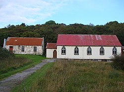
Strathnaver Museum is located in Bettyhill, Sutherland, Scotland. It is a fully accredited volunteer-run independent museum which first opened in 1976. It explores the history of north west Sutherland through the context of the Highland Clearances. The Clan Mackay Centre is located on the 1st floor of the main museum building.

References

Click twice to view map Skerray map.png
Click twice to view map
  1. Royal Scottish Geographical Society (1987). Scottish Geographical Magazine. Royal Scottish Geographical Society.
  2. 1 2 Maps (Map). Google Maps.
  3. 1 2 3 "SKERRAY". Mackaycountry.com. Archived from the original on 28 January 2013. Retrieved 27 December 2011.
  4. Black's picturesque tourist of Scotland (Public domain ed.). A. and C. Black. 1857. p. 568.
  5. United States. Hydrographic Office (1915). British Islands pilot (Public domain ed.). Govt. print. off. p. 343.
  6. The Railway news ... (Public domain ed.). 1894. p. 510.
  7. The Topographical, Statistical, and Historical Gazetteer of Scotland: I-Z (Public domain ed.). A. Fullarton. 1853. pp.  761–.
  8. 1 2 3 Smith, Angèle Patricia; Gazin-Schwartz, Amy (2008). Landscapes of clearance: archaeological and anthropological perspectives. Left Coast Press. p. 171. ISBN   978-1-59874-266-4.
  9. Great Britain. Hydrographic Dept (1895). North Sea pilot. Sold by J. D. Potter. p. 40.
  10. Jedrej, Charles; Jȩdrej, M. Charles; Nuttall, Mark (1995). White settlers: the impact of rural repopulation in Scotland. Psychology Press. p. 131. ISBN   978-3-7186-5753-7.
  11. "Agricultural Demonstration Projects Could Help Target Funding". Scottish National Heritage. 5 August 1999.
  12. Society and space. Pion Ltd. 2002. p. 538.
  13. 1 2 "247 TORRISDALE, SKERRAY, SUTHERLAND KW14 7TH". orkneyit.com. p. 2. Retrieved 28 December 2011.
  14. 1 2 Smith, John Smart (September 1988). The County of Sutherland. Scottish Academic Press. p. 270. ISBN   9780707305363.
  15. Great Britain. Committee on Education (1844). Minutes of the Committee of Council on Education Correspondence, Financial Statements, etc., and Reports by Her Majesty's Inspectors of Schools (Public domain ed.). Clowes. p. 656.
  16. Cooper, Doug; Reid, George (2005). Scottish Sea Kayaking: Fifty Great Sea Kayak Voyages. Pesda Press. p. 193. ISBN   978-0-9547061-2-8.