Slater, Iowa

Last updated

Slater, Iowa
Flag of Slater, Iowa.svg
Story County Iowa Incorporated and Unincorporated areas Slater Highlighted.svg
Location of Slater, Iowa
Coordinates: 41°52′49″N93°40′54″W / 41.88028°N 93.68167°W / 41.88028; -93.68167 Coordinates: 41°52′49″N93°40′54″W / 41.88028°N 93.68167°W / 41.88028; -93.68167
Country Flag of the United States.svg  United States
State Flag of Iowa.svg  Iowa
County Story
Area
[1]
  Total1.91 sq mi (4.95 km2)
  Land1.91 sq mi (4.95 km2)
  Water0.00 sq mi (0.00 km2)
Elevation
1,037 ft (316 m)
Population
 (2020)
  Total1,543
  Density807.01/sq mi (311.55/km2)
Time zone UTC-6 (Central (CST))
  Summer (DST) UTC-5 (CDT)
ZIP code
50244
Area code 515
FIPS code 19-73515
GNIS feature ID0461667

Slater is a city in Story County, Iowa, United States. The population was 1,543 at the time of the 2020 census. [2]

Contents

History

There has been a post office in Slater since 1887. [3] The city was named for Michael Slater, the original owner of the town site. [4]

Geography

Slater is located at 41°52′49″N93°40′54″W / 41.88028°N 93.68167°W / 41.88028; -93.68167 (41.880265, -93.681642). [5]

According to the United States Census Bureau, the city has a total area of 1.26 square miles (3.26 km2), all land. [6]

Demographics

Historical populations
YearPop.±%
1900 426    
1910 473+11.0%
1920 616+30.2%
1930 568−7.8%
1940 544−4.2%
1950 583+7.2%
1960 717+23.0%
1970 1,094+52.6%
1980 1,312+19.9%
1990 1,268−3.4%
2000 1,306+3.0%
2010 1,489+14.0%
2020 1,543+3.6%
Source: "U.S. Census website". United States Census Bureau . Retrieved March 29, 2020. and Iowa Data Center
Source:
U.S. Decennial Census [7] [2]

2010 census

As of the census [8] of 2010, there were 1,489 people, 589 households, and 418 families living in the city. The population density was 1,181.7 inhabitants per square mile (456.3/km2). There were 614 housing units at an average density of 487.3 per square mile (188.1/km2). The racial makeup of the city was 98.5% White, 0.3% African American, 0.2% Native American, 0.8% from other races, and 0.1% from two or more races. Hispanic or Latino of any race were 1.3% of the population.

There were 589 households, of which 35.5% had children under the age of 18 living with them, 60.8% were married couples living together, 6.5% had a female householder with no husband present, 3.7% had a male householder with no wife present, and 29.0% were non-families. 23.3% of all households were made up of individuals, and 9.7% had someone living alone who was 65 years of age or older. The average household size was 2.53 and the average family size was 3.02.

The median age in the city was 35.7 years. 26.5% of residents were under the age of 18; 7.5% were between the ages of 18 and 24; 29.5% were from 25 to 44; 24.1% were from 45 to 64; and 12.3% were 65 years of age or older. The gender makeup of the city was 51.7% male and 48.3% female.

2000 census

As of the census [9] of 2000, there were 1,306 people, 532 households, and 369 families living in the city. The population density was 1,057.6 inhabitants per square mile (408.3/km2). There were 555 housing units at an average density of 449.4 per square mile (173.5/km2). The racial makeup of the city was 99.46% White, 0.31% African American, 0.15% Asian, and 0.08% from two or more races.

There were 532 households, out of which 34.6% had children under the age of 18 living with them, 61.7% were married couples living together, 5.8% had a female householder with no husband present, and 30.6% were non-families. 28.0% of all households were made up of individuals, and 13.9% had someone living alone who was 65 years of age or older. The average household size was 2.45 and the average family size was 3.03.

26.7% are under the age of 18, 6.4% from 18 to 24, 28.9% from 25 to 44, 24.0% from 45 to 64, and 14.0% who were 65 years of age or older. The median age was 38 years. For every 100 females, there were 94.1 males. For every 100 females age 18 and over, there were 85.8 males.

The median income for a household in the city was $45,417, and the median income for a family was $58,036. Males had a median income of $37,760 versus $27,031 for females. The per capita income for the city was $20,647. About 0.6% of families and 2.0% of the population were below the poverty line, including none of those under age 18 and 7.8% of those age 65 or over.

Education

The Ballard Community School District operates local area public schools. [10]

See also

Related Research Articles

<span class="mw-page-title-main">Odenville, Alabama</span> Town in Alabama, United States

Odenville is a city in St. Clair County, Alabama, United States. It incorporated in 1914. At the 2010 census the population was 3,585, up from 1,131 in 2000. It annexed the former town of Branchville in 2007. Odenville annexed a portion of Springville in 2015 due to Springville not running water to some of its residences.

<span class="mw-page-title-main">Sheldahl, Iowa</span> City in Iowa, United States

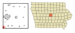
Sheldahl is a city in Polk, Boone, and Story counties in the U.S. state of Iowa. The population was 297 at the time of the 2020 census.

<span class="mw-page-title-main">McClelland, Iowa</span> City in Iowa, United States

McClelland is a city in Pottawattamie County, Iowa, United States. The city was founded in 1903 after the Great Western Railroad was extended to include Council Bluffs, IA. The population was 146 at the time of the 2020 census.

<span class="mw-page-title-main">Erhard, Minnesota</span> City in Minnesota, United States

Erhard is a city in Otter Tail County, Minnesota, United States. The population was 132 at the 2020 census.

<span class="mw-page-title-main">Slater, Missouri</span> City in Missouri, United States

Slater is a city in Saline County, Missouri, United States. The population was 1,856 at the 2010 census.

<span class="mw-page-title-main">New Melle, Missouri</span> City in Missouri, United States

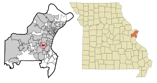
New Melle is a small country community in St. Charles County, Missouri, United States. It is located approximately 38 miles west of St. Louis. The population was 475 at the 2010 census.

<span class="mw-page-title-main">Country Club Hills, Missouri</span> City in Missouri, United States

Country Club Hills is a city in St. Louis County, Missouri, United States. The population was 1,274 at the 2010 census.

<span class="mw-page-title-main">Warson Woods, Missouri</span> City in Missouri, United States

Warson Woods is a city in St. Louis County, Missouri, United States. The population was 1,962 at the 2010 census.

<span class="mw-page-title-main">Fort Shawnee, Ohio</span> CDP in Ohio, United States

Fort Shawnee is census-designated place (CDP) in Allen County, Ohio, United States. The population was 6,263 at the 2020 census. It is included in the Lima, Ohio Metropolitan Statistical Area. Fort Shawnee is adjacent to the city of Lima and the village of Cridersville in Auglaize County. In 2012, village residents voted to disincorporate the village. Fort Shawnee is located at 40°40′54″N84°8′21″W. According to the United States Census Bureau, the village had a total area of 7.25 square miles (18.78 km2), of which 7.21 square miles (18.67 km2) is land and 0.04 square miles (0.10 km2) is water.

<span class="mw-page-title-main">Lucasville, Ohio</span> Census-designated place in Ohio, United States

Lucasville is a census-designated place (CDP) in Scioto County, Ohio, United States. The population was 1,655 at the 2020 census. It is part of the Portsmouth micropolitan area.

<span class="mw-page-title-main">Mannsville, Oklahoma</span> Town in Oklahoma, United States

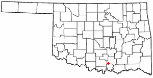
Mannsville is a town in Johnston County, Oklahoma, United States. The population was 863 at the 2010 census, up from 587 in 2000.

<span class="mw-page-title-main">North Miami, Oklahoma</span> Town in Oklahoma, United States

North Miami is a town in Ottawa County, Oklahoma, United States. The population was 290 at the 2020 census. North Miami is part of the Joplin, Missouri metropolitan area. The town is primarily a bedroom community for several larger towns in the county.

<span class="mw-page-title-main">Vera, Oklahoma</span> Town in Oklahoma, United States

Vera is a town in Washington County, Oklahoma, United States. The population was 334 as of the 2020 census.

<span class="mw-page-title-main">Indiana Township, Allegheny County, Pennsylvania</span> Place in Pennsylvania, United States

Indiana Township is a township in Allegheny County, Pennsylvania and a Pittsburgh suburb located in the United States. The population was 7,254 at the 2020 census.

<span class="mw-page-title-main">Elder Township, Cambria County, Pennsylvania</span> Township in Pennsylvania, United States

Elder Township is a township in Cambria County, Pennsylvania, United States, about 24 miles (39 km) northwest of Altoona. As of the 2010 census, the township had a population of 1,038. It is part of the Johnstown, Pennsylvania Metropolitan Statistical Area.

<span class="mw-page-title-main">New Berlin, Pennsylvania</span> Borough in Pennsylvania, United States

New Berlin is a borough in Union County, Pennsylvania, United States. The population was 791 at the 2020 census.

<span class="mw-page-title-main">Buffalo Township, Washington County, Pennsylvania</span> Township in Pennsylvania, United States

Buffalo Township is a township in Washington County, Pennsylvania, United States. The population was 2,069 at the 2010 census.

<span class="mw-page-title-main">Jonesville, South Carolina</span> City in South Carolina, United States

Jonesville is a town in Union County, South Carolina, United States. The population was 911 at the 2010 United States Census.

<span class="mw-page-title-main">Elk Point, South Dakota</span> City in South Dakota, United States

Elk Point is a city in and county seat of Union County, South Dakota, United States. The population was 2,149 as of the 2020 census.

<span class="mw-page-title-main">Mount Enterprise, Texas</span> City in Texas, United States

Mount Enterprise is a city in Rusk County, Texas, United States. The population was 447 at the 2010 census.

References

  1. "2020 U.S. Gazetteer Files". United States Census Bureau. Retrieved March 16, 2022.
  2. 1 2 "2020 Census State Redistricting Data". census.gov. United states Census Bureau. Retrieved August 12, 2021.
  3. "Story County". Jim Forte Postal History. Retrieved March 28, 2015.
  4. Chicago and North Western Railway Company (1908). A History of the Origin of the Place Names Connected with the Chicago & North Western and Chicago, St. Paul, Minneapolis & Omaha Railways. p. 125.
  5. "US Gazetteer files: 2010, 2000, and 1990". United States Census Bureau. February 12, 2011. Retrieved April 23, 2011.
  6. "US Gazetteer files 2010". United States Census Bureau. Archived from the original on July 2, 2012. Retrieved May 11, 2012.
  7. "Census of Population and Housing". Census.gov. Retrieved June 4, 2015.
  8. "U.S. Census website". United States Census Bureau . Retrieved May 11, 2012.
  9. "U.S. Census website". United States Census Bureau . Retrieved January 31, 2008.
  10. "Ballard" (PDF). Iowa Department of Education . Retrieved July 10, 2020.