Southampton Common

Last updated

Southampton Common
SouthamptonCommon.jpg
Southampton Common, January 2005
Southampton from OpenStreetMap.png
Red pog.svg
Shown within Southampton
Type Common land / Public park
Location Southampton
Coordinates 50°55′34″N1°24′39″W / 50.9262°N 1.4109°W / 50.9262; -1.4109
Area365 acres (148 ha)
CreatedUnknown. First documented 13th century as common land
1844 as public park
Operated bySouthampton City Council
OpenAll year
Status Green Flag Award
Site of Special Scientific Interest
Southampton Common
Site of Special Scientific Interest
Wilder area of the common - geograph.org.uk - 207178.jpg
Location Hampshire
Grid reference SU 414 146 [1]
InterestBiological
Area223 acres (90.3 hectares) [1]
Notification 1987 [1]
Location map Magic Map

Southampton Common is a large open space to the north of the city centre of Southampton, England. It is bounded by the districts of Shirley, Bassett, Highfield and Portswood. The area supports a large variety of wildlife, including one of the largest populations in Britain of the nationally rare great crested newt. The Common is used for a wide variety of community events, Flower Festival, Race for life Cancer Research UK and formerly 'Power in the Park' hosted by Power FM.

Contents

An area of 223-acre (90.3-hectare) is a biological Site of Special Scientific Interest. [1] [2]

Layout

Southampton Common currently includes 365 acres (148 ha) [3] of woodland, parkland, rough grassland, ponds, wetlands, nature trails, a children's play area, a model yachting lake, and a fishing lake.

The Hawthorns Urban Wildlife Centre at the southern end has been built on the former site of Southampton Zoo and the comprehensive displays document the natural history of the area; with interactive resources, educational facilities and information about local wildlife and environmental management. To the west, bordering on Hill Lane, is a historic cemetery that also includes many rare flora and fauna. Cemetery Lake is popular for birdwatching.

The south east of the Common includes a large play area for children with sand and water play. This is located near to a car parking zone and the Cowherds Inn, a local landmark which has a history going back to the 17th century.

The A33 road between Southampton and Winchester runs through the common. [4] The section through the common is known as the Avenue. [4] In 1760 it was straightened by the Southampton to Winchester turnpike trust. [4] Since at least 1763 trees have been deliberately planted alongside the road. [4]

There are a number of streams on the common that are collectively part of the Rollesbrook catchment. [5] An artificial connection to Freemantle stream that runs to the ornamental lake has also been created. [5] The mainline of the Rollesbrook rises slightly to the south of Cutthorn Mound at the northern end of the common. [5] [6] It flows in a general south westerly direction passing under The Avenue and being joined by several tributaries before leaving the area via the southern side of the cemetery. [5]

History

Paleolithic artifacts have been found in gravel pits on the common. [7] It has been suggested that the area's status as a common goes back to the town of Hamwic around 500AD. [8]

The documented history of Southampton Common can be traced back to a dispute over land rights in the 13th century. [8] The dispute (which also included land beyond the common) was between the Lord of the manor of Shirley – one Nicholas de Sirlie – and the Burgesses of Southampton. [8] The dispute was resolved on 13 May 1228 by the Borough agreeing to make a small payment to Nicholas de Sirlie and withdrawing any claims over the land that became known as Shirley Common. [8] In return Nicholas de Sirlie renounced any claims over Southampton common and accepted that rights of common would be limited to those living within the borough boundaries. [8]

The designation as Common Land allowed all householders within the borough who were paying "watch and ward" to use the land for fuel, clay, and taking berries and other wild, natural food. [9] The most important use was for grazing, however, and there was a cowherd, who was paid to be responsible for the cattle on the common. [10] As well as looking after the cattle, it was the cowherd's job to perform maintenance on the gates, fences, and banks on the common. [10] In the 17th Century, the cowherd was paid 2d per cow but, was required to rent a house on the common for 20 shillings per year. [10] The job of the cowherd was often performed by the same family from generation to generation, and the office was sometimes held by a woman such as Elizabeth Fawkens, who was the widow of the previous cowherd. She held the office for five years from 1675. [10]

By the mid 16th century the rising population of the Borough resulted in commoners being limited to having no more than two animals on the common. [9] At the same time the first reference to a brickmaker living and working on the common appear. [11] The area around the original brickmaker's house was worked out by the early 18th century resulting in the house being moved to site near the current wildlife center. [11] This site was worked out by 1814. [11]

In 1595 the first attempt to supply Southampton with water was made by Roger Pedley. [12] [13] This attempt was only partially successful and was disrupted a year later by a Mr Robert Russell digging on the common. [13]

The use of the common for grazing declined from the mid 18th century. [14] In 1762 the cowherd's house was rebuilt at the expense of Alderman William Knight who agreed to pay for the building on the condition that the rent (which was then raised to £6 a year) was distributed among the poor of Southampton's parishes. [14] In order to meet this higher rent the cowherd began to sell alcoholic beverages and refreshments. [14] In 1774 the office of cowherd was taken over by a brewer and in 1789 the cowherd's house was leased by town council to a firm of brewers as an inn. [14] The cowherd ceased to be appointed sometime between 1834 and 1836 with the remaining duties falling to the Haywarden until that office also stopped being filled in 1907. [14] The last brickmaking on the common ceased in 1852 although the brick maker had ceased to live on the common after 1814. [11] [15]

For a period the town gallows were located on the north of Southampton Common with the last execution taking place there in 1785. [6]

19th century

In 1814 the town clerk managed to get permission to build a house on the common on the site of the former brickmaker's house. [15] This house, known as Hawthorn cottage, was sold in 1851 to and again in 1887 and continued to be occupied until 1942. [15]

A racecourse was built in on the common in 1822 but, with falling attendances, the various structures on the course had to be sold off in 1848 to meet the costs, and it ceased to be used. [16] [17]

In 1843 10 acres (4.0 ha) of the common was split off by the Southampton Corporation to be used a cemetery. [18] [19] The power to do this was provided by the Southampton Cemetery Act 1843 which allowed up to 15 acres (6.1 ha) to be taken. [18] The Cemetery opened in 1846 and is now known as Southampton Old Cemetery. [18] A further 5 acres (2.0 ha) was taken from the common and added to the cemetery in 1863. [19] In 1884 an act of parliament was obtained to transfer another 12 acres (4.9 ha) to the cemetery. [19]

Southampton Common Cemetery lake Cemetery lake southampton common 2018.JPG
Southampton Common Cemetery lake

The common became a public park in 1844 as the result of the council using the powers of the Marsh Improvement Act of 1844. [20]

The racecourse on the common was rebuilt in 1860 and races continued to be held until 1881. [16] In the mid 1860s a cricket pitch was constructed within the racecourse with upgrades taking place in 1874. [21] In the same year the council gave permission for a golf course to be constructed on the common. [21]

The first agricultural show was held on the common in 1873 in the form of the Royal Counties Agricultural Society show. [22] From then on large shows either from the Royal Counties Agricultural Society or the Bath and West of England Society took place every few years. [22]

The first non-reservoir pond on the common appeared sometime between 1800 and 1846 and was just beyond what was then the Cemetery's north east corner. [23] This pond disappeared with the 1884 expansion of the cemetery. [23] Separately, a few years before the expansion, a disused gravel pit had filled with water to the point it became a rough pond. [23] In 1881 it was decided to form this pond into cemetery lake essentially by tidying it up and making more controllable connections to the streams on the common. [23]

In 1888 the council decided to construct a second lake known as the Ornamental Lake in part as a job creation scheme. [23] The lake was constructed in a crescent shape divided into two levels with a dam with a waterfall separating the two. [23]

Southampton Common ornamental lake Southampton Common ornamental lake.JPG
Southampton Common ornamental lake

In 1892 a small hospital was built on the common for cholera and smallpox cases. It was soon judged unsuitable and was removed by the end of the year. [24] The council instead purchased City of Adelaide to use as a hospital ship. [24]

Waterworks

In 1803 the first of a number of reservoirs was constructed by the Southampton Waterworks commissioners. [25] The reservoir was constructed behind the Cowherd's inn. [25] The second reservoir to be built on the common was constructed in 1830 just to the north of the initial reservoir and a third was added in 1831. [25] [13]

In 1835 the Southampton Waterworks commissioners decided to dig an artesian well on the common. [25] Work started on the well in 1836 but stopped a year later. [13] Work started again in 1842 but issues with the well producing only small amounts of water and disagreements between conservatives and radicals among the Southampton Waterworks commissioners resulted in work stopping in 1845. [25] Over the following decades occasional further drilling took place on the well with the final work being carried out in 1883 reaching a depth of 1,317 feet (401 m). [13] [26]

In 1850 a further pair of reservoirs was constructed on the northern part of the common this time to hold water taken from the River Itchen at Mansbridge. [13] The power to do this came from Southampton Waterworks Amendment Act 1850. [13] Water stopped being transferred from Mansbridge in 1892 and the reservoirs were converted to covered reservoirs in 1895. [13] Meanwhile, the reservoir behind the Cowherd's inn (the first reservoir constructed on the common) was filled in in 1871. [13] The second and third reservoirs continued to see some use supplying water for watering the roads. [23] The third reservoir was used for sailing model yachts from 1894 and in 1897 complaints over its condition resulted in the banks being rebuilt in concrete. [23]

20th century

During World War 1, much of the common was taken over by the military. [27] This marked the end of golf being played on the common. [21] A large number of huts were constructed on the common and it was used as a rest camp for troops preparing to leave the country via the Port of Southampton. [28] The common was returned to the council in 1919 and the remaining military buildings were removed over the next two years. [29] [28]

In the 1920s football was being widely played on the common with 30 pitches in use. [30] On top of this five cricket pitches were constructed between 1926 and 1932. [29] The demand for sporting facilities on the common declined with the opening of Southampton sports centre in 1938. [29]

During World War 2 the common was again taken over by the military and again huts were constructed on the common. [28] While it was mostly used as a camp by various allied forces a prisoner of war camp was also set up on the common. [28] The common continued to be used as a transit camp after the war and was returned to the civilian authorities in a rather piecemeal manner with the final part being handed over in August 1950. [28] During this period a number of huts were taken over by squatters. In particular a camp to the north east of the common (officially Camp C18 but it became known as The Squatters's Camp) ended up being run by Southampton housing department. [28] The last of the squatted huts were cleared at the end of January 1953. [28] A further four huts (originally part of camp C19) were used by the local education system until being removed in October 1970. [28]

Hawthorn cottage which had been empty since 1942 was purchased by the council in 1945. [15] By that point it was in rather a poor state so it was demolished and the area was used as a tree nursery. [15]

In 1947 the annual Southampton Horticultural Show and fete began being held on the common. [22] In 1952 it was renamed to the Southampton Show. [22] In 1988 the show transitioned into the Balloon & Flower Festival. [31]

Tiger at Southampton Zoo in 1981 Tiger at Southampton Zoo.jpg
Tiger at Southampton Zoo in 1981

In 1961 the 1.25 acres (0.51 ha) Southampton zoo was opened on the common using the site of the former Hawthorn cottage. [32] [15] Poor conditions at the zoo under Mary Chipperfield’s management led to protests in the early 80s including a march to Hoglands Park. [32] As a result, the zoo closed in 1985. [32] An application was then made to turn the site into a small theme park based around a big wheel. [33] This was rejected and instead the council used the site to construct the Hawthorns Urban Wildlife Centre. [33]

In 1968 the council proposed to construct two new car parks on the common. [34] This proposal was challenged in the high court by the Southampton Commons and Parks Protection Society, The Southampton Civic Trust and The Friends of Old Southampton. [34] The council lost the case and as part of the proceedings it became clear that in general driving motor vehicles on the common was illegal under the 1931 Southampton Corporation Act. [34] Since this banned the various vehicles used to maintain the common as well as those used in setting up fairs Southampton council decided to obtain a new act of parliament; the 1971 Southampton Common Act. [34] The 1971 act was later replaced with the 1983 Hampshire act. [35] In 1984 a second court case took place over the use of the common. [36] [35] This time it was over the question of if the common could be used to host Mission Solent (a subset of Billy Graham’s Mission England). [36] [35] The act stated that sections of the common could be closed for fairs, shows circuses or other functions of like nature. [36] [35] The court ruled that the religious event was not of like nature and could not be held on the common. [36] [35]

Waterworks

The exterior of the covered reservoir in 2018 Southampton common covered reservoir 2018.JPG
The exterior of the covered reservoir in 2018

In 1919 two drownings in the third reservoir (now the model yacht lake or boating lake) resulted in works that reduced its depth to four feet. [23] [5] The model yacht lake was supplied with water from and drained into the Rollesbrook stream. [5]

Between 1934 and 1937 the second reservoir was converted into a paddling pool with a fountain at the centre. [23] A feeder from the Rollesbrook stream was constructed but the pool was generally filled from the town's potable water system. [5] Any overflow from the pool drained into the Rollesbrook stream. [5]

Maintenance on the ornamental lake stopped during World War 2 resulting it becoming overgrown. [28] The military occupying the common also blocked much of drainage system. [28]

In 1952 the two covered reservoirs were merged into one. [13]

In the 1980s the banks of the island on Cemetery Lake were reinforced in response to erosion. [37]

Towards the end of 1983 and during the start of 1984 the ornamental lake was comprehensively dredged potentially doing significant damage to the wildlife in and around the lake. [38] A plan to do the same to the boating lake was halted by the intervention of the Nature Conservancy Council. [38] In 1985 silt traps were added to two of the streams flowing into the ornamental lake. [38]

21st century

The Balloon festival ceased to be held after 2005. [39]

Common People music festival in 2016 Common people southampton common.JPG
Common People music festival in 2016

The Common People music festival was first held on the common in 2015 and was then held for a further three years. [40] [41] [42] [43] The Alt-J song Bloodflood makes reference to the Common.

The Common is a venue for a Parkrun; a weekly 5 km run on a Saturday morning starting from near the Hawthorns Centre. [44]

Related Research Articles

<span class="mw-page-title-main">Jordan River (Utah)</span> River feeding the Great Salt Lake, USA

The Jordan River, in the state of Utah, United States, is a river about 51 miles (82 km) long. Regulated by pumps at its headwaters at Utah Lake, it flows northward through the Salt Lake Valley and empties into the Great Salt Lake. Four of Utah's six largest cities border the river: Salt Lake City, West Valley City, West Jordan, and Sandy. More than a million people live in the Jordan Subbasin, part of the Jordan River watershed that lies within Salt Lake and Utah counties. During the Pleistocene, the area was part of Lake Bonneville.

<span class="mw-page-title-main">Quabbin Reservoir</span> Massachusetts reservoir which serves the Boston area

The Quabbin Reservoir is the largest inland body of water in Massachusetts, and was built between 1930 and 1939. Along with the Wachusett Reservoir, it is the primary water supply for Boston, 65 miles (105 km) to the east, and 40 other cities and towns in Greater Boston. The Quabbin also supplies water to three towns west of the reservoir and acts as backup supply for three others. By 1989, it supplied water for 2.5 million people, about 40% of the state's population at the time. It has an aggregate capacity of 412 billion US gallons (1,560 GL) and an area of 38.6 square miles (99.9 km2).

<span class="mw-page-title-main">River Torrens</span> River in Australia

The River Torrens is the most significant river of the Adelaide Plains. It was one of the main reasons for the siting of the city of Adelaide, capital of South Australia. It flows 85 kilometres (53 mi) from its source in the Adelaide Hills near Mount Pleasant, across the Adelaide Plains, past the city centre and empties into Gulf St Vincent between Henley Beach South and West Beach. The upper stretches of the river and the reservoirs in its watershed supply a significant part of the city's water supply.

<span class="mw-page-title-main">Great Sacandaga Lake</span> Reservoir, man-made, construction: earth and concrete, date: March 1930 in New York, U.S.

The Great Sacandaga Lake is a large lake situated in the Adirondack Park in northern New York in the United States. The lake has a surface area of about 41.7 square miles (108 km2) at capacity, and the length is about 29 miles (47 km). The word Sacandaga means "Land of the Waving Grass" in the local native language. The lake is located in the northern parts of Fulton County and Saratoga County near the southern border of the Adirondack Park. A small portion also extends northward into southern Hamilton County. The broader, south end of the lake is northeast of the City of Johnstown and the City of Gloversville. Great Sacandaga Lake is a reservoir created by damming the Sacandaga River. The primary purpose for the creation of the reservoir was to control flooding on the Hudson River and the Sacandaga River, floods which had a historically significant impact on the surrounding communities.

<span class="mw-page-title-main">Shirley, Southampton</span> Human settlement in England

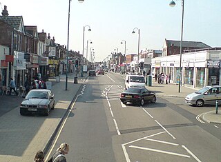
Shirley is a broad district and a former village on the western side of Southampton, England. Shirley's main roles are retailing and residential. It is the most important suburban shopping area in the west of the city. Housing is a mixture of council houses in the centre of the district surrounded by private housing, with larger suburban houses concentrated in Upper Shirley. Shirley is separated from Highfield by Southampton Common, a large green public space.

<span class="mw-page-title-main">Southampton Civic Centre</span> Municipal building in Southampton, Hampshire, England

The Civic Centre is a municipal building located in the Cultural Quarter area within the city of Southampton, England. It comprises offices occupied by Southampton City Council, the SeaCity Museum, the Guildhall, the Southampton City Art Gallery, and the city library. It was designed by the English architect Ernest Berry Webber in the Classical style in 1929 and constructed over a ten-year period. It was completed in 1939. Pevsner's Hampshire: South describes it as "the most ambitious civic building erected in the provinces in the interwar years". It was designated as a Grade II* listed building in 1980.

<span class="mw-page-title-main">Bull Run River (Oregon)</span> Tributary of the Sandy River in Oregon, United States

The Bull Run River is a 21.9-mile (35.2 km) tributary of the Sandy River in the U.S. state of Oregon. Beginning at the lower end of Bull Run Lake in the Cascade Range, it flows generally west through the Bull Run Watershed Management Unit (BRWMU), a restricted area meant to protect the river and its tributaries from contamination. The river, impounded by two artificial storage reservoirs as well as the lake, is the primary source of drinking water for the city of Portland, Oregon.

<span class="mw-page-title-main">Hinze Dam</span> Dam in South East Queensland

The Hinze Dam is a rock and earth-fill embankment dam with an un-gated spillway across the Nerang River in the Gold Coast hinterland of South East, Queensland, Australia. The main purpose of the dam is for potable water supply of the Gold Coast region. The impounded reservoir is called Advancetown Lake.

<span class="mw-page-title-main">Mansbridge</span> Human settlement in England

Mansbridge is a suburb on the northern perimeter of Southampton, England. The area is named after the Mans Bridge which spans the River Itchen. For a considerable time, this was the southernmost crossing point of the river, before the construction of Woodmill in Swaythling. The bridge itself still stands and is a Grade II listed structure but is closed to road traffic, having been replaced by a larger and more modern road bridge to carry the A27.

<span class="mw-page-title-main">Southampton</span> City in Hampshire, England

Southampton is a port city in Hampshire, England. It is located approximately 80 miles (130 km) south-west of London, 20 miles (32 km) west of Portsmouth, and 20 miles (32 km) south-east of Salisbury. Southampton had a population of 253,651 at the 2011 census, making it one of the most populous cities in southern England. Southampton forms part of the larger South Hampshire conurbation which includes the city of Portsmouth and the boroughs of Havant, Eastleigh, Fareham, and Gosport.

<span class="mw-page-title-main">Croton Distributing Reservoir</span> Former reservoir in New York City

The Croton Distributing Reservoir, also known as the Murray Hill Reservoir, was an above-ground reservoir at 42nd Street and Fifth Avenue in the New York City borough of Manhattan. Covering 4-acre (16,000 m2) and holding 20 million US gallons (76,000 m3), it supplied the city with drinking water during the 19th century. Its massive 50-foot-high (15 m) granite walls, which presented a vaguely Egyptian-style facade, were 25 feet (7.6 m) thick. Atop the walls was a public promenade offering panoramic views; Edgar Allan Poe enjoyed walking there.

<span class="mw-page-title-main">Bargate</span> Gatehouse in Southampton City Centre

The Bargate is a Grade I listed medieval gatehouse in the city centre of Southampton, England. Constructed in Norman times as part of the Southampton town walls, it was the main gateway to the city. The building is a scheduled monument, which has served as a temporary exhibition and event space for Southampton Solent University since 2012.

<span class="mw-page-title-main">Southampton Old Cemetery</span>

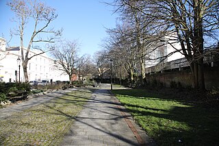
The cemetery has had various titles including The Cemetery by the Common, Hill Lane Cemetery and is currently known as Southampton Old Cemetery. An Act of Parliament was required in 1843 to acquire the land from Southampton Common. It covers an area of 27 acres (11 ha) and the total number of burials is estimated at 116,800. Currently there are 6 to 8 burials a year to existing family plots.

<span class="mw-page-title-main">Jacqueline Kennedy Onassis Reservoir</span> Reservoir in Central Park, New York City

The Jacqueline Kennedy Onassis Reservoir, also known as Central Park Reservoir, is a decommissioned reservoir in Central Park in the borough of Manhattan, New York City, stretching from 86th to 96th Streets. It covers 106 acres (43 ha) and holds over 1 billion US gal (3.8 million m3) 3070 Acre-foot of water.

<span class="mw-page-title-main">Lake Roland (Maryland)</span> Reservoir in Baltimore County, Maryland

Lake Roland is a 100-acre (0.40 km2) defunct reservoir in Baltimore County, Maryland. It was named for Roland Run, a nearby stream that feeds the lake and eventually flows into Jones Falls. It runs southeast through the city center to the Northwest Branch of the Patapsco River and the Baltimore Harbor. It is located just north of the Baltimore city limits.

<span class="mw-page-title-main">Vega State Park</span> State park in Mesa County, Colorado

Vega State Park is a 1,823-acre (738 ha) Colorado state park in Mesa County, Colorado in the United States. Vega Reservoir is a fishing destination and is located at an elevation of 7,696 feet (2,346 m). Year-round recreational activities at Vega State Park include boating, hiking, snowmobiling and camping. The park was established in 1967 in cooperation with the Bureau of Reclamation which was responsible for the construction of Vega Dam and Vega Reservoir.

<span class="mw-page-title-main">Lake Gregory (Nuwara Eliya)</span> A freshwater lake in Sri lanka

Lake Gregory sometimes also called Gregory Lake or Gregory Reservoir, is a reservoir in heart of the tea country hill city, Nuwara Eliya, Sri Lanka. Lake Gregory was constructed during the period of British Governor Sir William Gregory in 1873. The lake and the surrounding area make up the Gregory Lake Area.

<span class="mw-page-title-main">Royal Pier, Southampton</span> Pier in Southampton, England

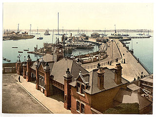
The Royal Pier is a pier in Southampton, United Kingdom, built during the 1830s of Victorian England and was in operation until its closure in late 1979.

<span class="mw-page-title-main">Centennial Park Reservoir</span> Historic site in New South Wales, Australia

The Centennial Park Reservoir or WS001 is a heritage-listed underground reservoir at 3R Oxford Street, Centennial Park, City of Randwick, New South Wales, Australia. It was designed and built by NSW Public Works Department from 1896 to 1898. The property is owned by Sydney Water, an agency of the Government of New South Wales. It was added to the New South Wales State Heritage Register on 18 November 1999.

<span class="mw-page-title-main">Rockstone Place Park</span>

References

  1. 1 2 3 4 "Designated Sites View: Southampton Common". Sites of Special Scientific Interest. Natural England. Retrieved 19 May 2020.
  2. "Map of Southampton Common". Sites of Special Scientific Interest. Natural England. Retrieved 19 May 2020.
  3. Cosgrove, M.E (1989). Southampton Common. City of Southampton Society. p. 60. OCLC   655858743.
  4. 1 2 3 4 Thomson, Sheila D (1989). Southampton Common. City of Southampton Society. pp. 19–21. OCLC   655858743.
  5. 1 2 3 4 5 6 7 8 Burgess, Lawrence (1982). The Streams and Watercourses Of Southampton. Friends of Old Southampton. pp. 5–7.
  6. 1 2 Thomson, Sheila D (1989). Southampton Common. City of Southampton Society. pp. 11–12. OCLC   655858743.
  7. Cosgrove, M.E (1989). Southampton Common. City of Southampton Society. p. 62. OCLC   655858743.
  8. 1 2 3 4 5 Thomson, Sheila D (1989). Southampton Common. City of Southampton Society. p. 1. OCLC   655858743.
  9. 1 2 Thomson, Sheila D (1989). Southampton Common. City of Southampton Society. pp. 2–3. OCLC   655858743.
  10. 1 2 3 4 Thomson, Sheila D (1989). Southampton Common. City of Southampton Society. pp. 4–5. OCLC   655858743.
  11. 1 2 3 4 Thomson, Sheila D (1989). Southampton Common. City of Southampton Society. pp. 8–9. OCLC   655858743.
  12. Burgess, Lawrence (1982). The Streams and Watercourses Of Southampton. Friends of Old Southampton. p. 8.
  13. 1 2 3 4 5 6 7 8 9 10 Thomson, Sheila D (1989). Southampton Common. City of Southampton Society. pp. 16–19. OCLC   655858743.
  14. 1 2 3 4 5 Thomson, Sheila D (1989). Southampton Common. City of Southampton Society. pp. 6–8. OCLC   655858743.
  15. 1 2 3 4 5 6 Thomson, Sheila D (1989). Southampton Common. City of Southampton Society. pp. 10–11. OCLC   655858743.
  16. 1 2 Rance, Adrian (1986). Southampton An Illustrated History. Milestone Publications. p. 114. ISBN   0903852950.
  17. Thomson, Sheila D (1989). Southampton Common. City of Southampton Society. pp. 22–23. OCLC   655858743.
  18. 1 2 3 "Southampton Cemetery". The Heritage List. Historic england. Retrieved 21 February 2017.
  19. 1 2 3 Thomson, Sheila D (1989). Southampton Common. City of Southampton Society. pp. 23–24. OCLC   655858743.
  20. Rance, Adrian (1986). Southampton An Illustrated History. Milestone Publications. p. 113. ISBN   0903852950.
  21. 1 2 3 Thomson, Sheila D (1989). Southampton Common. City of Southampton Society. pp. 30–31. OCLC   655858743.
  22. 1 2 3 4 Thomson, Sheila D (1989). Southampton Common. City of Southampton Society. pp. 35–36. OCLC   655858743.
  23. 1 2 3 4 5 6 7 8 9 10 Thomson, Sheila D (1989). Southampton Common. City of Southampton Society. pp. 26–29. OCLC   655858743.
  24. 1 2 Thomson, Sheila D (1989). Southampton Common. City of Southampton Society. p. 44. OCLC   655858743.
  25. 1 2 3 4 5 Rance, Adrian (1986). Southampton An Illustrated History. Milestone Publications. p. 111. ISBN   0903852950.
  26. Burgess, Lawrence (1982). The Streams and Watercourses Of Southampton. Friends of Old Southampton. pp. 6–9.
  27. Rance, Adrian (1986). Southampton An Illustrated History. Milestone Publications. p. 138. ISBN   0903852950.
  28. 1 2 3 4 5 6 7 8 9 10 Thomson, Sheila D (1989). Southampton Common. City of Southampton Society. pp. 40–43. OCLC   655858743.
  29. 1 2 3 Thomson, Sheila D (1989). Southampton Common. City of Southampton Society. pp. 32–33. OCLC   655858743.
  30. Gadd, Eric Wyeth (1979). Southampton in the 'Twenties. Paul Cave publications. p. 52. OCLC   16549941.
  31. "A Guide to The Management Plan for Southampton Common" (PDF). southampton.gov.uk. Southampton City Council. 2003. Retrieved 5 July 2018.
  32. 1 2 3 Gale, Jez. "The beasts that brought Southampton to life". Southern Daily Echo. Retrieved 14 July 2015.
  33. 1 2 Velecky, Lubor (2000). Protect it now: A History of Southampton Commons and Parks Protection Society. Southampton Commons and Parks Protection Society. p. 26.
  34. 1 2 3 4 Velecky, Lubor (2000). Protect it now A History of Southampton Commons and Parks Protection Society. Southampton Commons and Parks Protection Society. pp. 20–26.
  35. 1 2 3 4 5 Samuels, Alec (1985). "Southampton Common: the Legal Regime" (PDF). Proceedings of the Hampshire Field Club and Archaeological Society. 41: 261. Retrieved 17 January 2019.
  36. 1 2 3 4 Velecky, Lubor (2000). Protect it now A History of Southampton Commons and Parks Protection Society. Southampton Commons and Parks Protection Society. pp. 31–38.
  37. Velecky, Lubor (2000). Protect it now A History of Southampton Commons and Parks Protection Society. Southampton Commons and Parks Protection Society. p. 121.
  38. 1 2 3 Townsend, C (November 1985). "Status of the dragonflies and damselflies (Odonata) on Southampton Common, Hampshire". Bulletin of the Amateur Entomologists' Society. 44: 190–193. Retrieved 24 June 2018.
  39. Streatfield, Emma (14 March 2015). "Key figures across Southampton are looking at restoring the balloon festival at Southampton Common following a public petition". Daily Echo. Retrieved 23 July 2018.
  40. Gough, Patrick (27 May 2015). "Common People Festival 2015 - Southampton Common". Bournemouth Echo. Retrieved 17 February 2017.
  41. "Common People: 'Horrendous' festival queues complaints". BBC News. 30 May 2016. Retrieved 17 February 2017.
  42. Reddin, Lorelei (12 August 2016). "Common People festival pumped £1.1m into Southampton's economy this year". Southern Daily Echo. Retrieved 17 February 2017.
  43. Adams, Rachel (29 January 2019). "Southampton's Common People festival has been axed". Southern Daily Echo. Retrieved 1 February 2019.
  44. "Home | Southampton parkrun | Southampton parkrun".

Further reading